Good morning.
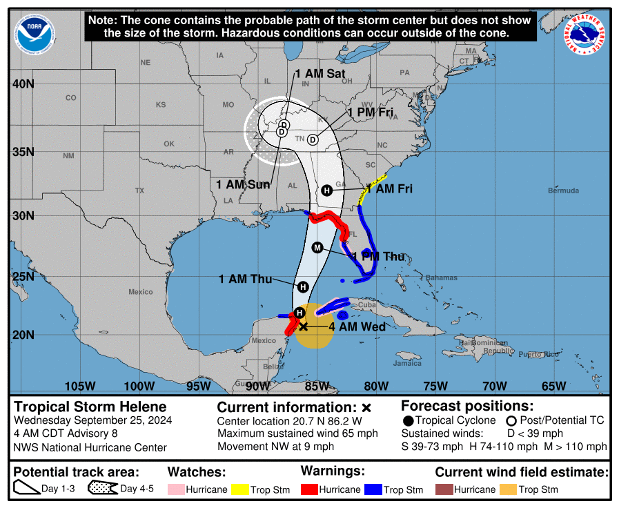
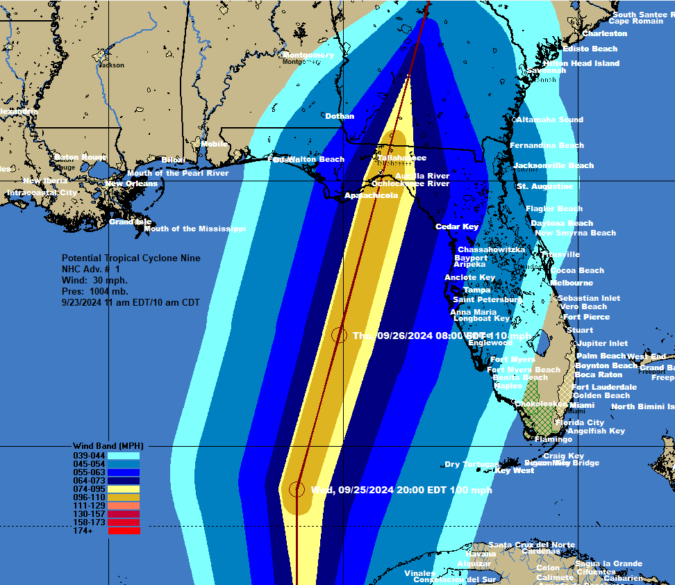
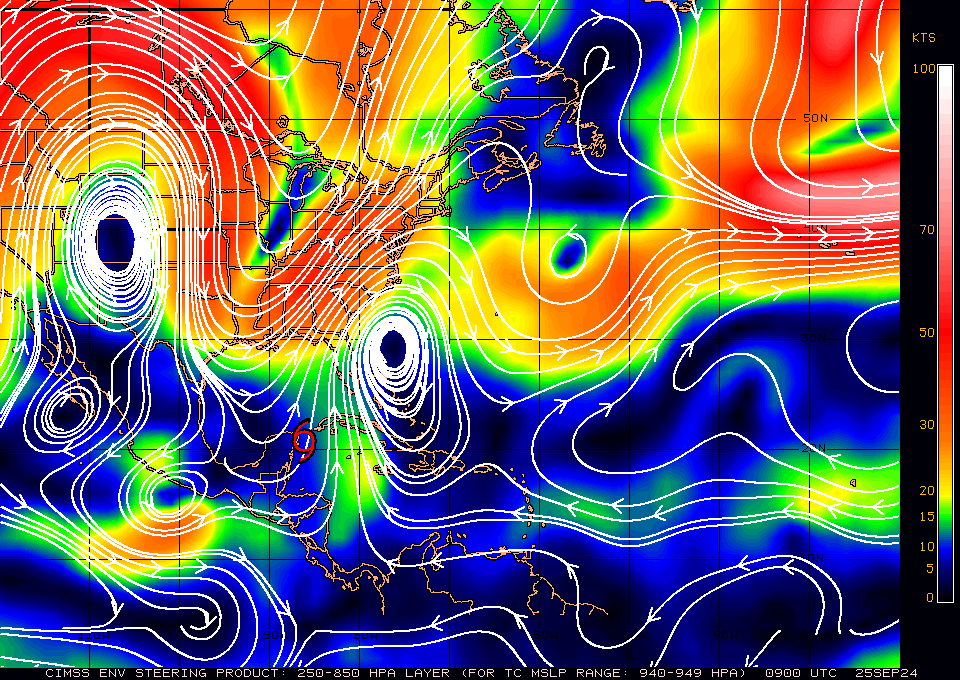
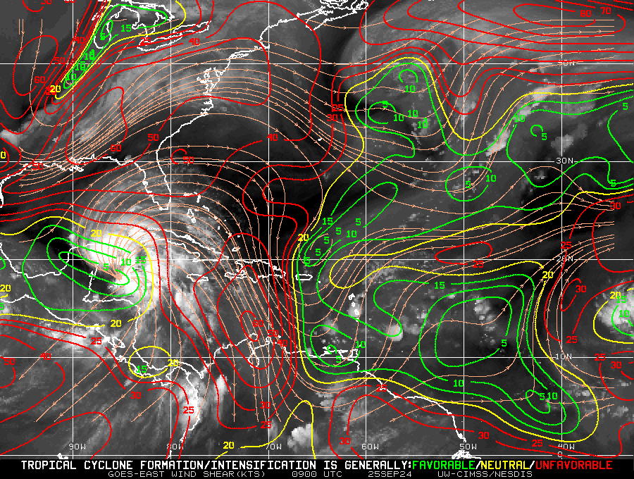
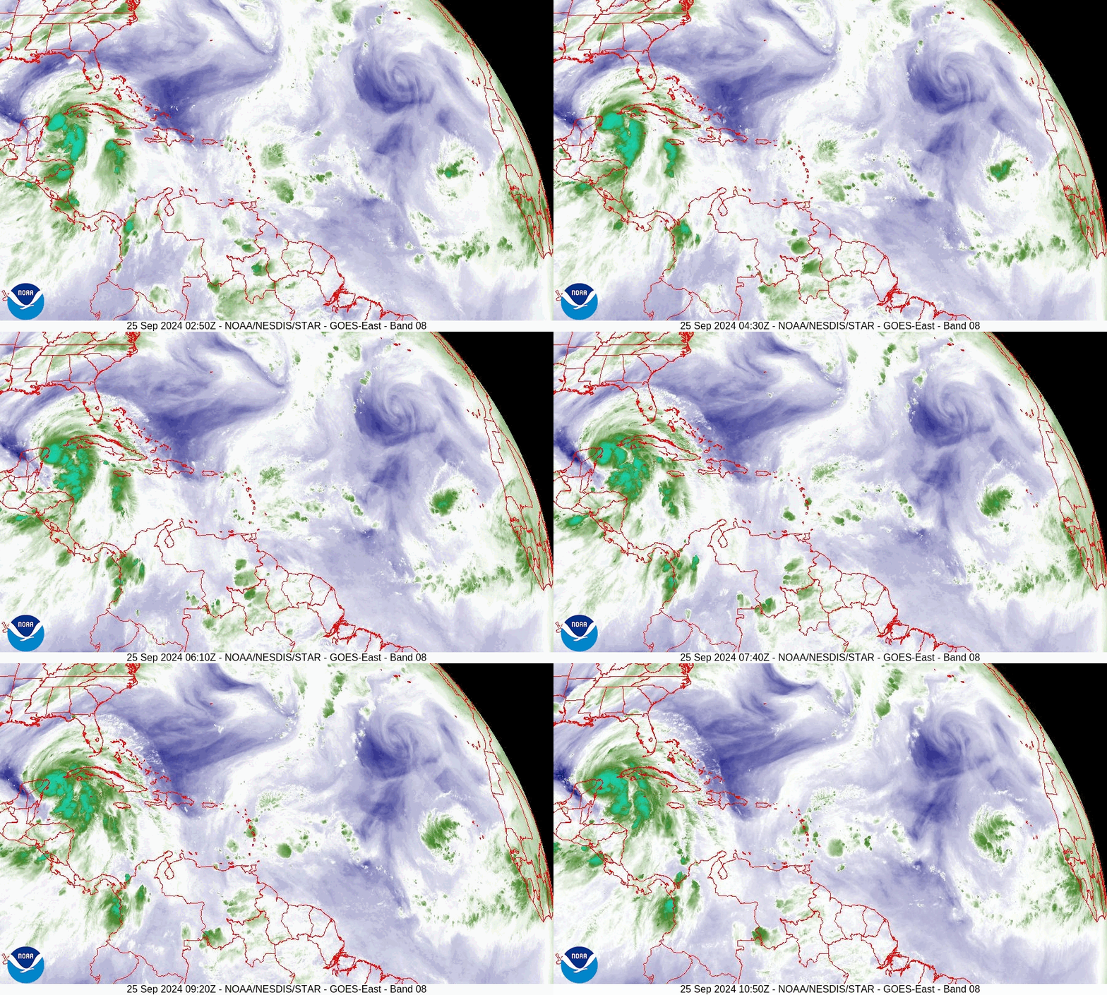
TS Helene is currently approaching the tip of the Yucatan Peninsula and should become a hurricane soon. It is becoming much better organized and at 5 am had a central pressure of 985 mbs. It usually takes a central pressure of 982-983 mbs to be a hurricane, ie it is close. It is moving NW and has slowed. This is a sign that it about to turn to the north. Systems almost always slow prior to a change in direction. If you look at the surface map below you can see the the high pressure over NW Florida has shifted eastward as anticipated in my last forecast. This should leave a clear path to the Florida Panhandle. We are unlikely to see a significant deviation from this track. It should start to accelerate northward tomorrow between the two strong high pressure systems, 1 over the Western Atlantic just east of N Florida and the other over the S Central US. If you look at the water vapor loop bottom diagram you can see the frontal boundary over the SE US very slowly moving eastward.
Helene is currently west of where it was anticipated to be at this time yesterday and as a result the NHC has shifted its track slightly to the west. There may be some further slight changes, but not a lot.
South Florida should experience some passing showers this afternoon, tonight and tomorrow morning however as it consolidates over the Gulf most of the weather will be drawn inward and affect primarily the West Coast of Florida. Shear has increased over the Gulf however Helene will be moving in the direction of the shear which will effectively lessen it. The intensity forecast will be tricky but in general the faster it moves the better. The NHC is currently forecasting it to be a 120 mph Cat 3 at landfall. It could be more, hopefully a little less.
Wishing everyone in its path the best.
Until next time,
Matt.
