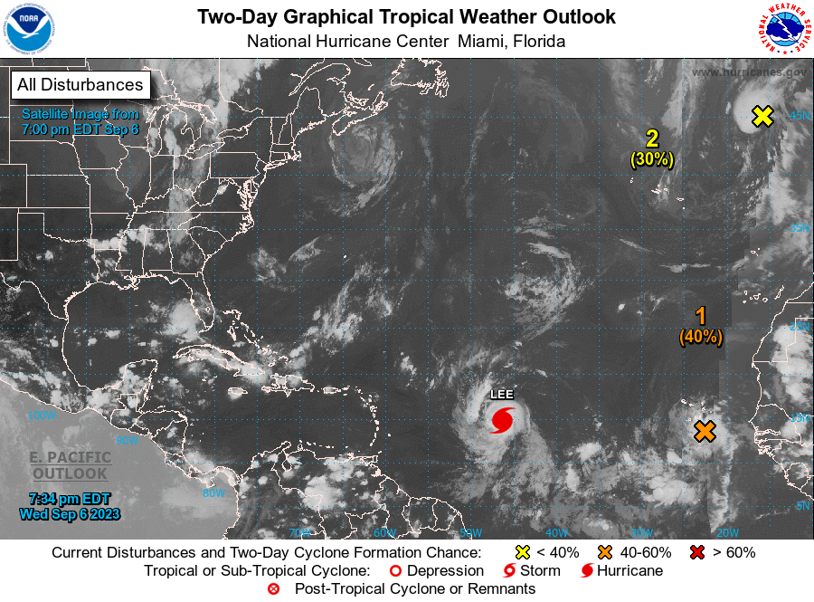
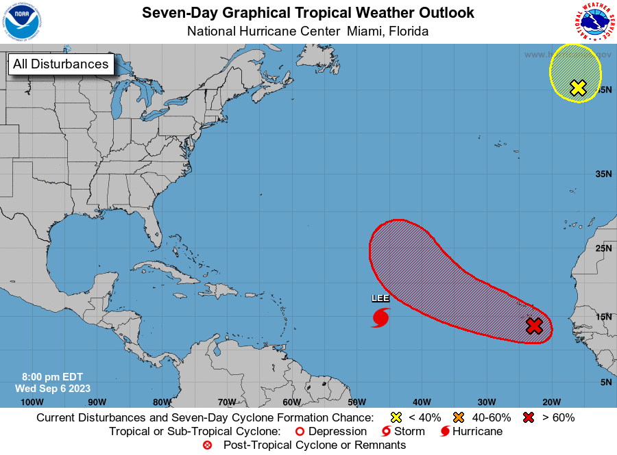
Good evening.
Just a quick update on Lee. I have already received several calls and texts due to our hysterical media. It is extremely unlikely that Lee will affect South Florida or other parts of the state as well.
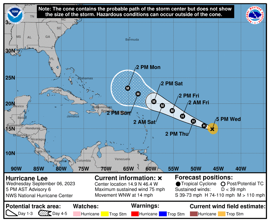
If you look at the surface map below you can see that high pressure remains over Florida, however its center has shifted westward and it is no longer directly over Florida. You will also notice extreme weakness (large distance between the isobars north of Puerto Rico and the Virgin Islands) in the pressure pattern over the Western Atlantic. This will allow Lee to move northward when it gets north of the islands. There are currently north and NW winds over Florida which would prevent it from approaching the state if it were in our vicinity now, we'll have to see what they are when it gets closer however this type of pattern has persisted all summer and it is unlikely to be significantly different in a few days.
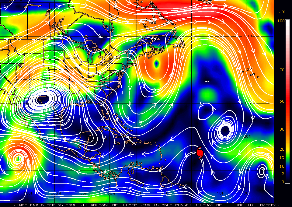
If you look at the models below you can see that they also agree in this scenario with all of them taking Lee north, probably missing the US entirely.
The one thing that could throw things off would be if it were to stall. As long as it keeps moving we should be okay.
Please don't let the TV and other medias psyche you out. We will probably be in a low risk pattern for the next couple of weeks.
Until next time,
Matt.
Just a quick update on Lee. I have already received several calls and texts due to our hysterical media. It is extremely unlikely that Lee will affect South Florida or other parts of the state as well.
If you look at the surface map below you can see that high pressure remains over Florida, however its center has shifted westward and it is no longer directly over Florida. You will also notice extreme weakness (large distance between the isobars north of Puerto Rico and the Virgin Islands) in the pressure pattern over the Western Atlantic. This will allow Lee to move northward when it gets north of the islands. There are currently north and NW winds over Florida which would prevent it from approaching the state if it were in our vicinity now, we'll have to see what they are when it gets closer however this type of pattern has persisted all summer and it is unlikely to be significantly different in a few days.
If you look at the models below you can see that they also agree in this scenario with all of them taking Lee north, probably missing the US entirely.
The one thing that could throw things off would be if it were to stall. As long as it keeps moving we should be okay.
Please don't let the TV and other medias psyche you out. We will probably be in a low risk pattern for the next couple of weeks.
Until next time,
Matt.