Good morning.
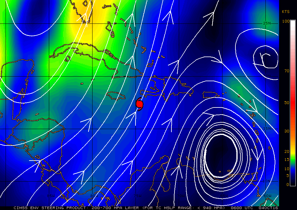
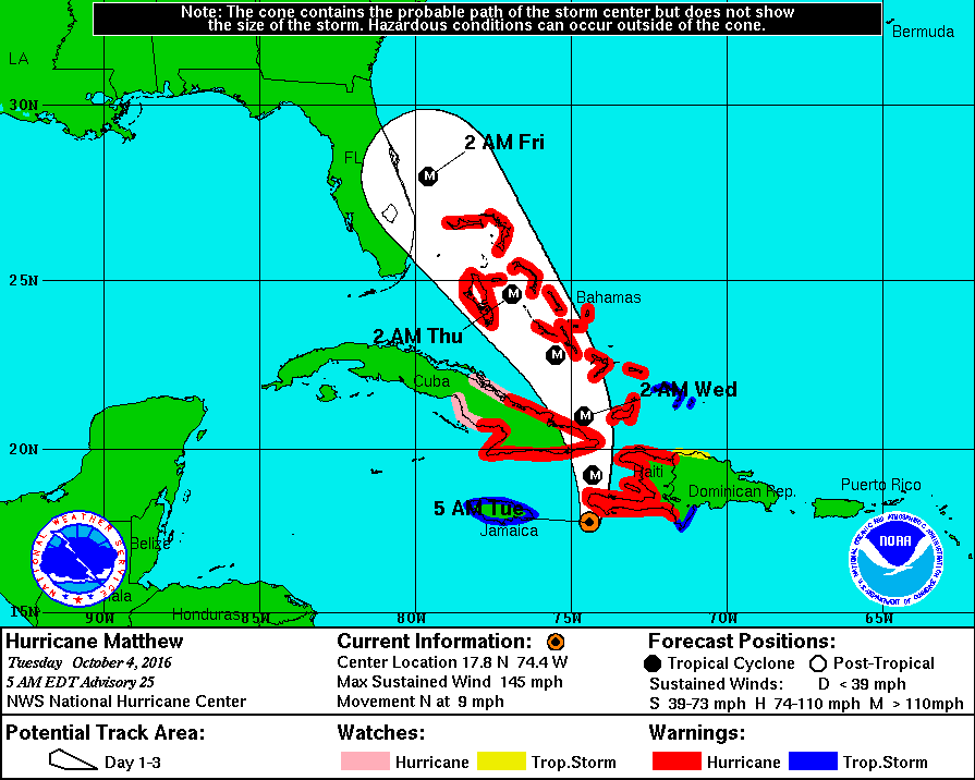
At 5 am Hurricane Matthew was located at 17.8 N & 74.4 W and was moving NNE @ 9 mph with a barometric pressure of 934 mbs and peak winds of 145 miles. Matthew is about to make landfall along the western tip of Haiti and is headed toward the Windward Passage and "The Box" (see Weather Trivia section). In viewing the water vapor loop this am there are a few things of note. First is that the stalled frontal system across northern Florida is now moving eastward and a tropical disturbance is forming in the Central Atlantic just east of Matthew. Both of these factors along with its slightly more eastern location and trajectory than forecast yesterday could well lead to a slight eastern shift in the models. The high pressure ridge to its east is forecast to build slightly westward in 36 hours which is why the NHC models shifted to the west yesterday which I had anticipated and mentioned in yesterday AM's forecast.
My current track is about 30 miles to the east of the NHC's current track.
If the NHC's current track holds Matthew would pass approximately 200 miles to the east of Miami and storm conditions would not be anticipated. Due to SW shear when it is near Florida Hurricane force winds are forecast to extend only 30 miles on the west side of the storm. On its present forecast track Florida would not experience hurricane conditions.
HOWEVER due to uncertainty of the forecast it is likely that the east coast of Florida will be placed on a Hurricane Watch and Tropical Storm Warnings later today. Please do not panic. It does not mean that it will come here only that we need to keep an eye out and prepare. I anticipate that the models will shift slightly to the east late today or tomorrow. We may even see some Fujiwhara Effect which could shift the track slightly east too. (see Weather Trivia Section).
As we get closer the forecasts will become more accurate. I'll write again tomorrow, things should be clearer by then,
Matt.


