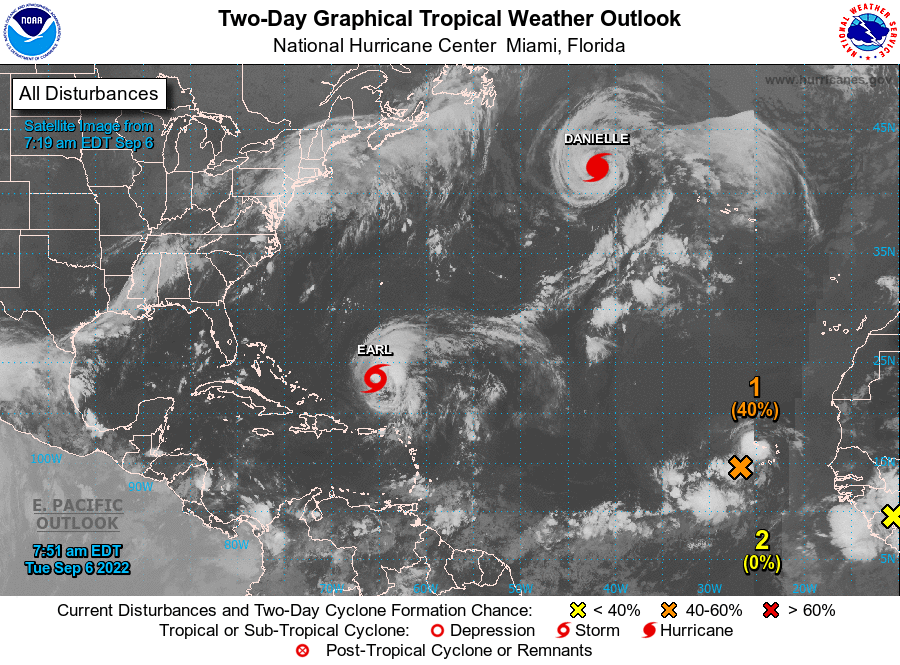
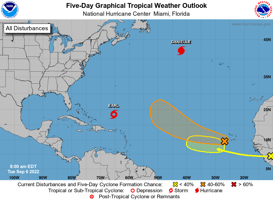
Matt on the Tropics
Tropical Updates
  • Home
  • About
  • Archive (pre-blog)
  • Contact
  • Weather Links
  • Weather Trivia

tropical update Thrusday 9-22-22, 7:30 pm

9/22/2022

 
Good evening.

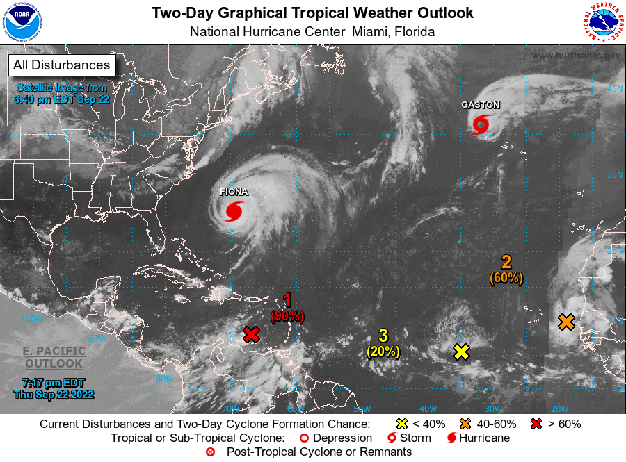
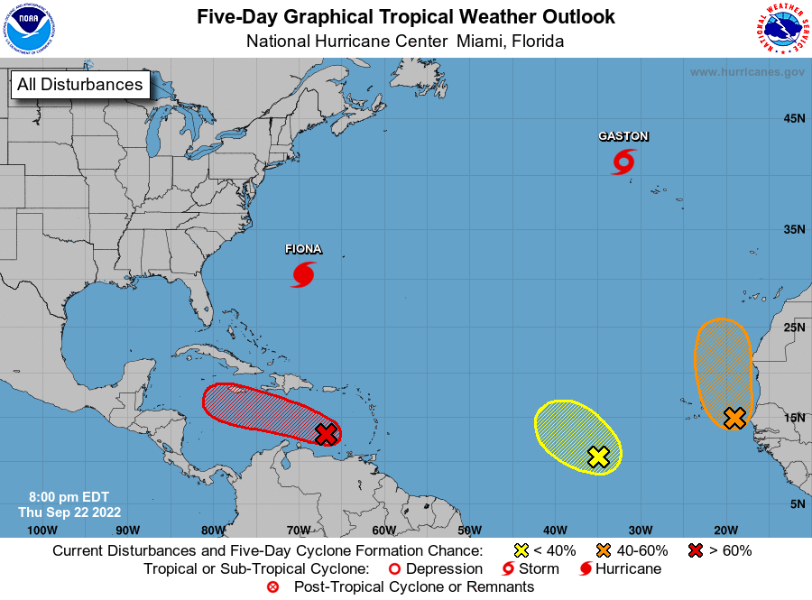
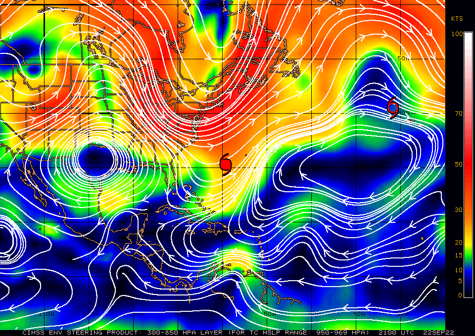
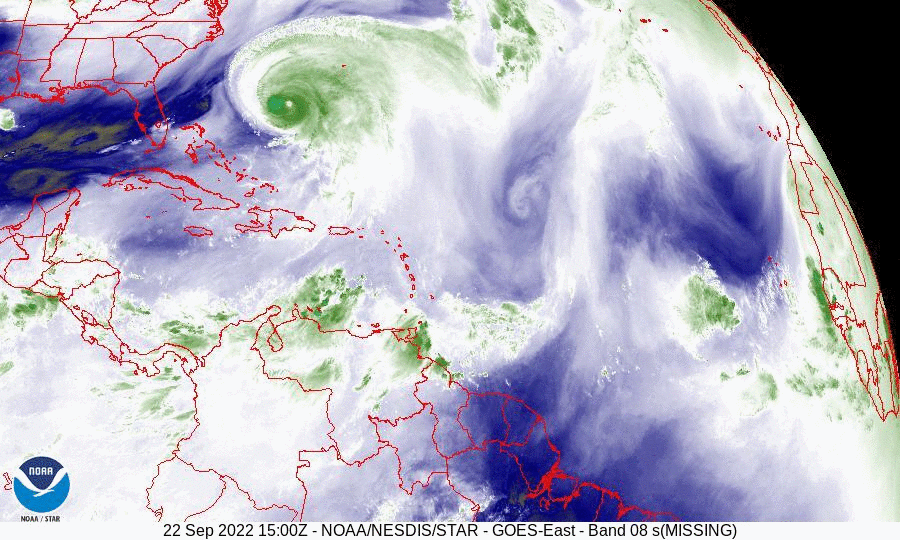
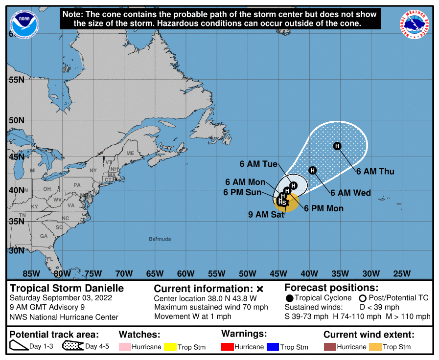
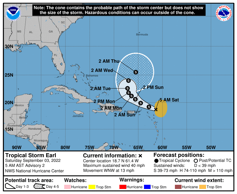
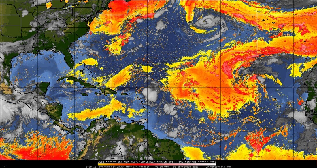
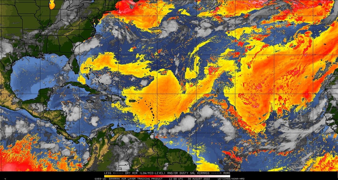
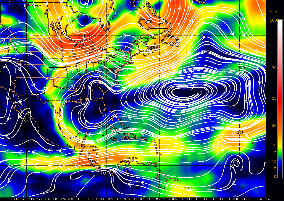
I'm writing about a system in the Southern Caribbean Sea which some of the models bring toward South Florida. See Data below. I've been receiving calls and texts through out the day. I would first like to say, " It is way too early for ANYONE to make an accurate prediction about this system." If you look at the water vapor loop below you will notice several features. First is the area in question moving westward just north of Venezuela. Next high pressure spinning clockwise over the Caribbean. Next Fiona moving NNE. Next a cold front just starting to move off the US East Coast. 

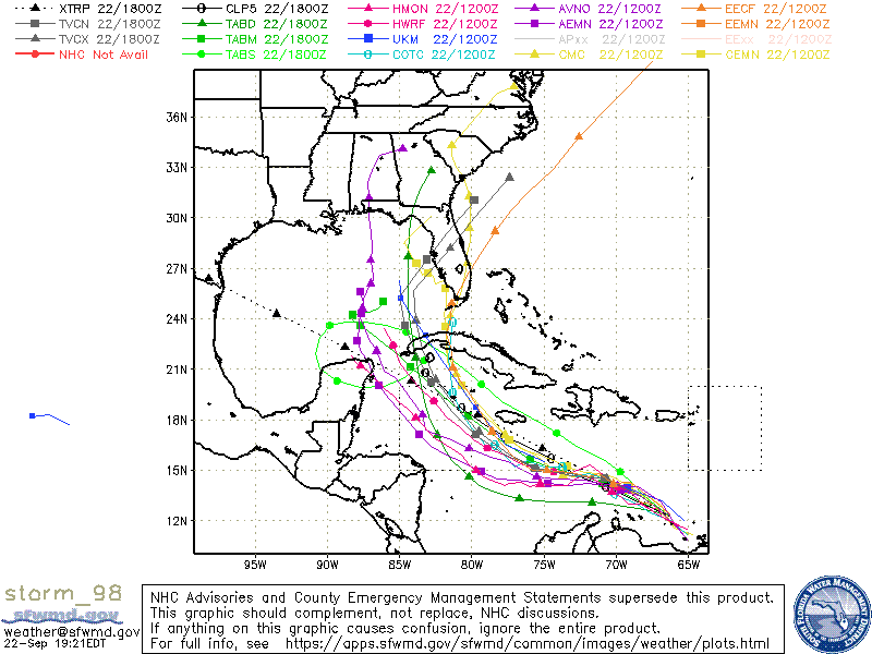
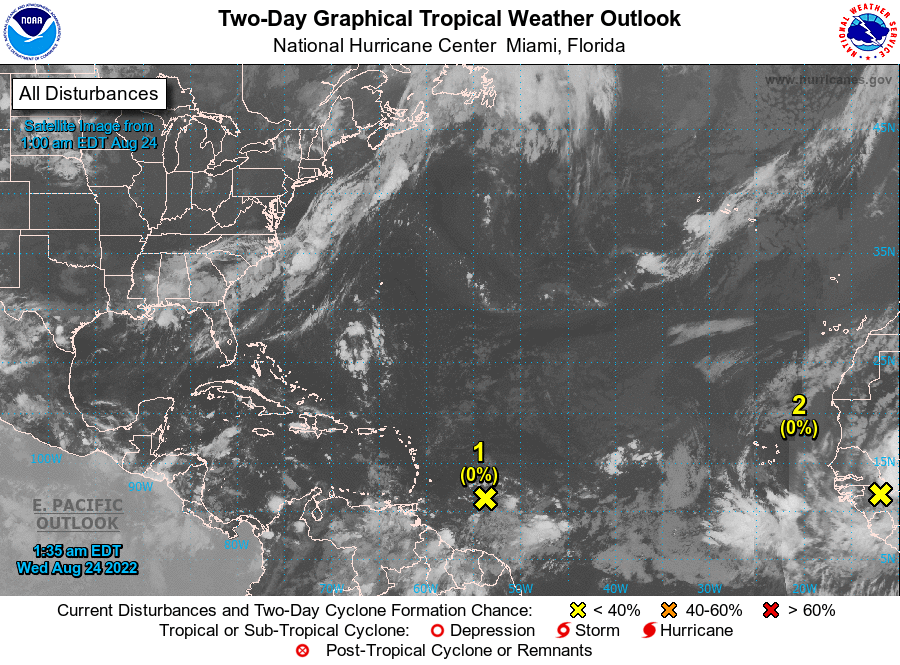
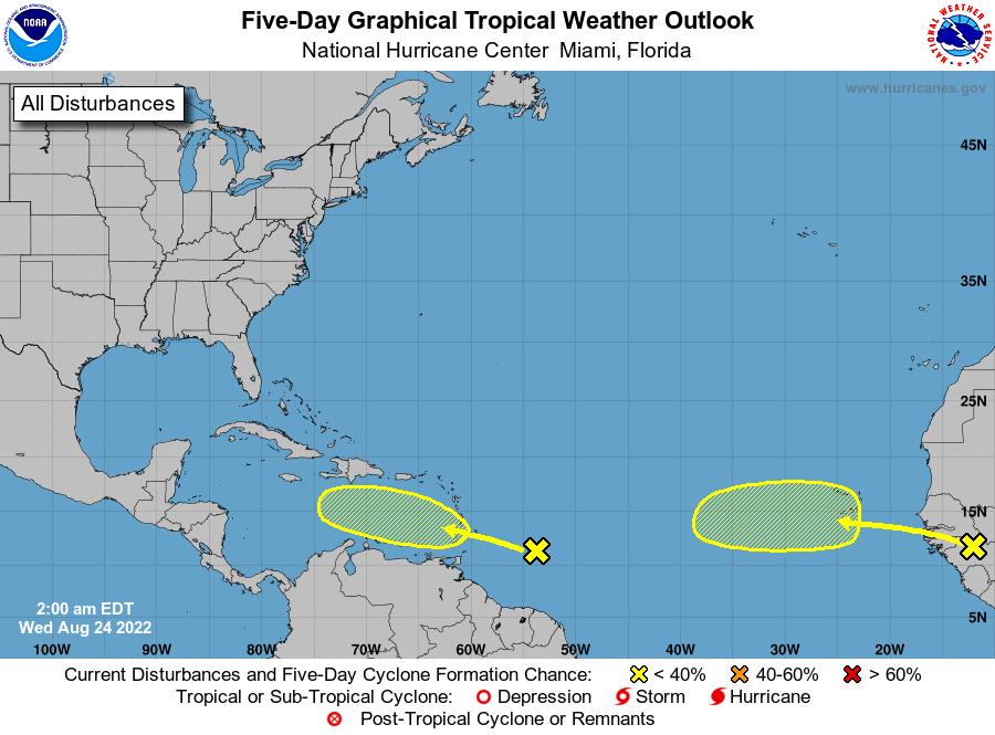
If you look at the area in question you will notice that there is no spin. Until it actually forms no forecast will be accurate, that said it is currently headed toward Central America and the Yucatan. The main variables will be when it actually forms, the later, the further west it should go, and the location of high pressure over the Southern US. If you look at the surface map you can see it currently over Texas. Yesterday it was over Louisiana, however as Fiona moves to the NE it should move back to the east. The timing will be key and if you look at the computer models you will notice the wide spread in them. This is reflective of the high uncertainty in this forecast at this time.

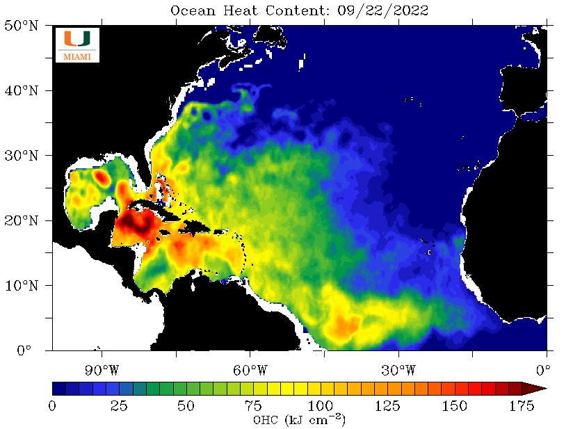
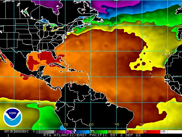
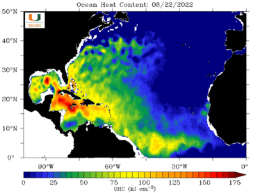
Also notice the extremely high heat content in the northwestern Caribbean. There is a lot of fuel out there and something is going to tap into it. Possibly this system. My suspicion is that the high pressure over the US will shift eastward leading to a more westward track. Its lack of organization should favor this. We're just going to have to wait and see as things develop. The current model consensus is unlikely to be its actual track.

Until next time,
                                          Matt.

​
Picture
Picture
Picture
Picture
Picture
Picture

tropical update monday 9/19/22, 11 am

9/19/2022

 
Picture

Just a quick note. Fiona formed shortly after my last update and as forecast should move out to sea and miss the Continental US.  It is creating a huge rain event for Puerto Rico and Hispaniola.

There is not much else out there at present.

I'll keep you posted as needed.

Matt.
​

Tropical Update 9-14-22

9/14/2022

 
The National Hurricane Center is watching a disturbance in the central Atlantic. It is projected to approach Hispaniola and then turn north and miss the US. High pressure over Florida and the trough to our east should protect us.

Until next time,
​Matt
Picture
Picture

tropical update tuesday 9-6-22, 8 am

9/6/2022

 
Good morning.

Since my last report Danielle and Earl are larger and still moving out to sea.
Two new areas off and about to come off Africa should move out to sea as well. We'll need to watch the second one however high pressure over Florida and weak high pressure over the Atlantic will likely prevent a US landfall.

Until next time,
                                          Matt.
​
Picture
Picture
Picture
Picture

tropical update Saturday 9-3-22, 7 am

9/3/2022

 
Good morning.

Just another quick update. As noted previously it's September and the tropics are becoming more active however both current systems are small and moving out to sea.

We set a record this August, being the first August since they've been tracking storms without a named storm.

Over Africa there are a couple of waves one which should move offshore in about 2-3 days and one in about 8 days I'll be watching them however high pressure is currently relatively weak over the eastern and central Atlantic which should allow them to move northward as well. I don't think we'll see much until mid September/October. If you look at the Saharan Air Layer Analysis below you will see that the SAL is eroding. Each tropical wave/storm does its part in eating away at it. Wind shear is light over the tropical Atlantic and once the air over it moistens the potential for more development will increase. Hopefully they'll continue to move out to sea.

Until next time,

                                       Matt.
​
Picture
Picture
Picture
Picture
Picture

tropical update tuesday 8-30-22, 9 am

8/30/2022

 
Good morning.

Just a quick update. The media has been talking about a couple of systems. Neither is a threat to the US at this time. Both will probably move out to sea. In addition if you look at the SAL analysis below they are both approaching large areas of dry Saharan air and dust to their north. They will have a hard time becoming much if anything. Nothing to worry about at this time. We probably won't see much until mid September /October. I'll keep my fingers crossed.

Until next time,

                    Matt.

Picture
Picture
Picture

tropical update wednesday 8/24/22, 7 am

8/24/2022

 
Good morning.

Today marks the 30th anniversary of Hurricane Andrew. For those who were here for it, we will never forget.

In the tropics things are changing. See images below. The Saharan dry air and dust is still present but is starting to erode and has moved slightly north. Wind shear over the Caribbean and tropical Atlantic has lessened and waters remain warm over the Gulf of Mexico and the Western Caribbean. As noted previously these will be the areas to watch. Dry air should continue to hinder any development for the next week or so but as we enter September the tropics should become more active. Central America, Mexico and the Gulf of Mexico remain at greatest risk this season.

I'll be watching.

I hope everyone is having a good summer.

Until next time,
                                                                  Matt.

​
Picture
Picture
Picture
Picture
Picture
Picture
Picture

Tropical update 8-3-22, Wednesday, 9 am

8/3/2022

 
Good morning.

Just a quick update. So far so good. The combination of strong high pressure over the Atlantic and abundant dust storms over North Africa with resultant abundant Saharan dust and hot dry air over the Atlantic has kept a lid on tropical development in the Atlantic Basin to date. 
This has also lead to a hot dry summer for South Florida as well. It will probably take at least 2-3 weeks before we see any significant development as it will take time and several systems to erode the dust that is out there and it continues to move WSW across the Atlantic. In addition the high pressure should keep any systems well south of the US East Coast and Florida for a while. I anticipate that we won't see much until late August / September. As noted earlier the Caribbean and the Gulf of Mexico will be the areas to watch later in the season, ? September/ October?

Wishing everyone a quiet 2022 Hurricane Season.

                                                                          Matt.

​
Picture
Picture
Picture
Picture

Tropical update Sunday 6-5-22, 11 pm

6/5/2022

 
Tropical Storm Alex was named this morning well after crossing the Florida peninsula yesterday. It is currently headed out to sea and should pass north of Bermuda.

Rainfall in Miami-Dade County ranged from 6-12”. The greatest rainfall actually fell in Biscayne Bay with over 15 inches of rain wetting the fish. Peak winds were in the 10s to low 20s with a single gust to 31 mph recorded at Miami International Airport. 
Similar winds were noted on the SW coast. No storm conditions were recorded. (It was not a depression nor tropical storm when it crossed Florida.)

Rainfall at my house totaled 11.53 inches again showing the significance of rain events.

Until next time,

                                                       Matt.
​

​

tropical update Saturday 6-4-22, 7 am

6/4/2022

 
Good morning.

Potential Tropical Cyclone #1 remains a potential. It has not developed into a Depression nor a Tropical Storm and it probably won't until after it crosses Florida. Most of its associated weather has already moved east of the state. The NHC has found that it continues to be a broad trough of low pressure with peak winds recorded in the 30s. If you look at the radar below you can see a low pressure circulation center approaching the Fort Myers area. The NHC is currently expecting a new low pressure center to form east of the Central Florida Peninsula and effectively "jump" into the Atlantic. The continuous rain of last night is over, today we'll see improving conditions with bands of rain with further improvement in conditions by early afternoon.
Rainfall totals so far are in the 4-8" range and should end up in the 5-10" range when the event ends.

Florida should be fine and end up with a significant recharge of our freshwater reservoirs including Lake Okeechobee and we'll all be better off because of this.

Until next time,
                                               Matt.

​
Picture
Picture
Picture
<<Previous
Forward>>

    Categories

    All
    Preseason Update