Matt on the Tropics
Tropical Updates
  • Home
  • About
  • Archive (pre-blog)
  • Contact
  • Weather Links
  • Weather Trivia

tropical update, Monday, 11-7-22, 4 am

11/7/2022

 
Good morning.

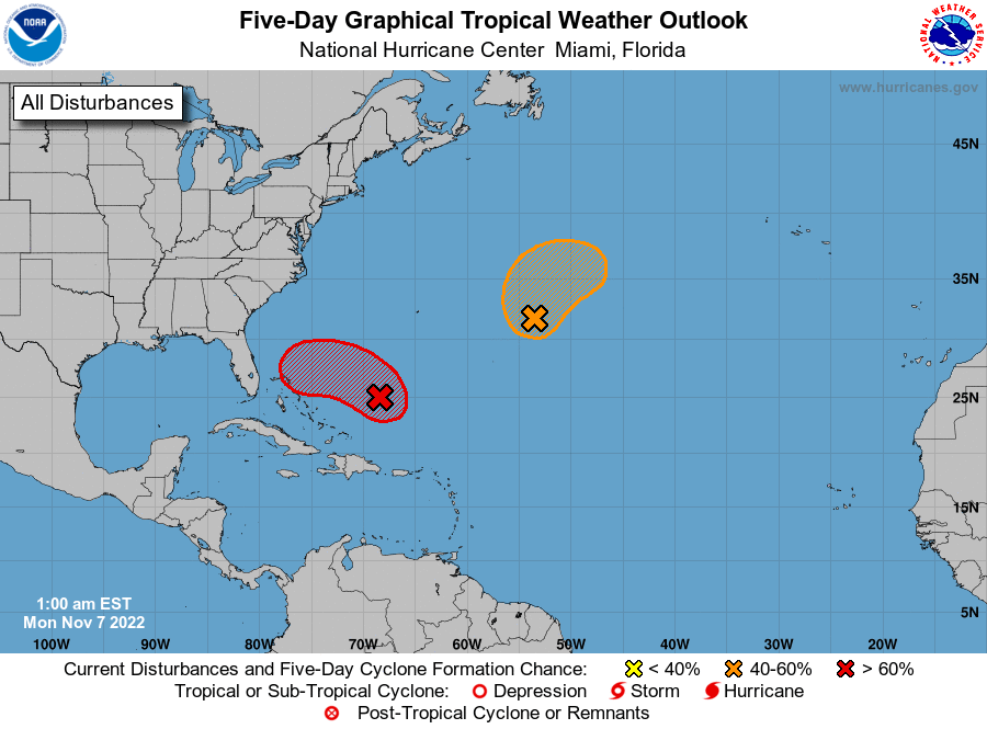
Since yesterday a few things have changed with regards to the system currently east of the Bahamas.
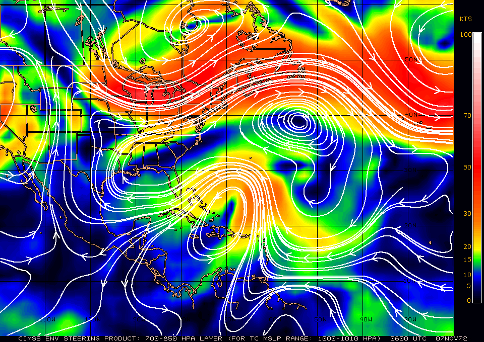
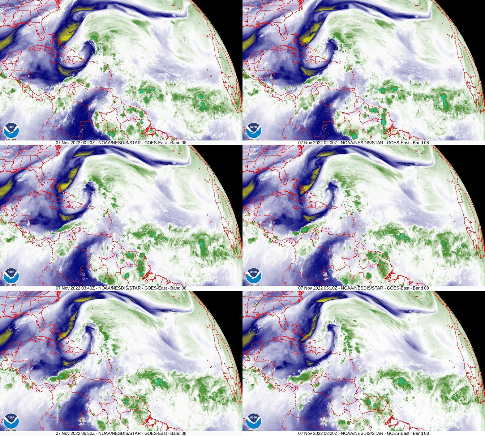
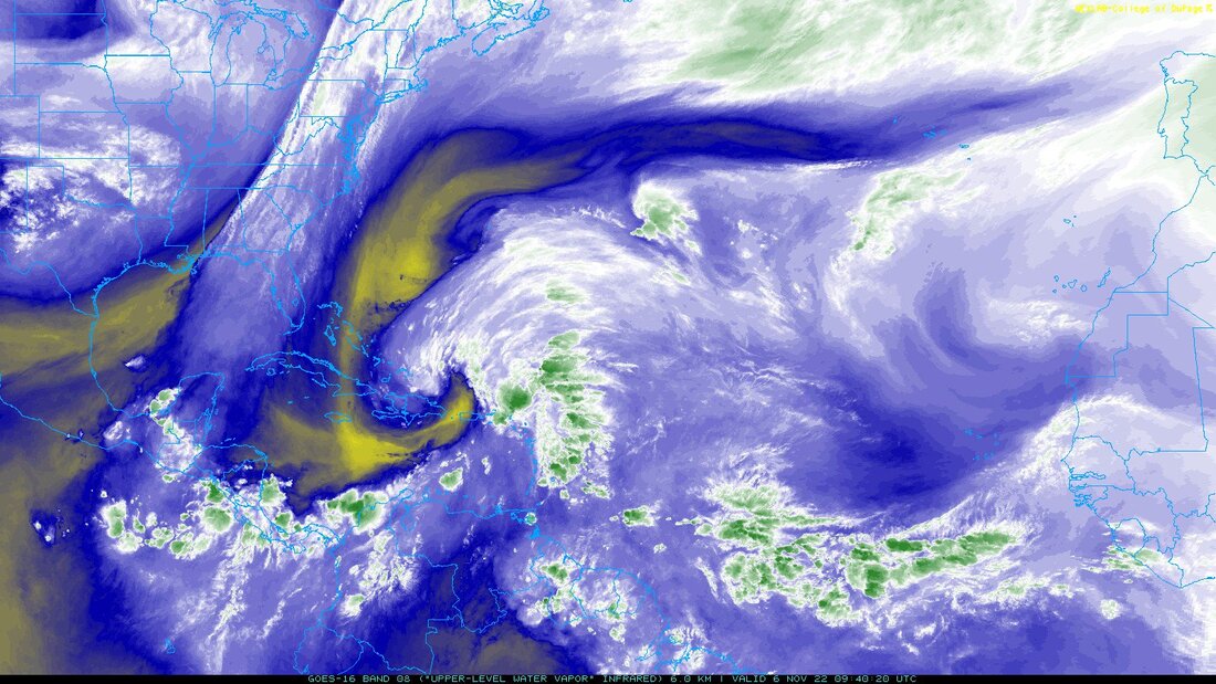
Most importantly you will notice on the Water Vapor Loop below that the frontal system along the US East Coast has stalled and flattened out now orienting east west rather than north south. This is due to high pressure building over the SE US and the Western Atlantic. See Surface Map below. The net result of this is that it will probably hit the east coast of Florida. Conditions around it are still not ideal as noted yesterday and most of its associated weather remains well east of the center. The key to where it eventually goes will depend on where the center actually is when it forms and how far north it gets before it starts to turn to the west and southwest.

We'll need to keep an eye on it. Its currently almost due east of Miami and heading NW. 

Until next time,   
 
                                              Matt.

​
Picture
Picture
Picture
Picture

tropical update Sunday 11/6/22 ,5 am

11/6/2022

 
Good morning.

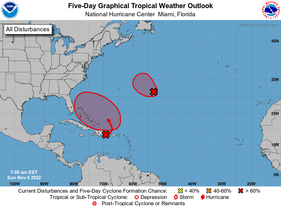
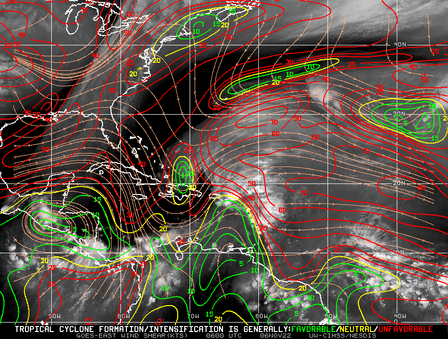
Just a quick update for now.  A disturbance over the Dominican Republic may affect the east coast of Florida or the Carolinas this coming week. You will notice that due to shear most of its weather is well east of the center and that dry air is being pulled into it and significant shear lies to its north. This will slow and limit development. There is also a front slowly moving eastward along the US East Coast, if the system moves slowly this may lead to a miss for everyone. The NHC is forecasting a possible tropical storm or Cat 1 Hurricane. It's too early to say where exactly it may go, but I'll be watching.

Until later,   Matt.

Picture
Picture
Picture
Picture

tropical update monday 10-3-22, 5 am

10/3/2022

 
Good morning.

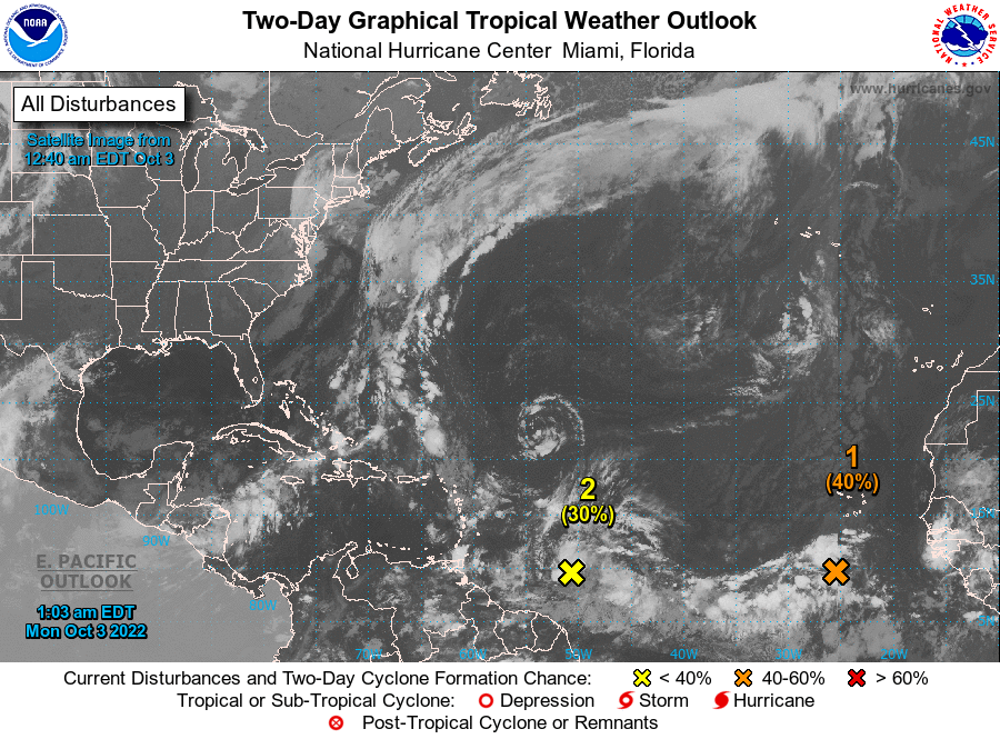
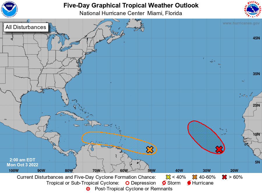
There are two areas in the Atlantic that the NHC is watching along the inter-tropical convergence zone (ITCZ). Neither is currently expected to affect the US , however things can change.
 I'll be watching.

Until next time,
                                              Matt.
​
Picture
Picture

tropical update wednesday 9-28-22, 6:30 pm

9/28/2022

 
Good evening.

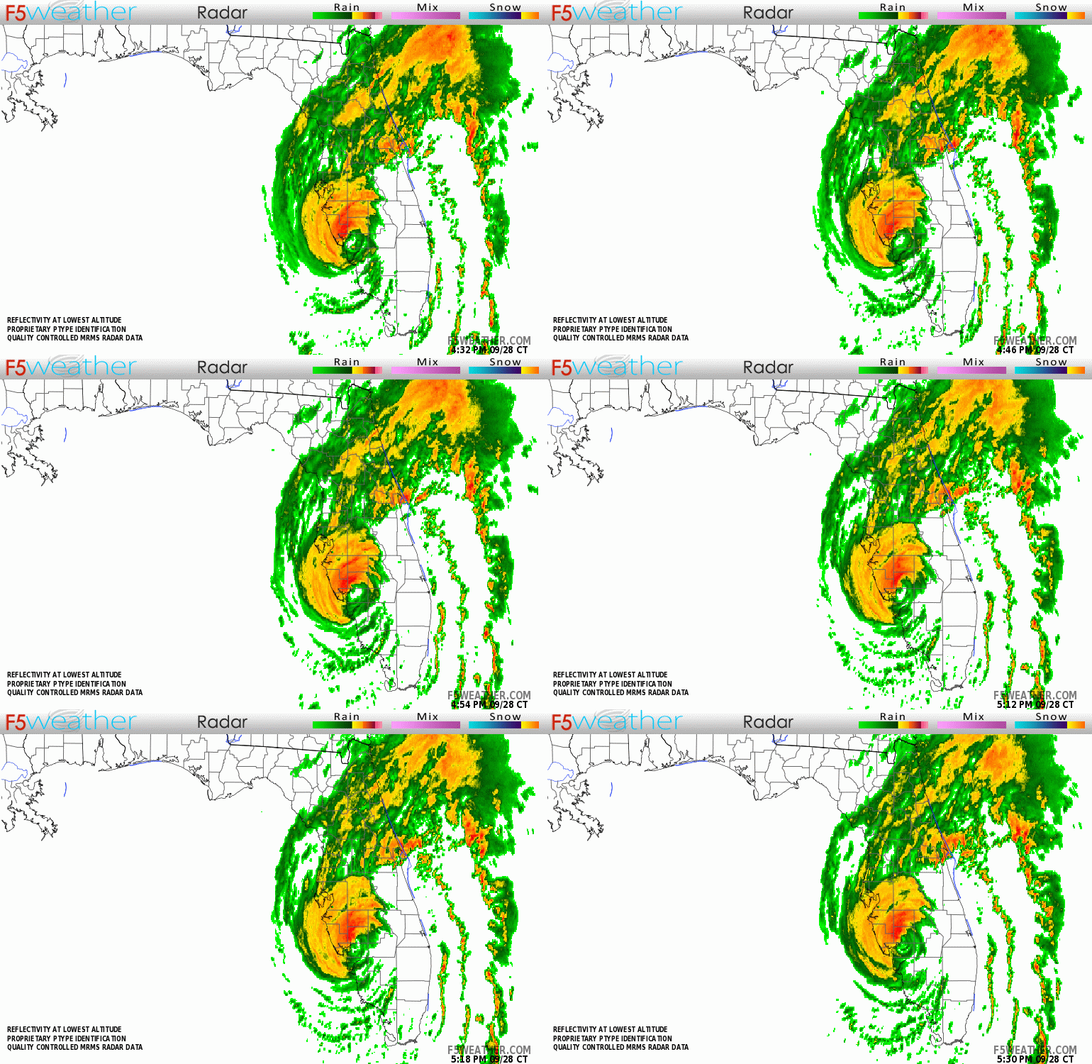
Hurricane Ian made landfall this afternoon over Charolette Harbor just  south of Venice, Florida as a strong Cat 4 hurricane with peak winds of 155 mph and a barometric pressure of 937 mbs. It took an eastern jog as I'd anticipated after its western wobble early this morning, which I spoke about this morning, and came ashore south of the forecast track. Wobbles close to shore can be very significant. It appears to be steadily weakening now.

My thoughts and prayers go out to a friend and his family on the Myakka River who was in eye wall almost all afternoon, as well as everyone else in its path. The Tampa area should only experience Cat 1 conditions and offshore winds and no surge.

This will probably be my last post on Ian.

My best to all, until next time.

                                                                Matt.

​PS. Rainfall at my house this past week has totaled 9.07 inches, which appears to be fairly typical for most of Miami-Dade County. More than Albuquerque, NM usually gets in a year. Once again stressing the importance of rain events.
​
Picture
Picture

tropical update wednesday 9-28-22, 5 am

9/28/2022

 
Good morning.

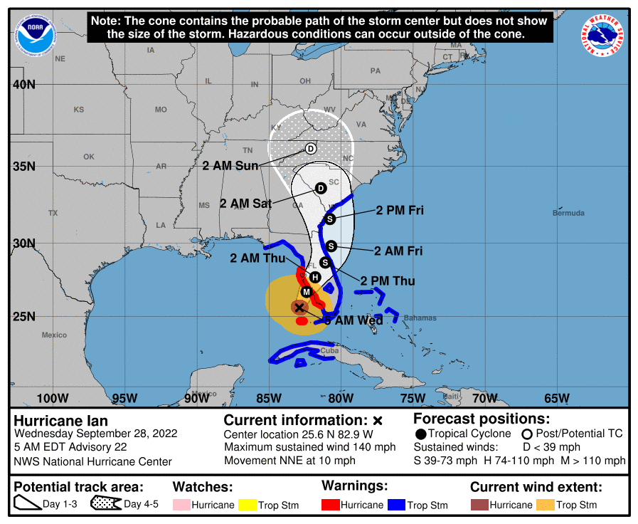
Early this morning Ian has taken a decided western wobble and effectively has moved almost due north overnight. The net effect of this is that it is unlikely to hit Ft Myers. Western wobbles are usually followed by eastern wobbles. The NHC's track has not changed. Ian should make landfall this evening along the Florida West Coast. The area between Venice and Sarasota currently appear to be at greatest risk due to this wobble.

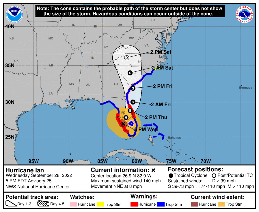
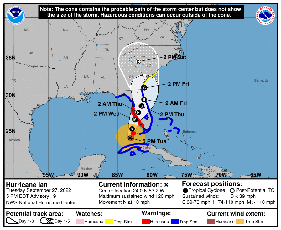
If you look at the NHC track below you will see the size of the storm force and hurricane force wind fields. The eye is currently around 20 miles wide and should remain about that size thru landfall. The center  would need to pass within 15 miles of you to receive eye wall, the eye wall is where the major hurricane force winds are.

I'll write again this evening as it approaches the coast.

Best wishes to everyone along the West Coast who may be affected by this storm. Please look in the Weather Trivia section of this website and read "What to do during a hurricane".

Be safe.

Until next time,

                                                          Matt.

Picture
Picture

tropical update tuesday 9-27-22, 5 pm

9/27/2022

 
Good evening.

Hurricane Ian is currently located in the SE Gulf of Mexico and has been moving steadily NNE at 10 mph throughout the day today. It is currently east of where the NHC had forecast to be at this time yesterday, and is moving faster. As a result the NHC's track has shifted to the south and east and the NHC is currently forecasting  it to make landfall tomorrow evening between Ft. Myers and Tampa. It is currently headed towards Venice, Florida. As we've seen its track has been fluctuating and it may continue to do so, however, it is running out of time.

On this track Tampa would still get a hurricane however it would be spared the worst of it and its surge.

Its eye is currently 20 miles wide and at present appears to be undergoing an eye wall replacement cycle with shrinkage of its eye. This is often a sign of intensification and the NHC is currently forecasting it to be a 130 mph Cat 4 hurricane at landfall tomorrow due to its more southerly route. Hopefully it will weaken some prior to landfall.

Due to its more SE location Miami-Dade and Broward Counties may get winds into the 30s late tonight and early tomorrow morning in squalls. It should be due west of Miami at around 4 am tomorrow.

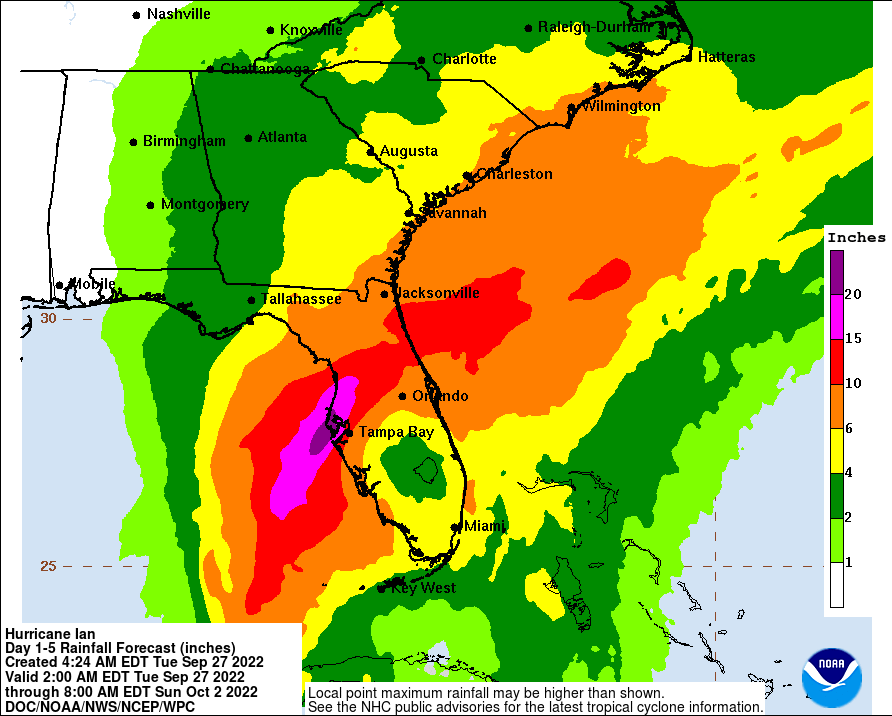
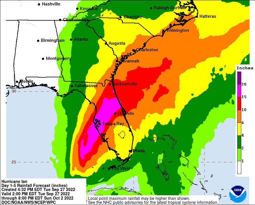
I've attached a revised Rainfall Forecast accounting for the more southerly track.

I'll write again early tomorrow morning.

Until then,

                                       Matt.


Picture
Picture
Picture

tropical update tuesday 9-27-22, 5 am

9/27/2022

 
Good morning.

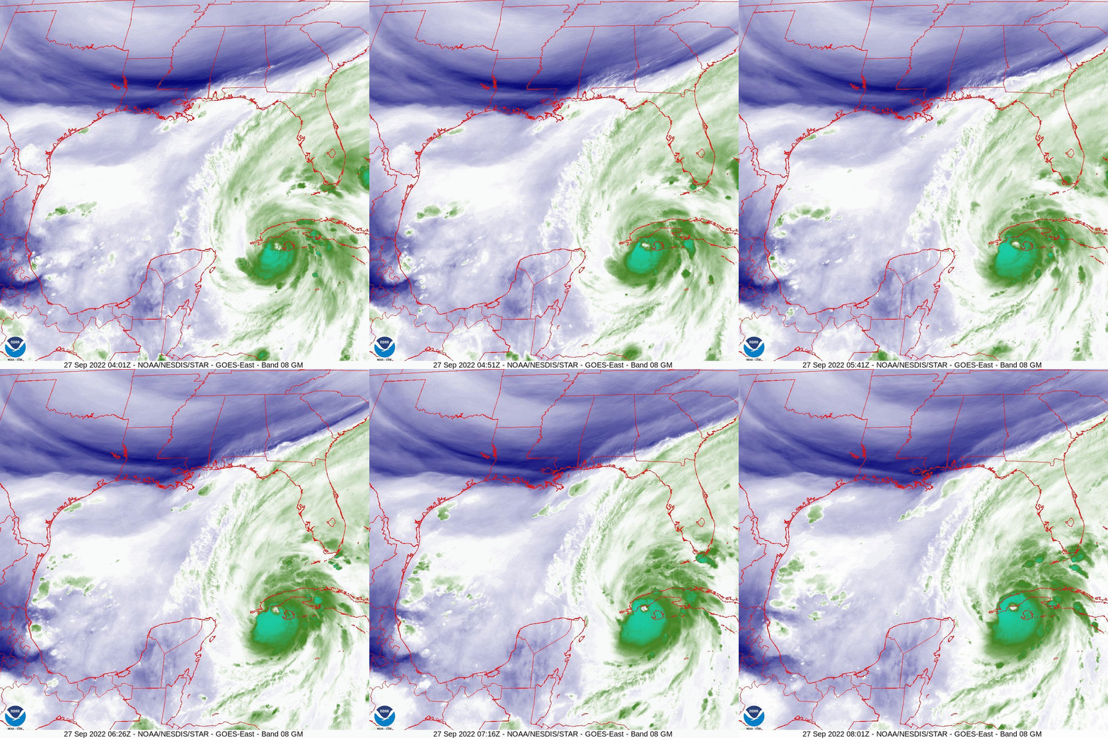
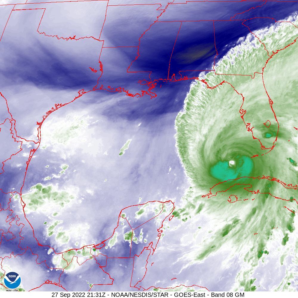
At 5 am Hurricane Ian was making landfall over Western Cuba, see WVL below. You will also notice the cold front slowly pushing south towards North Florida. It is currently forecast to be in the Tampa Bay region on Thursday morning as Ian approaches the West Coast of Florida. Ian is currently moving just slightly west of due north and may not make it to 84.0 degrees west. It is already starting to slow down and should markedly slow down Wednesday and Thursday. This will lead to a prolonged rain event for the Florida Peninsula and wind event for the affected areas of the West Coast. It is currently forecast to be a 115-120 mph Cat 3 Hurricane at landfall in the Tampa Bay region. Hurricane force winds are forecast to extend 40 miles to the east of the center with Major Hurricane force winds extending 15-20 miles from the center. Storm surge will be significant with the slow approach to the coast. This will be a severe event.

With its slow motion wobbles will become very significant and could lead to landfalls north or south of the current forecast, areas from Ft Myers to the Big Bend should continue to prepare, Tampa Bay remains at highest risk.

I will post again this evening after we see how it progresses today.

Until then,

                                           Matt.
​
Picture
Picture
Picture
Picture
Picture
Picture

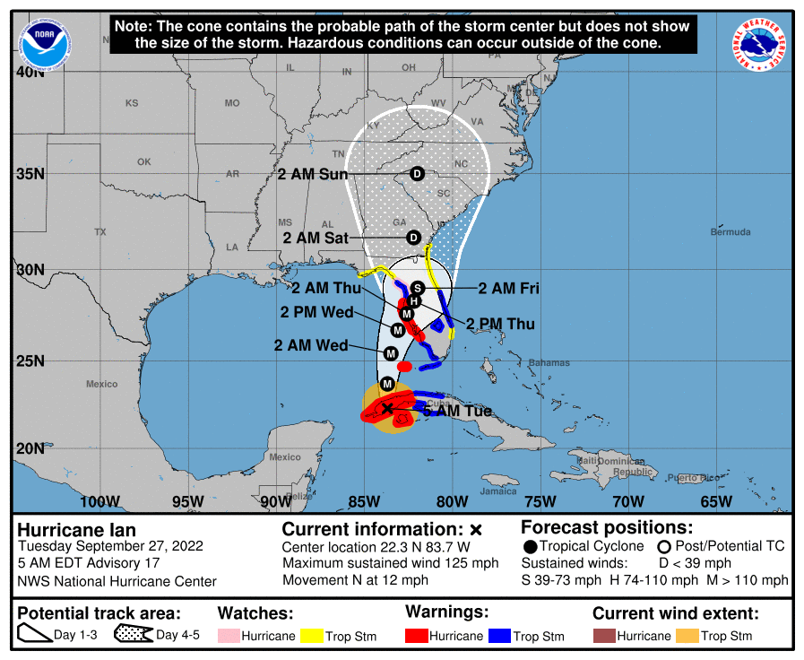
tropical update Monday 9-26-22, 6 pm

9/26/2022

 
Good evening.

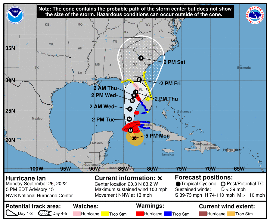
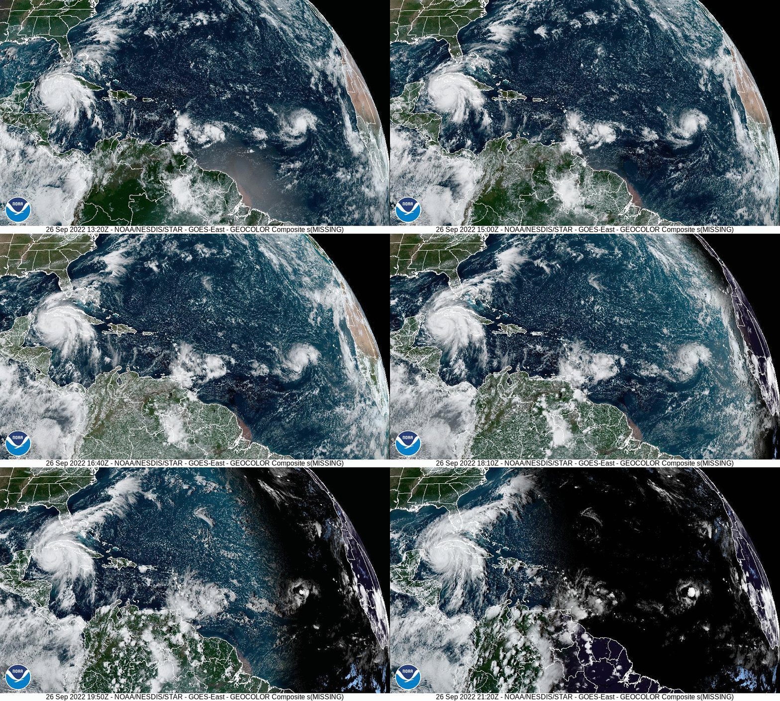
Ian has been intensifying steadily today and I am expecting a distinct eye to form soon. If you look at the latest NHC forecast you will notice that they have shifted it further east, once again towards the Tampa Bay area. This is in response to an earlier than expected turn to the NNW today. Just how far west Ian gets before turning north will be key in determining where it will make land fall. The further west the longer the track and the later its arrival, (giving more time for the stationary front to drift northward). The further east the shorter the track and the earlier the arrival. The further north it gets the weaker it will become. On its the current NHC forecast track it is forecast to get to 84.0 W, it is currently 83.2 degrees west. If if gets to greater than 84.0 W a track more northward would be more likely, conversely less than 84.0 W would favor a more southerly track. We should have that answer by around 5 pm tomorrow.

On its present track it should pass > 200 miles west of Miami and Ft Lauderdale areas. Some passing rain bands would be expected  tomorrow and Wednesday with ? 2-4 inches of rain and winds in the 20s.

The lower Keys should experience squalls accompanied by some storm force winds in the 40s. The West Coast will have significantly more weather however it is too early to say. We should know by tomorrow evening.

Until next time,

                                           Matt.
​
Picture
Picture

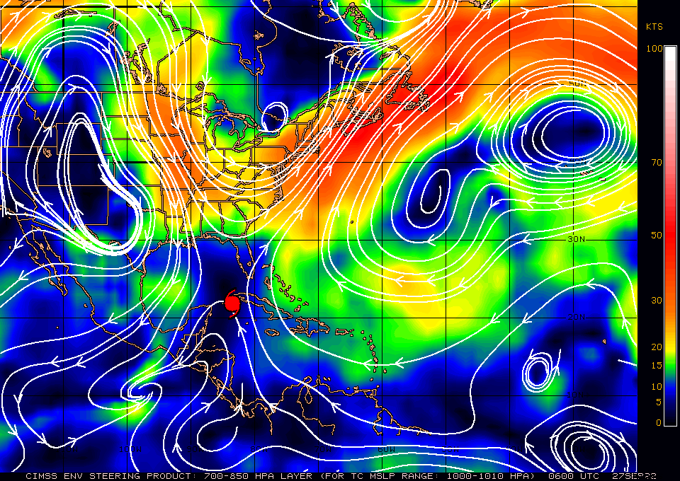
tropical update monday 9-26-22, 5 am

9/26/2022

 
Good morning.

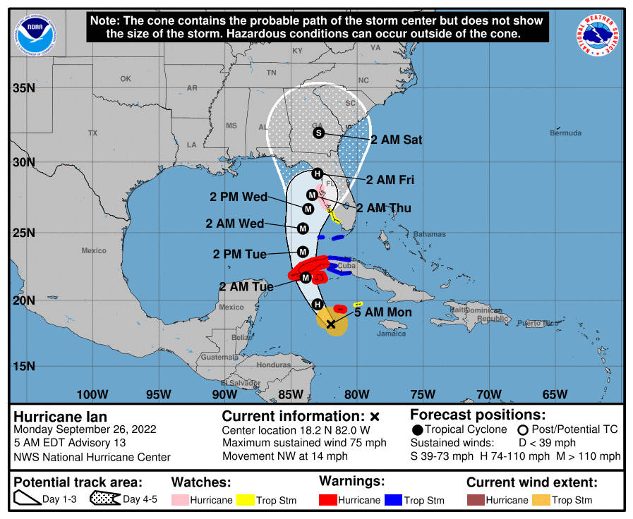
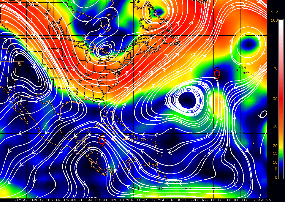
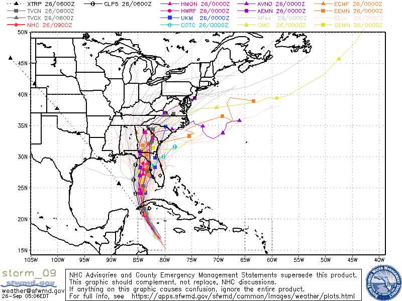
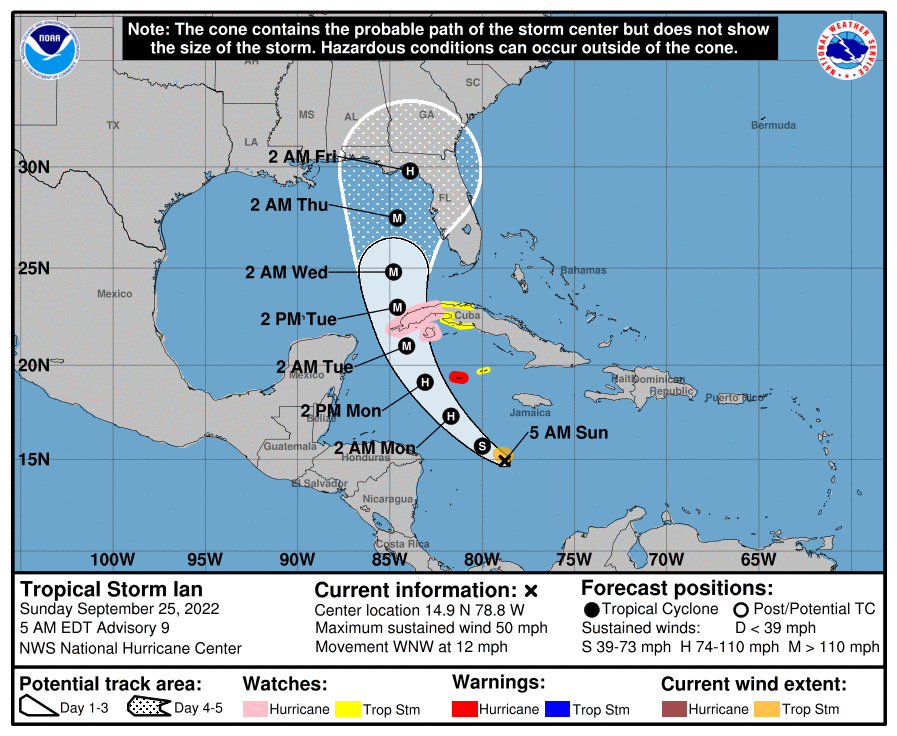
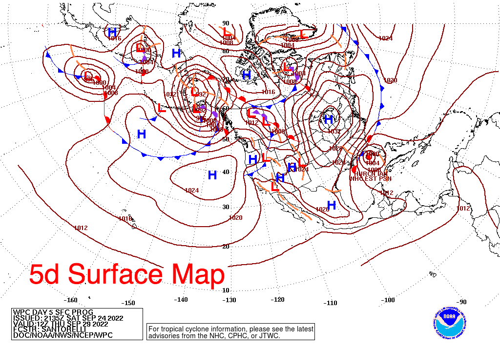
Ian became a Hurricane as of the 5 am advisory today and is expected to under go rapid intensification today. It has been moving steadily NW over night and is about to enter the very warm waters of the NW Caribbean. If you look at the Surface Map below you can see that there is a wide window currently open for Ian to its N and NW, roughly from Ft Myers to the Florida Panhandle. In addition steering forces are light there and it should slow down as it enters that window.

If you look at the models below you will notice that they are in fairly tight agreement for the first 48 hour, and then start to spread. When storms slow things can change and wobbles can become significant. It is currently forecast to make landfall early Friday morning. We will probably have a better idea of just where it will make landfall on Wednesday morning. The stationary front which I spoke about the past few day is forecast to be in the Big Bend area, where the current NHC forecast has it making landfall on this map. Timing will be key as the front can waver up or down with time.

High shear and dry air which I've spoken about previous are forecast to weaken it prior to landfall. Just how much we'll have to see.

Until next time,

                                                    Matt.
​
Picture
Picture
Picture
Picture

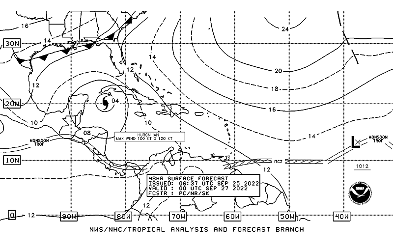
tropical update sunday 9-25-22, 5 am

9/25/2022

 
Good morning.

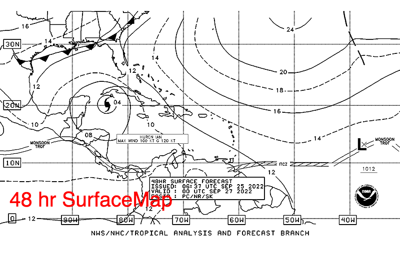
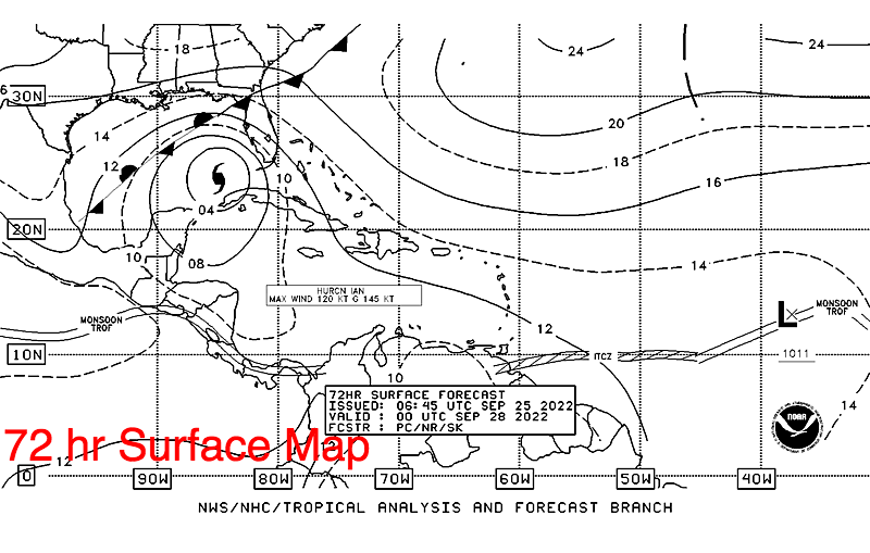
With regards to TS Ian there have been a few changes. Most importantly it has been moving further west than forecast as noted yesterday evening. As a result its track will be longer and later in time. As a result it currently is not anticipated to make landfall until early Friday morning. This also affects the location of the frontal boundary which it will be drawn toward. Timing is everything and could still change. On Friday morning the stationary front is forecast to be across the Florida Panhandle, currently in the Big Bend region. A weak frontal boundary across South Florida, presently in the Ft Myers area is expected to dissipate and a new front will start approaching the area in 2 days.

See Surface Maps below.

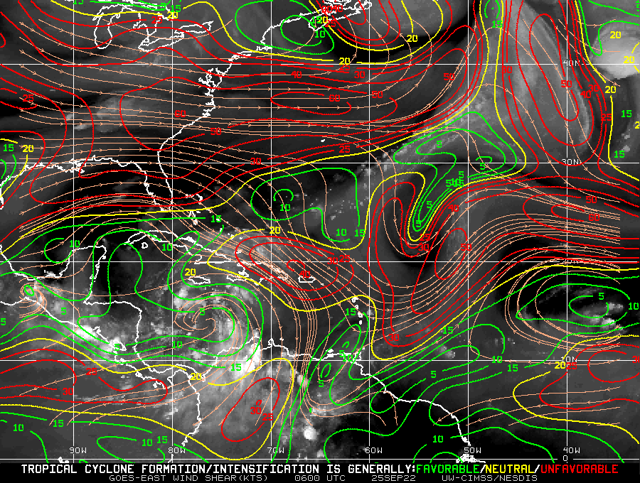
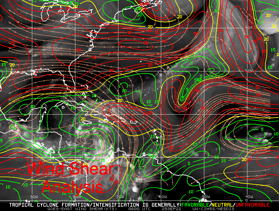
​Over the last 6 hours Ian has started to move WNW and should turn NW in response to the approaching front across the SE US. Wind shear is quite high over North Florida and the Northern Gulf of Mexico and though Ian is anticipated to become a Cat 3 or 4 Hurricane in the Southern Gulf of Mexico it is anticipated to weaken prior to landfall and is currently forecast to come ashore as a  90 mph Cat 1 storm. Intensity forecasts are difficult and less predictable however the further north it goes the likely weaker it should get. See Wind Shear Analysis below.

Until next time,

                                                Matt.
​
Picture
Picture
Picture
Picture
Picture
<<Previous
Forward>>

    Categories

    All
    Preseason Update