Matt on the Tropics
Tropical Updates
  • Home
  • About
  • Archive (pre-blog)
  • Contact
  • Weather Links
  • Weather Trivia

September 24th, 2022

9/24/2022

 
Good evening.

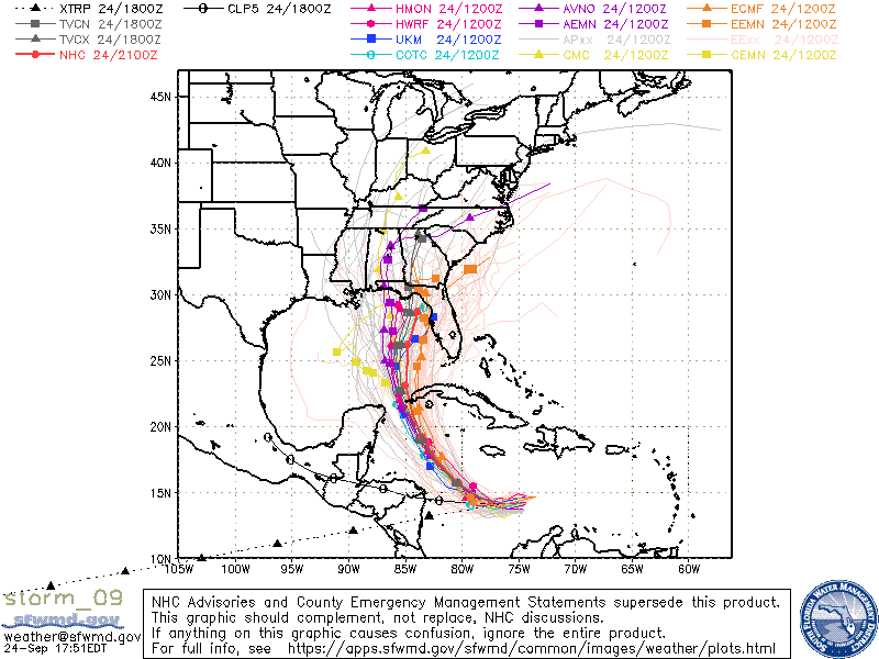
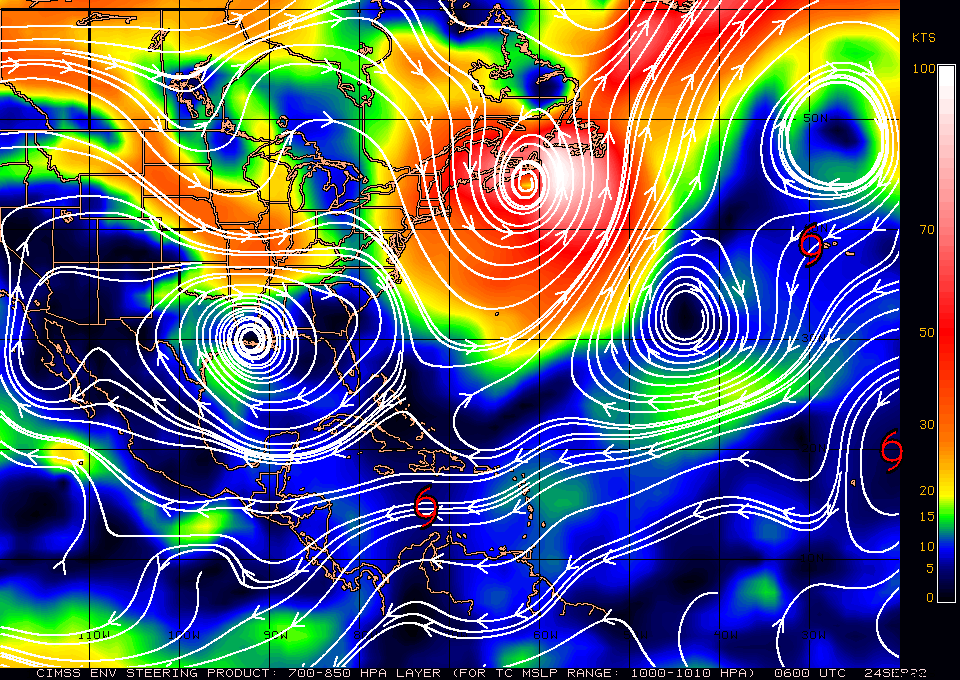
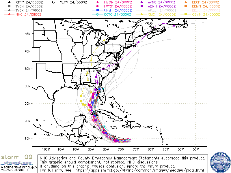
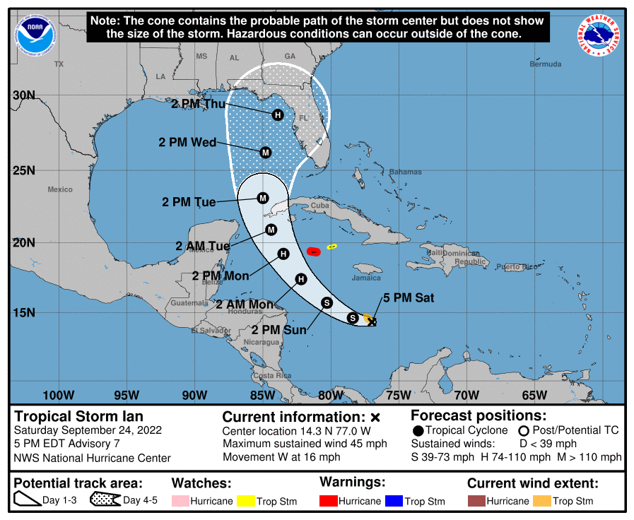
Just a quick update. Ian has been moving just south of due west all day today and is currently over 100 miles south of where the NHC had forecast it to be at this time yesterday. As a result the models are starting to shift to the north and west. Whether this trend continues or not we'll just have to see.

Note there is quite a bit of spread in the models so some further changes are likely.

Until tomorrow am, 

                                                       Matt.
​
Picture
Picture

tropical update saturday 9/24/22, 5 am

9/24/2022

 
Good morning.

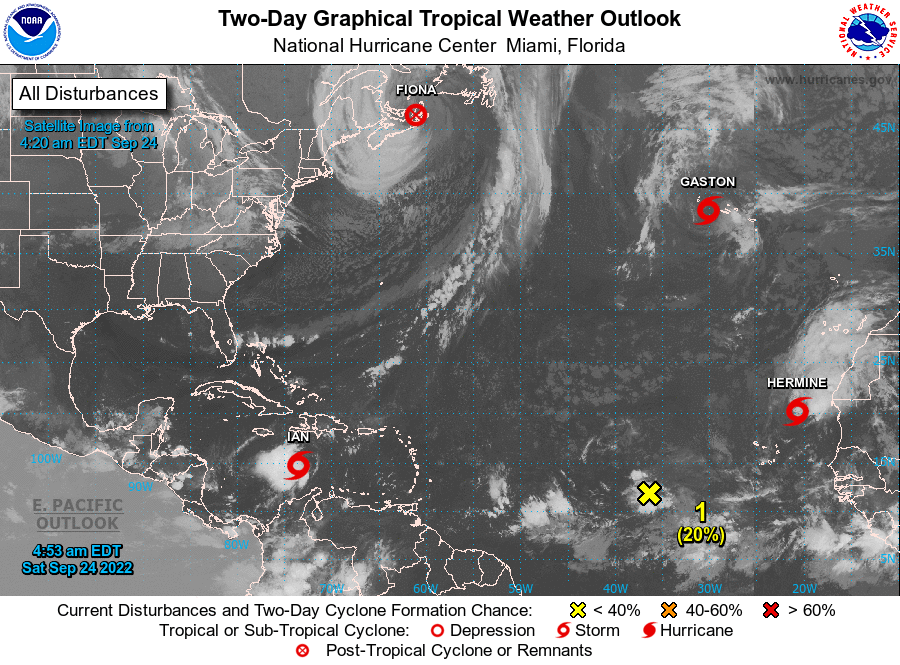
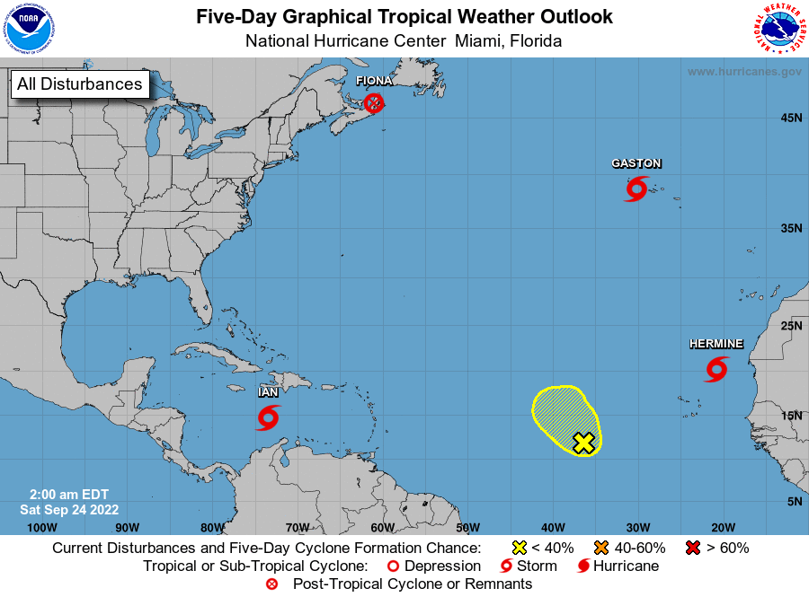
If you look at the satellite image below you will see as expected things are getting active in the tropics. Overnight TS Hermine formed, but not where we expected, along the west coast of Africa, it is moving north and already showing signs of weakening. Ian, which was beaten out in its naming by just a few hours is the one we'll need to watch.

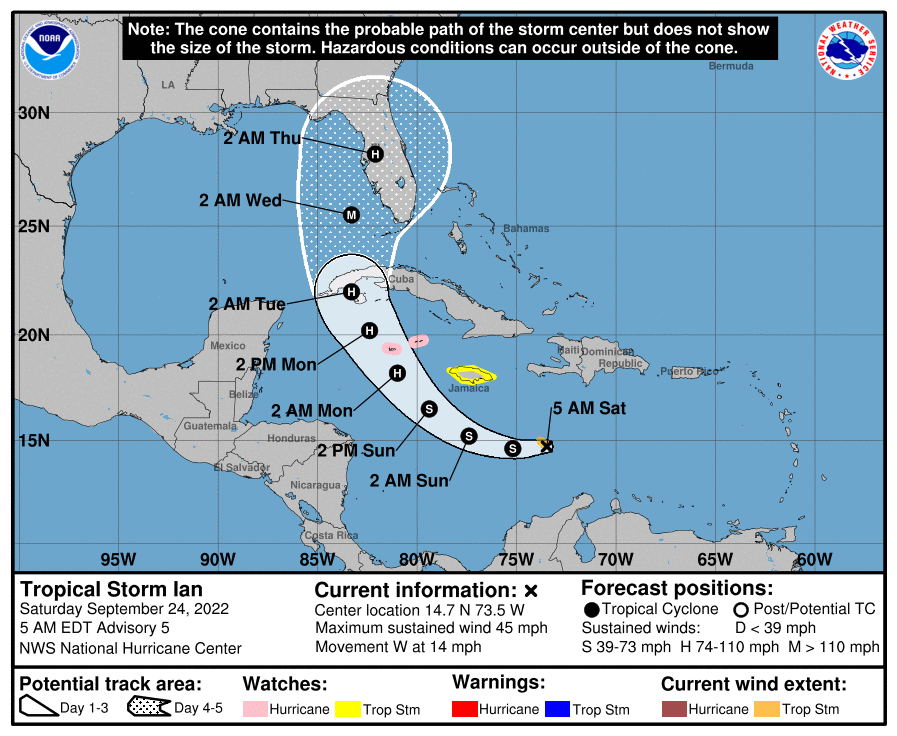
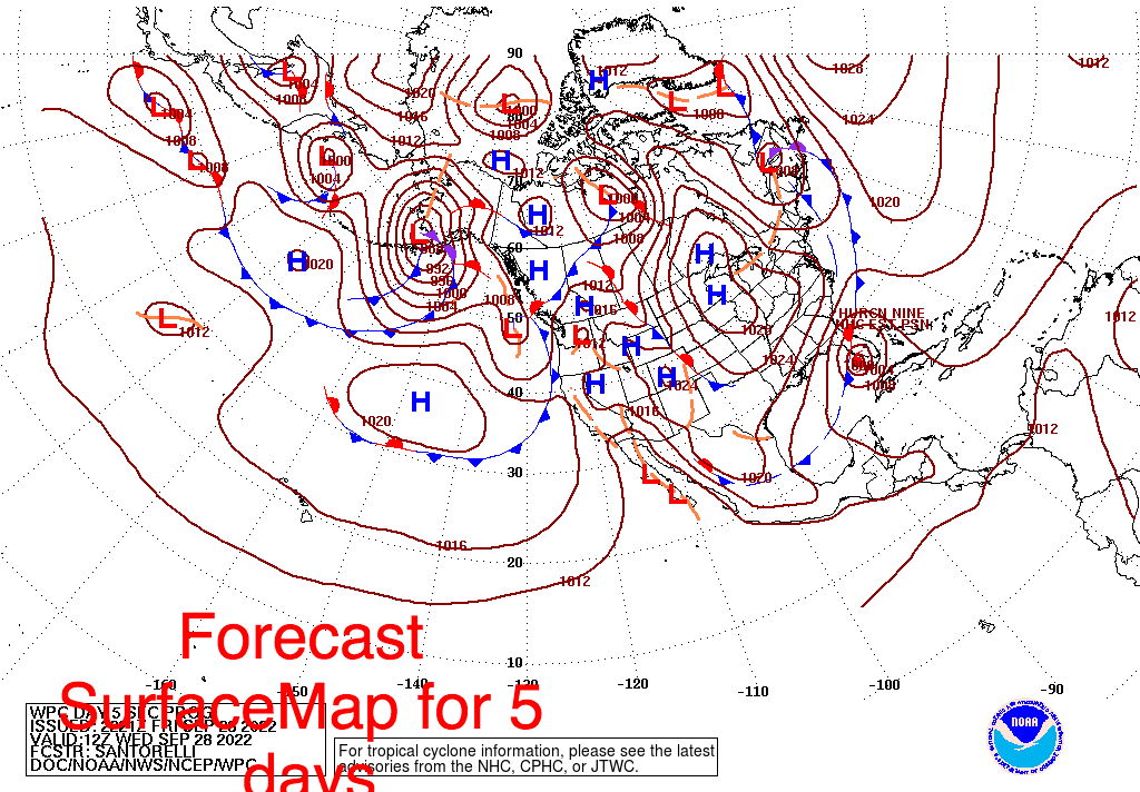
​See graphics below. It is currently moving due west. If you look at the forecast 5 day surface map you can see why the current NHC forecast and the models have shifted north and are now in agreement with me that the Tampa Bay area is currently the area at greatest risk. This is where the stationary front across Florida is forecast to be when Ian approaches. 

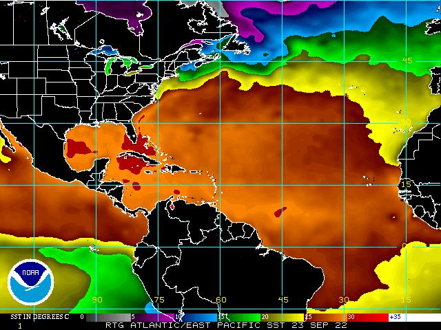
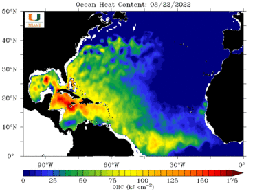
Extremely warm waters with high heat content in the NW Caribbean Sea and SW Gulf of Mexico could leads to rapid intensification as it approaches Western Cuba. There is still dry air in the Gulf of Mexico and high shear in the northern Gulf which will hopefully slow or dampen development as it approaches Florida. If it gets to at least 83 degrees west the impacts on SE Florida should be minimal. We'll know more as things develop however the further west it goes the less SE Florida should see. The West Coast will be a different story. A lot will depend on the size of the storm, the size of its eye as it approaches and its intensity at landfall. I'll be writing at least daily (more frequently as it approaches) with additional information and what exactly we can expect for different areas as Ian develops. It is currently forecast to affect Florida on Wednesday and Thursday.

The West Coast of Florida from Ft Myers to the Big Bend should be preparing for a possible major hurricane, most likely a Cat 3 or 4, hopefully a 2.

Until next time,

                                                 Matt.
​
Picture
Picture
Picture
Picture
Picture
Picture
Picture

tropical update friday 9-23-22, 5:30 am

9/23/2022

 
Good morning.

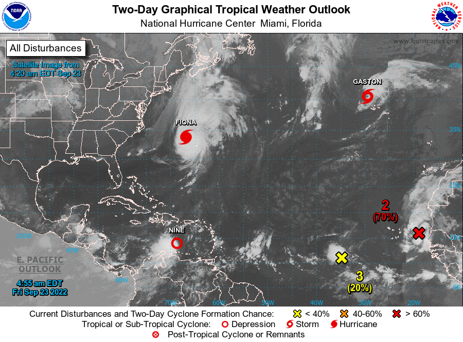
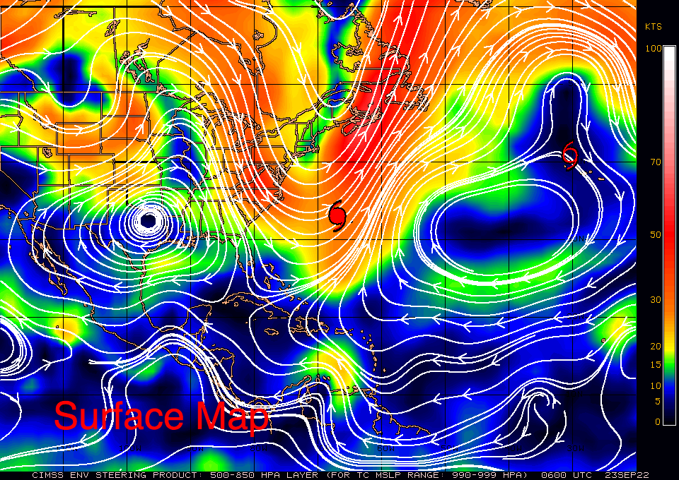
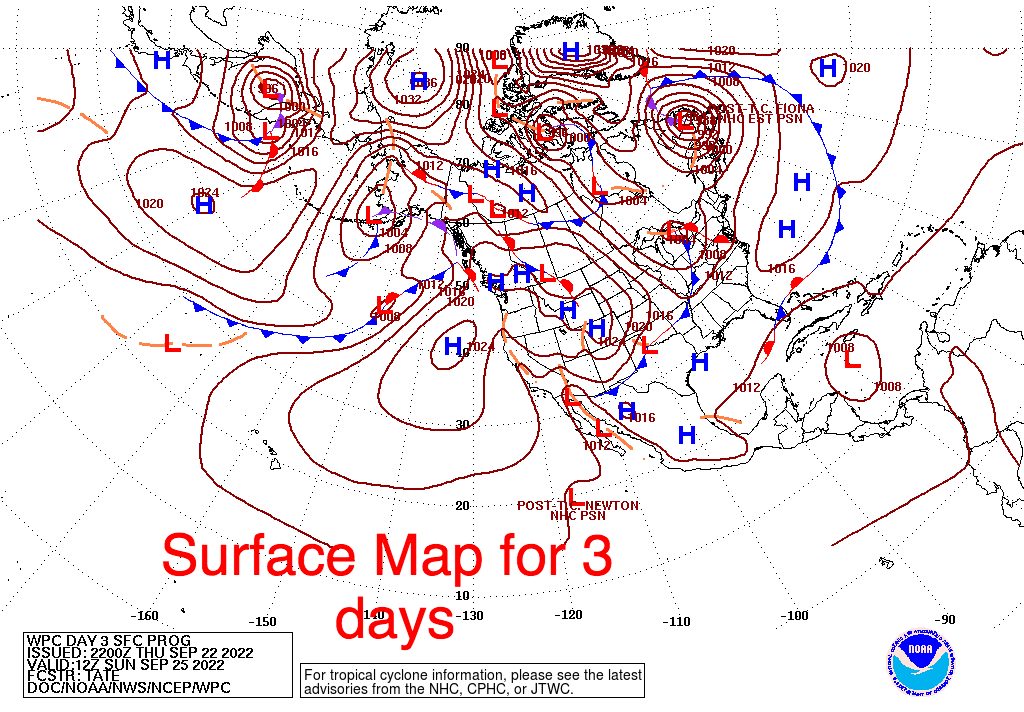
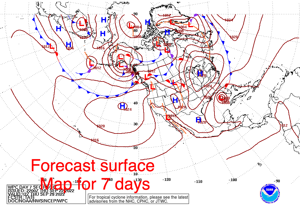
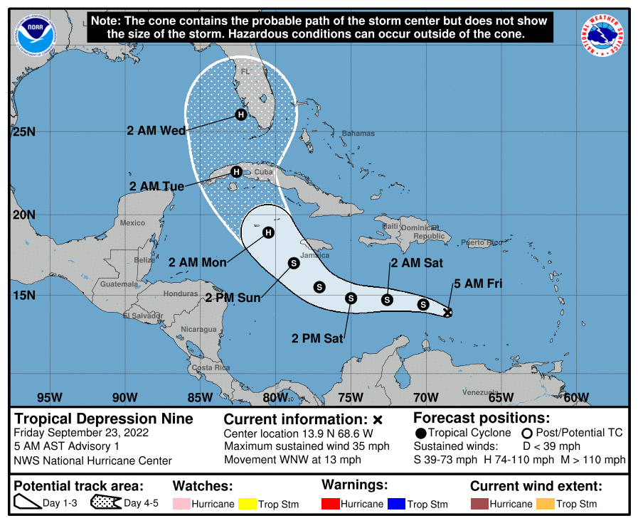
Overnight there have been some significant changes. Most importantly a big burst of convection leading to an earlier than expected development of a depression which will likely become TS Hermine. If you look at the Surface Map below you will see that high pressure over Texas is starting to move east. Next notice the forecast surface maps for 3 days and 7 days. A frontal boundary is forecast to stall over South-Central Florida in the Ft Myers area in 3 d and then start to drift north and is expected to be in the Tampa area in 7 days, when Hermine should be approaching the West Coast of Florida. Where exactly this frontal boundary is when Hermine approaches will be key as the storm will likely be drawn towards it regardless of how far west it goes. A Florida landfall is looking likely and at present the Tampa Bay area appears to be at greatest risk. Dry air over the Gulf of Mexico and Florida will hopefully limit intensity however at present the NHC is forecasting it to be a Cat 2 storm at landfall.

Until next time,

                                                Matt.
​
Picture
Picture
Picture
Picture
Picture
Picture
Picture

tropical update Thrusday 9-22-22, 7:30 pm

9/22/2022

 
Good evening.

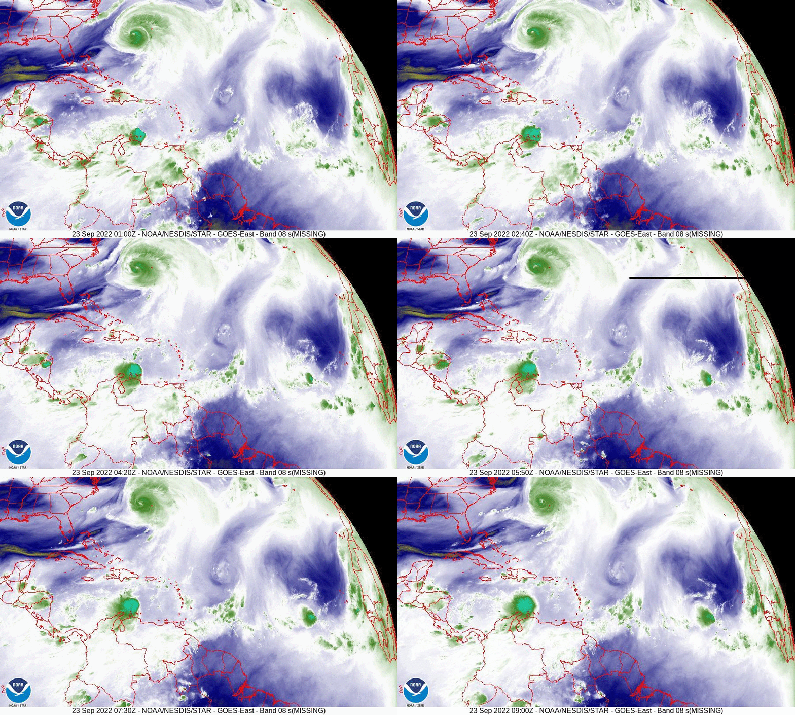
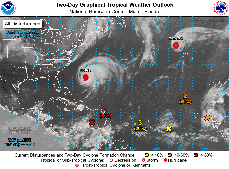
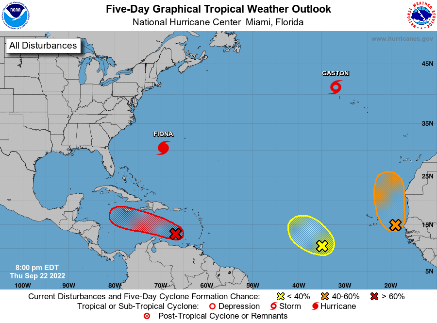
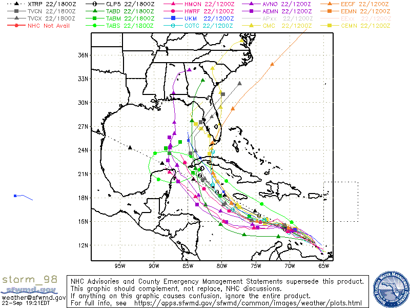
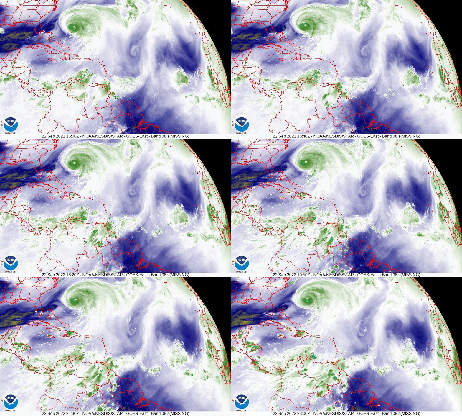
I'm writing about a system in the Southern Caribbean Sea which some of the models bring toward South Florida. See Data below. I've been receiving calls and texts through out the day. I would first like to say, " It is way too early for ANYONE to make an accurate prediction about this system." If you look at the water vapor loop below you will notice several features. First is the area in question moving westward just north of Venezuela. Next high pressure spinning clockwise over the Caribbean. Next Fiona moving NNE. Next a cold front just starting to move off the US East Coast. 

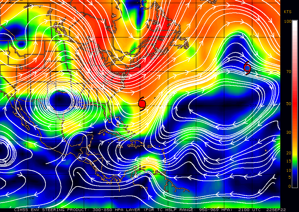
If you look at the area in question you will notice that there is no spin. Until it actually forms no forecast will be accurate, that said it is currently headed toward Central America and the Yucatan. The main variables will be when it actually forms, the later, the further west it should go, and the location of high pressure over the Southern US. If you look at the surface map you can see it currently over Texas. Yesterday it was over Louisiana, however as Fiona moves to the NE it should move back to the east. The timing will be key and if you look at the computer models you will notice the wide spread in them. This is reflective of the high uncertainty in this forecast at this time.

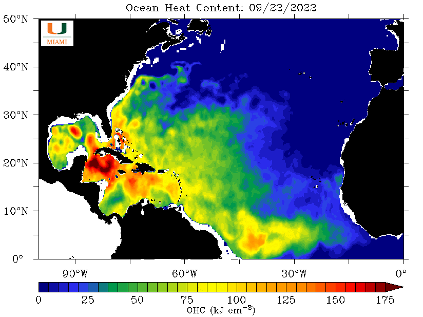
Also notice the extremely high heat content in the northwestern Caribbean. There is a lot of fuel out there and something is going to tap into it. Possibly this system. My suspicion is that the high pressure over the US will shift eastward leading to a more westward track. Its lack of organization should favor this. We're just going to have to wait and see as things develop. The current model consensus is unlikely to be its actual track.

Until next time,
                                          Matt.
​
Picture
Picture
Picture
Picture
Picture
Picture

tropical update monday 9/19/22, 11 am

9/19/2022

 
Picture

Just a quick note. Fiona formed shortly after my last update and as forecast should move out to sea and miss the Continental US.  It is creating a huge rain event for Puerto Rico and Hispaniola.

There is not much else out there at present.

I'll keep you posted as needed.

Matt.
​

Tropical Update 9-14-22

9/14/2022

 
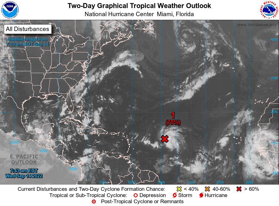
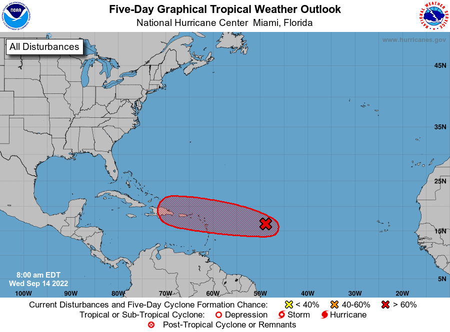
The National Hurricane Center is watching a disturbance in the central Atlantic. It is projected to approach Hispaniola and then turn north and miss the US. High pressure over Florida and the trough to our east should protect us.

Until next time,
​Matt
Picture
Picture

tropical update tuesday 9-6-22, 8 am

9/6/2022

 
Good morning.

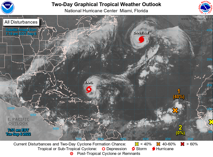
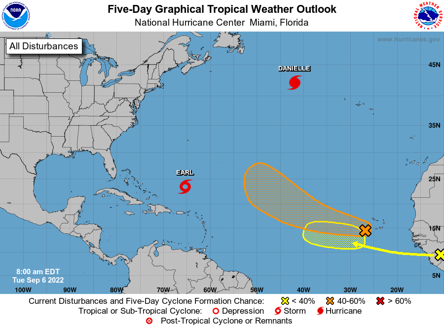
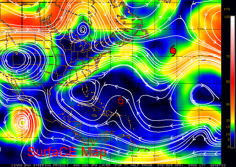
Since my last report Danielle and Earl are larger and still moving out to sea.
Two new areas off and about to come off Africa should move out to sea as well. We'll need to watch the second one however high pressure over Florida and weak high pressure over the Atlantic will likely prevent a US landfall.

Until next time,
                                          Matt.
​
Picture
Picture
Picture
Picture

tropical update Saturday 9-3-22, 7 am

9/3/2022

 
Good morning.

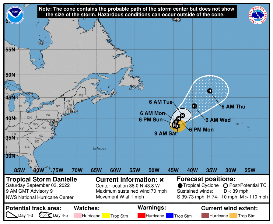
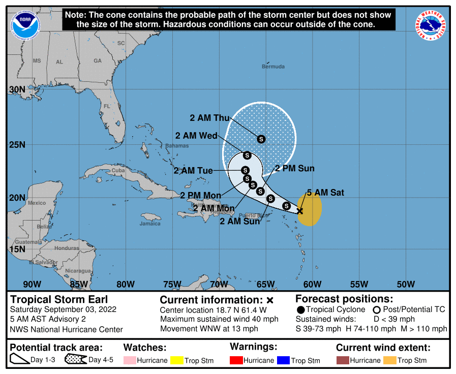
Just another quick update. As noted previously it's September and the tropics are becoming more active however both current systems are small and moving out to sea.

We set a record this August, being the first August since they've been tracking storms without a named storm.

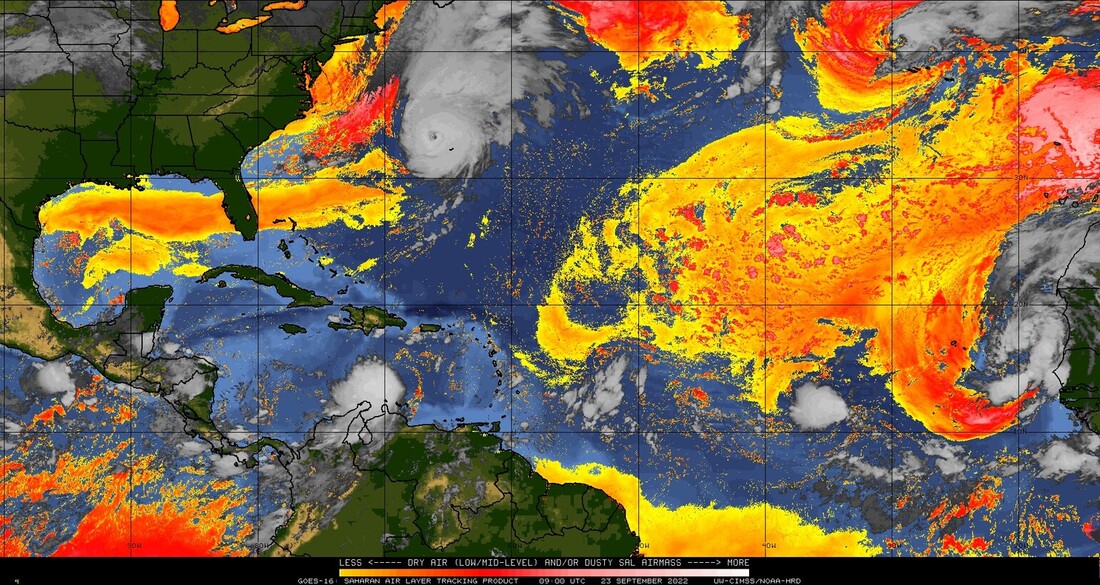
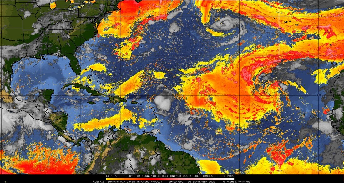
Over Africa there are a couple of waves one which should move offshore in about 2-3 days and one in about 8 days I'll be watching them however high pressure is currently relatively weak over the eastern and central Atlantic which should allow them to move northward as well. I don't think we'll see much until mid September/October. If you look at the Saharan Air Layer Analysis below you will see that the SAL is eroding. Each tropical wave/storm does its part in eating away at it. Wind shear is light over the tropical Atlantic and once the air over it moistens the potential for more development will increase. Hopefully they'll continue to move out to sea.
Until next time,

                                       Matt.
​
Picture
Picture
Picture
Picture
Picture

tropical update tuesday 8-30-22, 9 am

8/30/2022

 
Good morning.

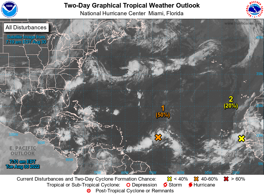
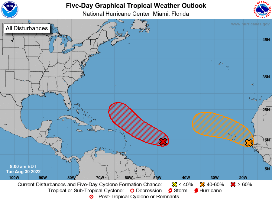
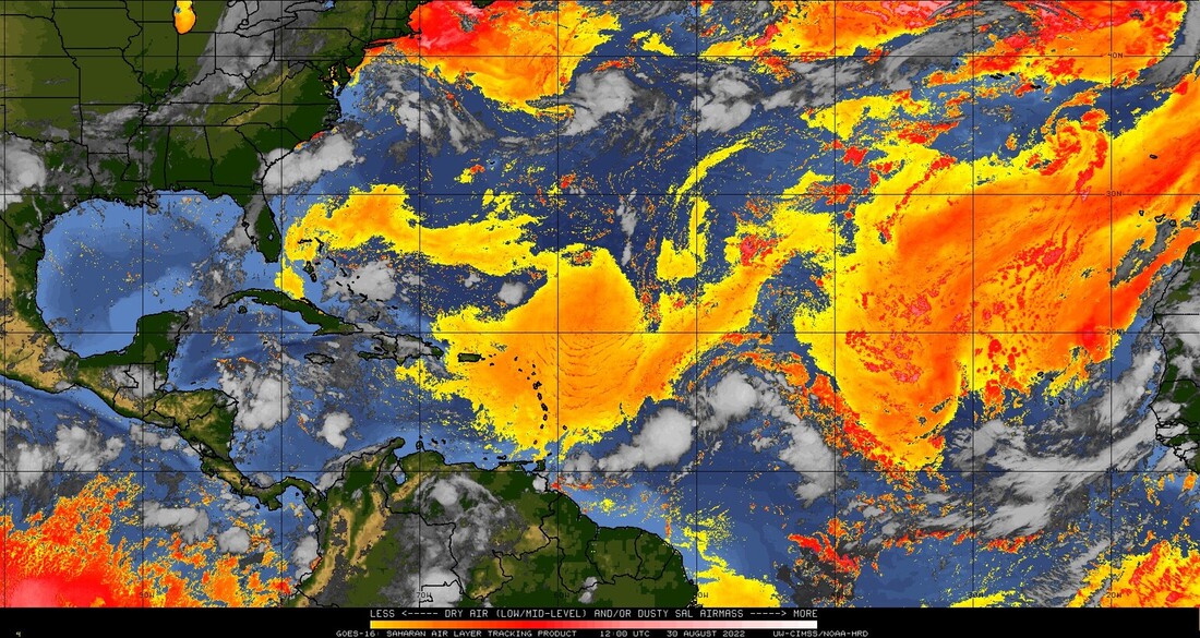
Just a quick update. The media has been talking about a couple of systems. Neither is a threat to the US at this time. Both will probably move out to sea. In addition if you look at the SAL analysis below they are both approaching large areas of dry Saharan air and dust to their north. They will have a hard time becoming much if anything. Nothing to worry about at this time. We probably won't see much until mid September /October. I'll keep my fingers crossed.

Until next time,

                    Matt.

Picture
Picture
Picture

tropical update wednesday 8/24/22, 7 am

8/24/2022

 
Good morning.

Today marks the 30th anniversary of Hurricane Andrew. For those who were here for it, we will never forget.

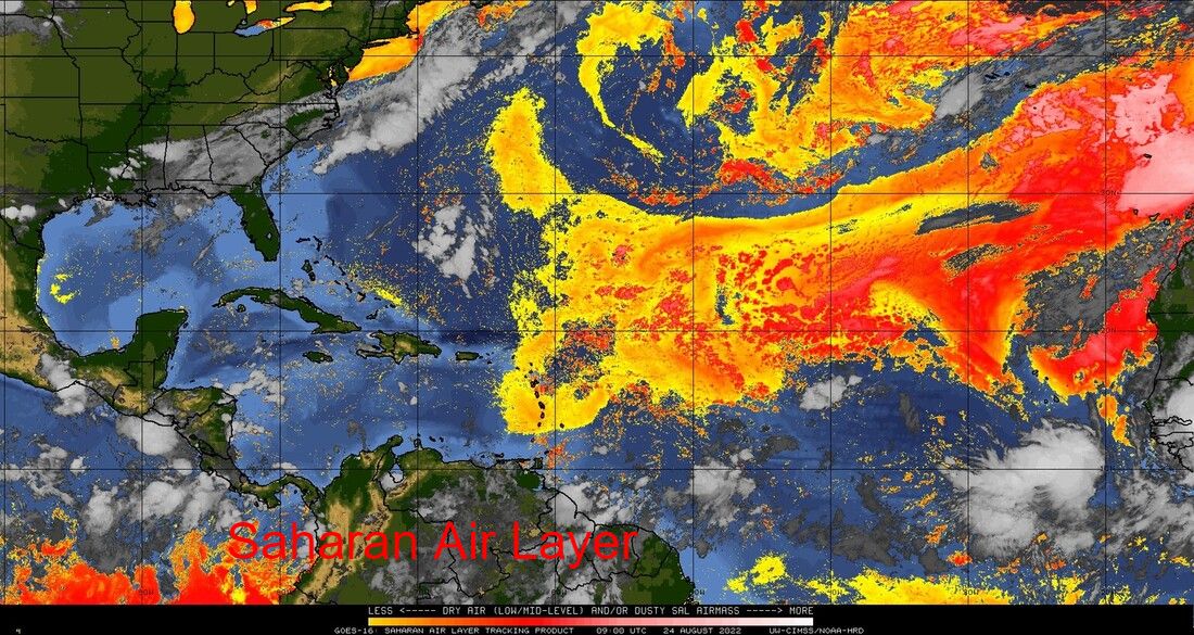
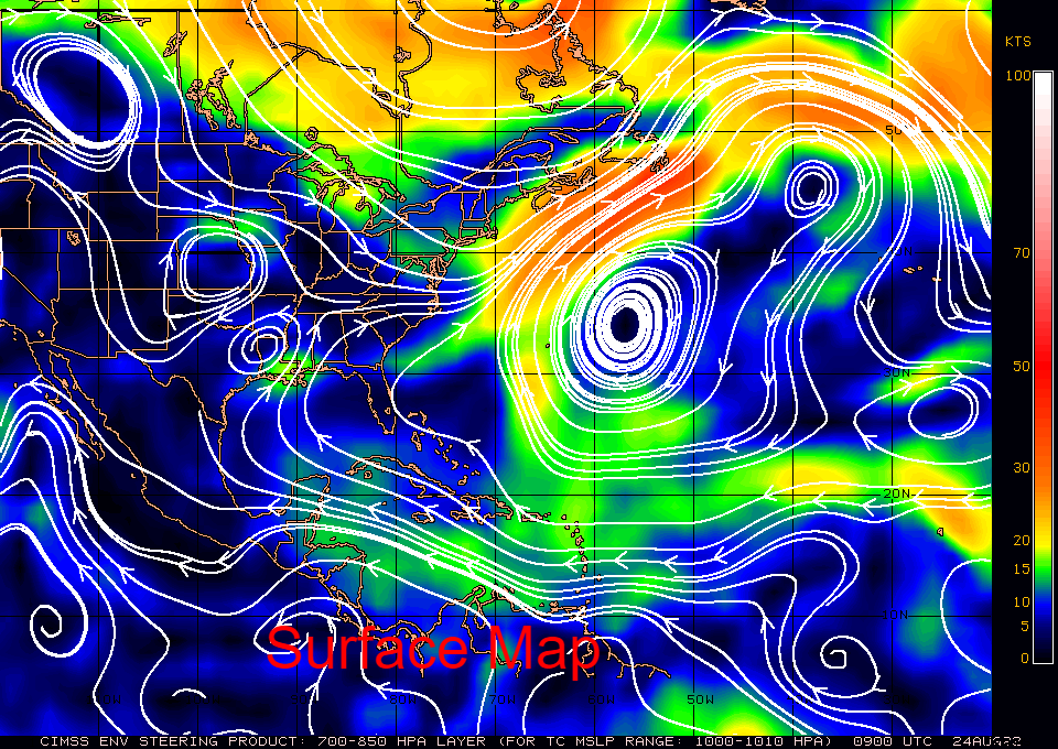
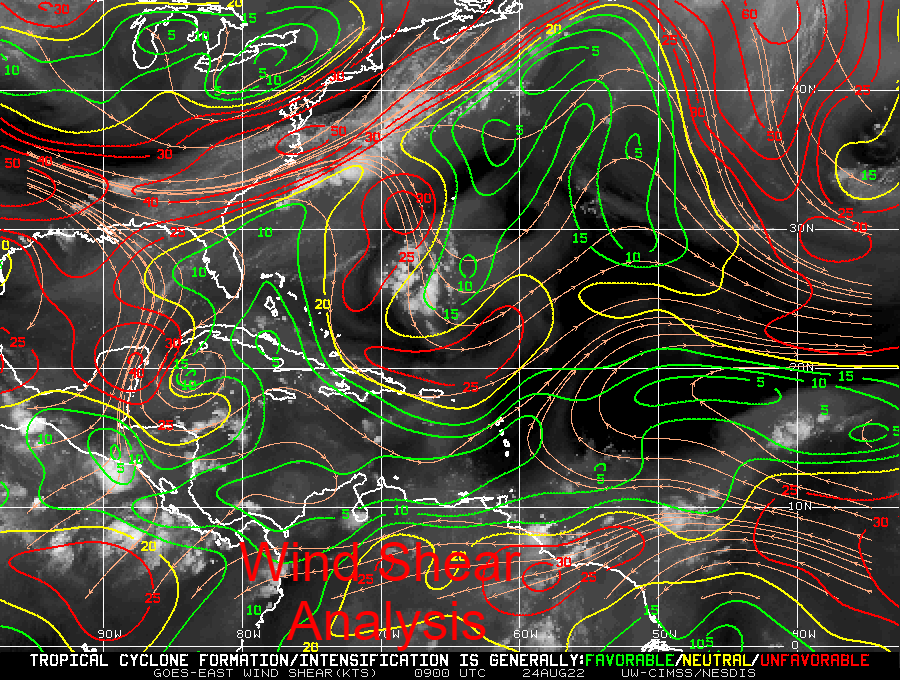
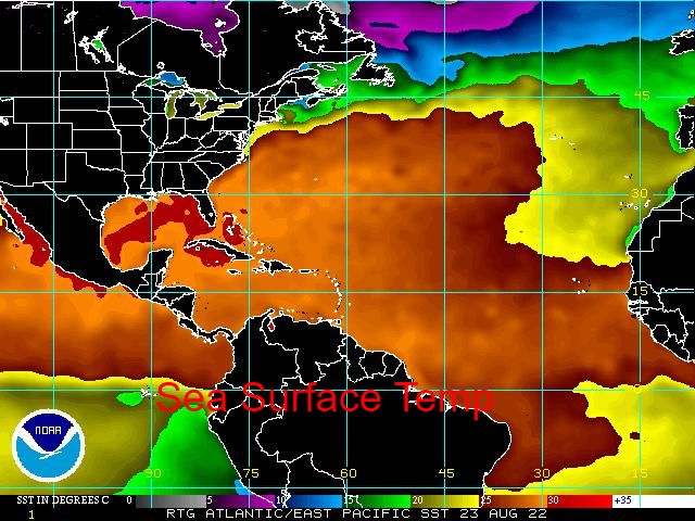
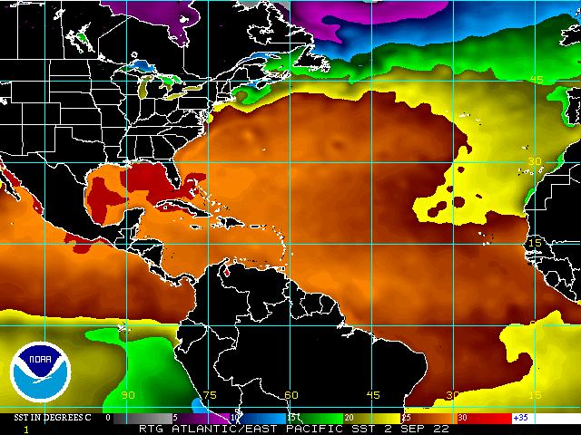
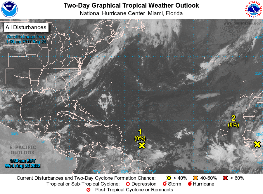
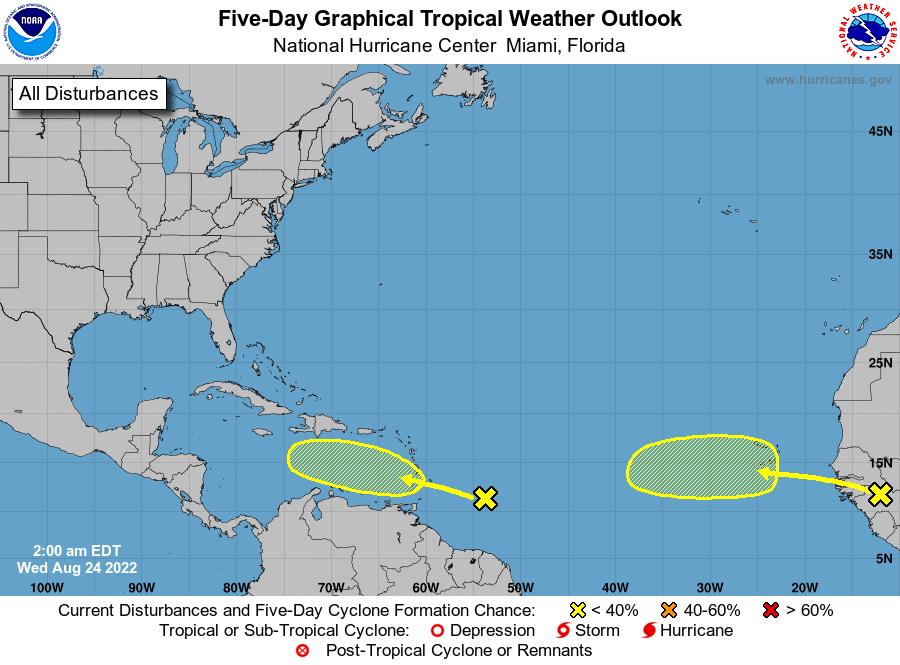
In the tropics things are changing. See images below. The Saharan dry air and dust is still present but is starting to erode and has moved slightly north. Wind shear over the Caribbean and tropical Atlantic has lessened and waters remain warm over the Gulf of Mexico and the Western Caribbean. As noted previously these will be the areas to watch. Dry air should continue to hinder any development for the next week or so but as we enter September the tropics should become more active. Central America, Mexico and the Gulf of Mexico remain at greatest risk this season.

I'll be watching.

I hope everyone is having a good summer.

Until next time,
                                                                  Matt.

​
Picture
Picture
Picture
Picture
Picture
Picture
Picture
<<Previous
Forward>>

    Categories

    All
    Preseason Update