kGood morning.
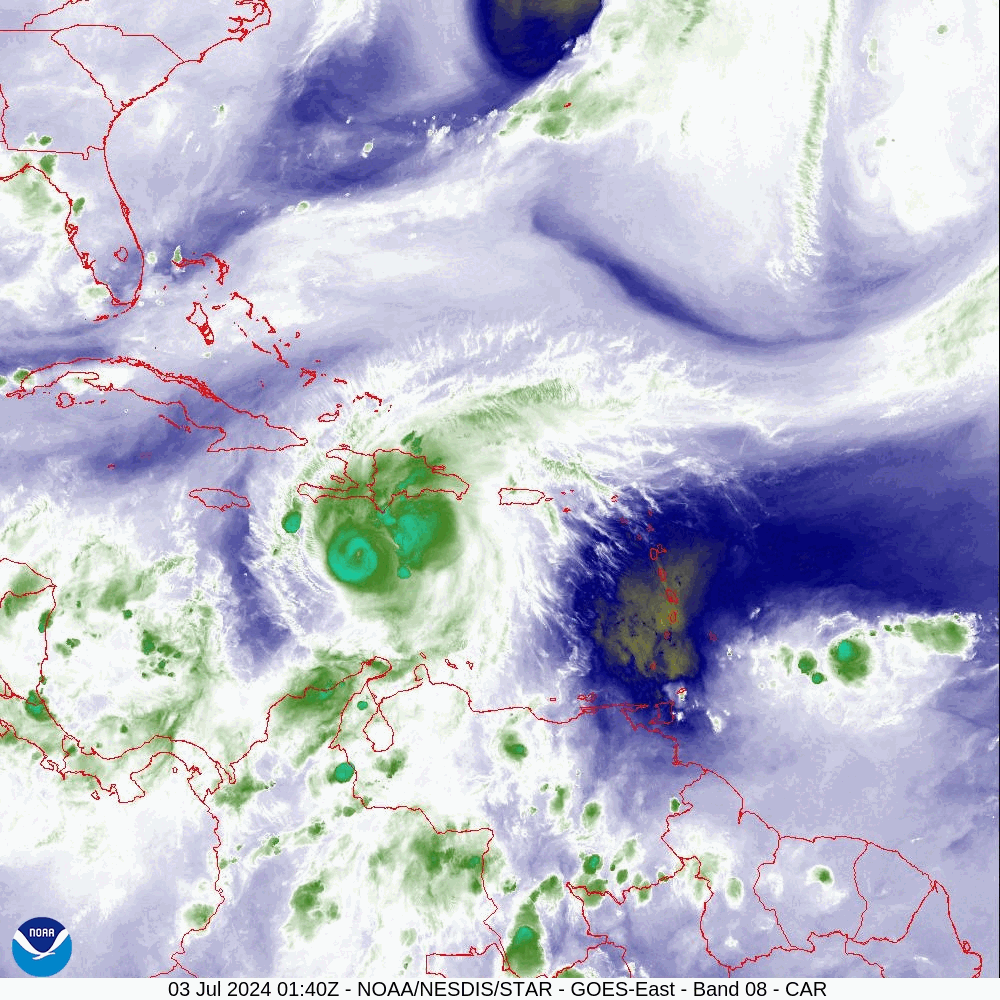
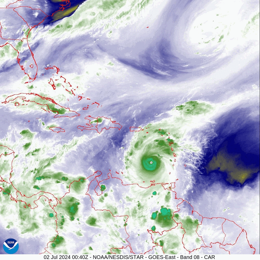
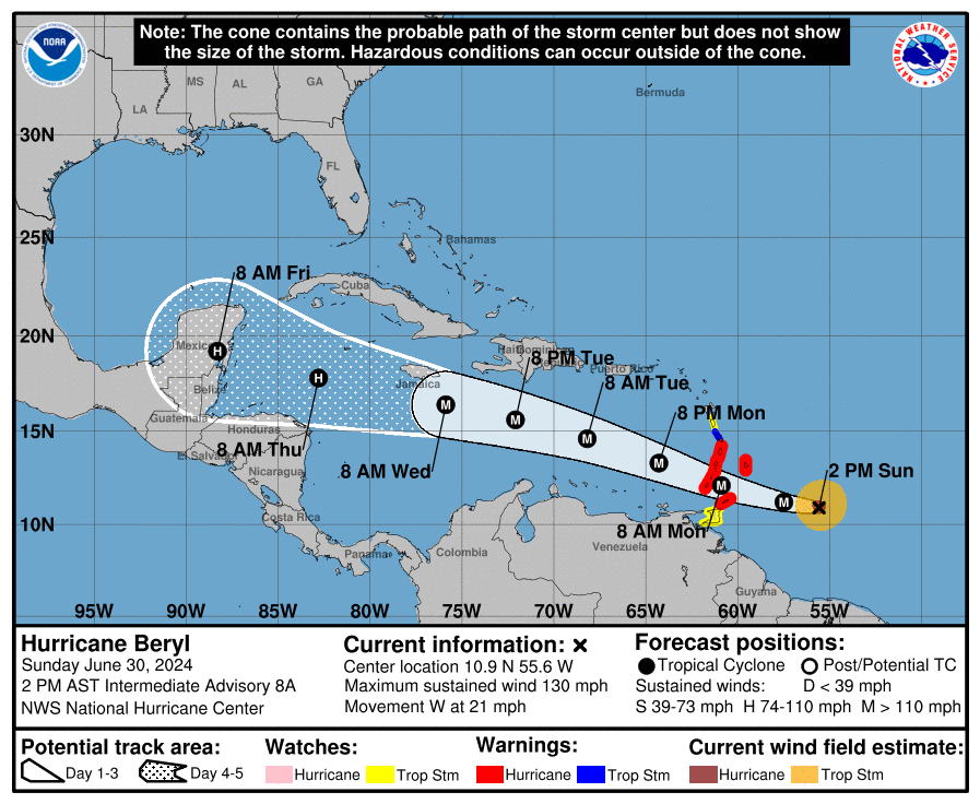
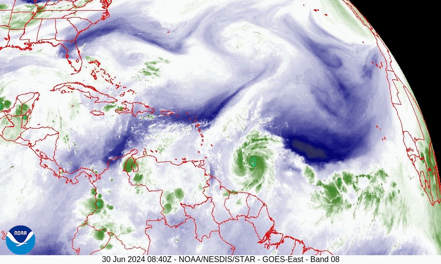
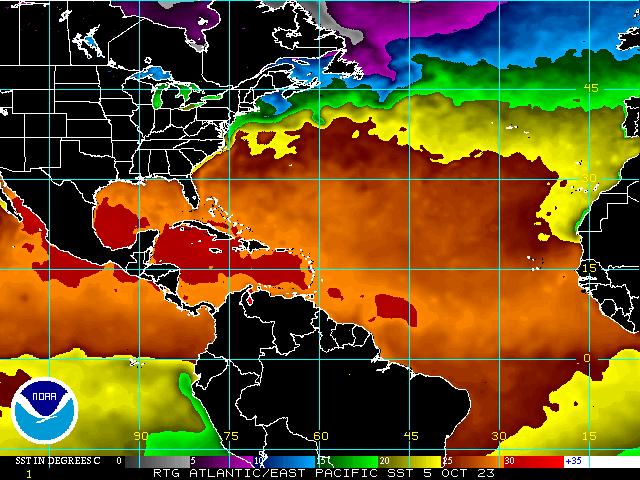
In looking a the water vapor loop below it looks like Beryl will pass south of Jamaica. It will still be a close call for them. Hurricane force winds extend around 30 miles to the north of the center. It is likely that the worst of it will remain offshore however they will still have significant wind, rain and storm surge. Flooding, mudslides and storm surge effects along the immediate southern coast will be the greatest risks.
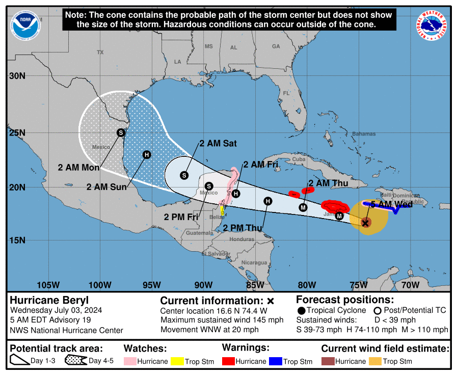
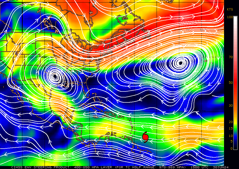
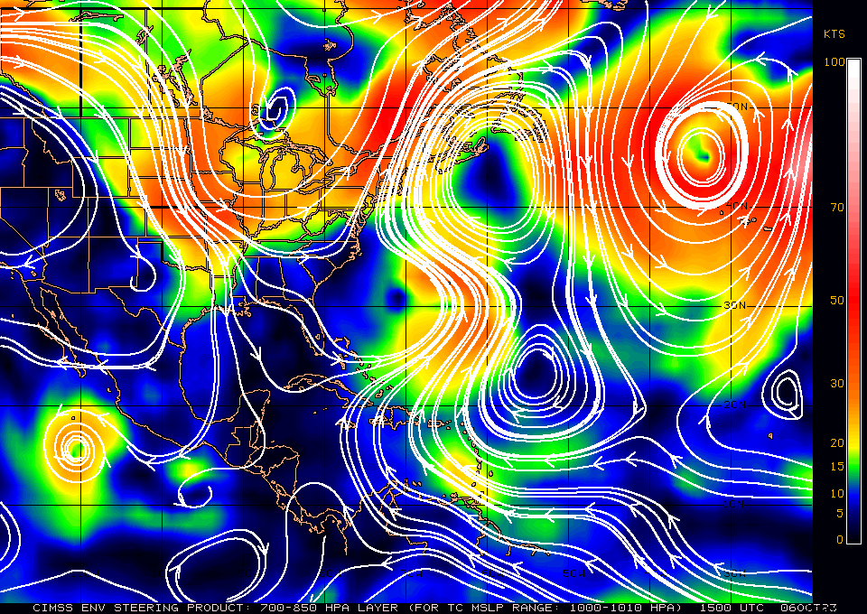
If you look at the surface map below you will notice that the high pressure over the Gulf of Mexico has shifted eastward, I spoke about this possibility in my first forecast on Beryl. This will allow Beryl to get closer to Southern Texas. We'll have a better idea about that on Saturday morning.
Until next time,
Matt.
In looking a the water vapor loop below it looks like Beryl will pass south of Jamaica. It will still be a close call for them. Hurricane force winds extend around 30 miles to the north of the center. It is likely that the worst of it will remain offshore however they will still have significant wind, rain and storm surge. Flooding, mudslides and storm surge effects along the immediate southern coast will be the greatest risks.
If you look at the surface map below you will notice that the high pressure over the Gulf of Mexico has shifted eastward, I spoke about this possibility in my first forecast on Beryl. This will allow Beryl to get closer to Southern Texas. We'll have a better idea about that on Saturday morning.
Until next time,
Matt.