Good afternoon.
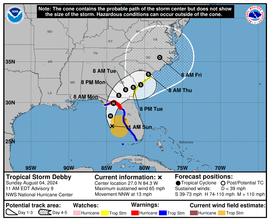
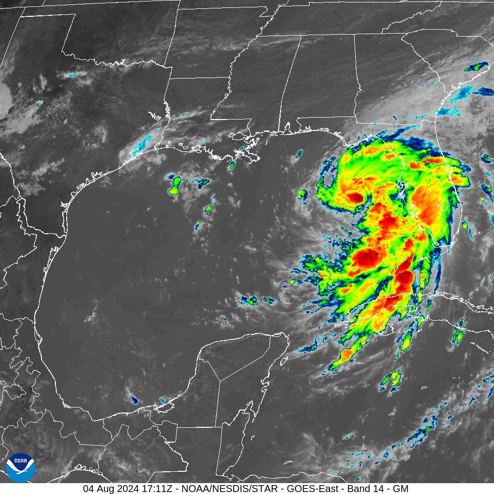
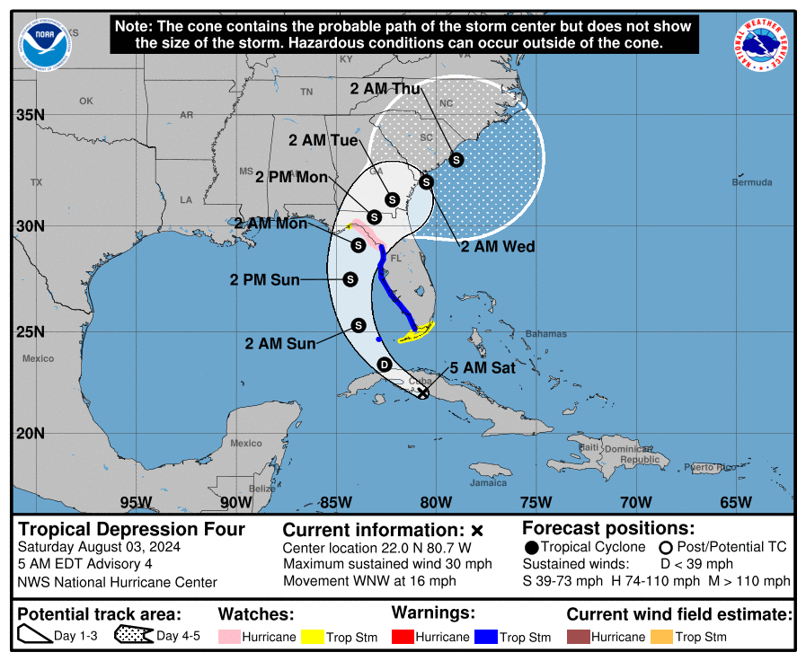
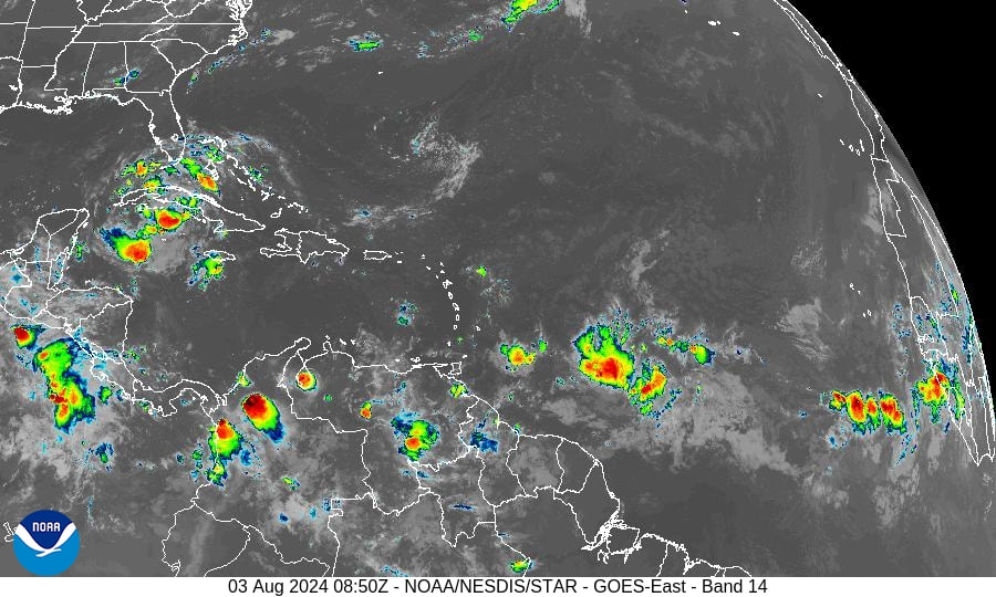
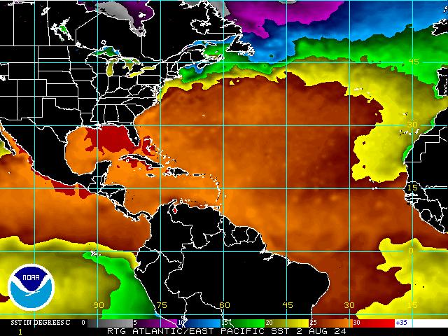
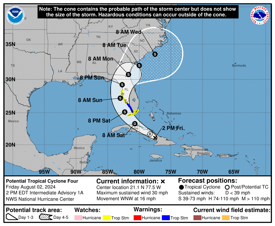
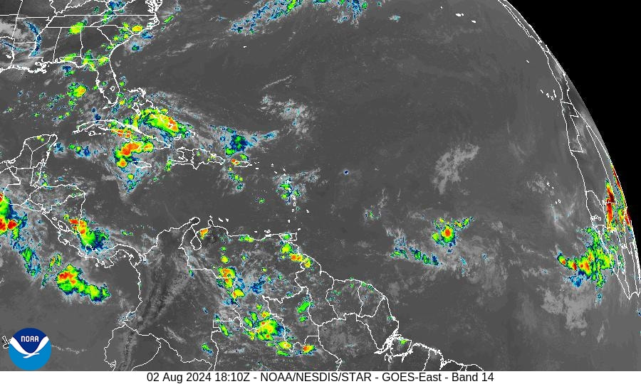
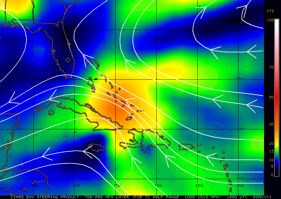
TS Debby is currently west of the Tampa Bay area and continues to head towards the Big Bend area of Florida. At 11 am peak winds had increased to 65 mph and the NHC is currently forecasting it to be a 90 mph Cat one at landfall tomorrow morning. It is even possible that it will be a 100-120 mph Cat 2 or 3 at landfall, due to the lack of shear and very warm waters. Since yesterday Debby has become much better organized with intense convection currently near its center. Rapid intensification is expected. The limiting factor will be time. The longer it is over the water the stronger it will get. After landfall it will start to encounter shear which will help it to weaken.
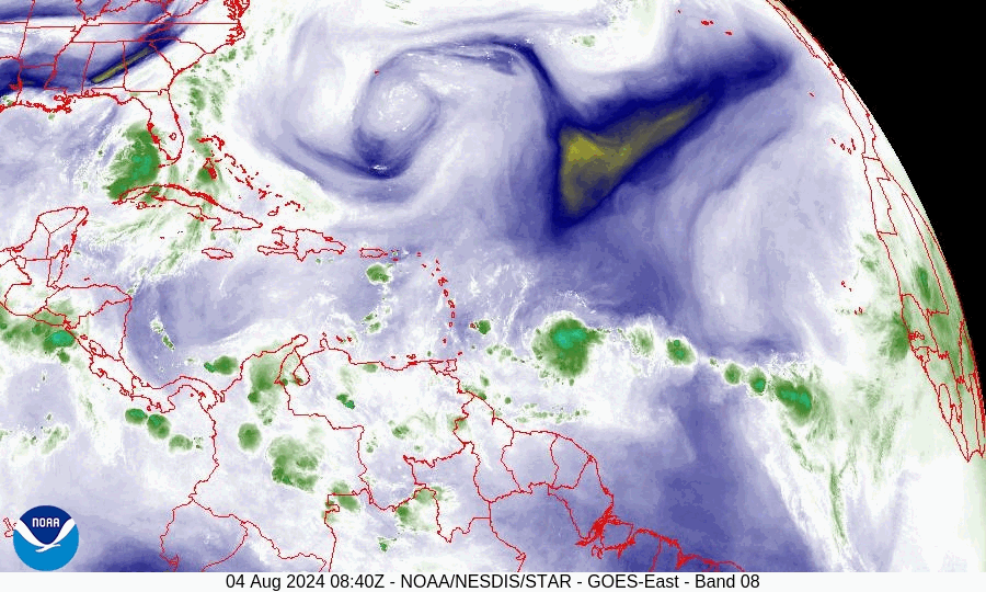
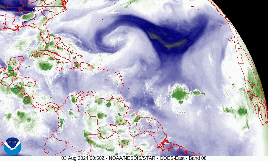
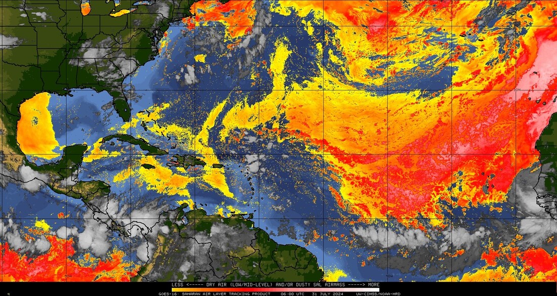
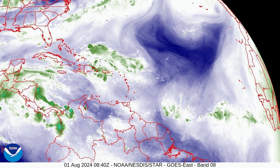
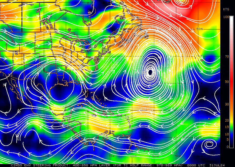
If you look at the water vapor loop below you will notice that the cold front over the SE US is no longer advancing, it is stationary. The NHC is forecasting it to move NE tomorrow and strand Debby over SE Georgia and Coastal South Carolina. This could lead to historic flooding for SE GA and Coastal SC, with greatest accumulations likely in the Savannah, GA and Bluffton, SC areas. If it re-emerges into the Atlantic even more rainfall can be expected.
With its consolidation strong winds should be limited to the Big Bend area. Its biggest effects will be heavy rainfall and flooding after landfall. The best we can hope for is that it arrives sooner than forecast and has less time to intensify. Fortunately it will miss Tampa.
Until next time,
Matt.
PS. Rainfall yesterday at my house totaled 2.19". None so far today.
TS Debby is currently west of the Tampa Bay area and continues to head towards the Big Bend area of Florida. At 11 am peak winds had increased to 65 mph and the NHC is currently forecasting it to be a 90 mph Cat one at landfall tomorrow morning. It is even possible that it will be a 100-120 mph Cat 2 or 3 at landfall, due to the lack of shear and very warm waters. Since yesterday Debby has become much better organized with intense convection currently near its center. Rapid intensification is expected. The limiting factor will be time. The longer it is over the water the stronger it will get. After landfall it will start to encounter shear which will help it to weaken.
If you look at the water vapor loop below you will notice that the cold front over the SE US is no longer advancing, it is stationary. The NHC is forecasting it to move NE tomorrow and strand Debby over SE Georgia and Coastal South Carolina. This could lead to historic flooding for SE GA and Coastal SC, with greatest accumulations likely in the Savannah, GA and Bluffton, SC areas. If it re-emerges into the Atlantic even more rainfall can be expected.
With its consolidation strong winds should be limited to the Big Bend area. Its biggest effects will be heavy rainfall and flooding after landfall. The best we can hope for is that it arrives sooner than forecast and has less time to intensify. Fortunately it will miss Tampa.
Until next time,
Matt.
PS. Rainfall yesterday at my house totaled 2.19". None so far today.