Good afternoon.
This is a non-weather report. Its an FYI.
The Rare Fruit Council International/ RFCI (a not for profit educational society /club of which I am the Vice President) is going to be sponsoring an event, a fruit jamboree at my farm on November 9th. We'll have farm tours, educational programs, fruit, plant and fruit tree sales, things for kids, food, a band and other vendors. It's going to be a fun event . The proceeds will be going to the RFCI.
Tickets will be limited so if you're interested I would recommend purchasing them sooner than later.
If you go to the Eventbrite.com site on the bottom of the flier and enter Redlands Jamboree you can get more information.
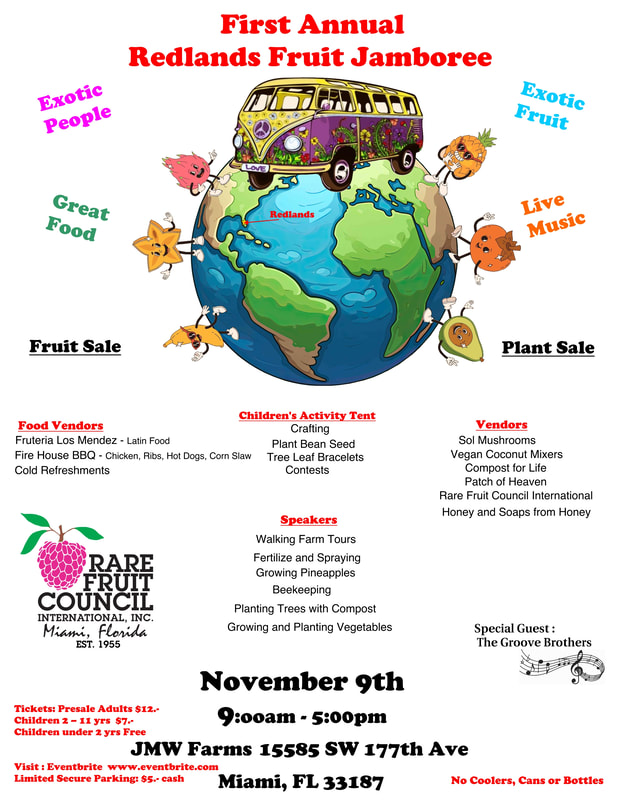