Matt on the Tropics
Tropical Updates
  • Home
  • About
  • Archive (pre-blog)
  • Contact
  • Weather Links
  • Weather Trivia

tropical update wednesday 9/6/23, 10 pm

9/6/2023

 
Good evening.

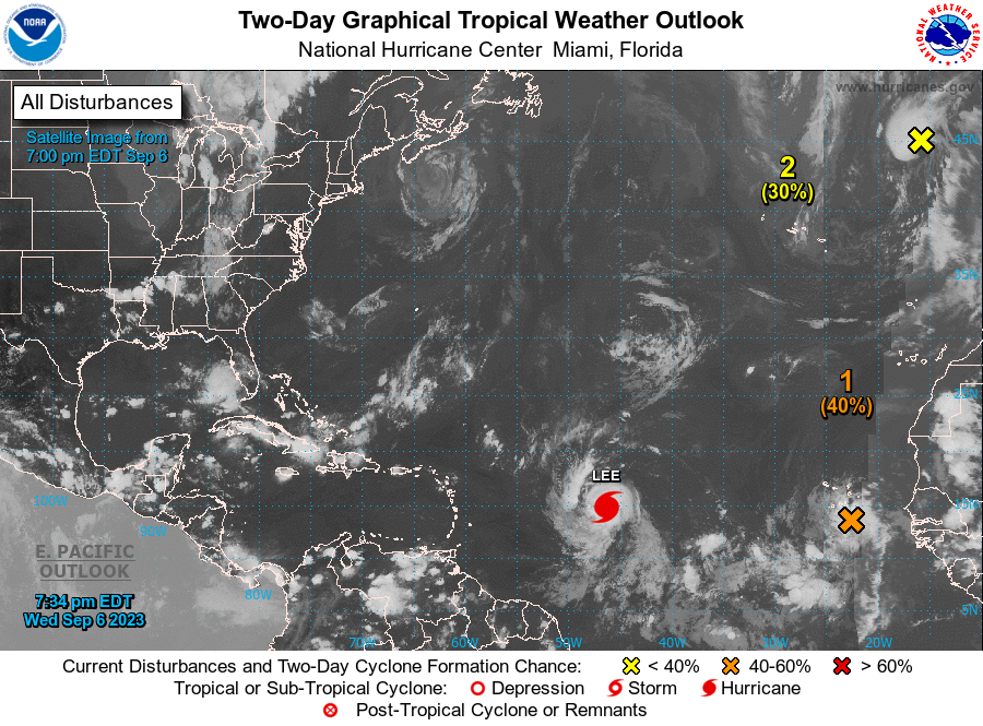
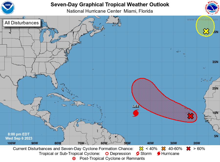
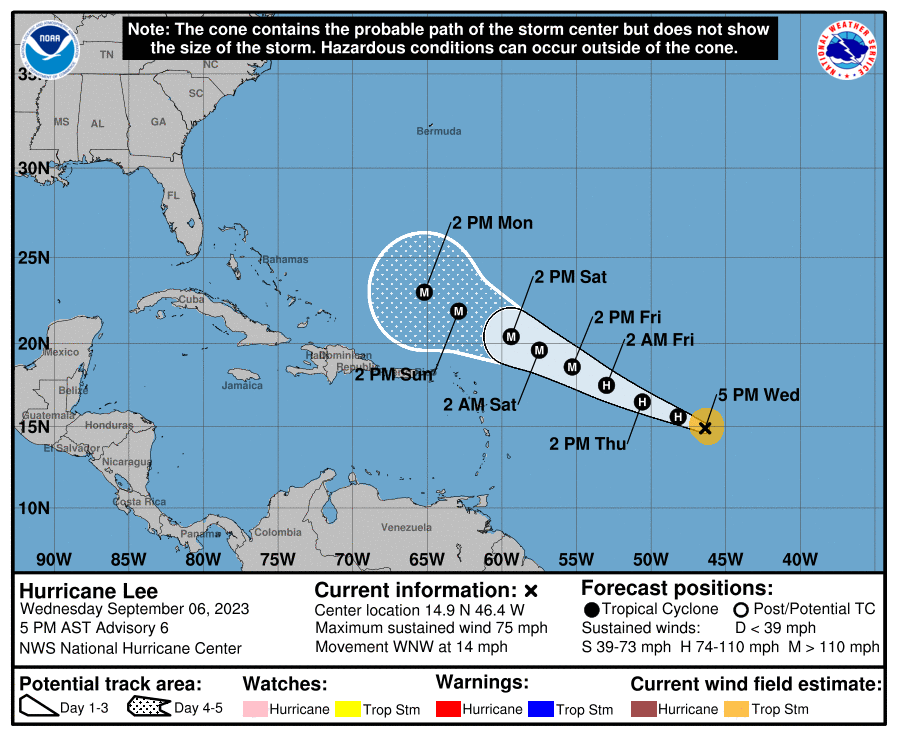
Just a quick update on Lee. I have already received several calls and texts due to our hysterical media. It is extremely unlikely that Lee will affect South Florida or other parts of the state as well. 

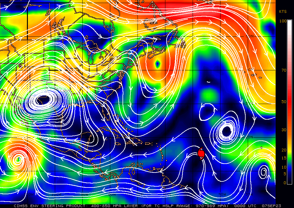
If you look at the surface map below you can see that high pressure remains over Florida, however its center has shifted westward and it is no longer directly over Florida. You will also notice extreme weakness (large distance between the isobars north of Puerto Rico and the Virgin Islands) in the pressure pattern over the Western Atlantic. This will allow Lee to move northward when it gets north of the islands. There are currently north and NW winds over Florida which would prevent it from approaching the state if it were in our vicinity now, we'll have to see what they are when it gets closer however this type of pattern has persisted all summer and it is unlikely to be significantly different in a few days. 

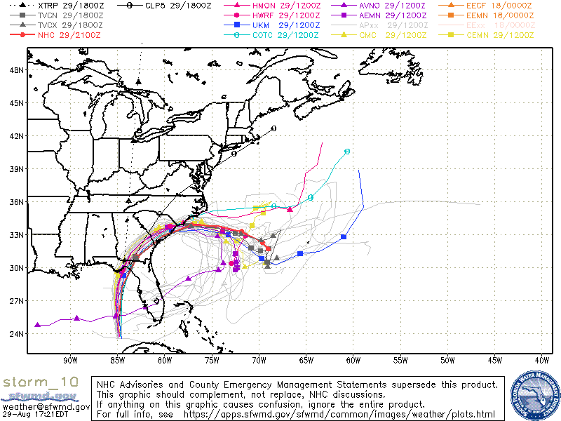
If you look at the models below you can see that they also agree in this scenario with all of them taking Lee north, probably missing the US entirely.

​The one thing that could throw things off would be if it were to stall. As long as it keeps moving we should be okay.

Please don't let the TV and other medias psyche you out. We will probably be in a low risk pattern for the next couple of weeks.

Until next time,

                                            Matt. 
​
Picture
Picture
Picture
Picture
Picture

tropical update saturday, 9/2/23, 7 am

9/2/2023

 
Good morning.

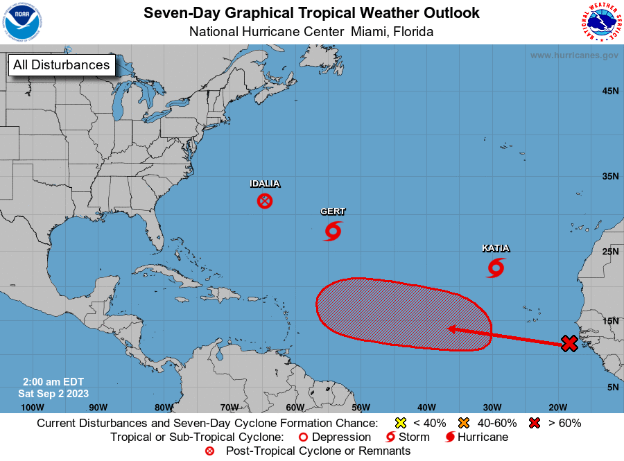
There are a few systems currently in the Atlantic though none pose a threat to to he US at this time.
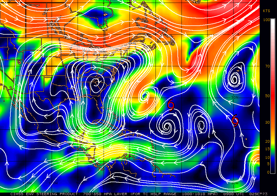
If you look at the surface map below you can see that high pressure has moved over the SE US and Florida. This should shield Florida and the US East Coast. It is forecast to remain roughly in place for the next week. In fact the only areas in the Continental US currently potentially vulnerable are Louisiana and Texas, and there is nothing out there threatening them.

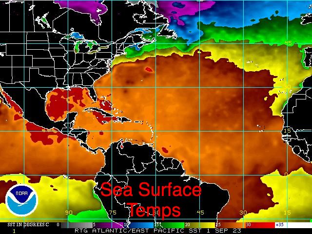
If you look at the bottom diagram, Sea Surface Temperatures, you can once again see that the area to watch remains the Gulf of Mexico. We will likely see at least one more system there later in the season.

The climatological peak of hurricane season is September 10th with a second small peak in early October.

We should have a breather for a week, ? +,  until things change.

Until next time,

​                                        Matt.
​
Picture
Picture
Picture

tropical update wed 8-30-23, 8 am, H. idalia

8/30/2023

 
Good morning.

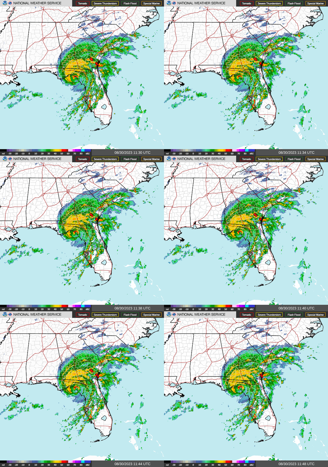
H. Idalia is making landfall right now and is currently directly over Hampton Springs and Perry Florida. 
​
Picture
Picture

tropical update wednesday 8-30-23, 5 am H. Idalia

8/30/2023

 
Good morning.

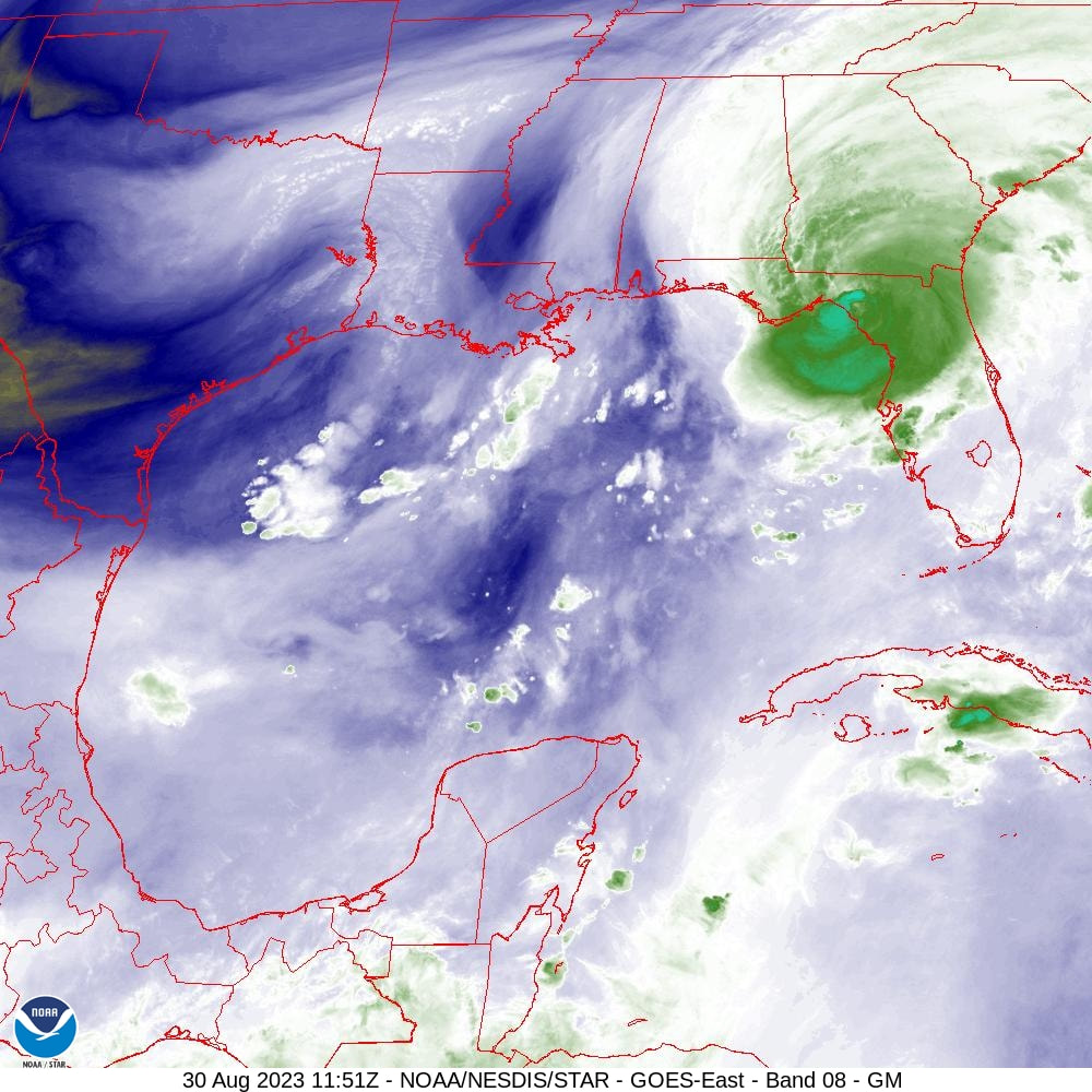
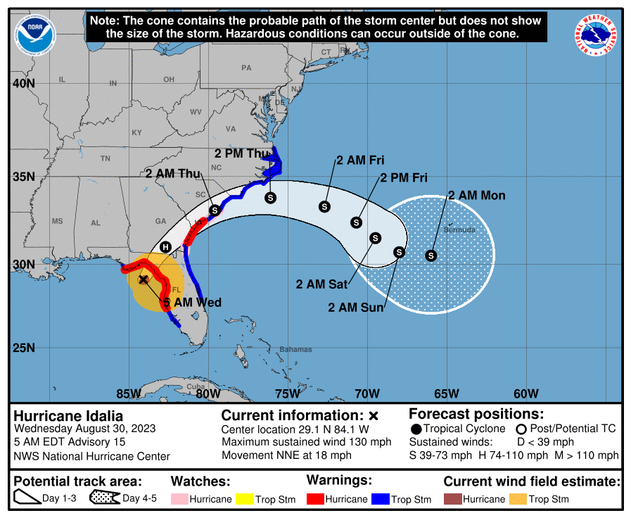
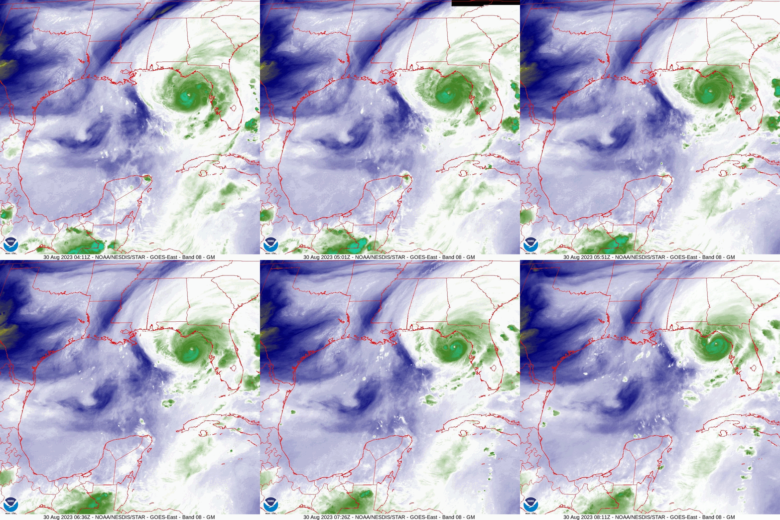
​At 5 am Hurricane Idalia was located about 70 miles SSW of Steinhatchee Florida. Pressures have continued to steadily fall overnight and winds are now 125 mph. It should be making landfall in around 4 hours and will likely be a 130-140 mph Cat 4 at landfall. It looks like it is going to miss Tallahassee, Orlando and Tampa. If you look at the water vapor loop below you can see that it's NE move has begun and it is heading towards Perry and Steinhatchee. It is moving now at 17 mph, pressure in 941 mbs. Storm surge in this area will be significant. The eye appears to be very small at this time and I would estimate it to be around 10-15 miles wide.

​Hopefully all in its path have left or are secure.

Best wishes to all.

​                                         Matt.
​
Picture
Picture

tropical update tuesday 8-29-23, 5 pm - H. idalia

8/29/2023


Good evening.

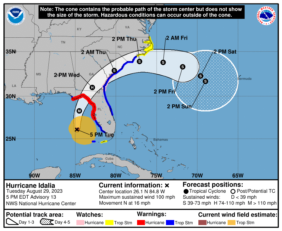
At 5 pm H. Idalia continues to head due north, now at 16 mph with maximum sustained winds of 100 mph. Pressures have been falling and Idalia has been steadily strengthening all day, as anticipated in this mornings forecast. The frontal system to its north has not changed location at all since this morning and as a result the NHC's and the model's tracks have shifted about 25 miles to the west and are now in pretty much agreement with my track. It could become a close call for Tallahassee though on the current NHC track it should avoid hurricane conditions, but that could change. There is nothing else out there to change its course. It should continue to strengthen overnight and increase its forward speed. My current track takes it between Steinhatchee and Crawfordville, centered near Hampton Springs and Perry Florida. This is one of the least populated areas on the Florida West Coast.

It is currently west of Ft Lauderdale and is now moving away from South Florida. If you look at the current visible satellite loop below you can see a tiny eye starting to form. Distinct eye usually form when winds get to around 100 mph. It appears to be only about 10-15 miles wide, consistent with the rapid intensification which it is undergoing. It should become more distinct very soon.

The current forecast advisory projects hurricane force winds to extend 25 miles to the east of the center and 15 miles to the west. It should remains a tight storm.

I'll write again early tomorrow morning.

Until then,

                                 Matt.

Picture
Picture
Picture
Picture

tropical update tuesday 8/29/23, 7 am

8/29/2023

 
Good morning.

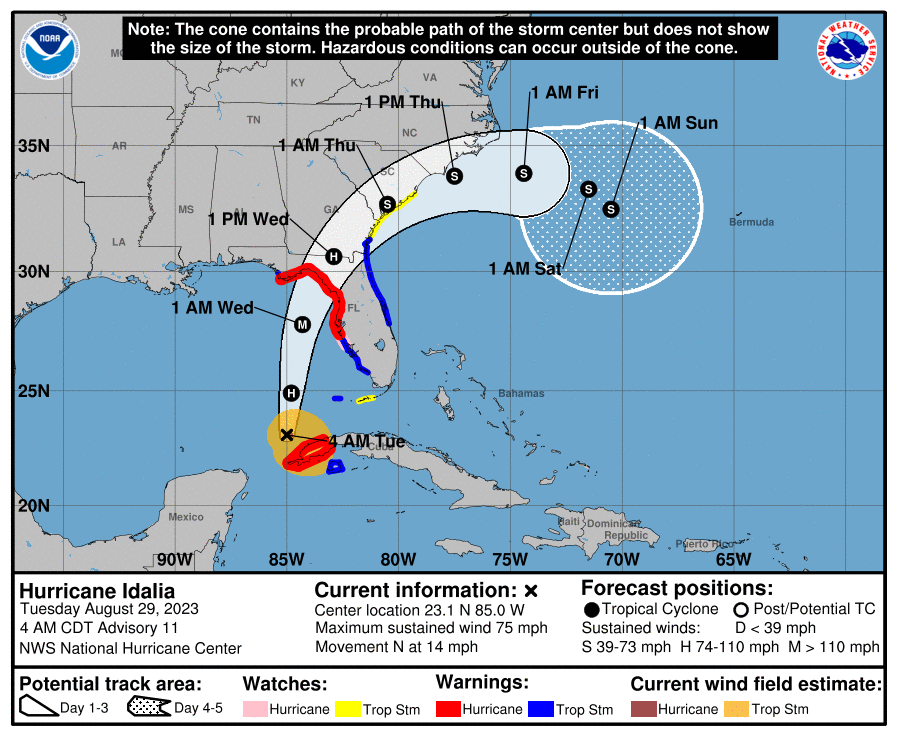
Just a quick update on Idalia. Idalia was designated a hurricane at 5 am this morning, 12 hours later than originally forecast, this was due to it's further east than anticipated drift and land interactions with the western tip of Cuba. Hopefully this will translate to a slightly weaker storm at landfall however there are some concerning features to note this morning. 

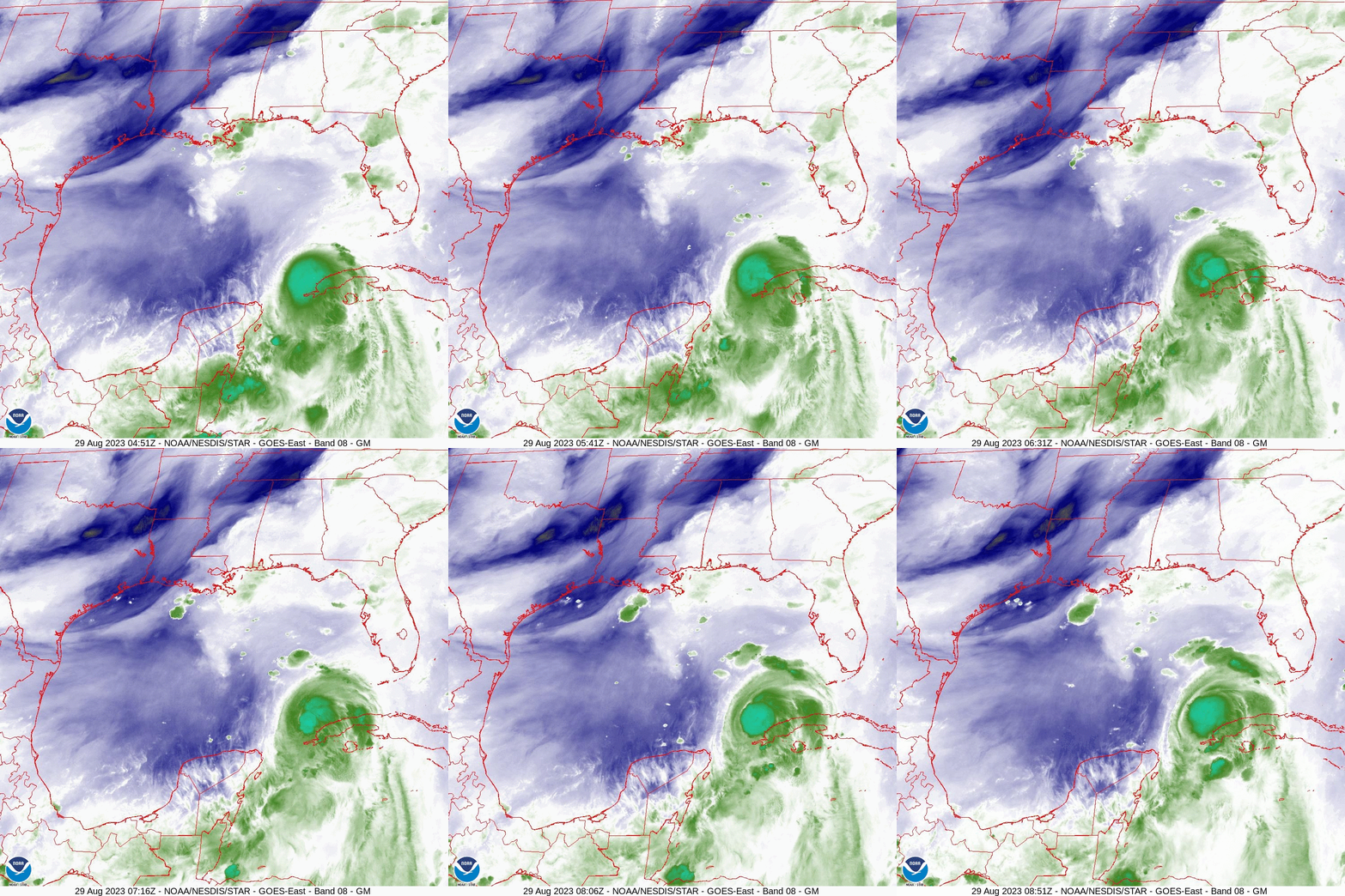
If you look at the water vapor loop from 5 am this morning you will notice a couple of things. First is Idalia spinning just north of Cuba, notice that the wide spread convection to its east is gone and it is consolidating around its center.
It appears to be about to undergo a period of rapid intensification. Idalia is  a very small storm despite what the media is saying. At landfall tomorrow the NHC is currently forecasting hurricane force winds to only extend 20 miles to the east and 15 miles to the west of the center. The area affected by eye wall will be even smaller. I would anticipate an eye diameter of 10-20 miles at landfall, most likely 15 if it draws itself inward as I expect. Despite the media telling you not to focus on the center of the path, that is the opposite of what we should be doing. It would have to pass within 20 miles of you to experience a hurricane and likely within 12 to experience a major hurricane.
Due to the tighter storm the rain shield will be contracting as well. Miami-Dade will possibly receive no direct effects though we may see an enhancement of our normal afternoon showers later today.
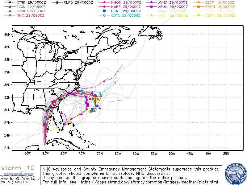
Next if you look at the water vapor below focus on the frontal boundary from Louisiana to Tennessee. The eastern portion is further north than previously anticipated by the NWS. Where it is tomorrow will be key however because of this the NE turn may not occur until it has moved further north. The NHC has revised it's track slightly to the west however it is still east of the model consensus, see below. Forward speed is increasing and it is expected to be moving at 17-18 mph or more at landfall which should make it a shorter duration event.

I will be posting again around 5 pm and will try to pinpoint more precisely where it I believe it will make landfall.

Until then,

                                           Matt.

Picture
Picture
Picture

tropical update monday 8-28-23, 5 pm - Idalia

8/28/2023

 
Good evening.

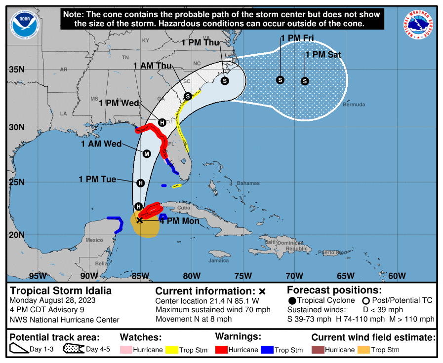
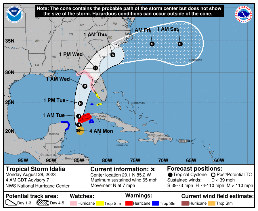
At 5 pm Idalia was located in the Yucatan Channel and was moving due N @8 mph. During the day TS Idalia has changed little. After passing north of the western tip of Cuba tonight it should start to strengthen after interactions with the mountainous terrain of Western Cuba abate. The NHC's track has not changed and remains in agreement with the model consensus. Idalia is still forecast to make landfall Wednesday morning as a Cat 3 major hurricane along the Big Bend area of Florida. Tomorrow night will be key to just how strong it gets.

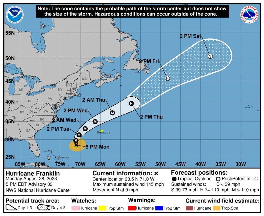
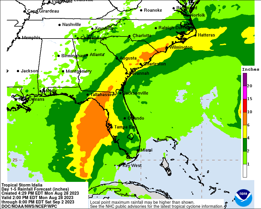
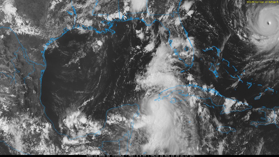
I have included the latest rainfall forecast as well as the current satellite image of both Idalia and H. Franklin. If you look closely at the eye of Franklin you can see a classic "Stadium Effect", this is typical of an intense major hurricane. Franklin is currently a dangerous Cat 4 storm with maximum sustained winds of 145 mph. Fortunately it s heading out to sea and posses no threat to land at present.

I will write again probably tomorrow afternoon, possibly in the morning as well if things should change.

Until then,

                                     Matt.
​
Picture
Picture
Picture
Picture
Picture

TROPICAL UPDATE, MONDAY 8-28-23, 5 AM

8/28/2023

 
Good morning.

Over the past 24 hours Idalia has drifted SE, however over the past 3 hours it appears that it is starting to finally move northward. If you look at the surface map below you will notice a few things. Since yesterday high pressure over the Western Atlantic has shifted westward as has the high pressure over the south central US. The window between the highs is now centered over the Florida Panhandle. The NHCs track has changed little since yesterday and the models remain in good agreement on this scenario. The Idalia has strengthened since yesterday and the NHC is now forecasting it to become a hurricane by 5 pm today and to be a 115 mph Cat 3 storm at landfall early Wednesday in the Big Bend area of Florida. It has very warm water in front of it and rapid intensification is forecast tomorrow. At this point in time the faster it moves the better as it is likely to continue to intensify until landfall. The longer it is over the warm waters of the Eastern Gulf, the stronger it is likely to become.

South Florida should experience associated showers and rain starting early Tuesday afternoon with clearing by Wednesday morning. Storm surge and high winds in the areas affected by the eyewall will be its greatest effects. The whole state of Florida should see significant rainfall, mostly however from Lake Okeechobee north.

I will be re-evaluating the data after the 5 pm advisory this evening and will probably post again then.

                                 Matt.
​


Picture
Picture

Tropical Update suday 8-27-23,  1:30 pm

8/27/2023

 
Good afternoon. 

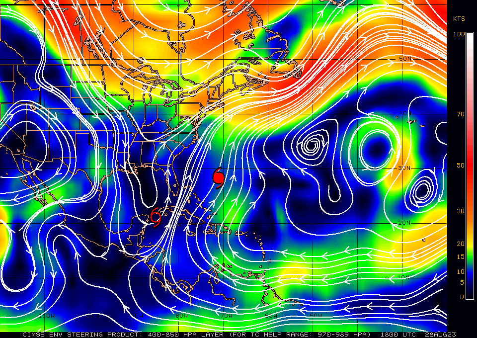
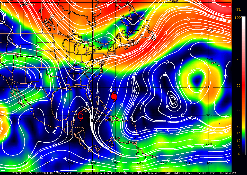
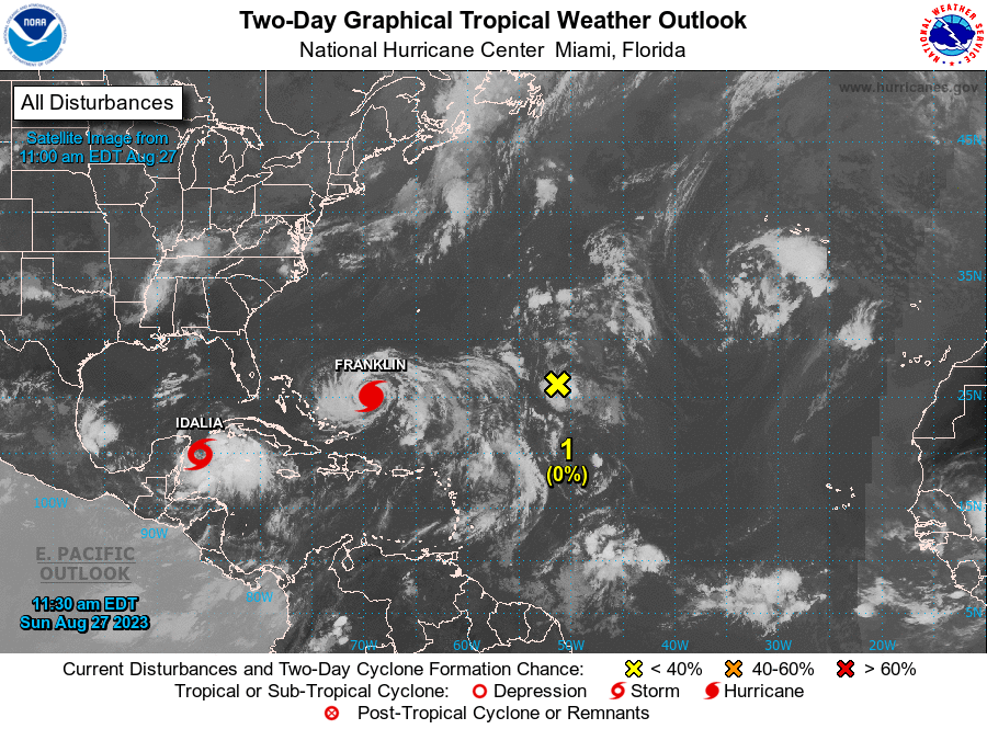
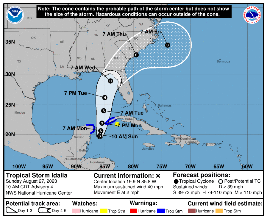
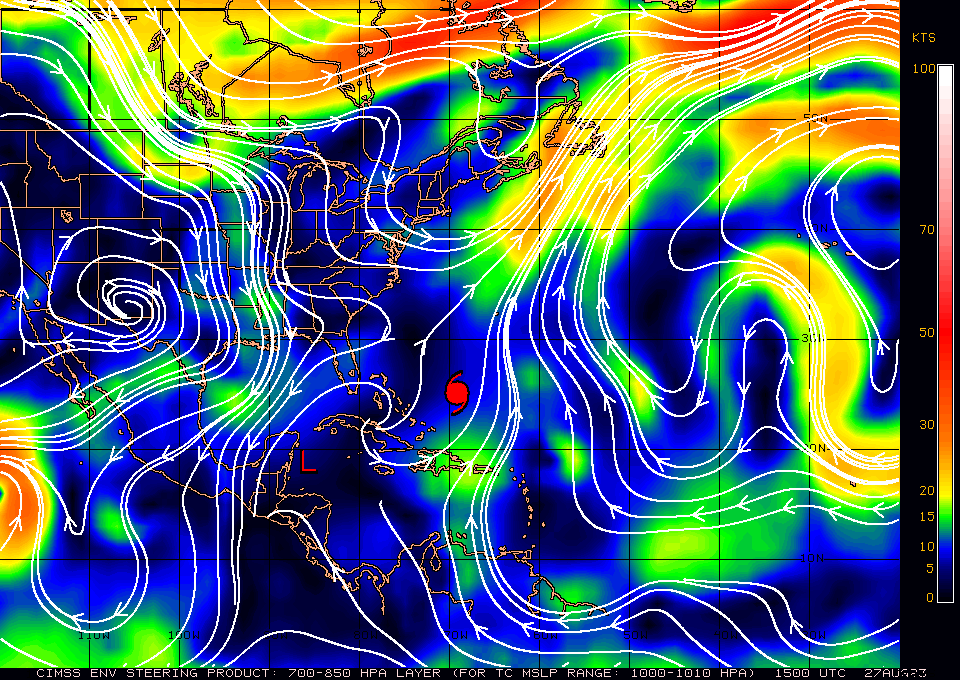
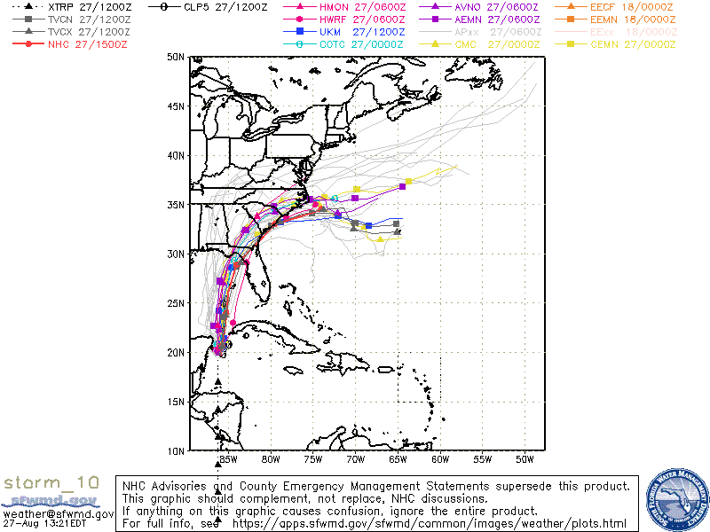
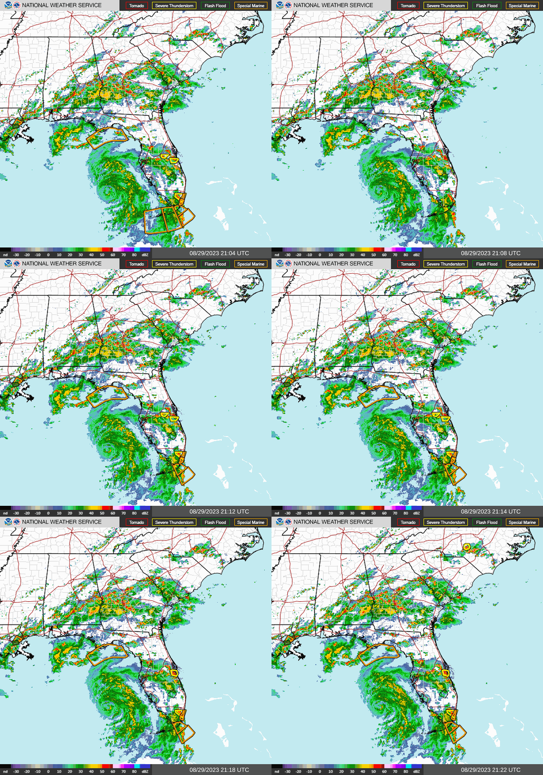
Tropical Storm Idalia was named this morning and is currently in the NW Caribbean Sea, right along the coast of the Yucatan Peninsula. Since this time yesterday Idalia has drifted about 70 miles to the south and is currently essentially stationary wobbling around. It is in a area of extremely weak steering forces. Light northerly surface flow is being off set by weak Coriolis forces which want to move it northward. The net effect is little motion. This is expected to persist for another 24-36 hours. After that time high pressure in the Atlantic is forecast to strengthen which should result in southerly winds aloft and a northward motion. A stationary front along the Gulf Coast should then turn it to the NE as it approaches the Northern Gulf Coast. The models are currently in good agreement on this scenario. The wild card will be its slow motion. If it stalls longer than expected conditions could change. We'll know more once it starts it northern motion. Wobbles and drifts to the east or west could have significant impacts on just where it makes landfall.

The NHC is currently forecasting it to be a strong Cat 1 at landfall, however the longer it remains over water the more time it will have to develop. There is moderate shear to its north however it is a small system. Sometimes small systems, with small eyes/centers can undergo rapid intensification with such strong updrafts and outflows that they can shield the core from the effects of the shear.

We're just going to have to see.

Until next time, 

                                                 Matt.
​
Picture
Picture
Picture
Picture

tropical update saturday 8-26-23, 11 am

8/26/2023

 
Good morning just a quick update.

The NHC is following a weak area of low pressure along the Yucatan Peninsula, Invest 93. It is giving it a 70% chance of tropical development over the next 2 days, 90% over the next 7 days. Steering forces are weak though the current models are in agreement in it moving towards the Florida Panhandle or Big Bend area. There is plenty of warm water in front of it though there is significant wind shear in front of it which should slow development. High pressure over the central and south central US has weakened as has the high pressure over the Atlantic. It should move slowly and a more westerly track is possible. We'll need to keep an eye on it however it currently does NOT pose a threat to South Florida. We may see enhanced rainfall associated with it on Monday and Tuesday.

We'll start to get a better feel for where it may go after it actually forms, if it does, though it is likely.

Until next time, 

                                       Matt.
​
Picture
Picture
Picture
Picture
Picture
Picture
<<Previous
Forward>>

    Categories

    All
    Preseason Update