Matt on the Tropics
Tropical Updates
  • Home
  • About
  • Archive (pre-blog)
  • Contact
  • Weather Links
  • Weather Trivia

preseason Forecast for 2025

4/22/2025

 
​ 
Good morning.

The 2024 Atlantic hurricane season was very active and extremely destructive with several landfalling hurricanes that became the third-costliest on record, behind only 2017 and 2005. It featured 18 named storms, 11 hurricanes, and 5 major hurricanes; it was also the first since 2019 to feature multiple Category 5 hurricanes. 

2025 is forecast to be a mildly above average season. Last year's La Nina has ended and we currently have neutral El Nino conditions, which are forecast to continue through the fall, which are usually associated with average seasons, however ocean water temperatures are currently warmer than average across the western and central Atlantic & are currently slightly below average over the eastern tropical Atlantic. Warmer than average ocean water temperatures are also currently occurring over the eastern subtropical Atlantic and the northern Gulf of Mexico. The warmer than average water temperatures are forecast to lead to an above average season with regard to the number of storms.

The net result of this is that the areas at greatest risk this year are the northwestern Caribbean northward to the northern Gulf coast, the Carolinas, Southern New England and the far northeastern Caribbean, including the far northern Leeward Islands, the Virgin Islands and Puerto Rico.

Rainfall at my house in 2024, despite a wet June and October, was 48.00", well below my 35 year running average of 66.71".


Wishing everyone a great 2025.

Until next time,

                       
                                                        Matt.

tropical update friday 11/15/24, 8 am

11/15/2024

 
Good morning.

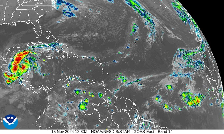
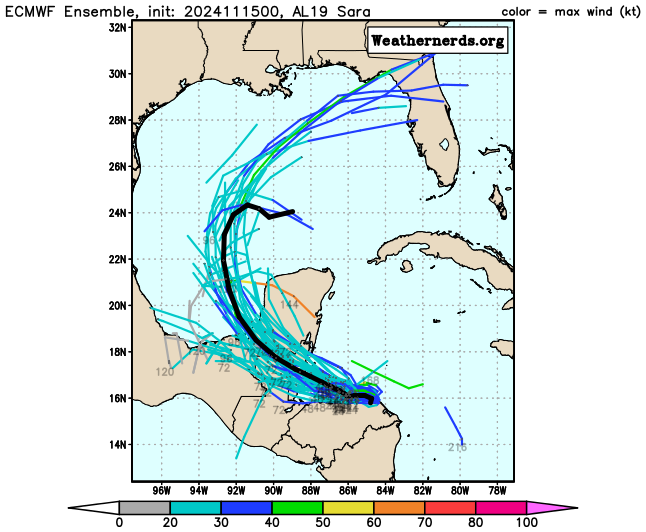
Tropical Storm Sara has formed in the SW Caribbean and its main threat will be heavy rainfall over Central America. It will be a slow moving system and its impacts will be significant.

Once it moves into the Gulf of Mexico it will encounter hostile conditions with dry air and abundant shear and is likely to dissipate. Even if it manages to hold itself together, forecasts only predict a 20-40 mph system.

Hopefully this will be the last system of 2024.

Until next time,

                                          Matt.


Picture
Picture
Picture
Picture
Picture

tropical update friday 11/8/24, 5:30 am

11/8/2024

 
Good morning.

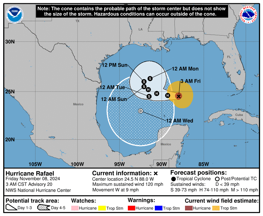
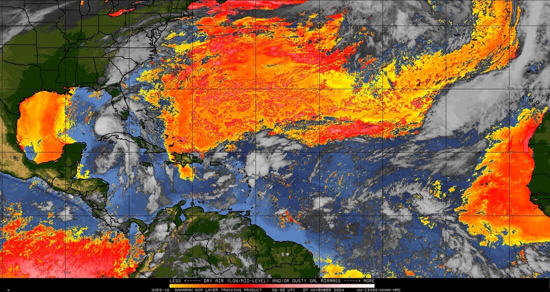
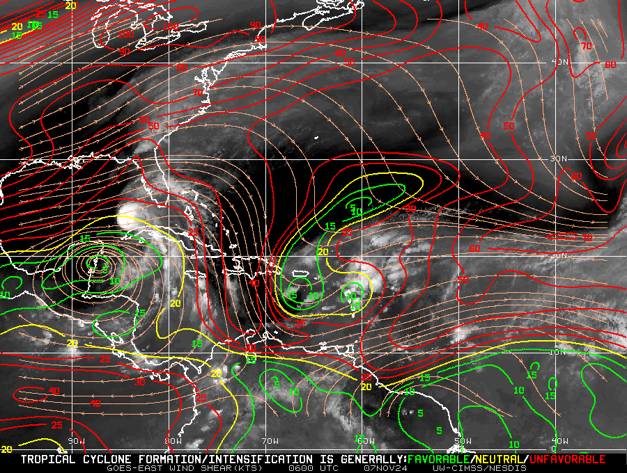
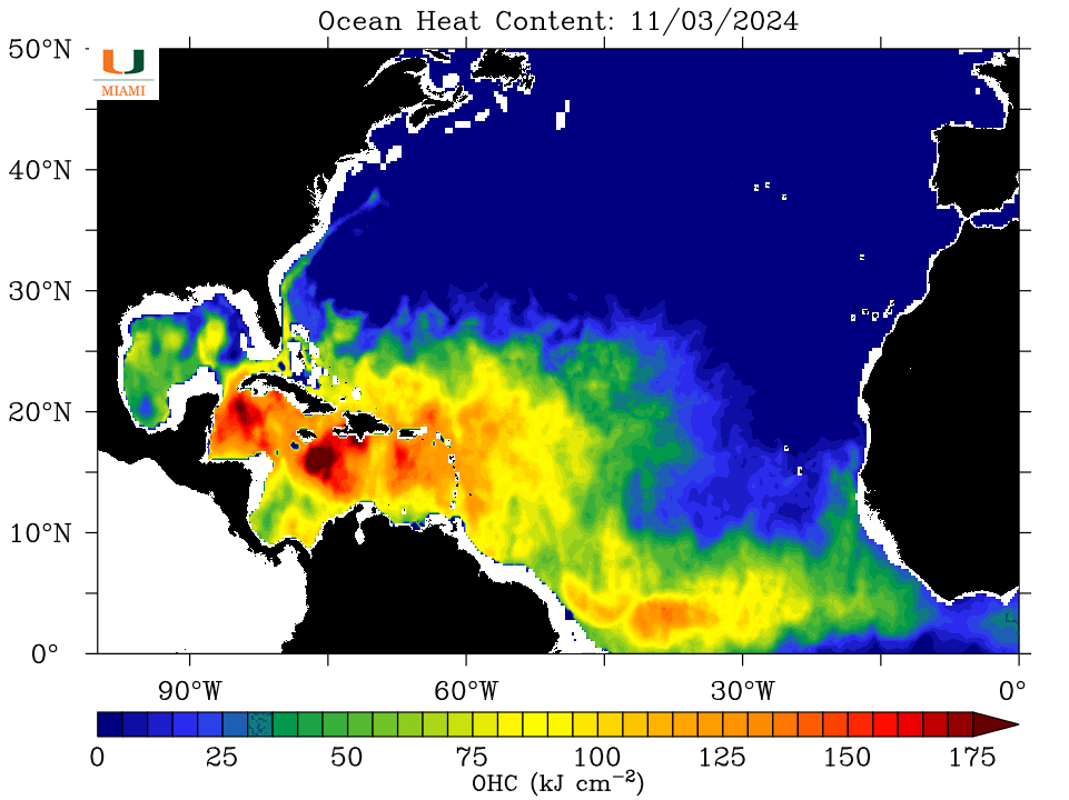
H. Rafael remains in the central Gulf of Mexico. The NHC is forecasting ti to meander over the Central and Western Gulf of Mexico for the next several days. As it encounters increasing shear and dry air it is currently forecast to dissipate 5-6 days, possibly sooner. This would be a best case scenario as no one would get a storm. In addition, it will continue to remove significant heat from the Gulf reducing the risk of further storms this year.

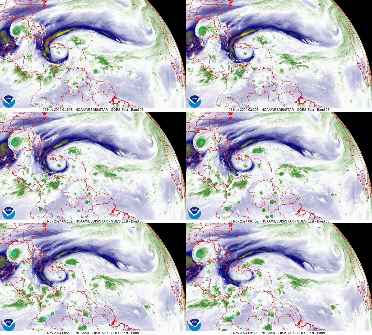
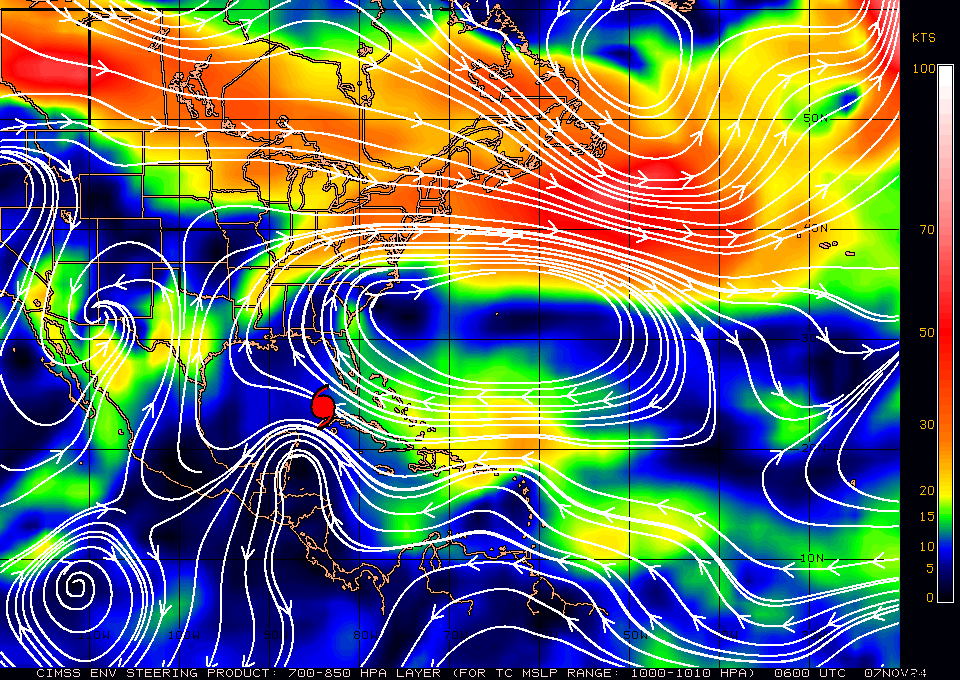
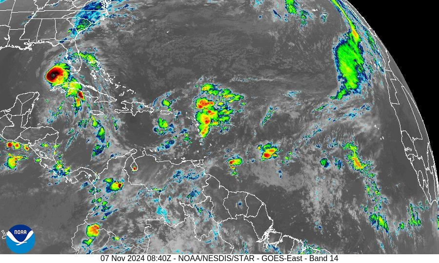
The other area mentioned yesterday show no sign of development as it interacts with an upper level low currently over Hispaniola, see below. Lots of shear out there, notice how fast the air is moving, which is good.

Until next time,

                                              Matt.


Picture
Picture

tropical update thursday 11/7/24, 4 am

11/7/2024

 
Good morning.

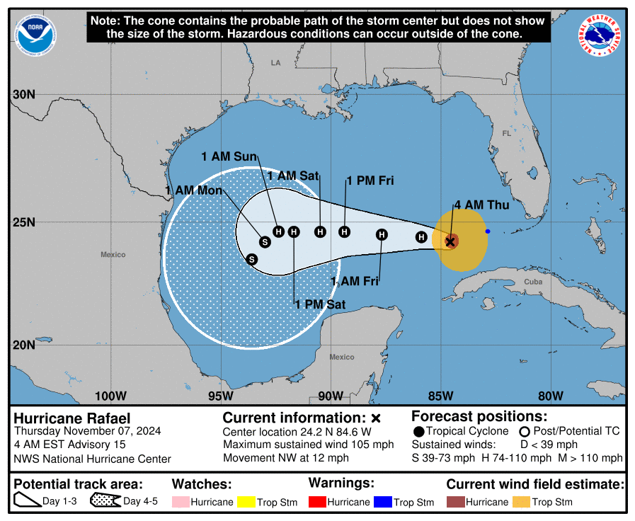
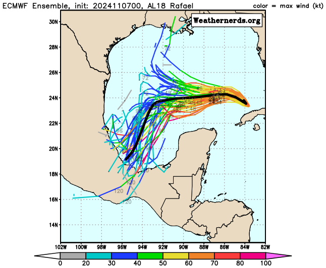
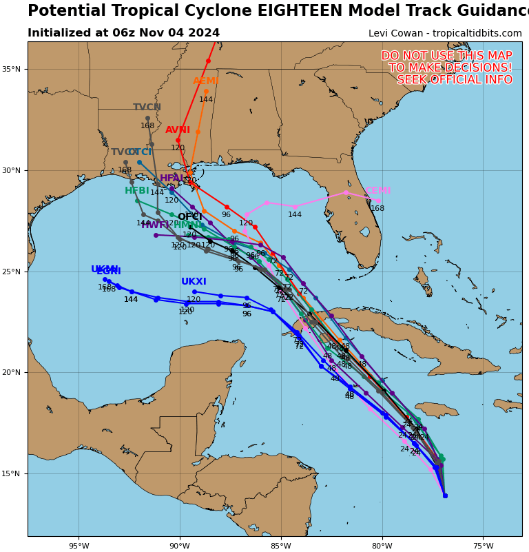
Since Monday the NHC's track on Rafael has changed. It moved faster than anticipated and the high pressure over the SE US coast has elongated and the NHC is now expecting it to move further west and south. If you look at the models, bottom graphic, you can see that the models are really all over the place. This is a low probability forecast. Someone anywhere from Southern Mexico to Alabama is likely to get a tropical storm next week. Its really too early to say where. The good news is that it should remove much of the remaining heat in the Gulf and due to dry air, wind shear and cooler waters should weaken. The longer it takes to make landfall likely the better as it will have more time to weaken.

Elsewhere a tropical disturbance just north of the NE Caribbean will need to be watched. The NHC is currently giving it a 30% chance of tropical development over the next week. Wind shear and dry air ahead of it should slow development. I'll be watching. Currently a track through the Florida Straits would appear most likely. Hopefully it won't develop or if it does, after it is past South Florida.

Until next time.

                                               Matt.

​
Picture
Picture
Picture
Picture
Picture
Picture
Picture

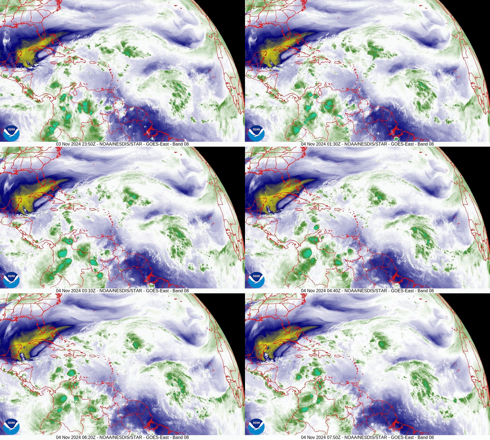
tropical update monday 11/4/24, 4 am

11/4/2024

 
Good morning.

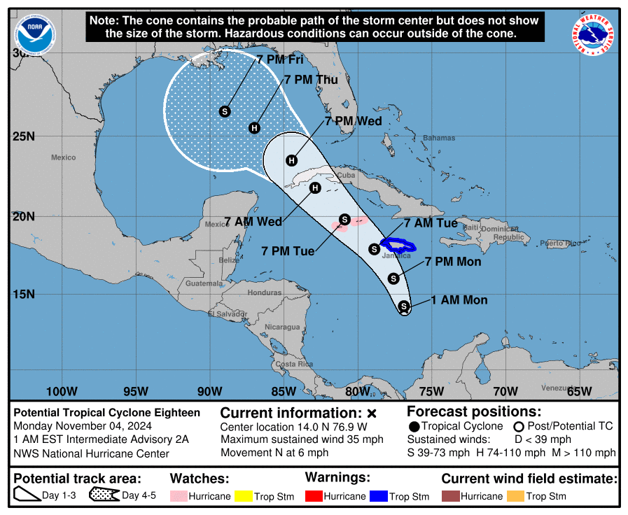
The NHC has been watching an area of disturbed weather in the SW Caribbean for about a week now. This morning it designated it Potential Tropical Cyclone # 18. They anticipate that it will become Tropical Storm Rafael later today. 

IF you look at the Surface Map below you will notice strong high pressure just off the SE US coast. This will tend to steer it toward the Northern Gulf Coast. This high pressure is forecast to move a little to the east. Currently it would tend to move it toward Louisiana, however timing will be the key. A faster motion could move it closer to Texas where as slower motion could steer towards Alabama or even the Florida Panhandle.

It is currently forecast to track over some of the warmest waters left in the Atlantic Basin (the northern and western Caribbean) and it is forecast to become a hurricane.

The good new however is that there is abundant dry air, cooler waters and significant shear over the Gulf of Mexico and the NHC currently forecasting it to be a tropical storm at landfall. It is way too early to predict intensity at this point in time and we'll just have to see how things evolve. South Florida may experience some associated showers Wednesday to Thursday morning however it should be far enough away to avoid any significant weather.

Until next time,

                                                     Matt.
​
Picture
Picture
Picture
Picture
Picture
Picture
Picture

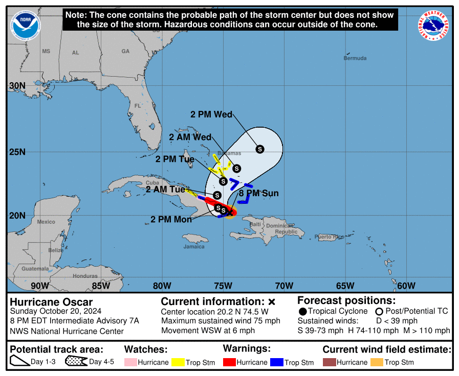
tropical update sunday 10-20-24,  10 pm

10/20/2024

 
Good evening.

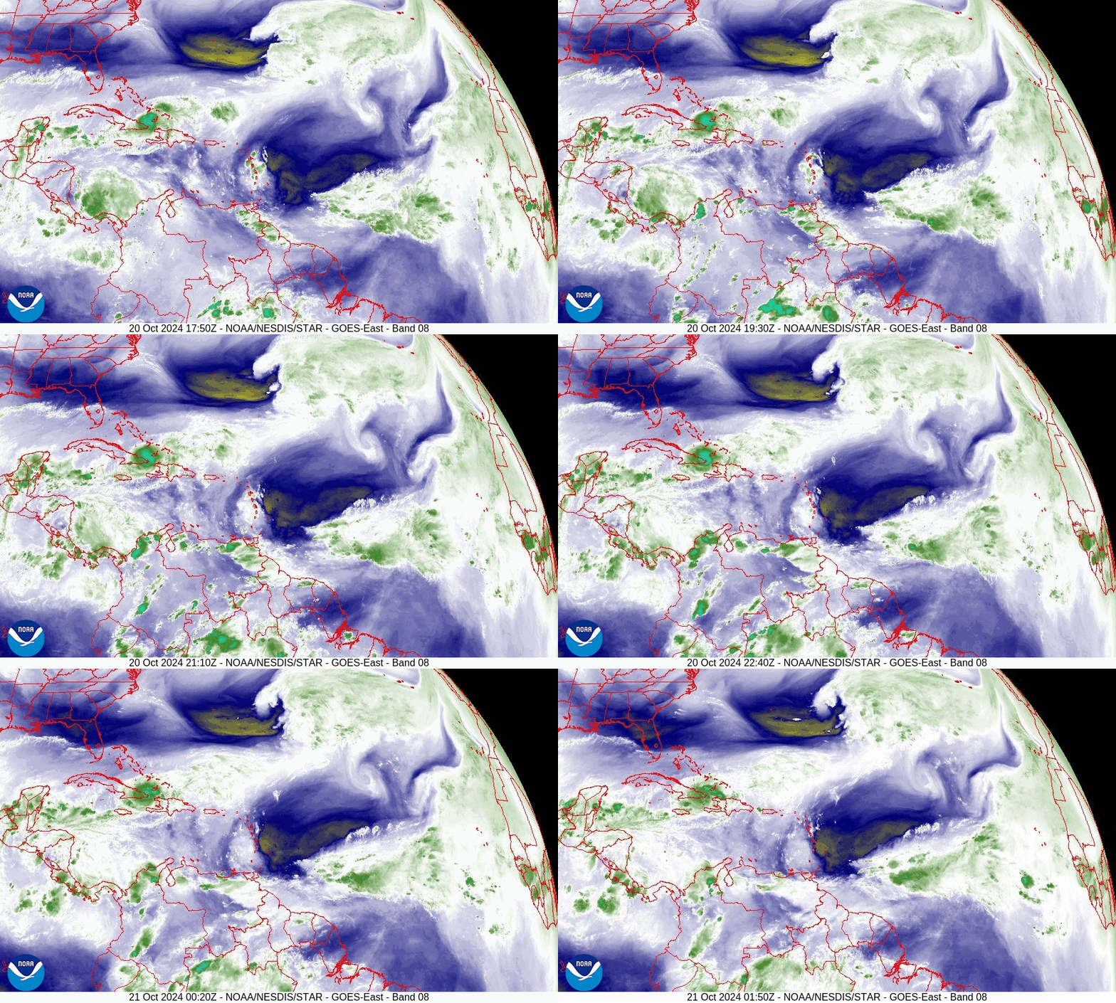
Since my last post not much has changed with now Hurricane Oscar. Strong west-southwesterly shear remains over Florida and should continue to protect the state.

Until next time , 

                                   Matt.
Picture
Picture
Picture

tropical update sunday 10-13-24, 9 pm

10/13/2024

 
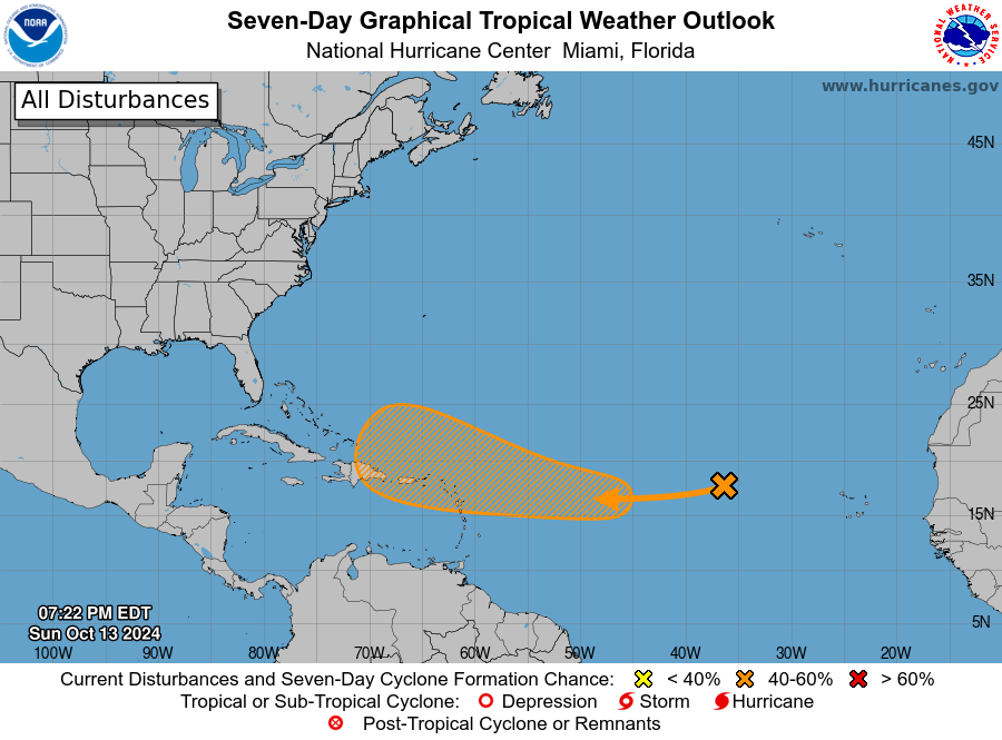
Good evening.

Just a quick update. The NHC is currently tracking a weak disturbance in the Eastern Atlantic and is giving a 40% chance of tropical development over the next 7 days. It is unlikely to affect the US. If you look at the surface map below you will see high pressure over the Central Atlantic as well as over the Gulf of Mexico. In addition if you look at the wind shear analysis below you will see strong WSW winds/ shear, over Florida. It will likely turn away from the US as it approaches the Bahamas. I do not expect to need to write further about this system. 

If things should change, I'll let you know.
FYI even most of the models are in agreement  with me on this.

Until next time,

                                             Matt. 
Picture
Picture
Picture
Picture

Non-Tropical Update friday 10-11-24, 7 am

10/11/2024

 
​Good afternoon.

This is a non-weather report. Its an FYI.

The Rare Fruit Council International/ RFCI (a not for profit educational society /club of which I am the Vice President) is going to be sponsoring an event, a fruit jamboree at my farm on November 9th. We'll have farm tours, educational programs, fruit, plant and fruit tree sales, things for kids, food, a band and other vendors. It's going to be a fun event . The proceeds will be going to the RFCI.

Tickets will be limited so if you're interested I would recommend purchasing them sooner than later.

If you go to the Eventbrite.com site on the bottom of the flier and enter Redlands Jamboree you can get more information.
Picture

tropical update Thursday 10-10-24, 4 am

10/10/2024

 
Good morning.

Milton is currently moving off into the Atlantic. Dry air is moving into the state with fair weather which should aid in the recovery efforts.

Data reports are coming in, this is what we have so far.

Peak winds :

Venice 107
Sarasota 102
St Pete 93
Tampa 85
Daytona 76
Orlando 74

Rainfall:

St Pete 15.31
Tampa 10.48
Bradenton 7.46.
Orlando 6.00
Osprey 5.10
Ft. Myers 3.67
Sarasota 3.16
West Plam Bch 1.65
Ft Lauderdale 0.24
Miami 0.04

Until next time,

​                                                  Matt.

Picture
Picture

tropical Update wednesday 10-9-24, 8:36 pm

10/9/2024

 
Good evening.

Milton is currently making landfall at 27.21 degrees N & 82.50 W  centered over Osprey and Oaks Club, FL. Tampa is currently in the northern eye wall with winds out of the east. We'll know more tomorrow.

                                                Matt.
​
Picture
Picture
Picture
<<Previous

    Categories

    All
    Preseason Update