Good morning.
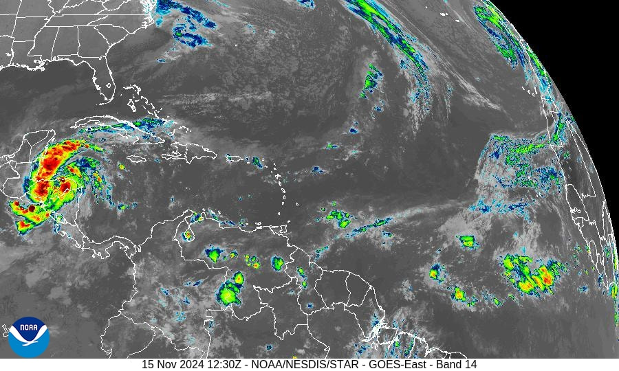
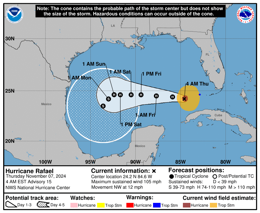
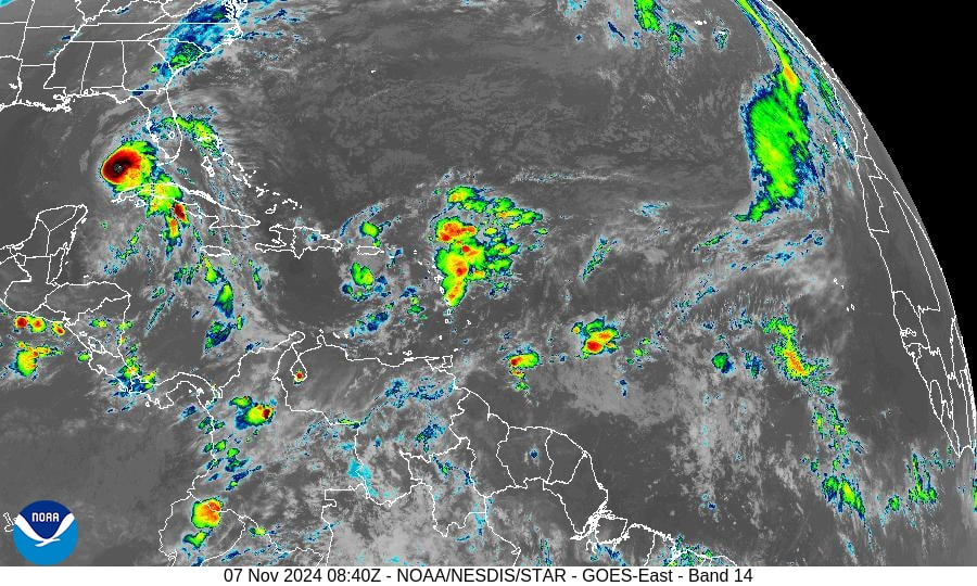
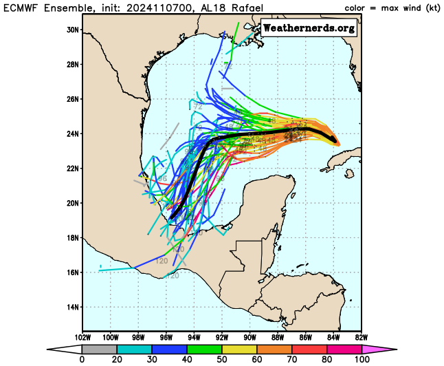
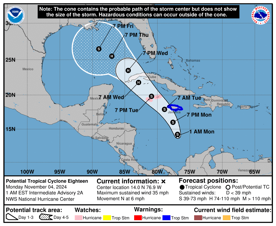
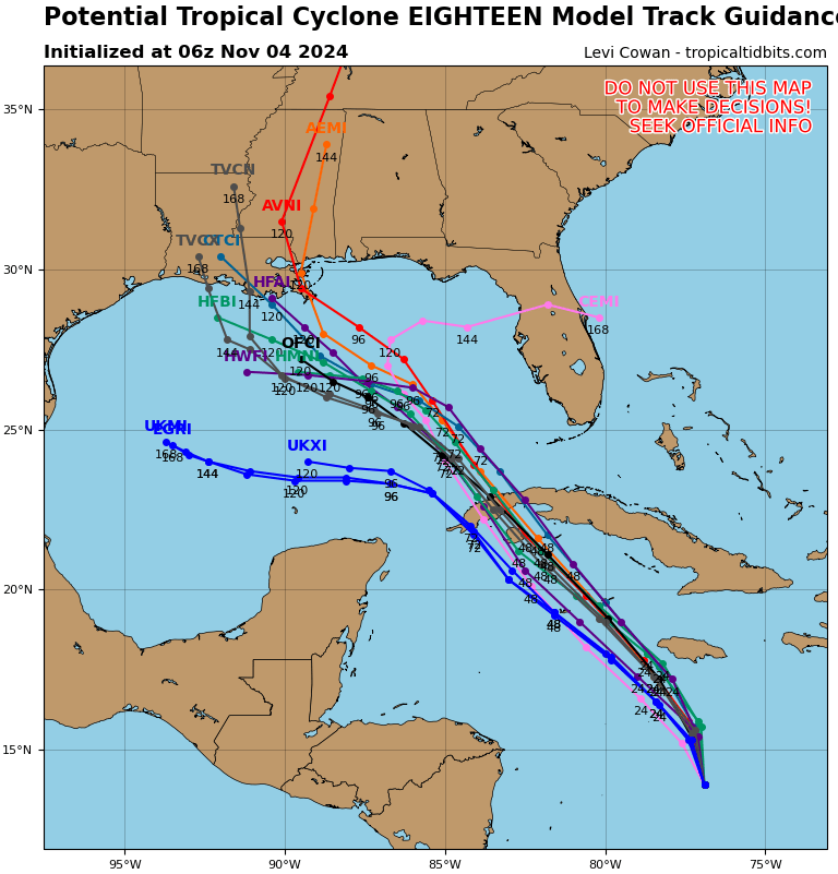
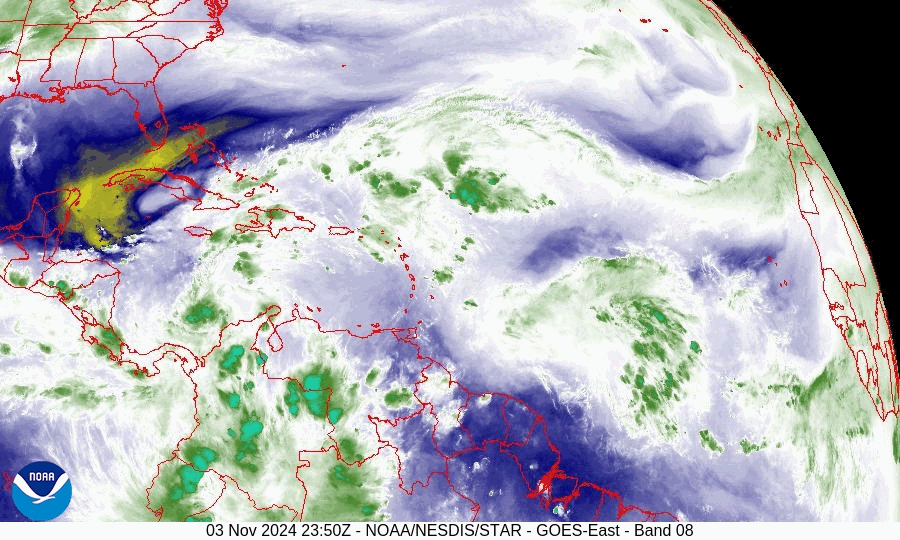
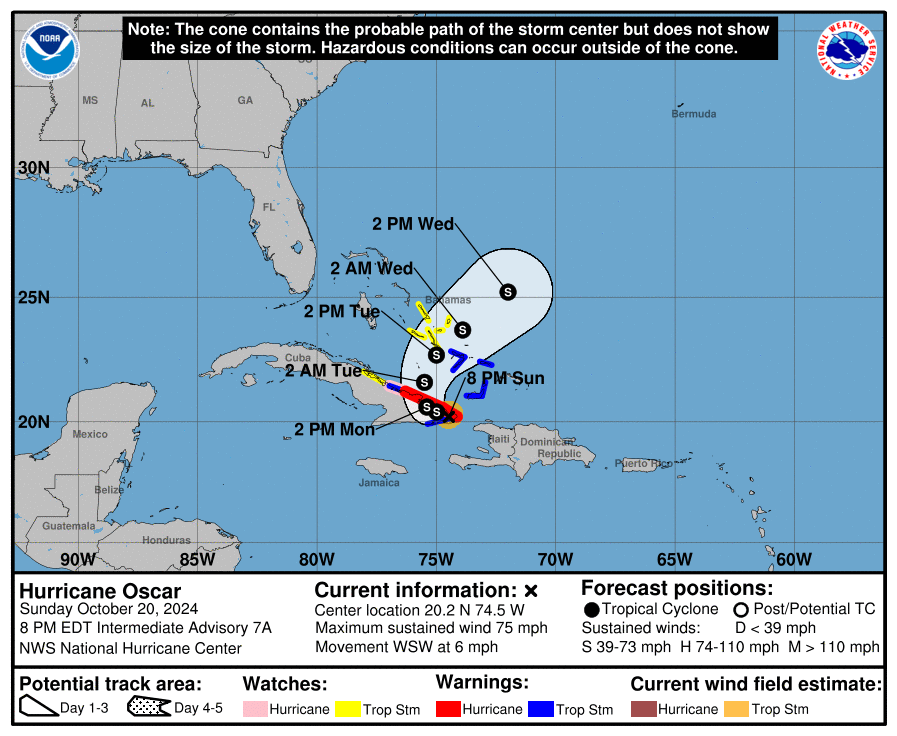
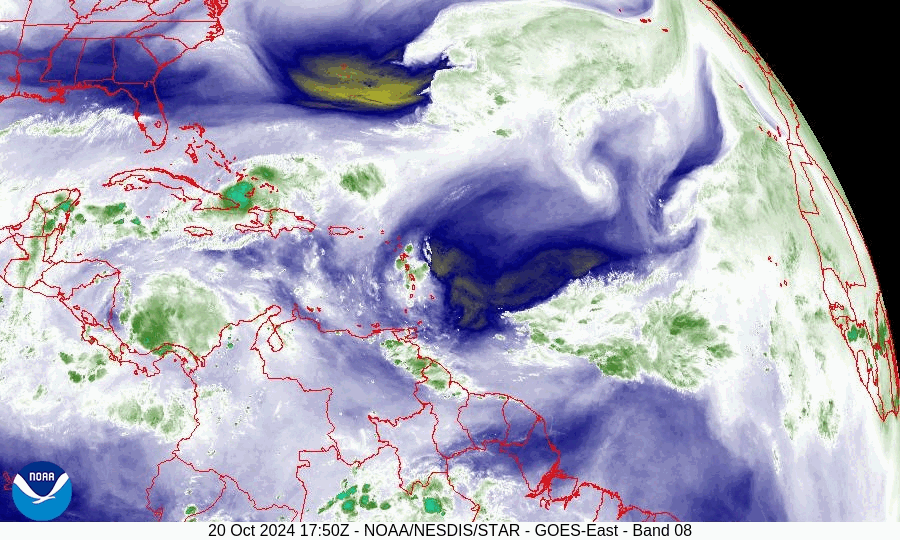
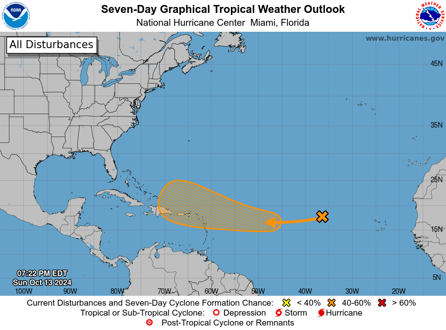
The 2024 Atlantic hurricane season was very active and extremely destructive with several landfalling hurricanes that became the third-costliest on record, behind only 2017 and 2005. It featured 18 named storms, 11 hurricanes, and 5 major hurricanes; it was also the first since 2019 to feature multiple Category 5 hurricanes.
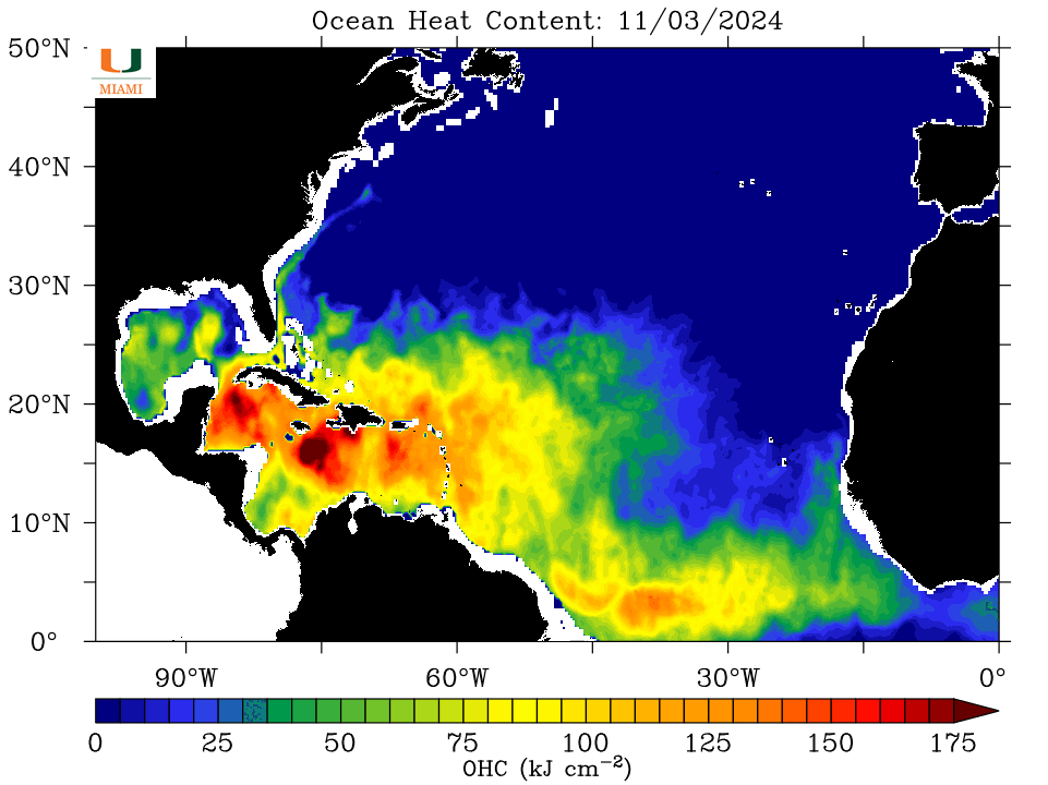
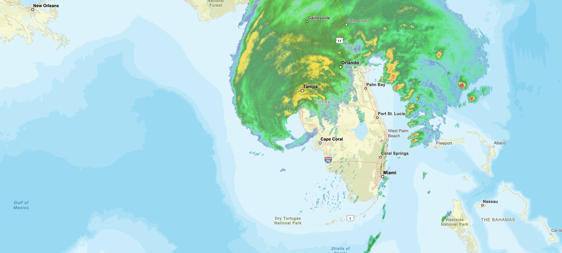
2025 is forecast to be a mildly above average season. Last year's La Nina has ended and we currently have neutral El Nino conditions, which are forecast to continue through the fall, which are usually associated with average seasons, however ocean water temperatures are currently warmer than average across the western and central Atlantic & are currently slightly below average over the eastern tropical Atlantic. Warmer than average ocean water temperatures are also currently occurring over the eastern subtropical Atlantic and the northern Gulf of Mexico. The warmer than average water temperatures are forecast to lead to an above average season with regard to the number of storms.
The net result of this is that the areas at greatest risk this year are the northwestern Caribbean northward to the northern Gulf coast, the Carolinas, Southern New England and the far northeastern Caribbean, including the far northern Leeward Islands, the Virgin Islands and Puerto Rico.
Rainfall at my house in 2024, despite a wet June and October, was 48.00", well below my 35 year running average of 66.71".
Wishing everyone a great 2025.
Until next time,
Matt.
Good morning.
The 2024 Atlantic hurricane season was very active and extremely destructive with several landfalling hurricanes that became the third-costliest on record, behind only 2017 and 2005. It featured 18 named storms, 11 hurricanes, and 5 major hurricanes; it was also the first since 2019 to feature multiple Category 5 hurricanes.
2025 is forecast to be a mildly above average season. Last year's La Nina has ended and we currently have neutral El Nino conditions, which are forecast to continue through the fall, which are usually associated with average seasons, however ocean water temperatures are currently warmer than average across the western and central Atlantic & are currently slightly below average over the eastern tropical Atlantic. Warmer than average ocean water temperatures are also currently occurring over the eastern subtropical Atlantic and the northern Gulf of Mexico. The warmer than average water temperatures are forecast to lead to an above average season with regard to the number of storms.
The net result of this is that the areas at greatest risk this year are the northwestern Caribbean northward to the northern Gulf coast, the Carolinas, Southern New England and the far northeastern Caribbean, including the far northern Leeward Islands, the Virgin Islands and Puerto Rico.
Rainfall at my house in 2024, despite a wet June and October, was 48.00", well below my 35 year running average of 66.71".
Wishing everyone a great 2025.
Until next time,
Matt.