Matt on the Tropics
Tropical Updates
  • Home
  • About
  • Archive (pre-blog)
  • Contact
  • Weather Links
  • Weather Trivia

tropical update friday 10-23-20, 8 am

10/23/2020

 
Good morning.

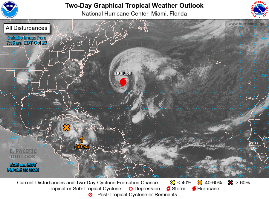
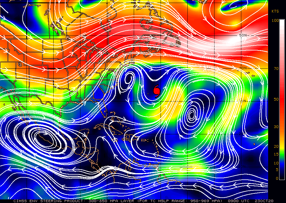
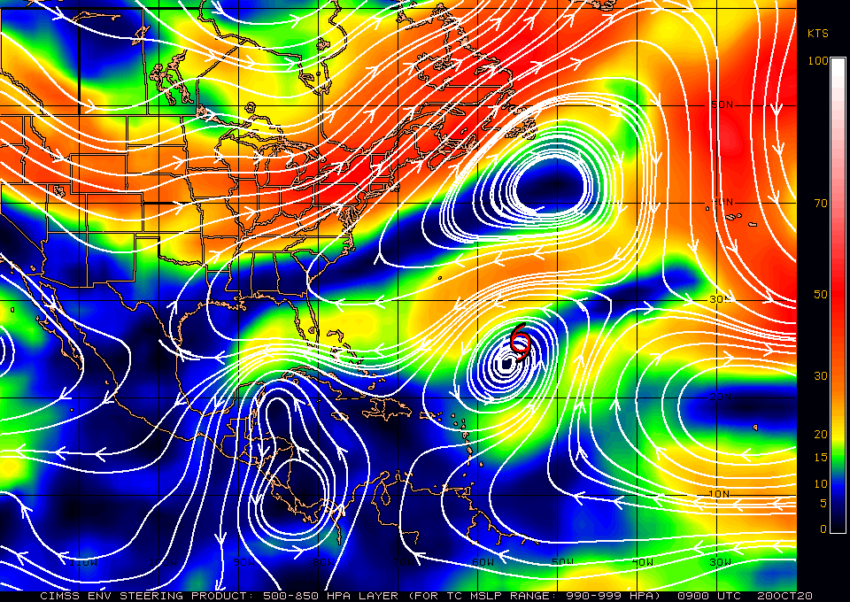
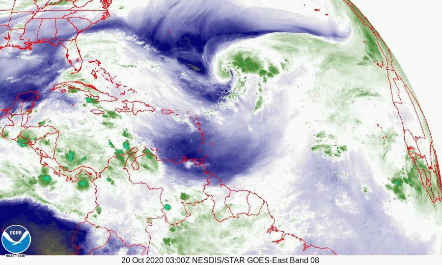
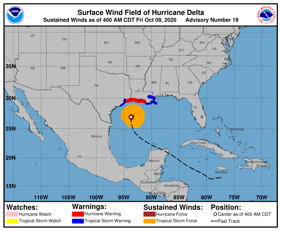
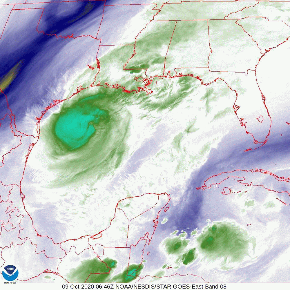
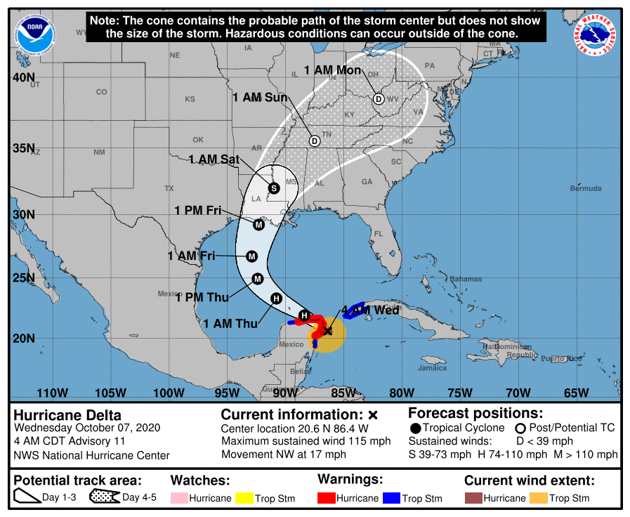
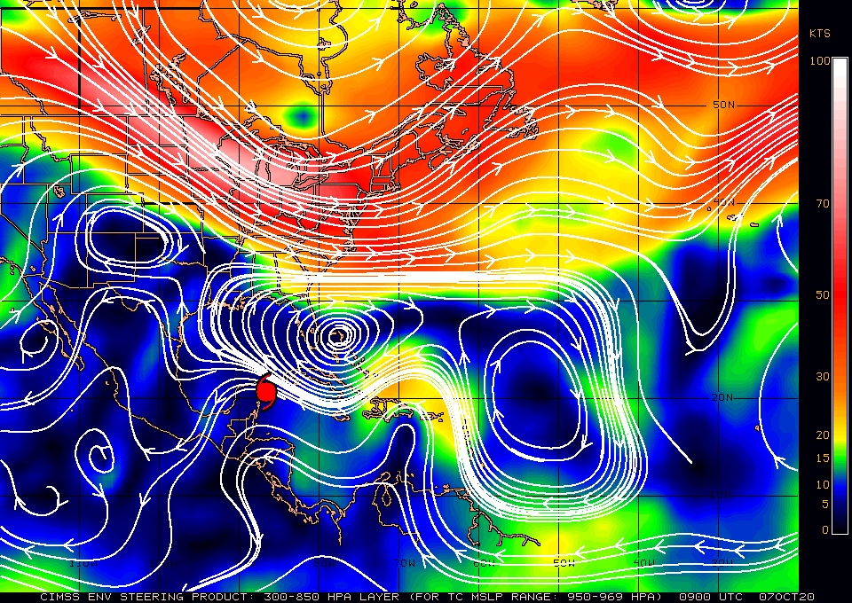
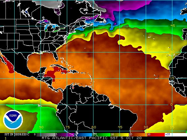
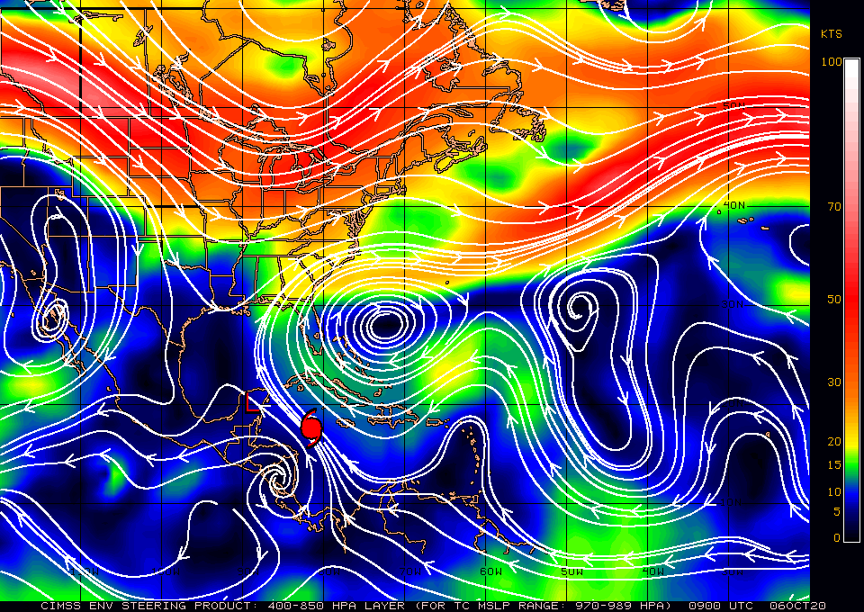
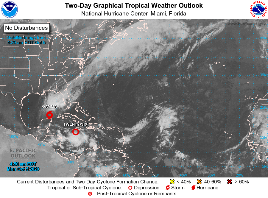
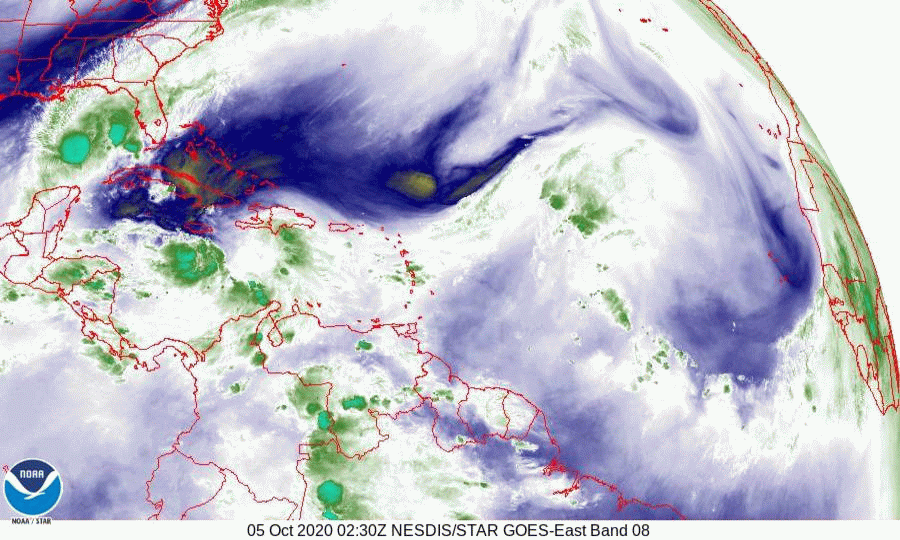
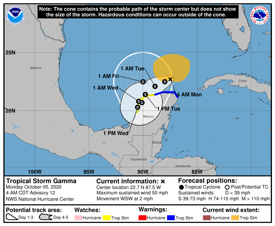
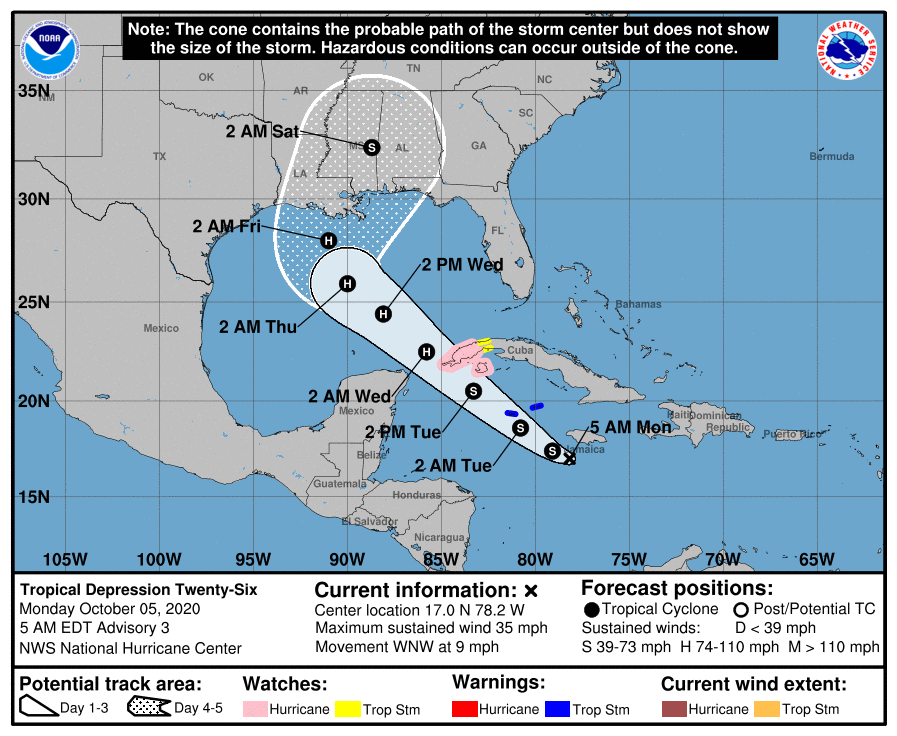
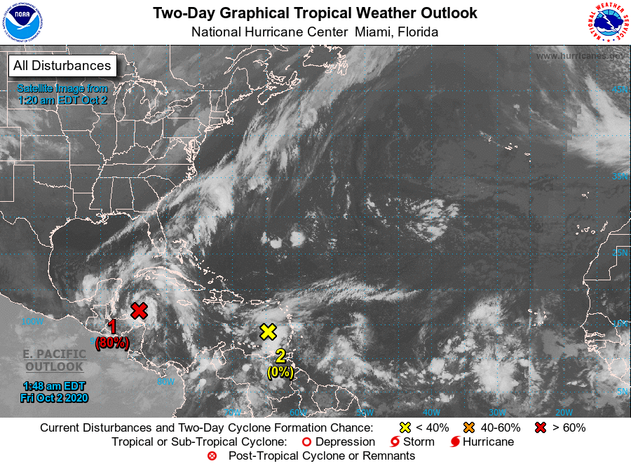
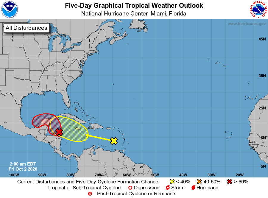
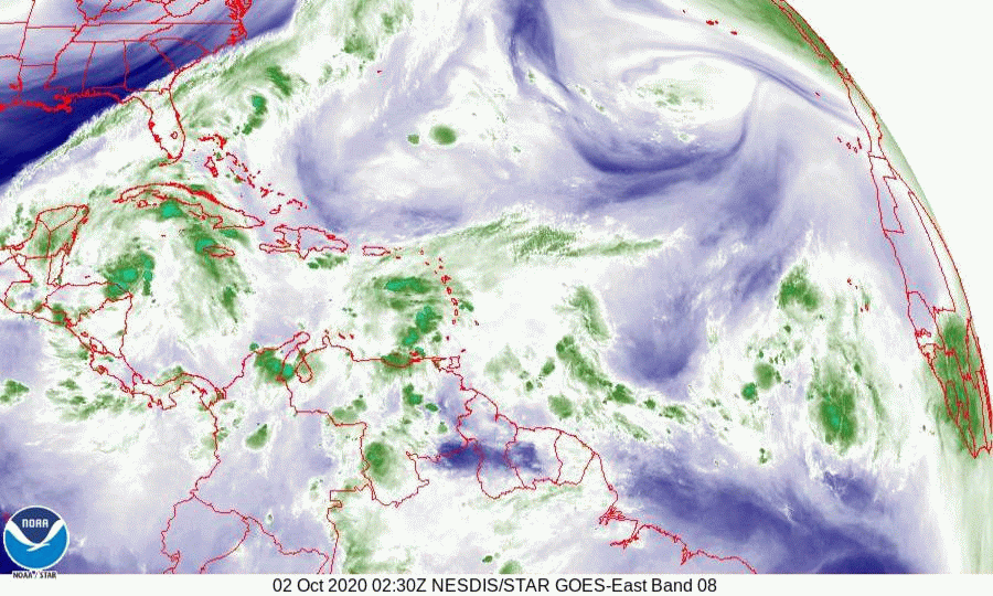
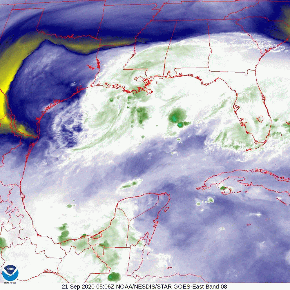
I'm writing about a new area of disturbed weather in the Central Caribbean. The NHC is currently giving it a 60% chance of development over the next 5 days. It is currently in an area of low shear however if you look at the wind shear analysis below you can see that it will encounter high shear as it approaches Western Cuba. If you look at the Surface map below it currently looks like it should pass through the Florida Straits toward the Central and Northern Bahamas. It could however pass close to South Florida and will likely bring more rain with tropical storm force winds possible. Due to the high shear over Florida it is unlikely to more than a tropical storm when it is near South Florida. We'll need to keep an eye on this one.

I'll write again tomorrow.

                                                                  Matt.

​
Picture
Picture
Picture

tropical update tuesday 10-20-20, 7:30 am

10/20/2020

 
Good morning.

Tropical Storm Epsilon formed yesterday morning and is moving out to sea. It should miss Bermuda and the US. Elsewhere a weak area of low pressure in the Western Caribbean has a low probability of development and even if it should, it should be a weak system due to high shear to its north and move into Mexico.

If you look at the water vapor loop and the wind shear analysis below you can see that overall shear is increasing every where. The 2020 Hurricane Season is winding down, thank goodness.

I'll write again if things should change but currently nothing is out there threatening the US.

Until next time,
                                                                             Matt.

​
Picture
Picture
Picture
Picture
Picture

tropical update Monday 10-12-20, 7 am

10/12/2020

 
Good morning.

Hurricane Delta made landfall on Friday evening near Creole, Louisiana, about 13 miles east of where Laura made landfall, as a Cat 2 hurricane. Peak sustained winds recorded on land were in the mid 80s with a peak gust of 100 mph at Texas Point, Texas near the Louisiana border at Sabine Pass. The highest rainfall was at Iowa, La., about 20 miles east of Lake Charles, La. with 16.51" recorded. The highest surge recorded was 9.3 feet SSW of Lafayette, La..

Below is a chart of Deltas Wind History. The yellow are storm force winds and the red hurricane force.

Currently there is nothing of real concern out there. One system exists which should encounter high shear and even if it should develop, it should miss the US.

Until next time,
                                                            Matt.

​
Picture

tropical update friday 10-9-20, 7 am

10/9/2020

 
Good morning.

At 5 am Hurricane Delta was moving N @ 12 mph towards the SW Louisiana coastline. It is probably at its peak intensity now and gradual weakening prior to land fall is forecast due to increasing wind shear to its north and cooler waters. The NHC is currently calling for it to be a 100-110 mph Cat 2 at land fall. More likely peak sustained winds will be in the 90-100 mph range. If you look at the water vapor loop below you can see it starting to encounter SW shear.

Delta currently has a 30 mile wide eye with hurricane force winds extending 35 miles to the east and 25 miles to the west of the center with strongest winds extending 20 miles from the center. If you look at the Wind Field diagram below, the dark orange area would have to pass over you to experience hurricane conditions. If you look at the Surface Map below you can see exactly where it is heading. It should make landfall around 9-10 pm tonight. You will also notice high pressure over Florida. This should protect the state both from Delta and the yellow X below.

If you look at the Sea Surface Temperature diagram below you can see how both Gamma and Delta have removed a lot of heat from the Western Caribbean. (Compare to prior diagrams, especially 10-2-20, 1 week ago. That is good.)

Until next time,

                                                         Matt.

​
Picture
Picture
Picture
Picture
Picture
Picture
Picture

tropical update wednesday 10-7-20, 7:30 am

10/7/2020

 
Good morning.

Hurricane Delta is currently making landfall along the Northern Yucatan Peninsula between Cancun and Cozumel as a Cat 2 hurricane with 100 mph winds. It has weakened overnight with steadily rising barometric pressures.

If you look at the surface map below you can see that building high pressure over Florida is making a Louisiana landfall more likely. High shear and cooler waters in the northern Gulf of Mexico should lead to weakening prior to landfall. It is forecast to strengthen once again to a Cat 4 tomorrow after it moves away from the Yucatan.

Just how strong it is at landfall will depend on how fast it is moving. In general the slower it goes the weaker it should become as it will have more time to be affected by the cooler waters and shear.

We'll have to see.

Elsewhere all is quiet.

Until next time,
                                                                     Matt.

​
Picture
Picture
Picture
Picture

GOES of Hurricane Delta, Tuesday 10-6-20, 4 pm.

10/6/2020

 
Attached is the current color satellite loop of Delta, as of 2 pm a 140 mph Cat 4 hurricane. Surprisingly a distinct eye is not yet apparent though should be so very soon. The eye is a tiny 5 miles wide at present. You'll notice the remnants of Gamma over the northern Yucatan which are starting to be drawn into Delta. By tomorrow what's left of Gamma should be gone, eaten by Delta.

​Matt.
Picture

tropical update tuesday 10-6-20, 7 am

10/6/2020

 
Good morning.

Delta has been undergoing rapid intensification since this time yesterday when it was a depression with 35 mph winds. They are now 100 mph and further rapid intensification is forecast and it will likely become a Cat 3 or 4 storm later today. Yesterday it moved due west rather than NW as was forecast and is now well south and west of where the NHC had forecast it to be. In light of this all of the models , for now, have shifted westward. It is presently in an area of low shear and warm water however shear will increase markedly after it moves into the northern Gulf of Mexico.. Delta is currently a very compact storm with hurricane force winds extending only 10-20 miles from the center and storm force winds extending 60-80 miles from the center. It will be much larger after it enters the Gulf. 

Gamma has dissipated and its remnants are currently over the northern Yucatan Peninsula. They will be drawn into Delta late tonight and early tomorrow as Delta approaches the northern Yucatan Peninsula.

In looking at the surface map below you can see the "window" centered over Louisiana, however due to shear most of Delta's weather is likely to be displaced to the east of the center. The NHC is still forecasting it to make landfall along the northern Gulf coast as a 100 mph Cat 2, due to shear and cooler waters close to shore, however its too soon to say.

I'll continue to watch for changes.

Until next time,                                     Matt.

PS. I'm going to try and post a Geo-Satellite Color Loop this afternoon which should be impressive by then.  We should be seeing a distinct eye by then.
Picture
Picture
Picture
Picture
Picture
Picture

tropical update monday 10-5-20, 7 am

10/5/2020

 
Good morning.

The Western Caribbean Sea remains the area to watch. TS Gamma is currently just north of the Yucatan Peninsula and is totally uncoupled and undergoing significant southerly shear with all of its weather displaced to the north and east of the center. (See water vapor loop below.) It is forecast to meander SW and then eastward as TD # 26, soon to become TS Delta approaches. It should eventually dissipate as its weather and circulation is drawn into TS or Hurricane Delta as it passes through the Yucatan Channel.

TD#26 is forecast to become TS Delta soon and the NHC is currently forecasting it to make landfall along the Louisiana coast as a Cat 2 hurricane. Due to the abundant shear in the northern Gulf of Mexico I'm not sure that that will happen. If you look at the surface map below you will see a wide window between the Louisiana coast and the Big Bend area of Florida. With the high amount of shear a track to the east of Louisiana appears to be more likely; and a weaker storm, but it is still way too early to make a prediction and just how much interaction that occurs between Gamma and Delta could have a significant impact on where Delta goes. They will come quite close to one another. 

South Florida should be okay.

Until next time,               
​                                                                       Matt.


Picture
Picture
Picture
Picture
Picture

tropical update friday 10-2-20, 7 am

10/2/2020

 
Good morning.

Things are starting to heat up again in the Tropics and as forecast the Western Caribbean Sea is the area to watch. There are 2 systems of note at present.

The first in the southwestern Caribbean is likely to become a tropical depression later today and make landfall on the Yucatan Peninsula before turning SW into the Bay of Campeche and dissipating. 

The second area is the one which we'll need to watch. If you look at the water vapor loop below you can see a cold front barely moving along the Big Bend area of Florida, with high SW shear aloft. The first system is too far south to feel it affects. If the system in the Eastern Caribbean gets far enough north by the time it enters the Western Caribbean it could be turned N and NE toward that front. The NHC is currently only giving it a 30% chance of development over the next 5 days. It currently has no organization in looking at the water vapor loop. If it should develop and get into the NW Caribbean a track toward the West Coast of Florida could happen with the current areas of greatest risk being between Ft Myers and Tampa.

Wind shear is extremely strong over Florida at present and unless it moves very rapidly NE it is unlikely to be a strong system. There is however a lot of hot water in the NW Caribbean.

If you look at the IR image of Africa below you will notice the Inter-Tropical Convergence Zone over Africa with 4 systems lined up, notice that they are all below 10 degrees latitude. Tropical cyclones don't develop within 8 degrees of the equator due to the absence of spin. The Cape Verde season is almost over. It ends when the I T C Z moves south of 8 degrees latitude.

I'll continue to watch as things develop, or not.

Until next time,

                                                                Matt.


Picture
Picture
Picture
Picture
Picture
Picture
Picture
Picture

tropical update monday 9-21-20, 7 am

9/21/2020

 
Good morning.

So far so good.

Teddy is heading north and should pass east of Bermuda. It is forecast to become an extra-tropical storm on Wednesday.

Beta, a slow moving very small storm could become a rain maker along the Texas and Louisiana coasts this week. It has already sucked quite a bit of heat out of the Western Gulf of Mexico.

If you look at the surface map below you will see that high pressure remains over Florida, protecting the state.

Until next time,

                                                             Matt.


Picture
Picture
Picture
Picture
Picture
Picture
<<Previous
Forward>>

    Categories

    All
    Preseason Update