Good morning.
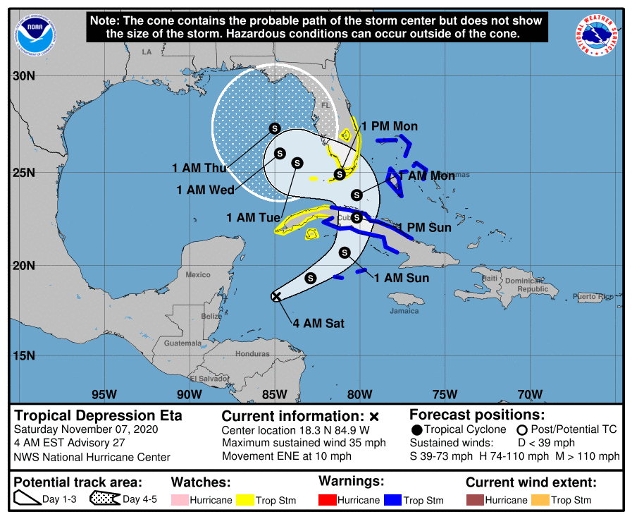
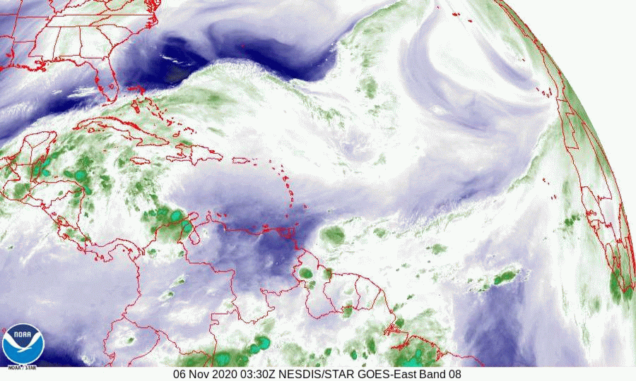
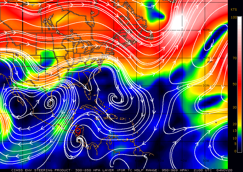
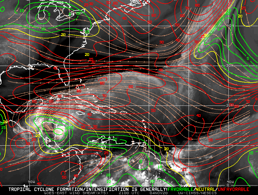
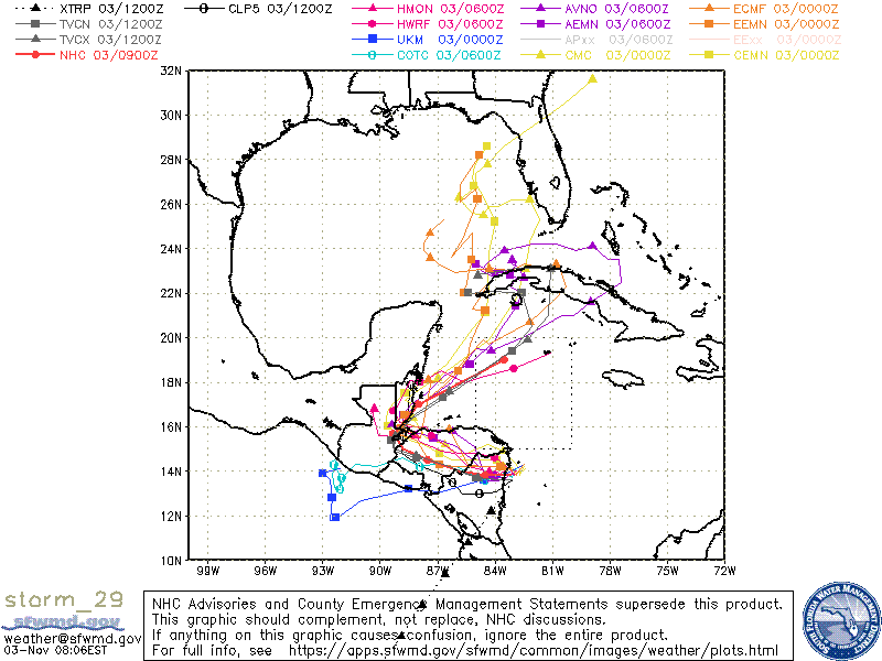
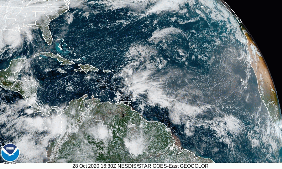
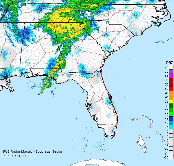
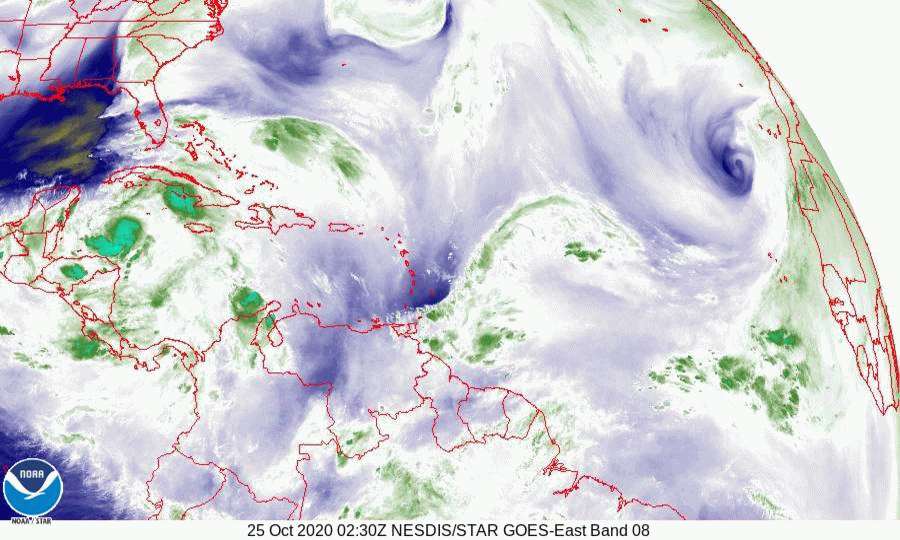
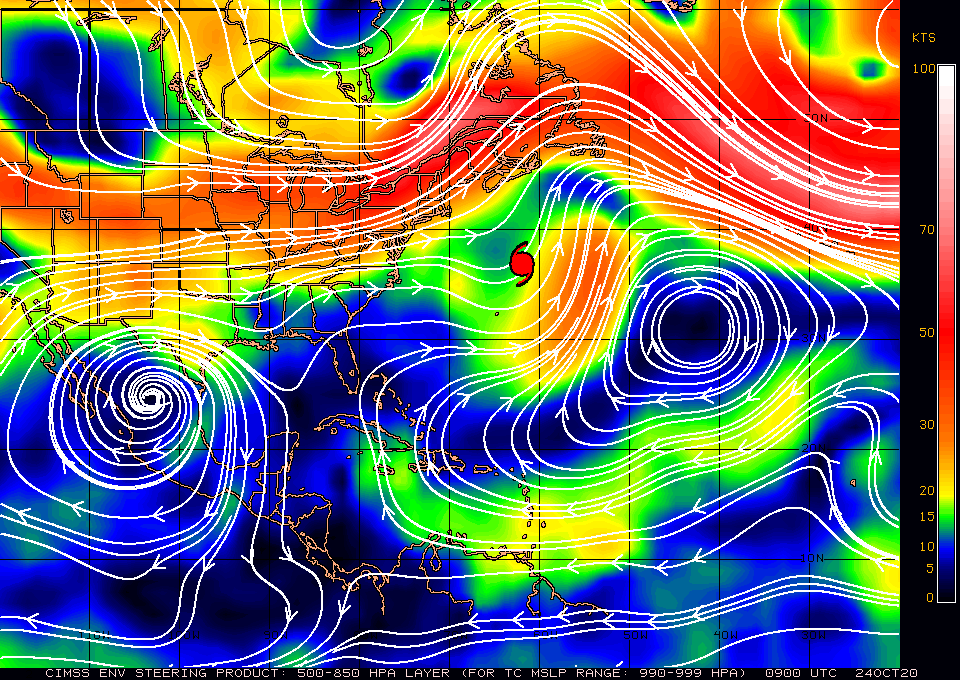
At 5 am Tropical Depression Eta was moving ENE at 10 mph with peak winds of 35 mph. Last night around 8:30 pm Eta had minimal convection and it appeared that it could dissipate however overnight an area of deep convection has reformed NE of the center. Note if you compare the map below to the water vapor loop you will see that the center is actually well SW of the "green blob", it is actually just below the small green flare to the west. This is due the high amount of shear that it is encountering and why it hasn't strengthened yet. One possible scenario is that a new center may form NE of the present one under the area of convection. If this should occur it could intensify.
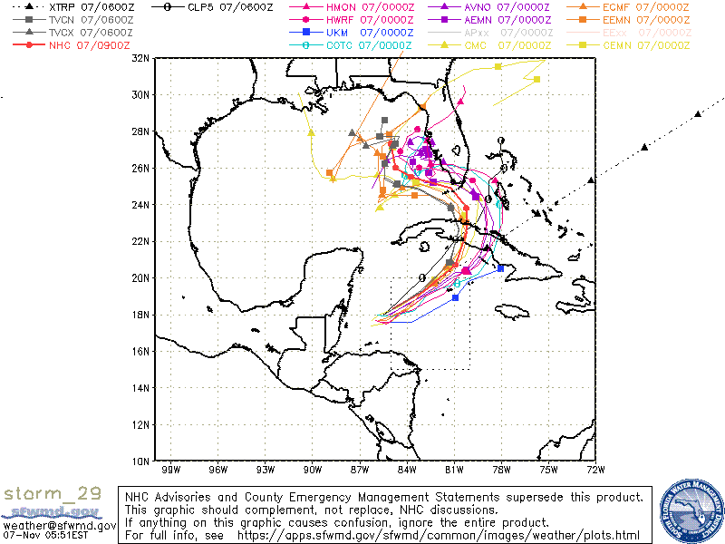
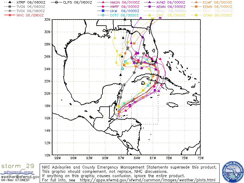
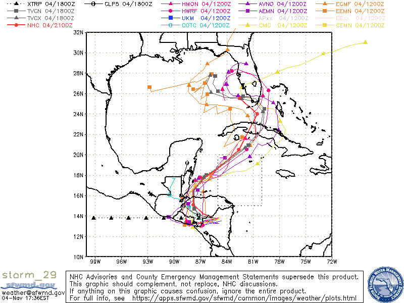
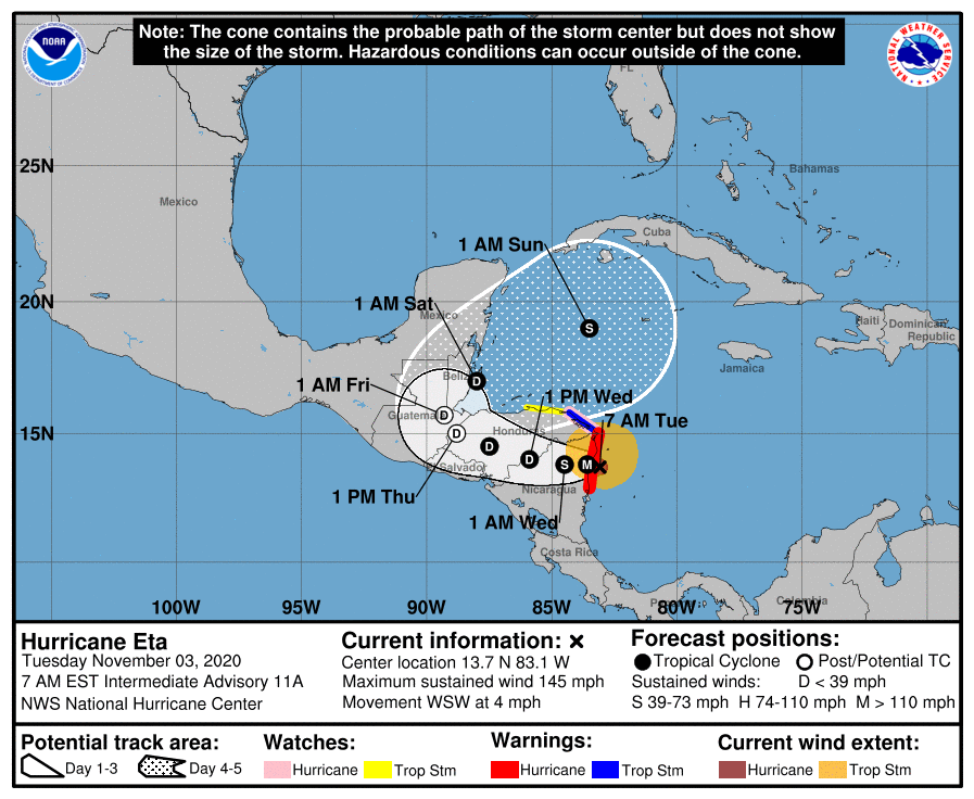
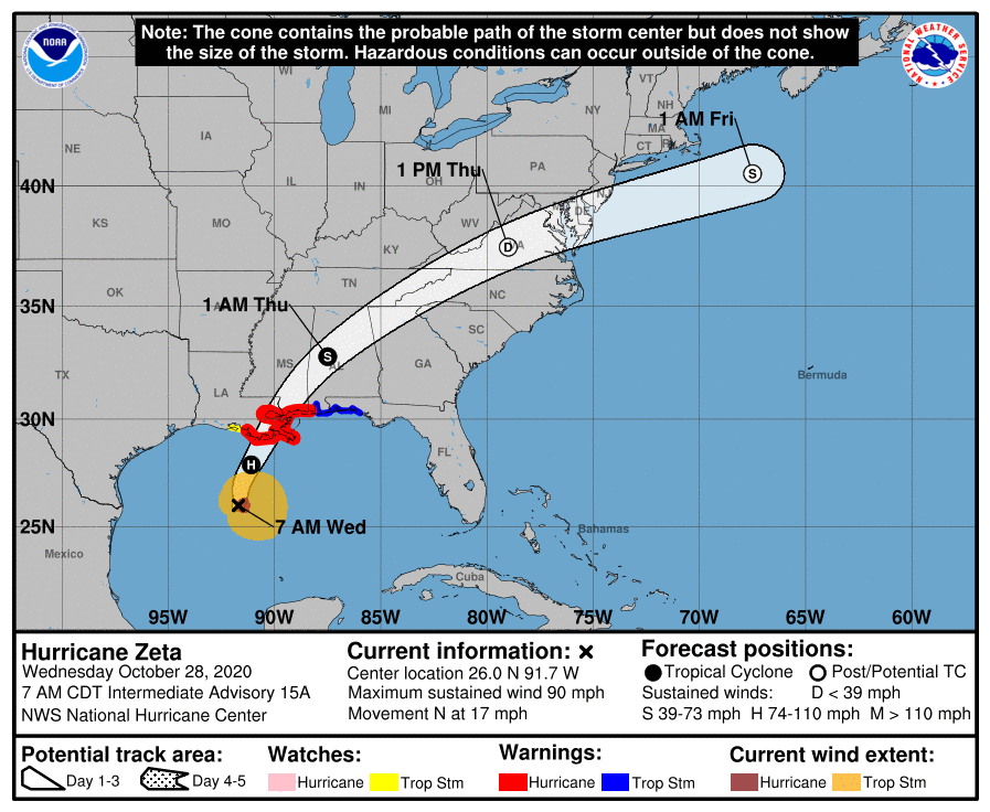
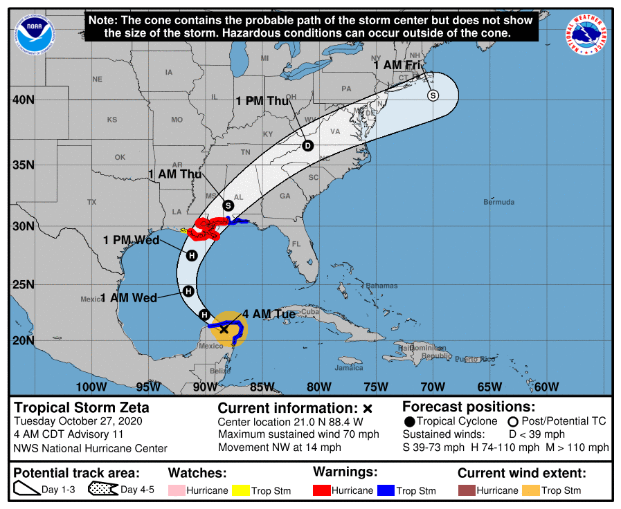
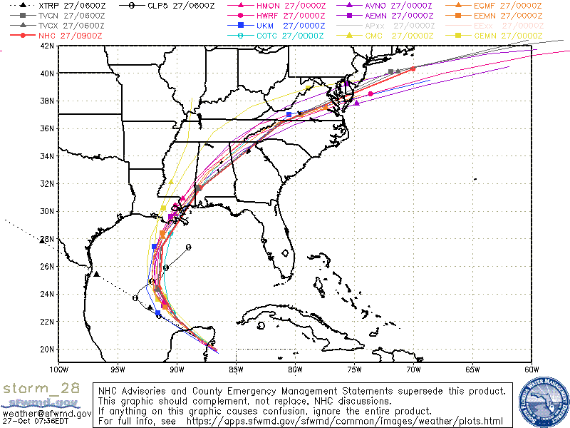
The NHC's track hasn't changed much, its a little west and north of yesterdays, however note it is significantly slower not bringing weather to South Florida until late Sunday night through Monday.
My track has not changed and is a little south of theirs. Bringing Eta just south of the Lower Florida Keys. (This difference will not likely affect the amount of weather that South Florida receives.)
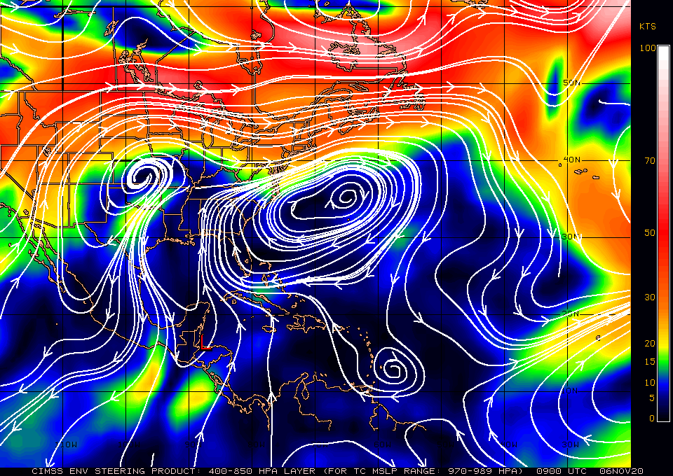
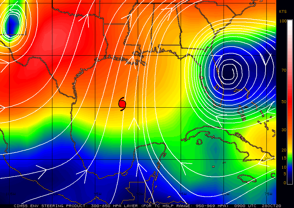
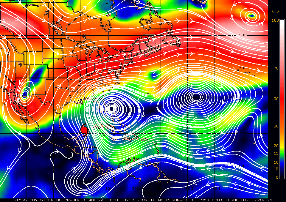
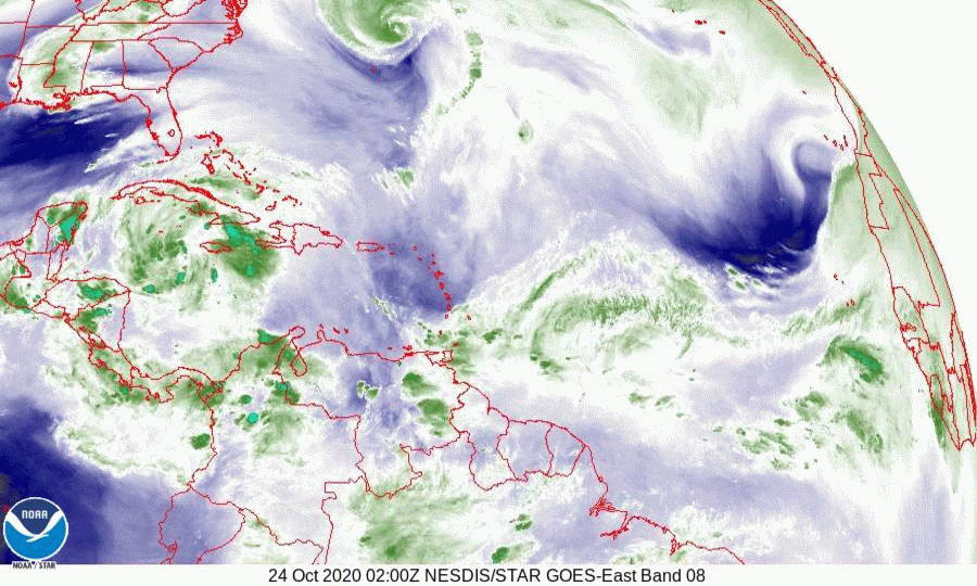
Also note on the water vapor loop you can see the upper level low which I talked about yesterday just south of Louisiana. This is forecast to move into the central Gulf of Mexico and merge with Eta probably Wednesday/Thursday. In addition note the dry, yellow air in the Central Gulf of Mexico.
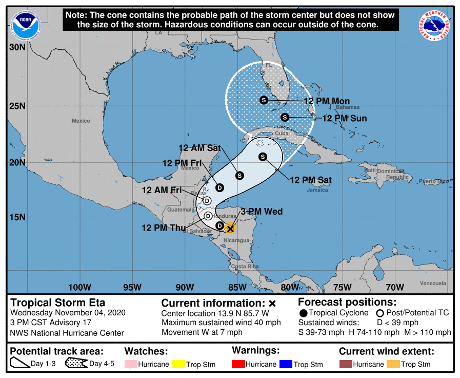
Due to high shear Eta will be an asymmetric system with most of its weather ENE of the center making Monday afternoon as the time when South Florida could see the most weather. (If the present timing is accurate.) Its still too early to say how much weather though most likely at this point, winds in the 40s with potentially a lot of rain if the "blob" stays over us but with the high shear, it may not. I suspect that it won't be as much as they are saying. (? 2-6" ?) It will all depend on how much it will be able to keep itself together in the hostile environment aloft in our area.
It is still possible that it doesn't intensify much if the center doesn't relocate or even dissipate in the high shear environment, and it still has to cross over the mountains of Cuba.
I'll write again this evening and early tomorrow morning.
Until next time,
Matt.
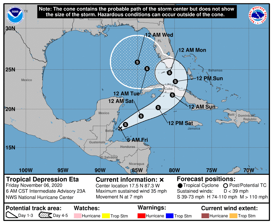
At 5 am Tropical Depression Eta was moving ENE at 10 mph with peak winds of 35 mph. Last night around 8:30 pm Eta had minimal convection and it appeared that it could dissipate however overnight an area of deep convection has reformed NE of the center. Note if you compare the map below to the water vapor loop you will see that the center is actually well SW of the "green blob", it is actually just below the small green flare to the west. This is due the high amount of shear that it is encountering and why it hasn't strengthened yet. One possible scenario is that a new center may form NE of the present one under the area of convection. If this should occur it could intensify.
The NHC's track hasn't changed much, its a little west and north of yesterdays, however note it is significantly slower not bringing weather to South Florida until late Sunday night through Monday.
My track has not changed and is a little south of theirs. Bringing Eta just south of the Lower Florida Keys. (This difference will not likely affect the amount of weather that South Florida receives.)
Also note on the water vapor loop you can see the upper level low which I talked about yesterday just south of Louisiana. This is forecast to move into the central Gulf of Mexico and merge with Eta probably Wednesday/Thursday. In addition note the dry, yellow air in the Central Gulf of Mexico.
Due to high shear Eta will be an asymmetric system with most of its weather ENE of the center making Monday afternoon as the time when South Florida could see the most weather. (If the present timing is accurate.) Its still too early to say how much weather though most likely at this point, winds in the 40s with potentially a lot of rain if the "blob" stays over us but with the high shear, it may not. I suspect that it won't be as much as they are saying. (? 2-6" ?) It will all depend on how much it will be able to keep itself together in the hostile environment aloft in our area.
It is still possible that it doesn't intensify much if the center doesn't relocate or even dissipate in the high shear environment, and it still has to cross over the mountains of Cuba.
I'll write again this evening and early tomorrow morning.
Until next time,
Matt.