Matt on the Tropics
Tropical Updates
  • Home
  • About
  • Archive (pre-blog)
  • Contact
  • Weather Links
  • Weather Trivia

tropical update Friday 7-2-21, 6 am

7/2/2021

 
Good morning.

Since yesterday a few interesting things have developed regarding Elsa.
​
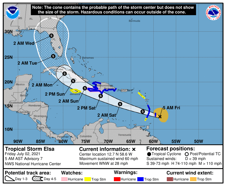
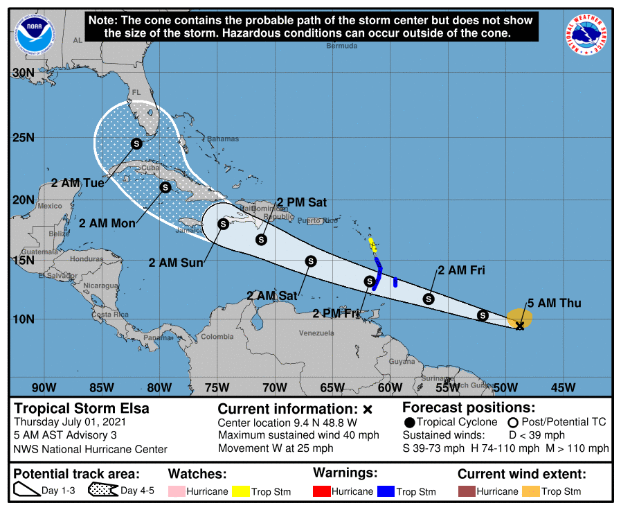
Elsa now moving quickly to the WNW at 28 mph and is a little ahead of yesterday's NHC forecast but is currently on their track.

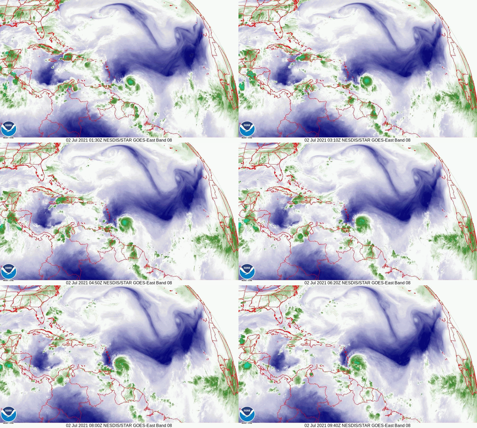
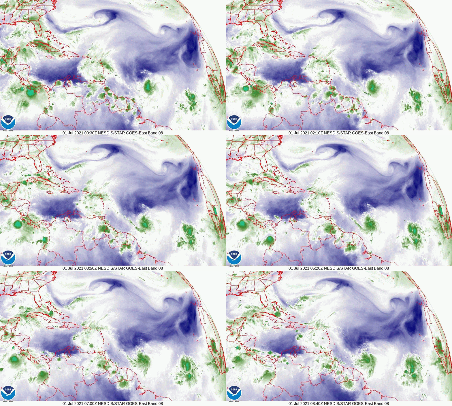
If you look at the Water Vapor Loop below you will notice a few things. First is that Elsa has become better organized and is moving steadily and symmetrically to the WNW. Next the upper level low is still in the central Gulf of Mexico. Next and most importantly see a cold front across the SE US pushing slowly to the SE. This will be a key factor in determining where Elsa will go.
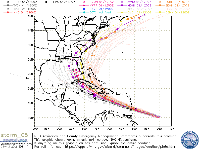
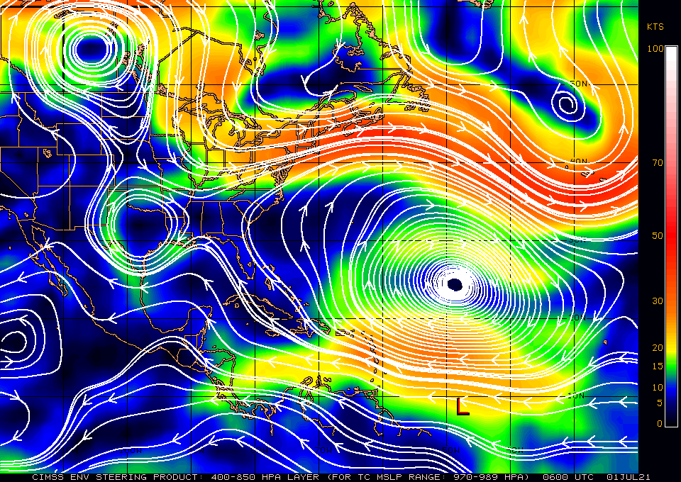
If you look at the Models from last night, which have not changed this morning, you will see that they are all over the place. Currently ALL tracks for Elsa are low confidence tracks. The NHC is currently using the consensus of the European models for their track however do not be surprised if a dramatic shift should occur. If you look at the Surface Map below you will notice when compared to yesterday's, the High pressure in the Western Atlantic has shifted a little eastward and the isobars over Cuba, the Yucatan Channel and Florida have widened. This is in response the approaching cold front across the SE US. It is not stationary and if it should get far enough south a further deflection to the east is possible. Note these shifts are temporary and timing will be key.

If you look at the isobar that Elsa is on, on the close up Surface Map, you will see that it take it into Hispaniola. Note this is north of the NHC track. A key for South Florida will be if Elsa tracks south of Hispaniola, vs through it and how much land interactions occur between it and Hispaniola and Cuba. If it should track across Hispaniola and emerge on its north coast a track thru the Bahamas and east of Florida and missing the US would become more likely. If it moves south of Hispaniola and Cuba a track into the West Coast of Florida would become more likely. If it should get south of Cuba it should slow dramatically and if that happens it will give time for the environmental conditions to change. This is what is leading to the marked uncertainty in Elsa's forecast.

Short term as stated above the key will be just what happens tomorrow afternoon and night with regards to Elsa and Hispaniola.

Until next time,

                                                Matt.

​
Picture
Picture
Picture
Picture
Picture
Picture
Picture

Thursday 7-1-21, 8 pm Model run

7/1/2021

 
Good evening.

I just wanted to share the latest model run. Pretty amazing. Look at the spread. Its almost 1400 miles wide! I'll explain why and what may happen with Elsa tomorrow morning. 

Matt.
​
Picture

Tropical Update Thursday 7-1-21, 5:30 am

7/1/2021

 
Good morning.

Early this morning Potential Tropical Cyclone #5 became better organized and the NHC located a center of circulation and named it Tropical Storm Elsa. If you look at the Surface Map below you will see that the isobar that it is on takes it to the northern Yucatan Peninsula. This is not likely where it will go. 
If you look at the water vapor loop below you will notice a couple of interesting features. First Elsa is south and west of where they anticipated it to be yesterday and it appears to be moving just south of west, not along the current NHC track. Next note an upper level low spinning counter clockwise over the central Gulf of  Mexico. IF this feature should persist it would tend to turn Elsa to the NW as it approaches the Western Caribbean. My current track is south and west of the NHC's and takes Elsa either through the eastern Yucatan Channel or into the Isle of Pines and the western tip of Cuba. Louisiana or Mississippi appear to be at highest risk at present, however it is still very early in the forecast track and some changes are likely.

I'll be watching and will write another post early tomorrow morning. Sooner if needed.

Until then,

​                                      Matt.

​
Picture
Picture
Picture
Picture

Tropical Update Wednesday 6-30-21 9:30 Pm

6/30/2021

 
Good evening.

I've been trying to get an update out all day however my website was down. I've spent most of the day with tech support and finally have it working again.

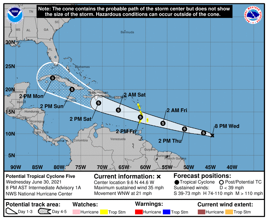
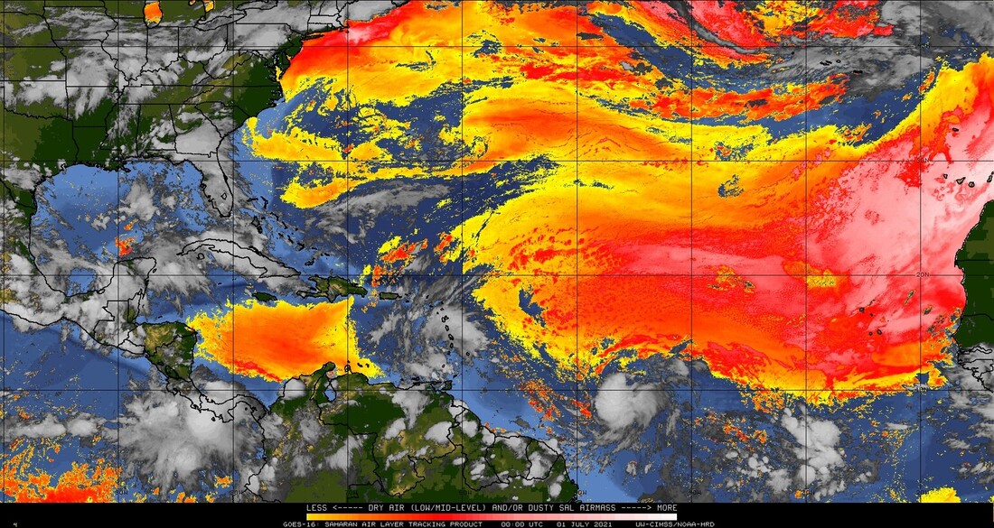
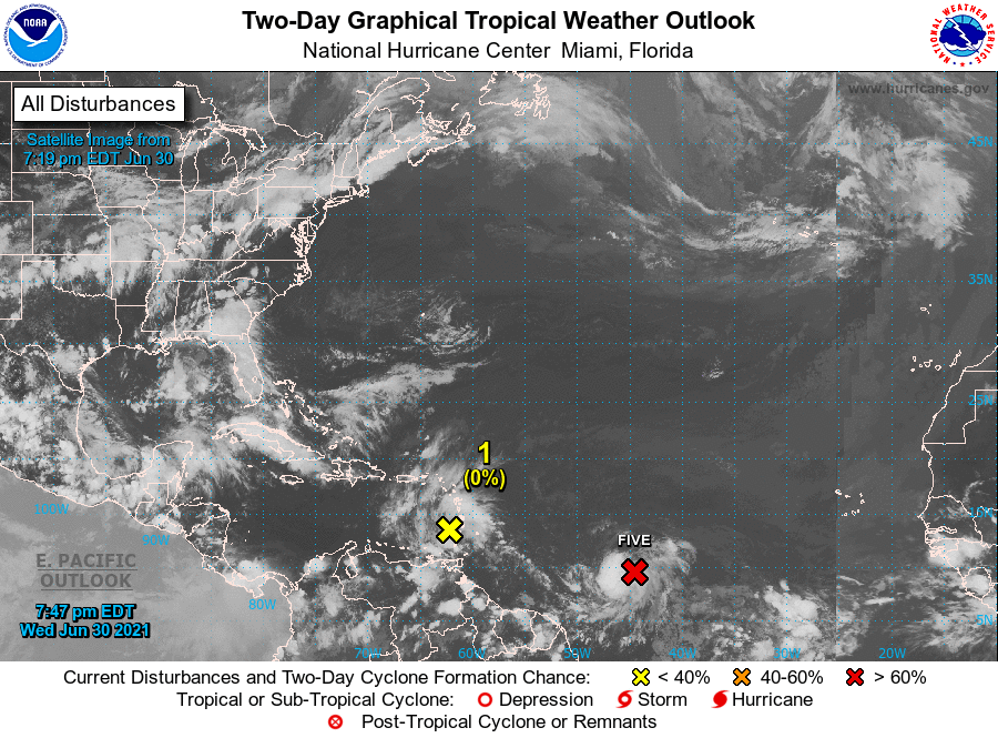
I'm writing about "Potential Tropical Cylcone #5" which will probably become a tropical storm early tomorrow. It is currently poorly organized without a distinct center of circulation. Until it has a definite center it will be extremely difficult to predict where it will go. A very strong Bermuda high is forecast to move it quickly to the WNW at 25-30 mph, this will hamper strengthening and it is currently forecast to only be a tropical storm in 5 days. Overall conditions are not very favorable and it is unlikely to become a strong system. We'll probably have a better idea by Friday. Tracks east of Florida, across South Florida or into the Gulf of Mexico are all possible at this time though if you look at the Surface Map below a track west of Florida into the Gulf of Mexico appears more likely however as noted until a true center forms its a crap shoot. I am presently not overly concerned.

The wave in front of it currently over the Lesser Antilles will not likely develop though will moisten the environment in front of PTC 5

I'll write again tomorrow.

Matt.

Picture
Picture
Picture
Picture
Picture

Preseason Tropical update Friday 4-23-21

4/23/2021

 
Good afternoon.

2020 was a busy year in the Tropics though a fairly quiet year for South Florida. Louisiana, the Gulf Coast, the Caribbean and the Carolinas received most of the activity. What lead to the overall increase in activity was the presence of La Nina conditions, which still exist. The current La Nina is expected to end in May or June with neutral ENSO conditions existing until September, October or November when La Nina conditions are expected to returns. El Ninos are associated with increased shear across the Caribbean leading to a reduction in the number of storms. Conversely La Ninas are associated with a decrease in shear and a resultant increase in tropical activity. Neutral Condition are associated with an average number of storms. In light of this I would anticipate an average start to the season, unless the current La Nina lasts longer than expected, with a possible increase in activity late, depending just if and when La Nina conditions should return.

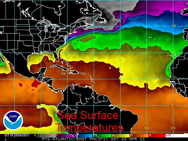
If you look at the chart of sea surface temperatures below you can see the warm water is in the Tropical Atlantic, the Caribbean, the Bahamas and the eastern Gulf of Mexico. Therefore for this year the areas at greatest risk will be northern Caribbean Islands, the Bahamas, Florida, the Carolinas and the eastern Gulf of Mexico. With a warmer Eastern Tropical Atlantic than we've seen in the past several years we may have an active Cape Verde season with long track storms, especially if a La Nina should return in September. Hopefully it will wait until November or later.

Rainfall at my house in 2020 measure 85.45 inches well above my 31 year running average of 68.12 inches. Looking back on the rainfall data in 2020 it illustrates the importance of rain events. In 2020 we had three major rain events first May 14-18, a stalled front just north of South Florida brought four days of moist southwest flow with approximately  9 inches of rain falling. May 24 and 25th due  to southerly flow from an upper level low south of Cuba pumping up deep tropical moisture led to over 11 inches of rain in those two days and Tropical Storm Eta, November 7-9 which passed through the upper and middle keys dropping another 11+ inches of rain.

In 2019 the rainfall total was 58.08 inches.
In 2018 the total was 52.37 inches.
in 2017 the total was 76.70 inches with the main rain event being Hurricane Irma, September 9-11 which dropped approximately 9 inches of rain.

Three rain events in one year is very unusual and accounted for over 30 inches of rainfall leading to our very wet overall 2020. Due to the two rain events in May we had over 21 inches of rain setting a record for the month; in fact May and June last year we had 34.05 inches of rain !

Hoping for a quiet year for all and that all the storms move out to sea.    

                                                             Matt.


2021 Atlantic Basin Tropical Cyclone Names:Ana Bill Claudette Danny Elsa
Fred Grace Henri Ida Julian
Kate Larry Mindy Nicholas Odette
Peter Rose Sam Teresa Victor
Wanda
Picture

tropical update friday 11-13-20, 1 pm

11/13/2020

 
Good afternoon.

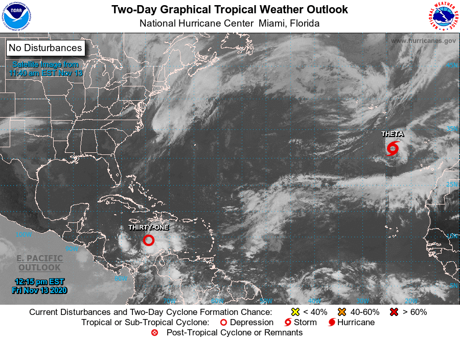
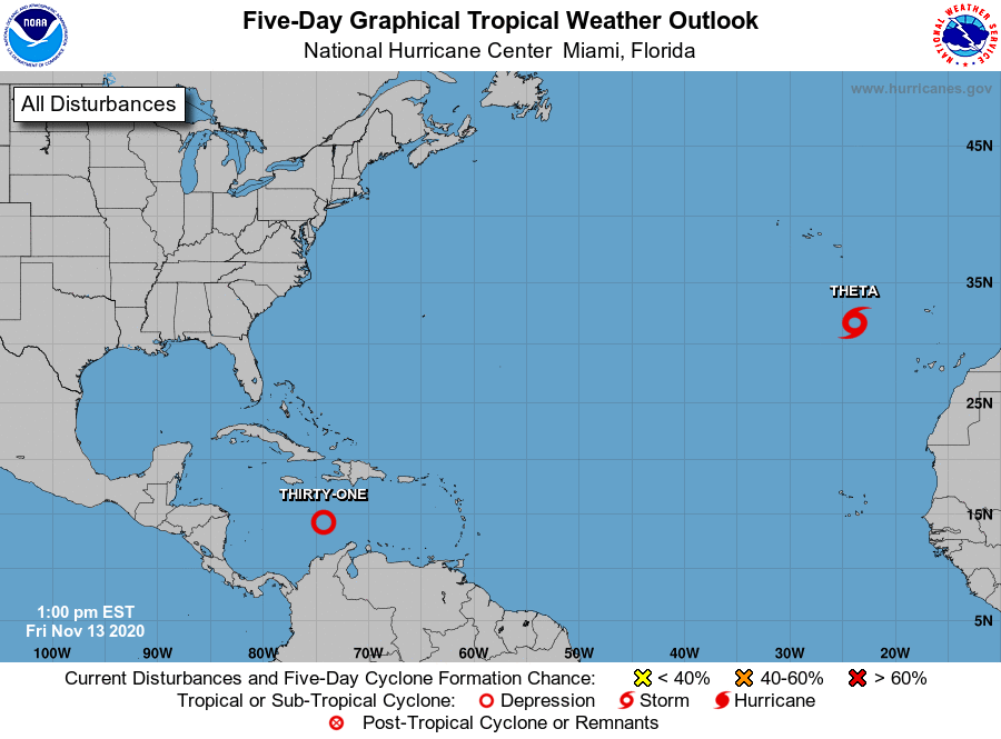
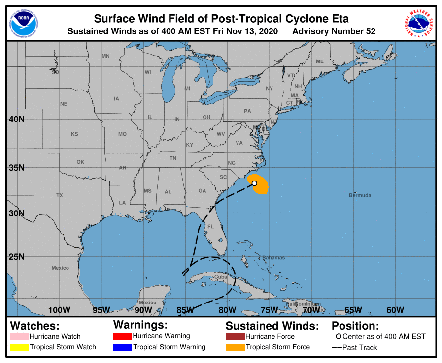
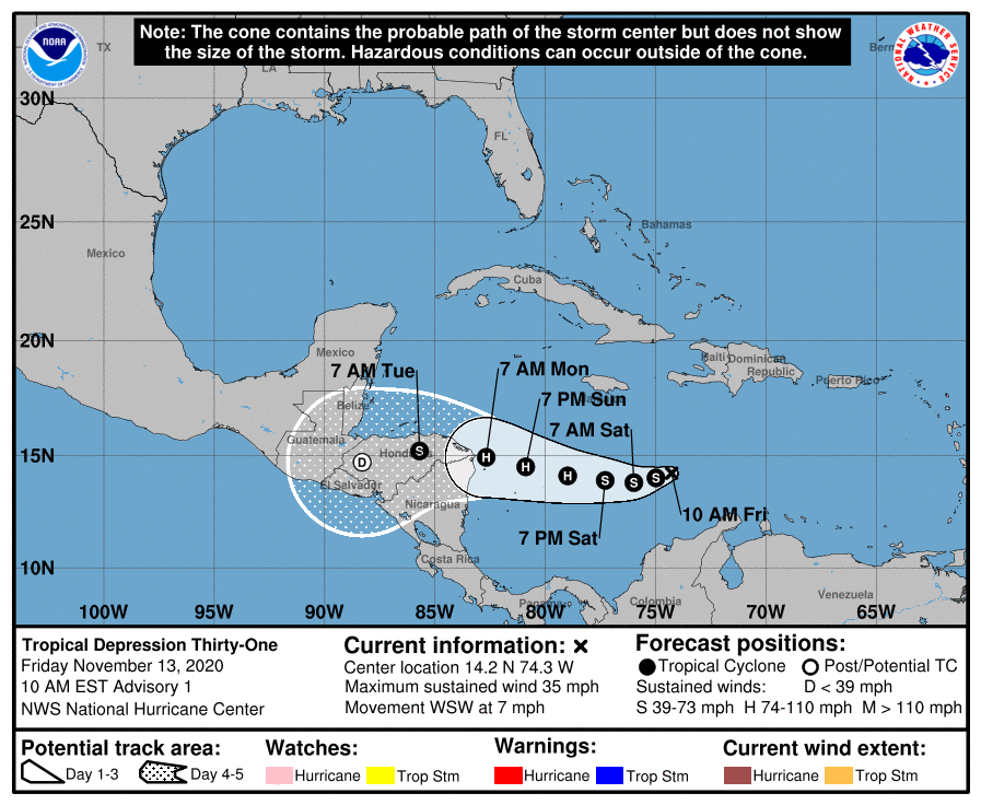
TD 31 !!!, soon to be TS Iota, just formed and it looks like its headed to Nicaragua and Honduras like Eta. It is expected to dissipate there but we'll have to see. Eta is finally heading out to sea and has been absorbed by a frontal boundary.

Elsewhere all is quiet.

Until next time, 
​                                                                       Matt.


Picture
Picture
Picture
Picture

tropical update Tuesday 11-10-20, 7 am

11/10/2020

 
Good morning.

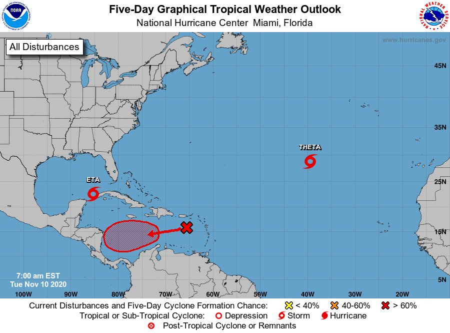
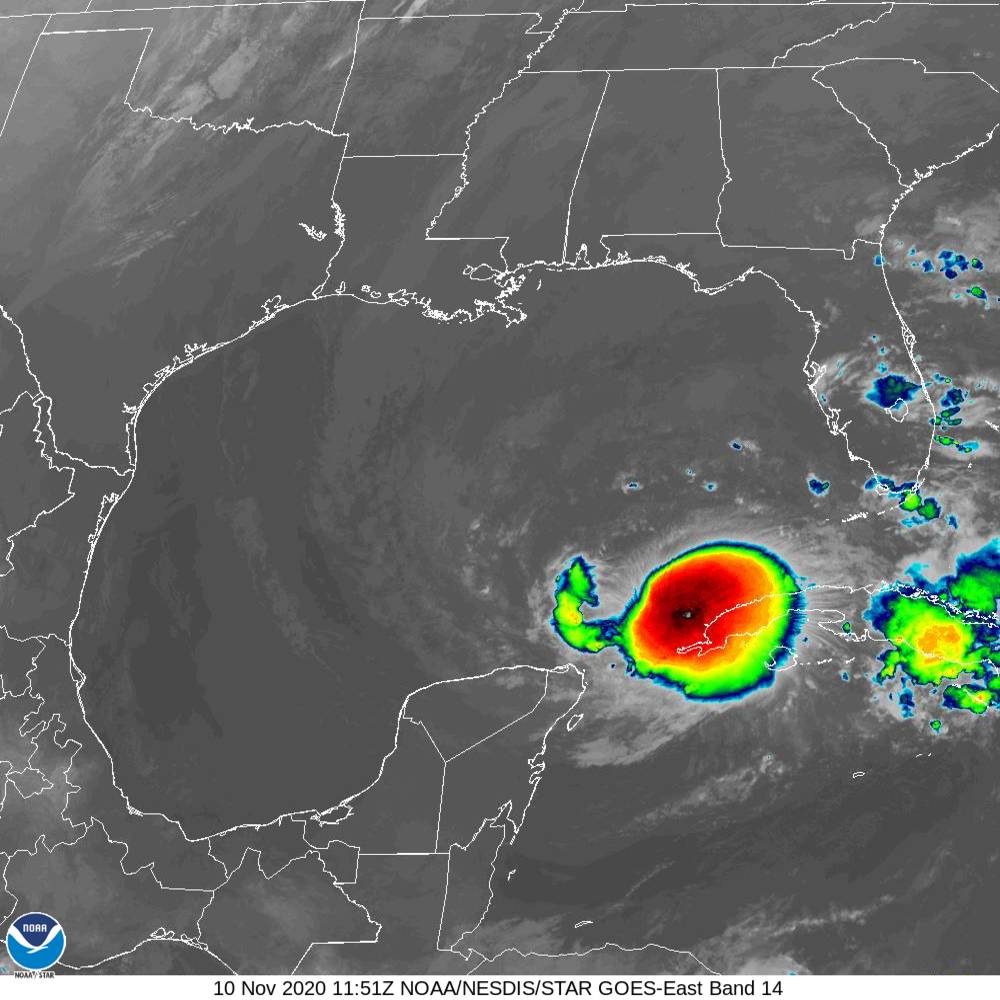
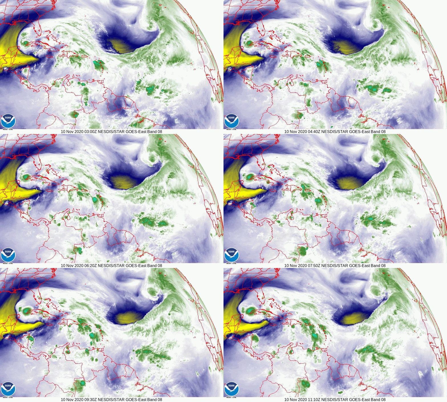
The record 2020, La Nina, Hurricane Season continues. TS Eta is currently located just off the western tip of Cuba and is moving slowly southward. It is expected to reverse course and start moving northward later today. It continues to defy the models and move off its expected  course. This is due to weak steering forces at present and a times throughout its course across the Caribbean, Florida Straits and Gulf of Mexico. It really has had a meandering and prolonged track moving from the central Caribbean to Nicaragua and Honduras, to right off the coast of Belize, to Central Cuba, to the Florida Keys and now back to the western tip of Cuba. It is surrounded by dry air and is expected to slowly drift north and make landfall as a tropical depression on Sunday along the Florida Panhandle. Who knows it may even make a trip to Louisiana to join all the others who've gone there this year. It should primarily be a rain event. 

​Rainfall at my house this past week largely due to Eta totaled 11.14" with most of it falling on Saturday night and early Sunday morning.

TS Theta is heading toward Portugal and poses no threat to the US.

The newest system (potentially TS Iota) is in the eastern Caribbean and is forecast to head on a similar course as Eta towards Nicaragua. Usually systems that go to Central America dissipate there in the mountains. Hopefully it won't regenerate as Eta did, but that would be a long shot. We'll see.

If you look at the next to last diagram, Heat Content, you will see that the last specks of heat left in the Atlantic Basin are in the Caribbean, and just off the western tip of Cuba. Its amazing how nature finds them. Tropical systems are the way the earth transfers heat from the tropics to the poles. The earth doesn't like excess heat build ups and works to balance things out.

Hopefully this will be it ???

Until next time,

                                                                   Matt.


Picture
Picture
Picture
Picture
Picture
Picture
Picture

Tropical Update Monday 11-9-20, 4:30 am

11/9/2020

 
Good morning.

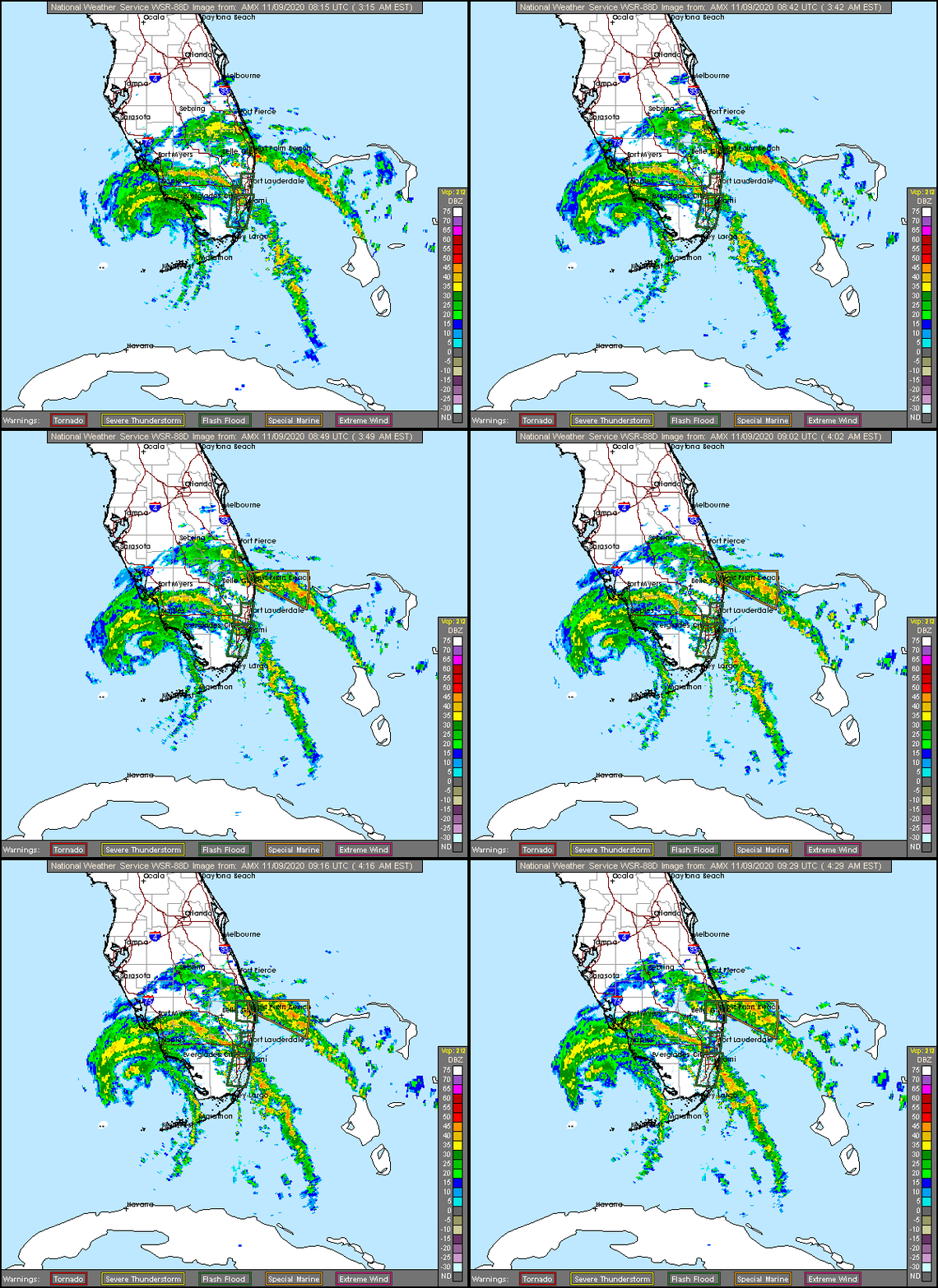
TS Eta is currently off the SW coast of Florida. It moved further north than any of the models had forecast however due to dry air intrusion it had relatively little weather associated with it when it was closest to SE Florida. As a result the impacts on the Florida mainland were less than expected. Most areas had peak winds in the 30s and 40s. Highest recorded gusts were 68 mph at Port Everglades, 49 at a pier in Lake Worth and 50 mph in Homestead. I'll report my rainfall total tomorrow. 
At closest approach it passed about 80 miles south of Miami. It passed directly over the Middle and Lower Keys.

On the radar loop below you can see that it is currently moving west and a SW motion is anticipated today, see forecast track. A few rain band are still out there and will likely be associated with some gusty winds but the worst is over.

Until next time,
                                                             Matt.

Picture
Picture

Update Sunday 11-8-20 7:30 pm

11/8/2020

 
Good evening.

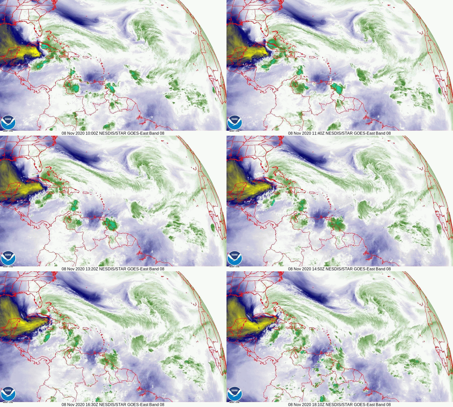
At 7:30 pm TS Eta was located due south of Miami and approaching the Middle and Lower Florida Keys. It is slightly north of the forecast track however due to dry air intrusion Eta has little associated weather with it at this time. See water vapor loop and Key West radar below. (There is no "Green Blob") It will pass over the Keys however they probably won't experience much weather until the eastern side of the storm crosses over them in a few hours. This will likely be a minor wind event for most of South Florida except for the Keys. 

Conditions should gradually clear in the morning with just some passing showers with a few gusts.

I'll write again in the morning but so far it looks like we're getting a break on this one.

Until then,               

​                                                              Matt.


Picture
Picture
Picture
Picture

tropical update sunday 11-8-20, 1:30 pm

11/8/2020

 
Good afternoon.

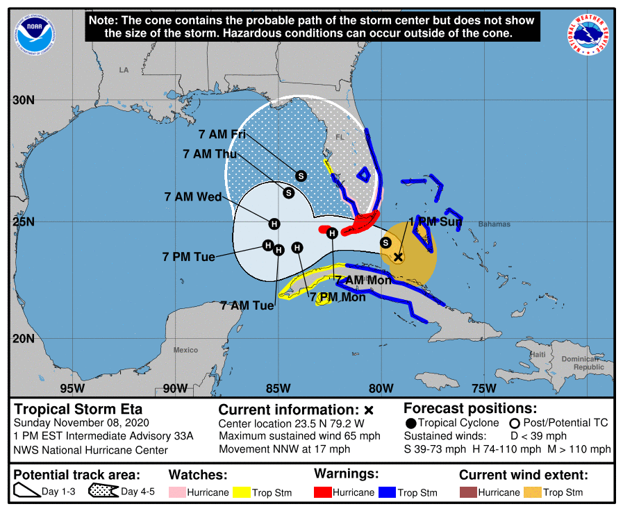
At 1 pm TS Eta was located just north of Central Cuba and was moving NNW, a turn to the NW and W should occur soon.

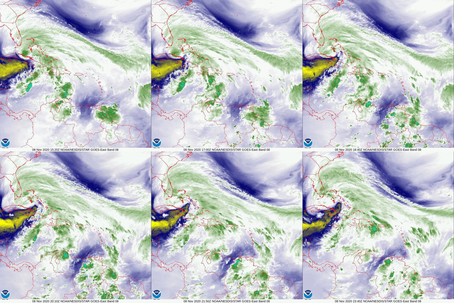
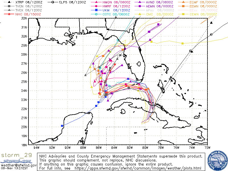
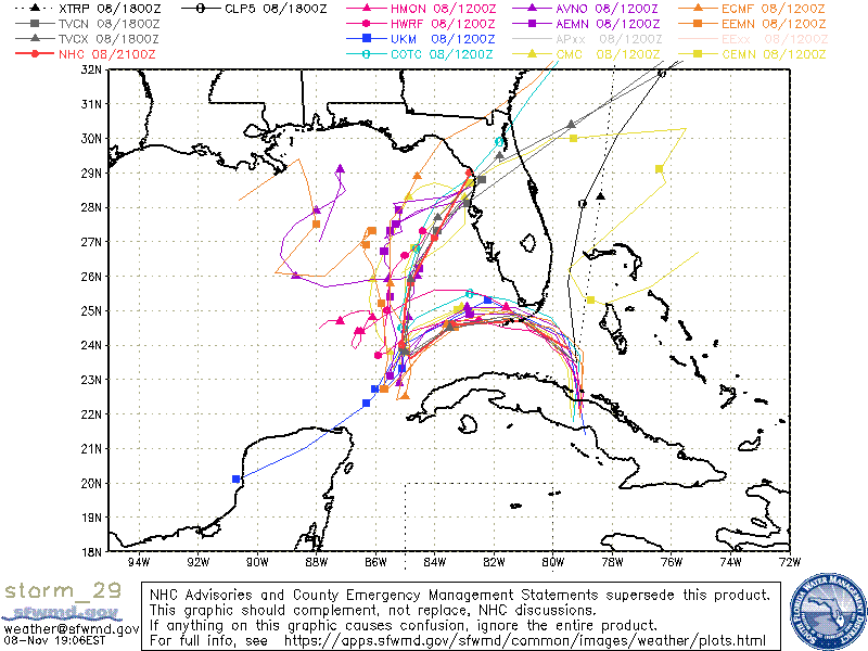
The NHC has shifted its track south and it is now in line with the model consensus and my original track, passing just south of the Lower Keys. Shear is expected to subside in the next 12-36 hours and the NHC is forecasting a possible Cat 1 hurricane for the Florida Keys, with the Lower Keys at greatest risk. Dry air intruding from the SW, evident on the water vapor loop below, may prevent this from happening until it is past them, but to be safe the NHC has placed the Florida Keys under a hurricane warning. 

It should be at its closest approach to the Miami area around 11 pm tonight with windy weather for South Florida starting around 7 pm, by 7 am tomorrow morning it is forecast to be in the vicinity of the Dry Tortugas and the weather should start to improve in the Miami area around that time. The exact timing may vary depending on the amount of convection that occurs overnight. 

With the more southerly track the wind projections from this morning still hold, except possibly to 70-80 mph in the Keys.

I'll write again this evening right after the 8 pm NHC advisory comes out.

Until then,

                                                             Matt.

Picture
Picture
Picture
<<Previous
Forward>>

    Categories

    All
    Preseason Update