Matt on the Tropics
Tropical Updates
  • Home
  • About
  • Archive (pre-blog)
  • Contact
  • Weather Links
  • Weather Trivia

Preseason Tropical  Update 4-22-20,  8 am

4/22/2020

 
Hello all,

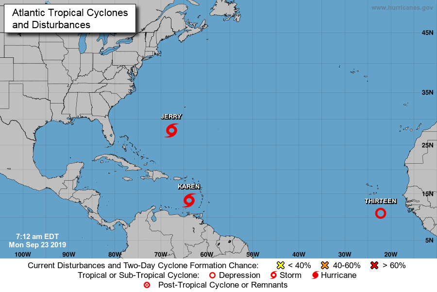
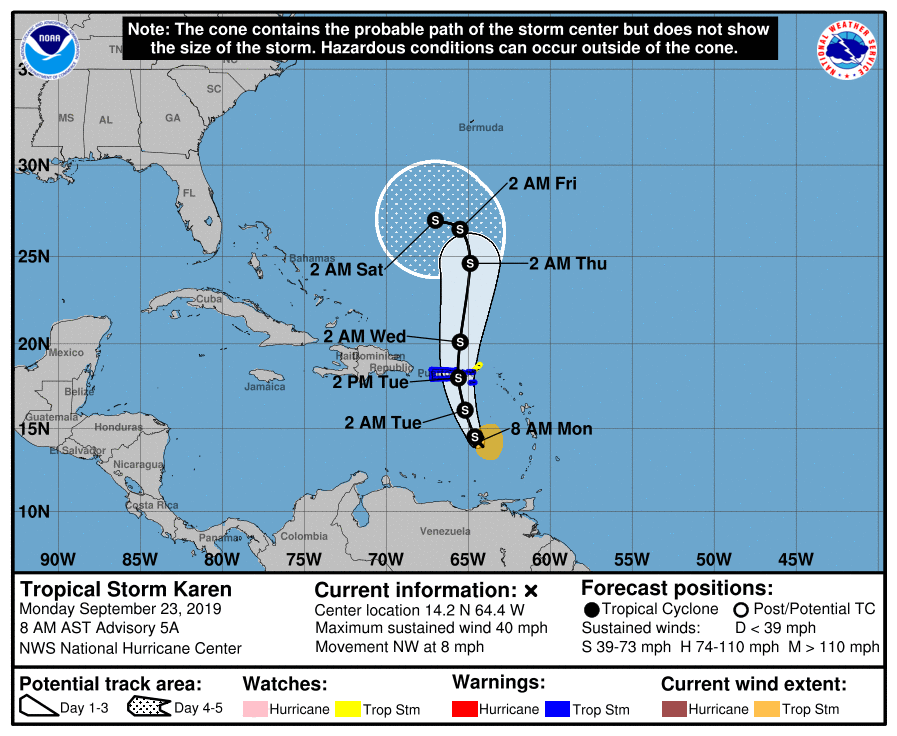
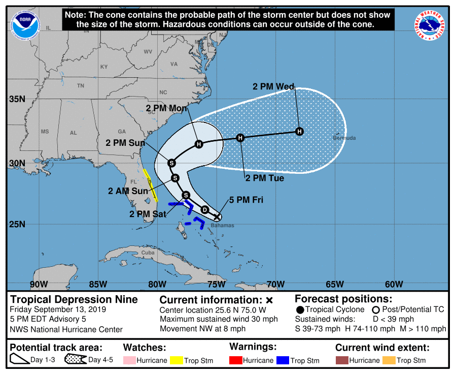
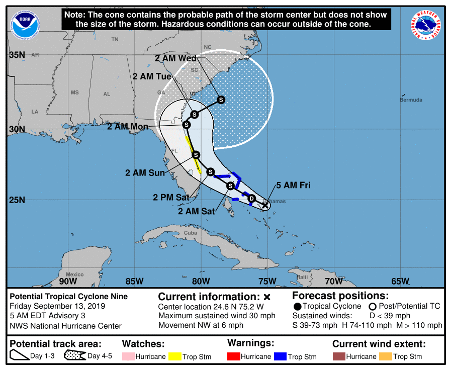
2019 was a quiet year for South Florida and the US in general though we had a scare from Hurricane Dorian which devastated Great Abaco and Grand Bahama Island with sustained Cat 5 conditions, and clipped the Outer Banks with Cat 1 conditions.

The National Weather Service just came out with its April 20th ENSO forecast. It currently shows that we have neutral ENSO conditions and is giving a 60% chance that they will continue through the end of the 2020 Hurricane Season. They currently give around a 30% chance of La Nina conditions developing in the fall. If that would occur it could increase the likelihood for an above average season.

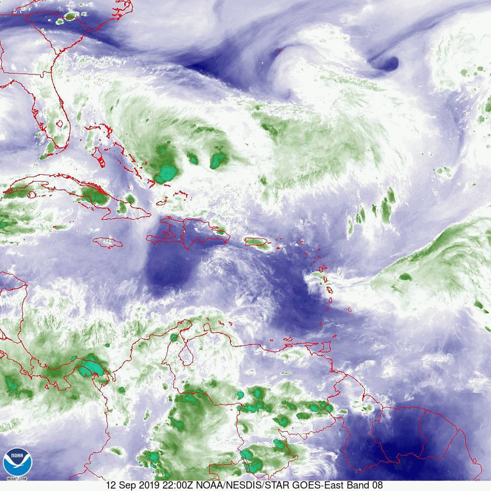
In looking at the tropics, we have above average water temperatures in the Caribbean and right along the coast of Central Africa with below average water temperatures across the Eastern and Central Atlantic (see first image below).

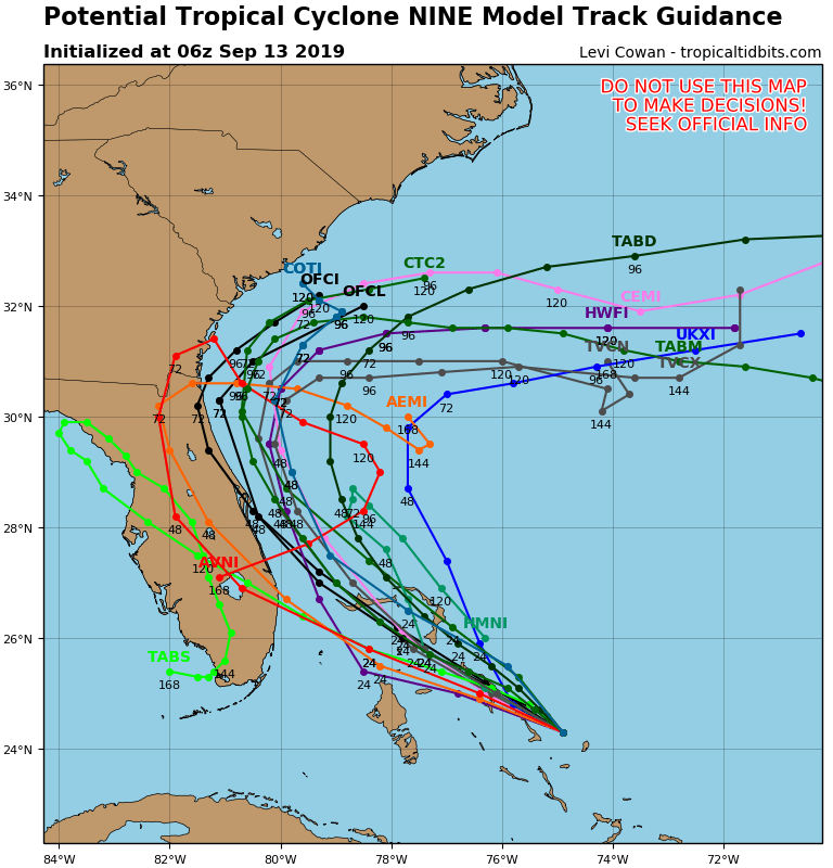
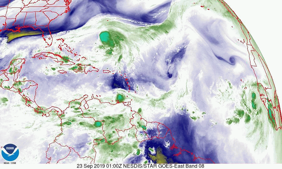
In looking at the current Saharan Air Layer Analysis (second image) we can see extensive dry air and Saharan dust across the entire Tropical Atlantic extending into the Caribbean Sea.

In light of all the above I am currently forecasting an above average season with a slow start and potentially busy finish to the season with areas of greatest risk being the Caribbean, northern and eastern Gulf of Mexico as well as the Carolinas. The warm water in the far eastern Atlantic could lead to an above average Cape Verde season as well.

On average we see  12 named storms/ year with 6-7 hurricanes of which 2-3 become major hurricanes. The overall risk for South Florida should be around average. The average risk of hurricane conditions being experienced in South Florida is about 14% chance per year.

Last year rainfall at my house totaled 58.08 ", below my 30 year running average of 67.55".


I'll be watching closely as usual and will write Updates as the need arises.

Hoping for a quiet season for all,

Matt.
Picture
Picture

Tropical Update 10-19-19, 8 AM

10/20/2019

 
​Good morning,
 
At 8 am the poorly-defined center of Tropical Storm Nestor was located over the extreme northwest Gulf of Mexico. Due to high shear over Nestor, Nestor is a completely “uncoupled” system, meaning that all weather and thunderstorm activity is well away from the center. The exact center of circulation is poorly defined and uncertain, according to the NHC, with no associated weather over it. This will be a non-event for those that the center passes over. 
 
All the weather is well east of the center, and the primary area affected will be the Big Bend area of Florida. Peak winds will be in the 40s and the main risk will be from isolated brief tornadoes and to those on the immediate coast who are at risk from a 2-4 ft. storm surge.
 
Wishing everyone a good weekend.
 
Until next time,
Matt
Picture
Picture

tropical update wednesday 10-16-19, 11 am

10/16/2019

 
Good morning.

Just a quick update. Things continue to look good in the tropics. An area of low pressure in the extreme SW Gulf of Mexico is forecast to drift  NE and eventually east. The NHC is currently giving it a 40% chance of tropical development over the next 5 days. If you look at the Surface Map below you can see that the steering forces will head it generally toward the Big Bend area of Florida. High wind shear over the northern Gulf of Mexico however should prevent any significant development. 
​
Sea surface temperatures, bottom diagram, fortunately are continuing to moderate.

Until next time,              Matt. 
​
Picture
Picture
Picture
Picture

tropical update Monday 10-7-19 9:30 am

10/7/2019


Good morning.

Just a quick update. The tropics remain quiet. There are a couple of areas of disturbed weather in the Atlantic. Both should miss the US and are surrounded by significant shear which should limit development. There are a couple of waves coming off Africa which I'll be watching however nothing to them at present.
Elsewhere a stalled frontal boundary over the Lake Okeechobee region of Florida combined with a southerly flow will lead to increased shower chances for South Florida this week.

Until next time,          Matt.
​
PS. Note SST diagram below. The waters are starting to cool. The Western Gulf of Mexico remains warm.
Picture
Picture

troical update friday 9-27-19, 8 am

9/27/2019

 
Good morning.

With regards to Karen we have good news. First it is north of where the NHC had expected it to be at this time. Second, and most importantly it is much weaker. The strong upper level westerly winds which I talked about on Monday have taken their toll. The latest NHC satellite observations could not find a clear center of circulation and all of the dynamic models are now forecasting dissipation within 4 days due to an increasingly hostile upper level environment. If you look at the water vapor loop below you can see that the upper level low, now over the northern Bahamas remains between Karen and the state of Florida. This is contributing to the shear of Karen. Currently the risk to Florida and the US is minimal.

Elsewhere Lorenzo is a Cat 4 storm and is slowly moving NNW and out to sea. It is drawing a lot of heat out of the ocean in the process which is also good news.

Presently there is nothing else out there and we should have another 1-2 weeks of low risk.

​Until next time,             Matt.

Picture
Picture

tropical update wednesday 9-25-19, 8 am

9/25/2019

 
Good morning.

With regards to TS Karen not much has changed overall. The NHC is forecasting it to stall on Friday and then meander for a few days while a ridge builds to its east and north. The models are still all over the place and the confidence in ANY track right now is very low. Of the approximately 50 models in the diagram below very few approach Florida. We currently have dry air and high pressure over Florida which is protecting the state. The variable of time with it stalling will be the wild card. It's just way too early to make a prediction however we are approaching October and frontal systems will be marching across the country and in all likelihood, if it meanders long enough, one will pick it up and whisk it off to the NE out to sea. It's just going to be a matter of timing.

Below you will see the Surface Map which shows where Karen and Jerry are heading. If you look at the Water Vapor Loop, bottom diagram you will notice an upper level low just north of the SE Bahamas. This could become a significant factor in a few days. If it stays between Karen and South- Central Florida it could  protect parts or all of the state.

​Jerry and Lorenzo are both moving out to sea. A wave over the Yucatan Peninsula will move into the Bay of Campeche and will be moving into Central Mexico in a few days.

Until next time,                  

Matt.
​
Picture
Picture
Picture
Picture
Picture
Picture

tropical update Monday 9-23-19, 8 am

9/23/2019

 
Good morning. 

I'm writing about a few areas in the tropics. First TS Jerry and TD #13 are going to both move out to sea. The only area of potential concern is TS Karen. It is in an area of high shear and is forecast to pass over or near Puerto Rico tomorrow afternoon as a weak tropical storm. The main concern there will be rainfall over the mountainous terrain. On Friday it is forecast to stall east of Florida, south of Bermuda. If you look at the models they are all over the place after it stalls.
If you look at the water vapor loop below you will see it struggling under easterly shear. You will also notice very strong westerly upper level winds over South and Central Florida. This is good. It is way too early to predict where it will ultimately go. We probably won't really know until late this weekend. Currently conditions do NOT favor a storm for South Florida, however the atmosphere is constantly changing and when systems stall, things can change. There is a good chance that it will stall, loop and then go back out to sea.

I'll write again later in the week, though at this time I am not overly concerned. 

Until next time,

Matt.

PS. Please note Sea Surface Temperatures (SST), bottom diagram, notice how these past several storms have reduced the overall water temperatures. Compare to SST chart of 9-10-19.
​
​
Picture
Picture
Picture
Picture
Picture

Tropical update tuesday 9-17-19, 8 am

9/17/2019

 
Good morning.

Just a brief update. Hurricane Humberto is moving ENE out to sea. It should pass north of Bermuda. Its slow movement should help to remove significant heat from the ocean from the Northern Bahamas to the Coastal Carolinas, this is a plus. A low pressure trough should move into Texas today providing needed rainfall, hopefully not excessive. There are two system in the Central Atlantic, both should move out to sea. We should have a week or two break without potential threats to the US from the tropics. 

Until next time,  Matt.
​
Picture
Picture
Picture

Tropical Update 9-13-19, 6 pm

9/13/2019

 
.Good afternoon,

Tropical Depression #9 formed at 5 pm today, with the center of circulation located at 25.6 N, 75.0 W. Of note, this is 84 miles to the east and 35 miles to the north of where the NHC expected it to be at this time. Therefore, all of the models are now projecting a track well offshore and a total miss for the U.S.

We shouldn't need to write any further about this system.

Until next time,

Matt and Cassie.

Picture

Tropical Update Friday 9-13-19, 7:30 am

9/13/2019

 
Good morning.

Potential Tropical Cyclone #9 still lacks a center of circulation though the NHC is forecasting it to become a tropical depression later today. The system is centered presently approximately 60 miles to the east and north of where the NHC had projected it to be at this time yesterday. In light of this all of the models have shifted to the N and E. See bottom diagram. The NHC track has it potentially threatening the Space Coast on Sunday however please note that until a defined center of circulation is established any projections could be subject to significant change if the center happens to develop significantly displaced from where they are estimating it to be now.
An additional significant factor in the shift is that it is moving slower than anticipated yesterday. This will allow an approaching cold front presently over the Mississippi Valley to move far enough SE to eventually push it out to sea. My present track keeps it offshore avoiding a US landfall. If that occurs it could become a stronger system due to the lack of land interaction. It will likely bring more rain to the Bahamas but without significant wind. This could be good as it will give them an opportunity to collect rainwater as Great Abaco's and Grand Bahama's fresh water supply was severely compromised by Dorian. It could also help to leach some of the salt out of the soil.

South Florida will see some passing showers the next 2 days due to the SW upper level flow due to the upper level low in the Gulf of Mexico. South Florida should see little if any direct effects from this system.
​
Until next time,    Matt.
​
Picture
Picture
Picture
<<Previous
Forward>>

    Categories

    All
    Preseason Update