Matt on the Tropics
Tropical Updates
  • Home
  • About
  • Archive (pre-blog)
  • Contact
  • Weather Links
  • Weather Trivia

tropical update sunday 8-4-24,  1 pm

8/4/2024

 
Good afternoon.

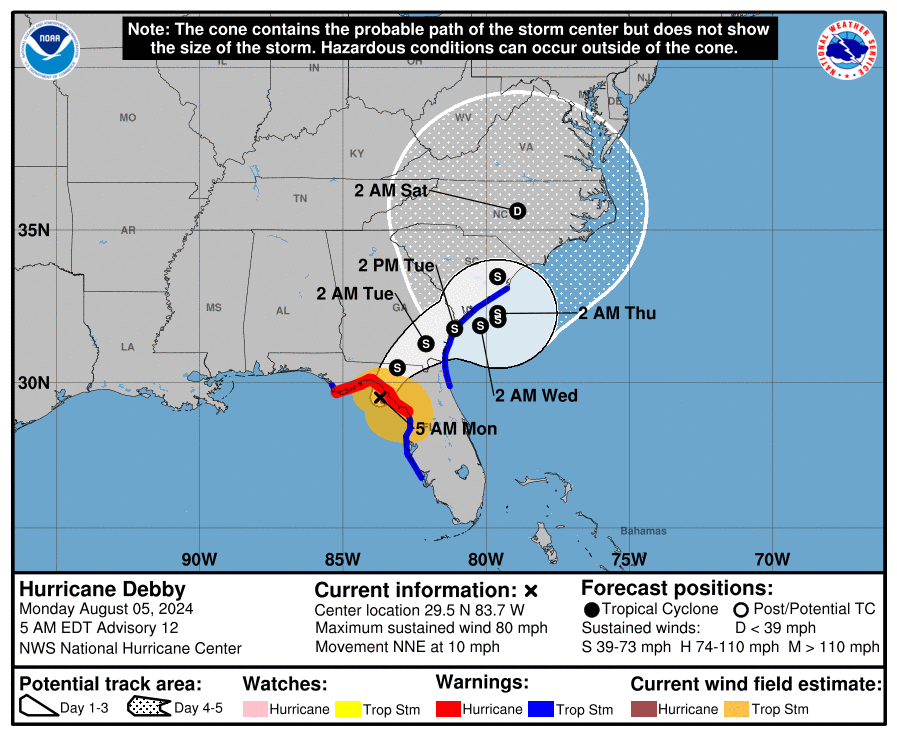
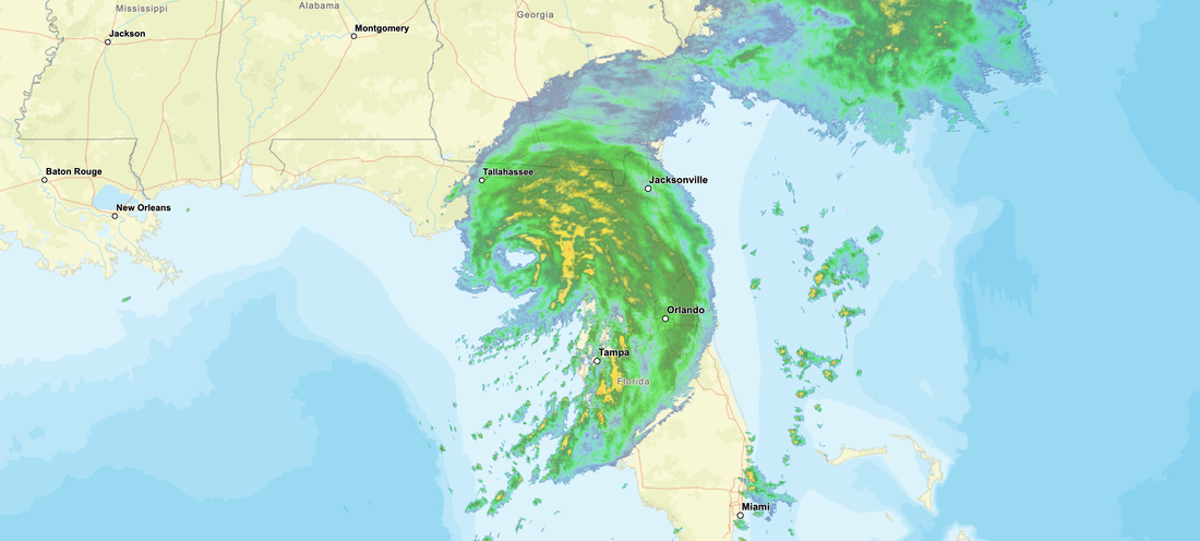
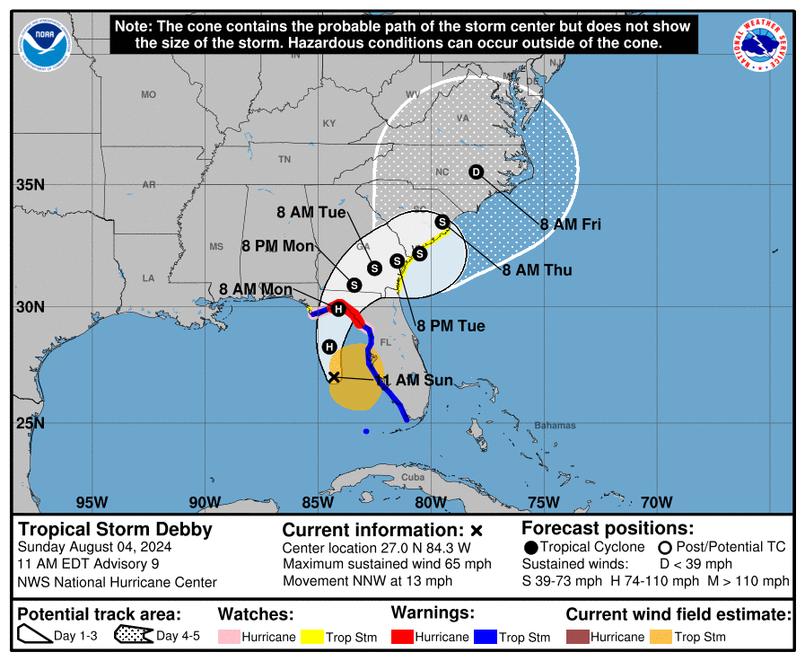
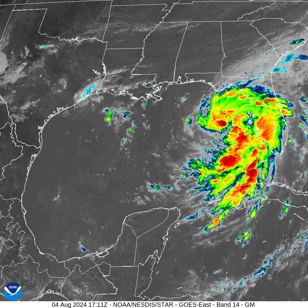
TS Debby is currently west of the Tampa Bay area and continues to head towards the Big Bend area of Florida. At 11 am peak winds had increased to 65 mph and the NHC is currently forecasting it to be a 90 mph Cat one at landfall tomorrow morning. It is even possible that it will be a 100-120 mph Cat 2 or 3 at landfall, due to the lack of shear and very warm waters. Since yesterday Debby has become much better organized with intense convection currently near its center. Rapid intensification is expected. The limiting factor will be time. The longer it is over the water the stronger it will get.  After landfall it will start to encounter shear which will help it to weaken.

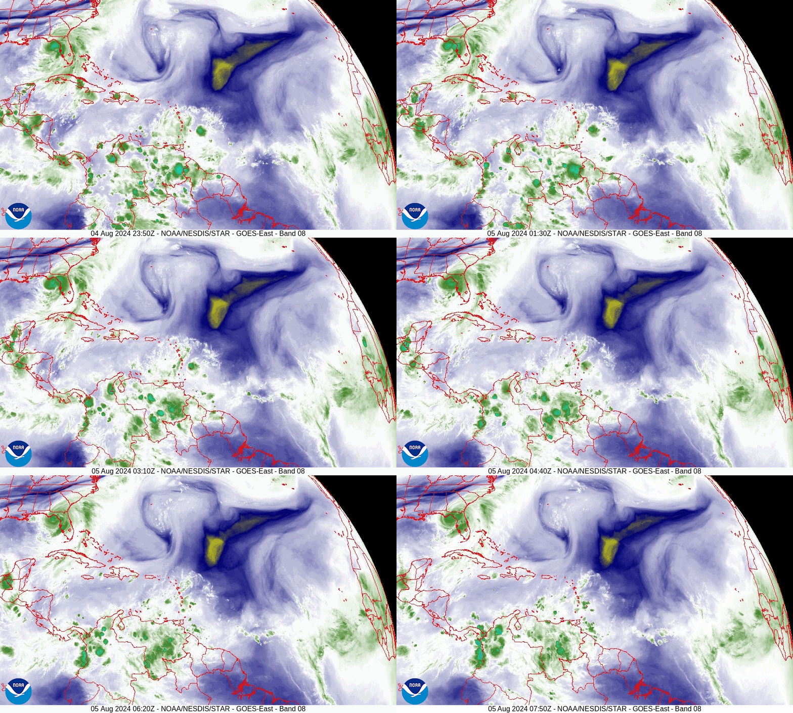
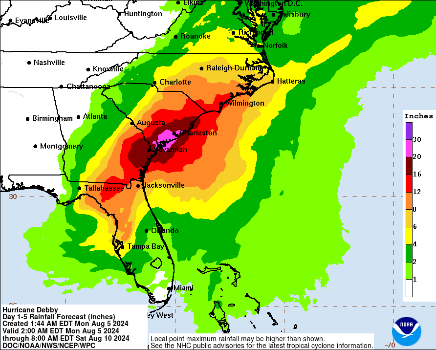
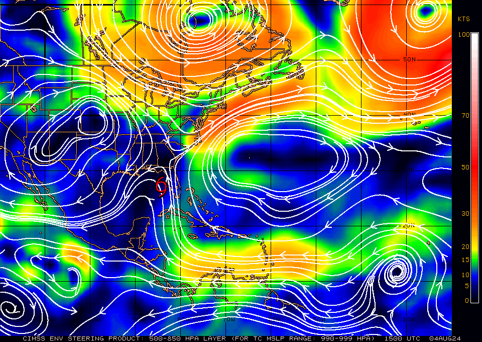
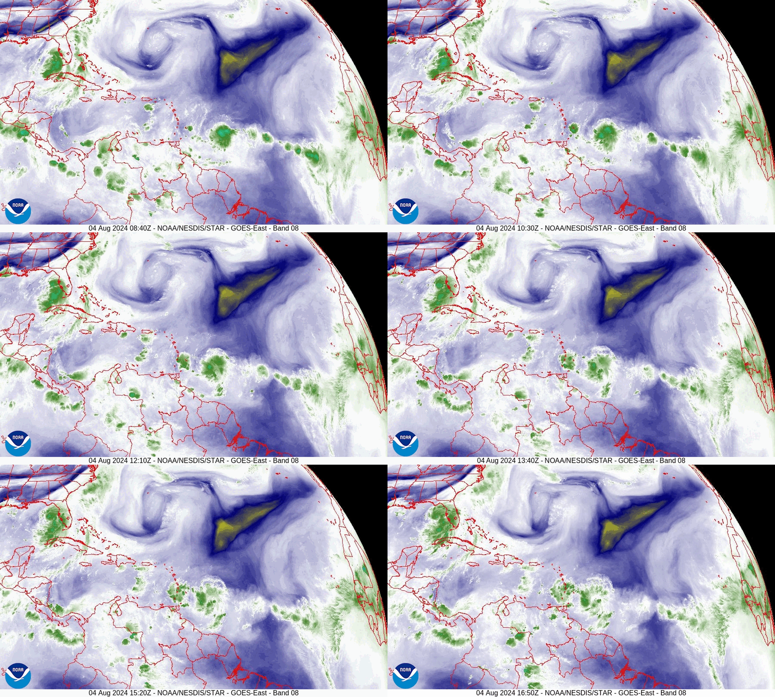
If you look at the water vapor loop below you will notice that the cold front over the SE US is no longer advancing, it is stationary. The NHC is forecasting it to move NE tomorrow and strand Debby over SE Georgia and Coastal South Carolina. This could lead to historic flooding for SE GA and Coastal SC, with greatest accumulations likely in the Savannah, GA and Bluffton, SC areas. If it re-emerges into the Atlantic even more rainfall can be expected.

With its consolidation strong winds should be limited to the Big Bend area. Its biggest effects will be heavy rainfall and flooding after landfall. The best we can hope for is that it arrives sooner than forecast and has less time to intensify. Fortunately it will miss Tampa. 

Until next time,

​                                                   Matt.

PS. Rainfall yesterday at my house totaled 2.19". None so far today.


Picture
Picture
Picture
Picture
Picture
Picture

tropical update saturday 8-3-24, 5 am

8/3/2024

 
Good morning.

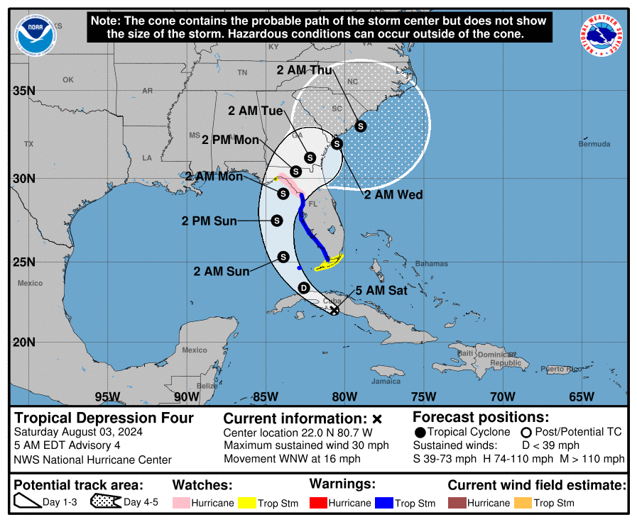
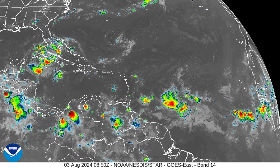
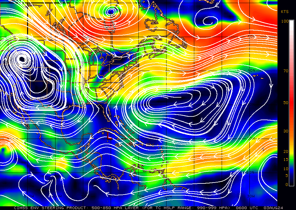
Late last night our tropical wave was designated TD #4 with the development of a clear circulation south of Cuba noted on radar images. The system remains poorly organized. Yesterday the NHC had expected a center to have formed along the North Coast of Cuba, in the Florida Straits. Its more southern location has shifted the NHC's track and the models to the west. It is expected to cross Western Cuba today and enter the Gulf of Mexico late this afternoon, early evening. This will lead to a more prolonged track over very warm water. If it can become better organized it definitely has the potential to become a hurricane prior to landfall.

The NHC is currently forecasting it to be a 70 mph tropical storm at land fall along the Big Bend area of Florida. ? Near the mouth of the Suwannee River? There is currently not a lot of weather associated with it though I would expect that to change after it enters the Gulf. The more western track will keep it further away from South Florida and I would anticipate little weather along the SE Florida coast.

If you look at the Surface Map below you can see that the window between the Western Atlantic and Gulf of Mexico highs has now shifted westward with the center in the Steinhatchee area along the Big Bend of Florida.

If you look at the water vapor loop below you will notice TD #4 with high pressure developing over it with clockwise rotation of high clouds above it, a large upper level low south of Bermuda moving slowing to the NE and a cold front along the SE US continuing to push SE. This will prevent it from moving further west.

I will write again tomorrow when we'll have a better idea of just what type of storm to expect along the Florida West Coast.

Until next time,

                                                     Matt.
​
Picture
Picture
Picture
Picture
Picture

tropical update friday 8-2-24, 2:30 pm

8/2/2024

 
Good afternoon.

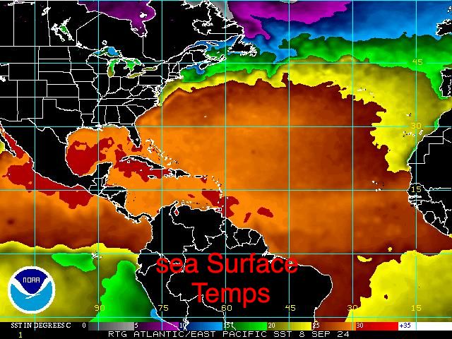
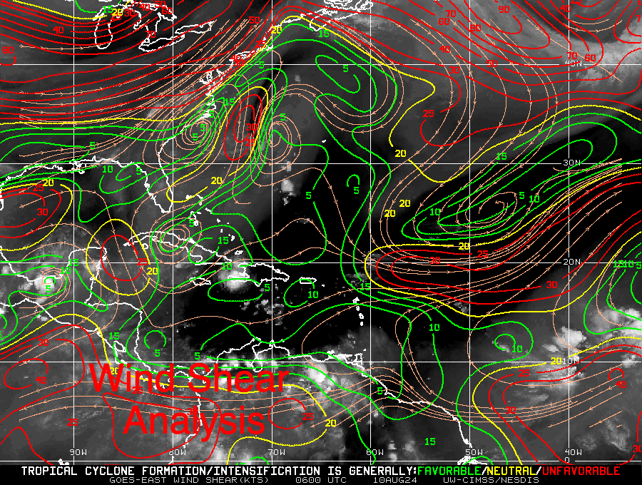
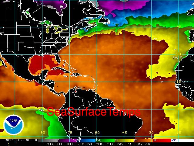
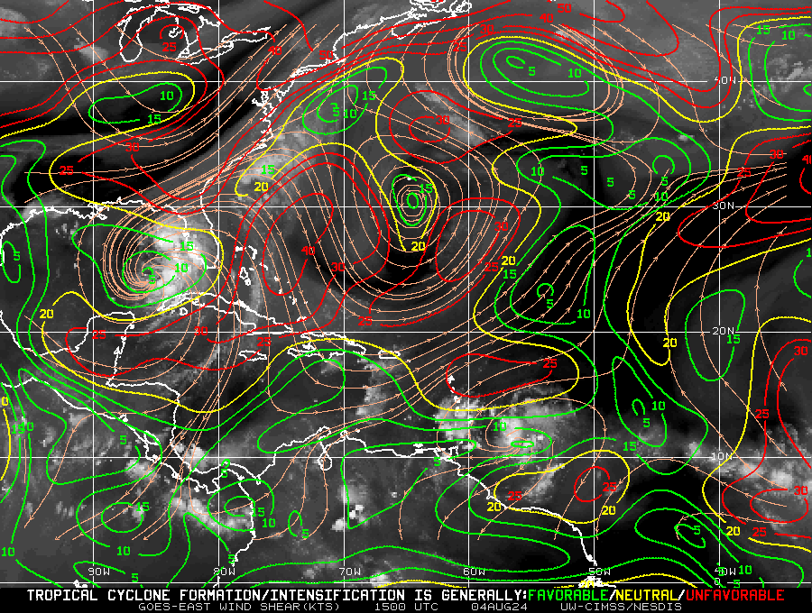
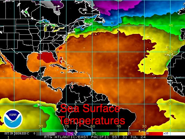
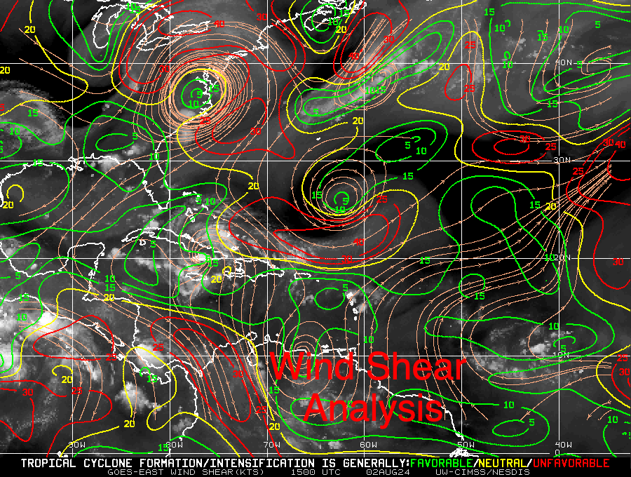
The tropical wave which I've been talking about the past few of days has just been named by the NHC as Potential Tropical Cyclone #4. It still has NOT developed however due to its proximity to Florida and its potential to become a tropical storm or hurricane with a possible landfall this weekend, the NHC is naming it so it can issue storm warnings. Little has changed since yesterday. It remains disorganized w/o a defined center of circulation. It is currently centered over Eastern and  Central Cuba with associated shower activity both north and south of the island. It is expected to move over the Florida Straits tomorrow. Once offshore a depression is forecast to form tomorrow. It will be entering an area with very low wind shear, see Wind Shear Analysis diagram below, (Green is favorable for development, red is not.) and very warm sea surface temperatures. See yesterdays Sea Surface Temperatures diagram.

The NHC is currently forecasting it to be a 65 mph Tropical Storm at landfall in the Tampa Bay area on Sunday. With the highly favorable environment, rapid intensification will be possible however that cannot start until it becomes much better organized which should take some time. The longer it takes to develop the better. Likewise the sooner it makes landfall the better. It has potential to be anything from strong tropical wave to a significant hurricane. The NHC is expecting it not to have enough time to get it act together prior to landfall.  We'll cross our finger. The good new is that it is not a depression nor tropical storm at this time. Thanks to all the dry air that it had to stave off on its way across the Atlantic.

If you look at the Water Vapor Loop below you can see a cold front moving southeastward into the SE US. This is what will prevent it from moving too far west and ultimately move it off towards the NE.

Miami-Dade County should see passing showers tomorrow with winds 15-20 mph, higher in gusts with showers. The NWS is currently forecasting 1-2" of rain tomorrow. If a depression forms possibly 2-4".

I'll be writing again tomorrow. 

Until next time,

                                               Matt.

Picture
Picture
Picture
Picture
Picture

tropical update thursday 8-1-24, 2 pm

8/1/2024

 
Good afternoon.

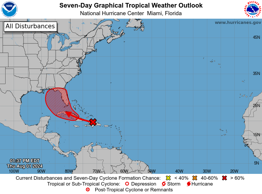
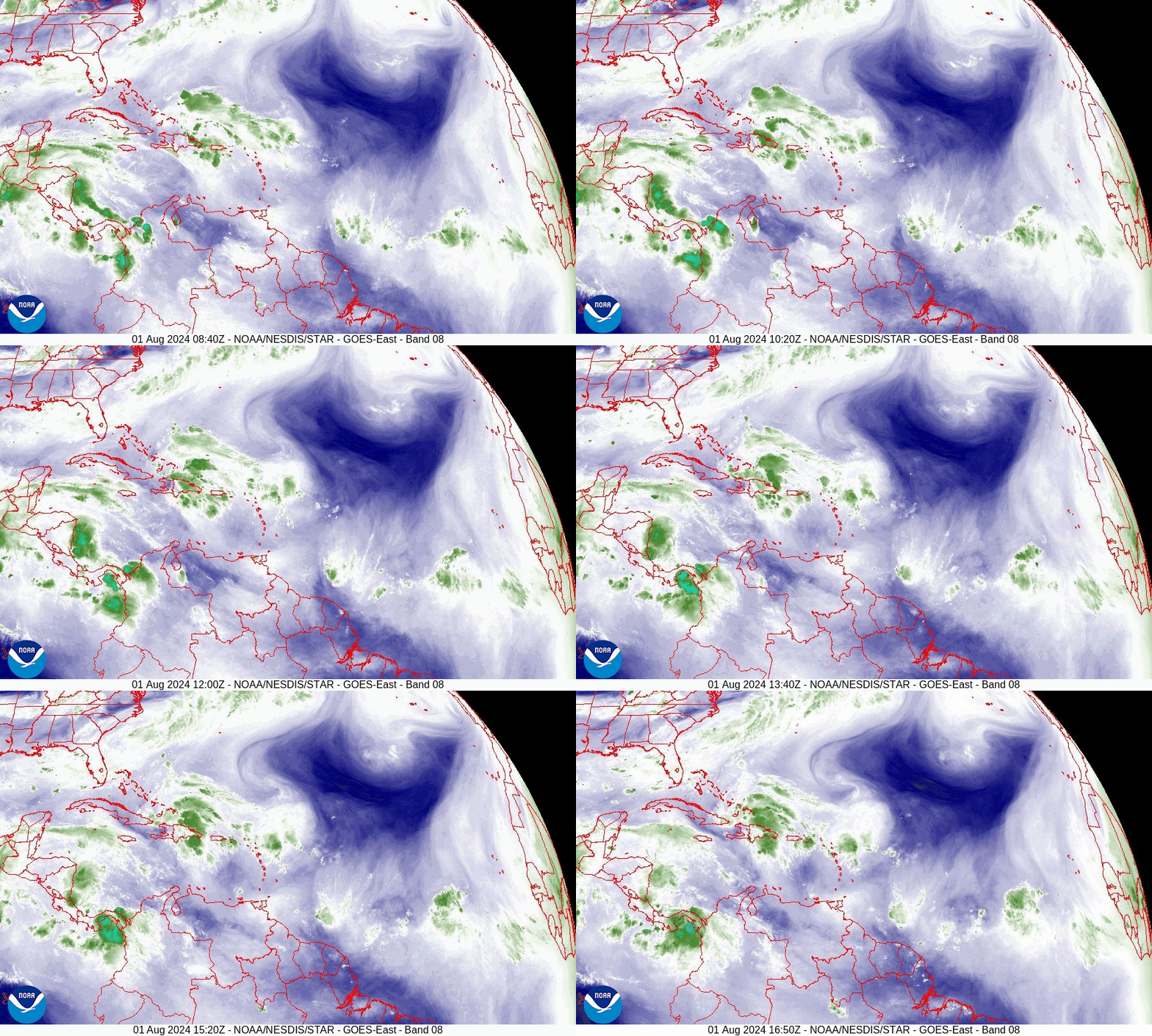
Since Tuesday a few things have changed with regards to the tropical wave in the Western Atlantic. Most importantly it has been moving westward instead of WNW as previously forecast and as a result is further south than originally anticipated. This has resulted in a shift in the NHC's track to the west. It remains poorly organized however it has succeeded in moistening the air around it and as a result the associated shower activity has increased. The NHC is now giving it a 70% chance of tropical development over the next 7 days. 

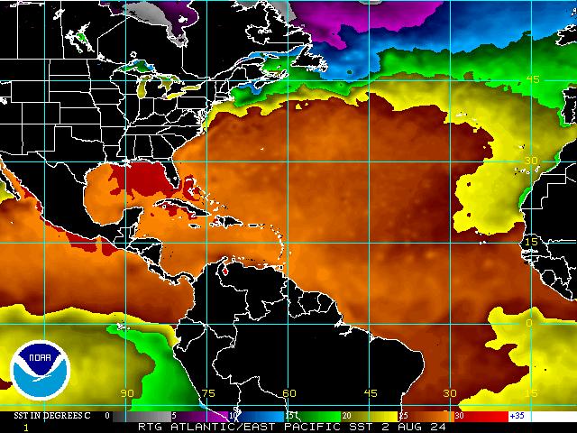
If you look at the surface map below you can see that the window remains open over the Bahamas, however if it should form far enough south of the window it could miss it, run down the spine of Cuba and end up in the Eastern Gulf of Mexico where it would then turn NW and northward and threaten the West Coast of Florida. Water temperatures are extremely warm in the Eastern Gulf of Mexico, see Sea Surface Temp diagram below.

If it does pass directly over Hispaniola and Cuba it would not likely develop until it enters the Gulf.

I'll continue to keep an eye on it and probably post again tomorrow afternoon or evening.

Until next time,

                                                 Matt.

Picture
Picture
Picture
Picture
Picture
Picture
Picture

tropical update tuesday 7/30/24, 9 pm

7/30/2024

 
Good evening.

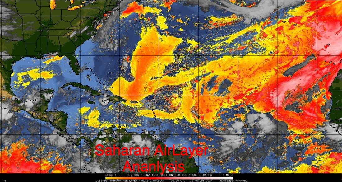
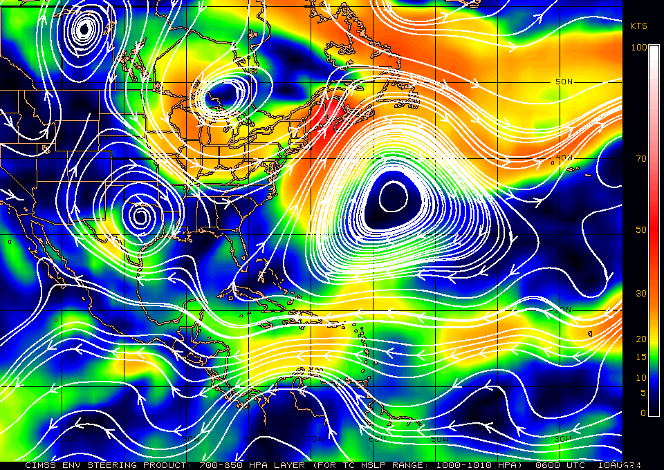
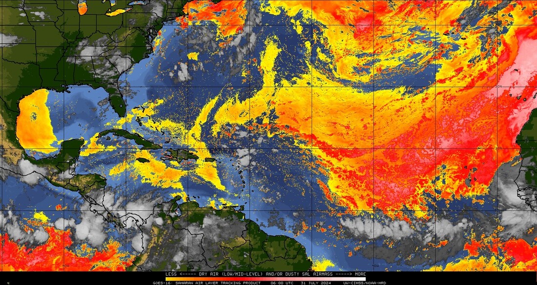
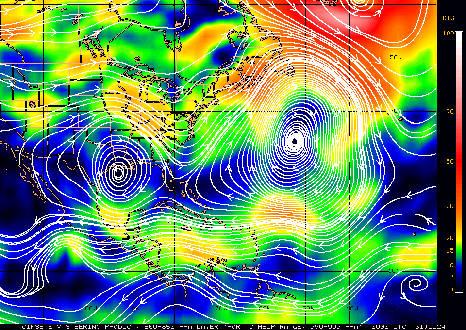
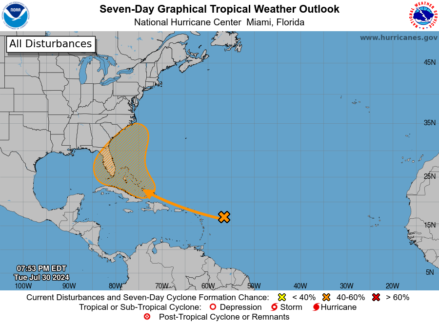
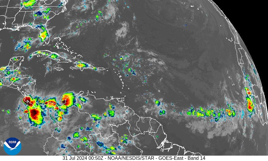
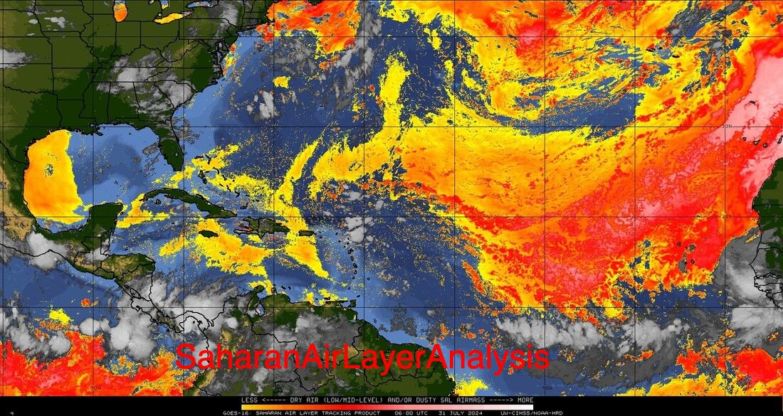
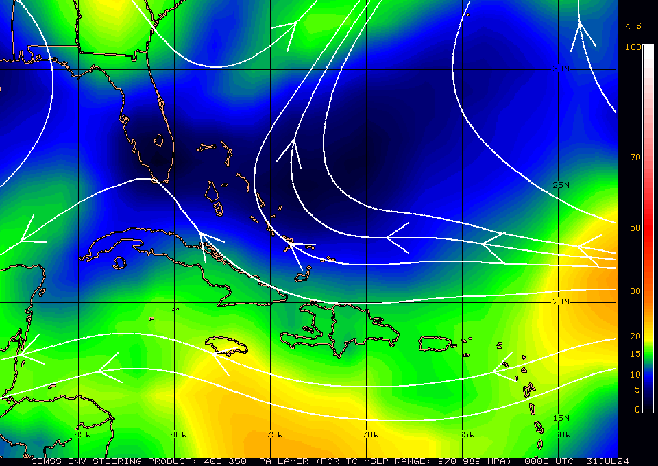
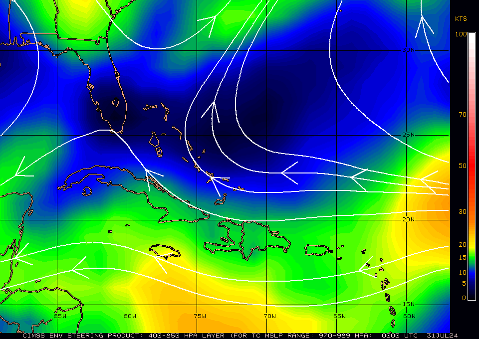
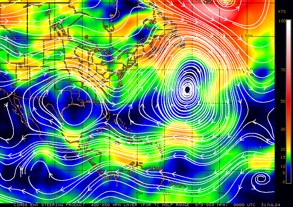
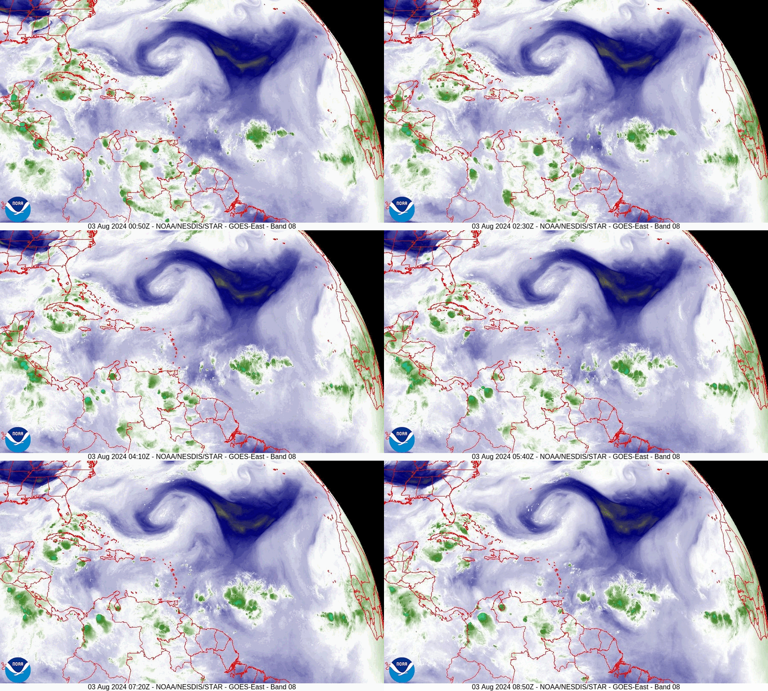
I'm writing about a potential system which currently does NOT exist. The NHC is giving an area of minimally disturbed weather a 50-60% chance of tropical development over the next 7 days. The NHC currently has the Bahamas, the whole state of Florida, the SE US coast and the northern coast of Cuba in its cone. In reality currently only the Bahamas appear to be at risk, however presently a storm does not exist. If you look at the Infra Red Satellite image below, second diagram, you can see just a few small showers. The third diagram, Saharan Air Layer Analysis, shows dry air and dust which surrounds the area in question. This is why it hasn't developed, however you will notice that once it gets into the region of the Bahamas the dry air lessens. In other words, it will be slow to develop as it will have to erode and moisten all of that dry air. Next if you look at the Surface map, 4th and 5th diagrams, you can see that if it does make it to the Bahamas, and were to develop, the steering forces would take it near the Bahamas and then N and NE away from the US.

Note the high pressures over the Gulf of Mexico and the Western Atlantic are not static and tend to move back and forth. Timing will be key with regards to the location of the window currently over the Bahamas. As it hasn't formed it is very difficult to make a precise forecast at this point in time.

However currently this is a low probability event. Even if it should develop it would be late in the forecast period and there's a good chance that it would miss Florida, and likely the US entirely.  I'll be keeping an eye on it but currently am not overly concerned.

Until next time,

                                             Matt.
Picture
Picture
Picture
Picture
Picture
Picture

tropical update tuesday 7/23/24, 5 am

7/23/2024

 
Good morning.

Just a quick update. The tropics have been quiet since Beryl made landfall in Texas. This has been due to large dust storms in North Africa providing abundant Saharan dust and dry air which has been pushed into the Tropical Atlantic by strong high pressure over the Atlantic. This has effectively shut down the Tropical Atlantic to tropical development. In addition if you look at the second diagram there is currently abundant  wind shear over the Caribbean and Western Atlantic, (areas in red).

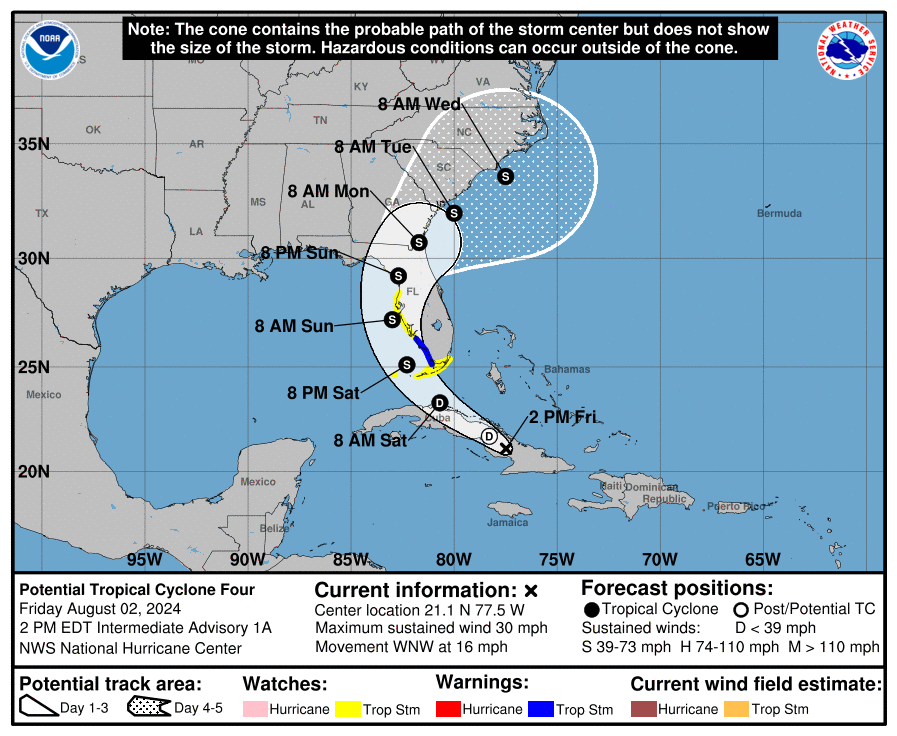
Also of note is the the forecast La Nina is likely to be late. Instead of arriving around now it will likely not develop until September. (Why we still have so much shear.)  If that does occur, and the Saharan dust dissipates in time we should have a busy end of the season, September/October, however we may not see as many storms as originally forecast. However its not the absolute number that counts. Its where they go. If you look at the bottom diagram, Sea Surface Temperatures, you can see that the warmest waters are in the Gulf of Mexico, Western Caribbean and Bahamas. We'll need to watch these areas closely as they could support stronger storms.

Until next time,
                                               Matt.

Picture
Picture
Picture

tropical update monday 7/8/24, 5:30 am

7/8/2024

 
Good morning.

Beryl fortunately listened to me and is arriving earlier than forecast as an 80 mph Cat 1 storm.
It is making landfall at this time along the center of the Texas coast. It should be downgraded to a tropical storm soon. It fortunately didn't have enough time to intensify further.

This will be my last post on Beryl.

Until next time,

                                            Matt.
Picture
Picture

tropidal update sunday 7-7-24, 12 pm

7/7/2024

 
Good afternoon.

Since yesterday not much has changed with the forecast on Beryl. It is expected to make landfall tomorrow along the mid Texas coast. It is starting to become better organized. The ULL is no longer in the vicinity and the NHC is currently forecasting it to be a 85 mph Cat 1 at landfall. It is over very warm water and if it should get reorganized enough it could possibly attain Cat 2 status. The sooner it makes landfall the better, if it slows it could have more time to intensify. After landfall it should start to accelerate to the N and NE.

Until next time,

                                       Matt.
​
Picture
Picture

tropical update saturday 7-6-24, 5 am

7/6/2024

 
Good morning.

If you look at the water vapor loop below you will notice couple of things. First is that Beryl is now very poorly organized. This was due to it's crossing the Yucatan Peninsula and SW shear from the upper level low talked about yesterday which is now just west of Beryl. The ULL doesn't appear to be moving much at present. In addition the ULL appears to be moving Beryl a little further north, which I discussed yesterday and the NHC track now reflects this with a shift in their track towards South Central Texas. As it moves further north the NHC expects Beryl to be far enough from the ULL that some re-intensification will occur. The NHC is still forecasting it to be an 85-90 mph Cat 1 at landfall.
Predicting the exact point of landfall will be difficult at this time with the absence of a clearly defined center. We'll know more tomorrow. Elsewhere all is quiet, for now

Until next time.

                                        Matt.

Picture
Picture

tropical update friday 7-5-24, 5 am

7/5/2024

 
Good morning.

Beryl is currently making landfall along the Yucatan Peninsula as a strong Cat 2 hurricane and is currently over Cozumel Mexico. The NHC is forecasting it to make a second landfall early Monday near Brownsville, Tx as an 85 mph Cat 1.

Beryl remains a very compact storm with hurricane force winds only extending 25 miles to the north and 15 miles to the south of the center. It has been encountering significant shear which has caused it to weaken from a Cat 5. Shear is expected to lessen as it approaches Southern Texas and Northern Mexico.

If you look at the water vapor loop below you will notice a wild card has entered into the equation. An upper level low in the SW Gulf of Mexico moving westward. If it is just west of Beryl and close enough, it could move it a little further north on Sunday. If it is very close it could weaken it as well. We'll need to watch this closely. Southern Texas should prepare for a Cat 1 storm and potentially a lot of rain. It will be slowing down as it approaches.

Until next time,

                                       Matt.

​
Picture
Picture
<<Previous
Forward>>

    Categories

    All
    Preseason Update