Matt on the Tropics
Tropical Updates
  • Home
  • About
  • Archive (pre-blog)
  • Contact
  • Weather Links
  • Weather Trivia

Tropical Update Monday 10-3-16, 11 am

10/3/2016

 
Good morning.

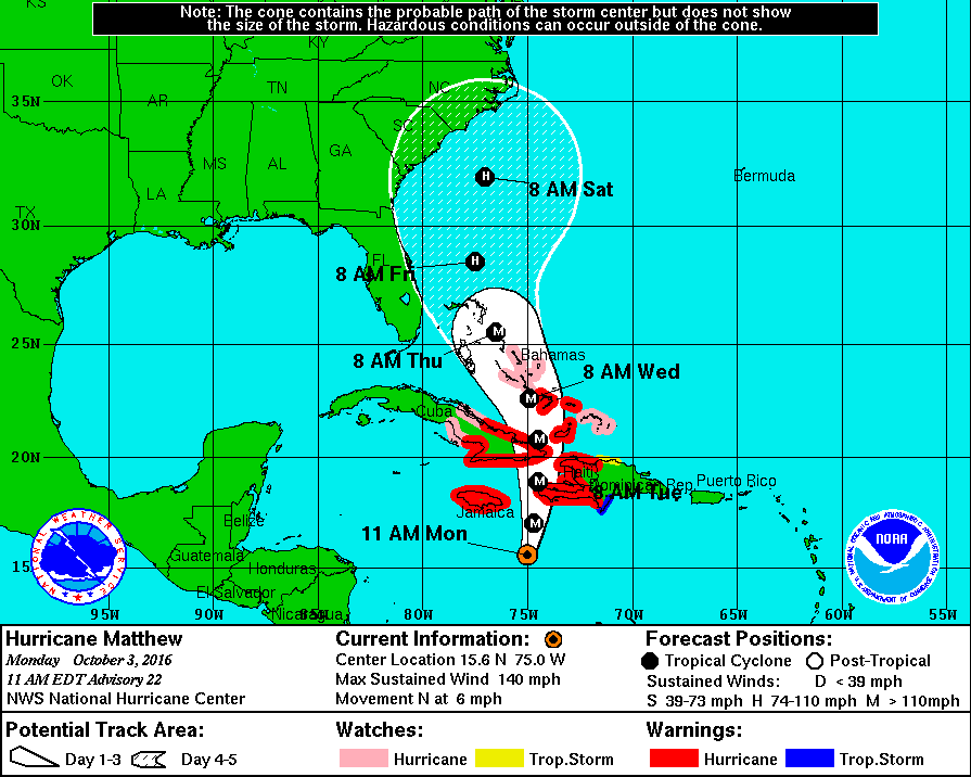
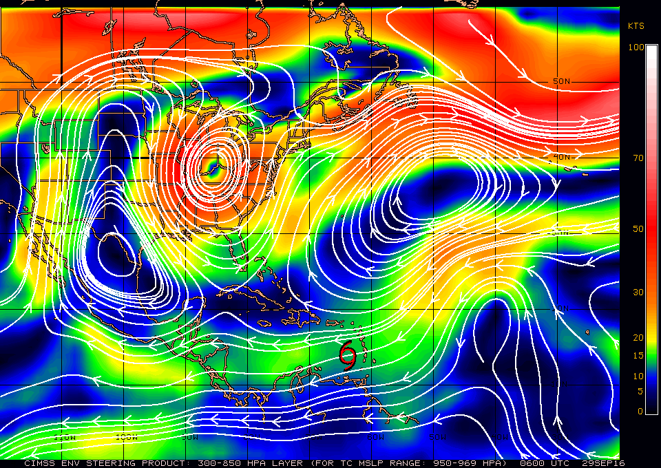
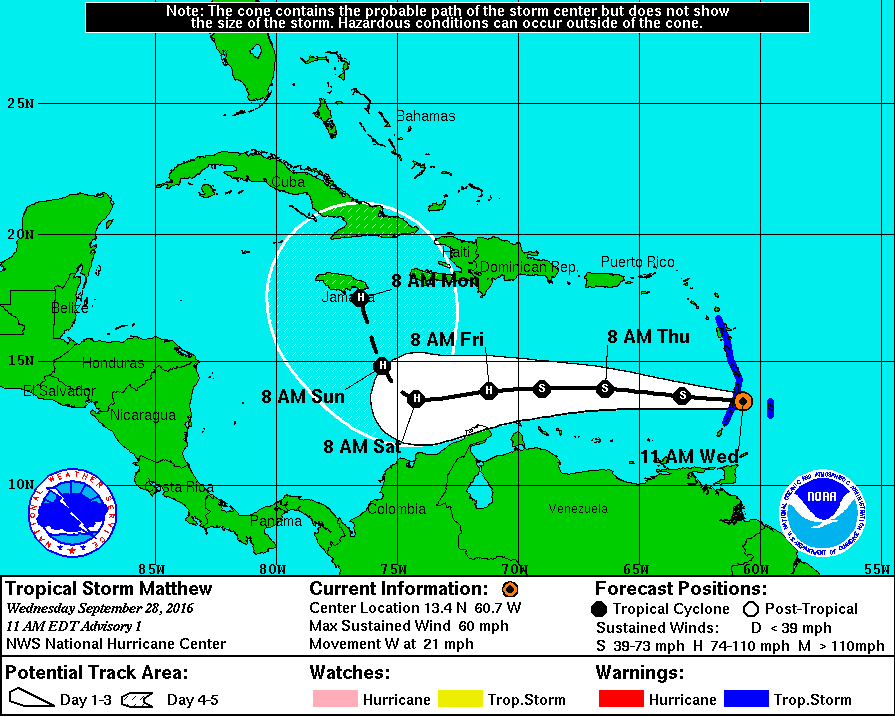
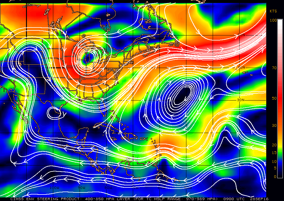
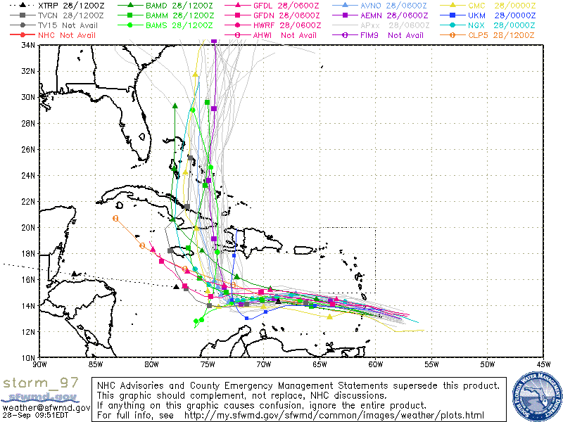
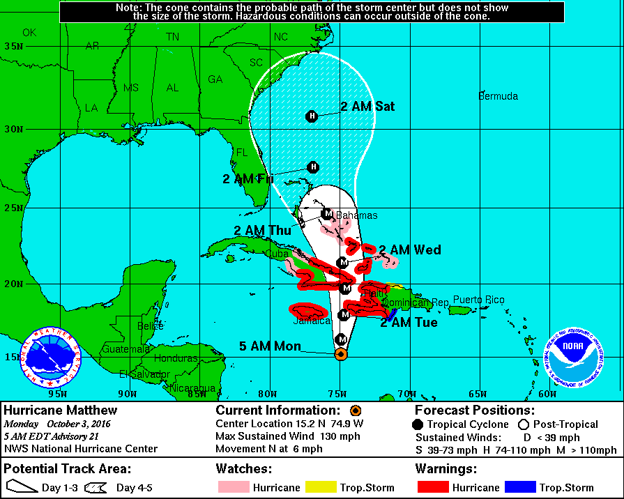
At 11 am Hurricane Matthew was located at 15.6 N and 75.0 W and was moving N @ 6 mph with 140 mph winds, a barometric pressure of 941 mbs and an eye spanning 14 miles. Matthew has been moving due north since late last night and the NHC models are in strong agreement with the track of yesterday for the next 48 hours. After it gets north of Cuba shear will increase and there is some divergence in the models. The stalled frontal boundary now over north Florida is not as strong as was anticipated and a shift in the models more westward is possible after it is north of Cuba. It should still miss South Florida however it is possible that it could get closer to Central and North Florida than the current tracks project. Other models however are further east. I suspect a track close to the current one, possibly just slightly west of it. One thing to note is that the weaker it gets the more westward potential the track. North of Cuba the shear is significant and weakening is anticipated however so far Matthew has been able to fend off most of its shear due to the strong high pressure above it.

I'll write again tomorrow but no cause for alarm at this time.

Matt.

Picture
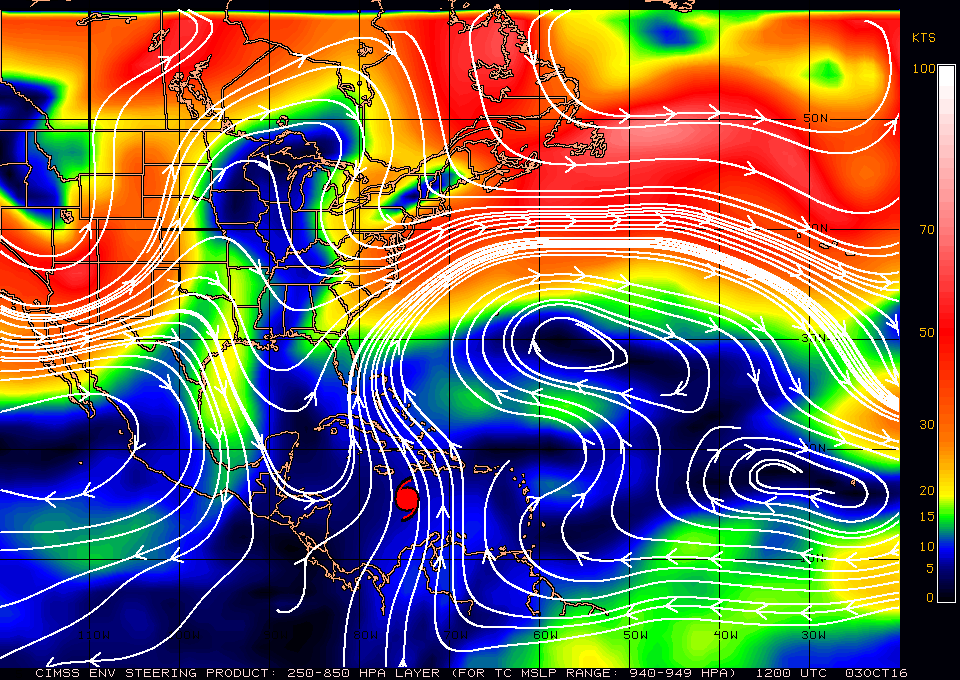
Surface Map at 940-949 mbs
Picture

Tropical update Sunday 10/2, 5 pm

10/2/2016

 
Good evening,

Hurricane Matthew, since last night, has been drifting steadily northwest and is currently located at 14.6 N and 74.8 W and is moving NW at 5 mph with winds of 145 mph and barometric pressure  of 945 mb. The NHC models have shifted little since yesterday and the NHC is projecting a turn to the north tomorrow. It remains a compact storm and on its present course should pass near the western tip of Haiti. In light of its small hurricane-force wind field, Jamaica may not see hurricane conditions. Due to slow movement, heavy rain is forecast for southern Haiti of 15-25 inches and 10-20 inches in eastern Jamaica. If its current track holds, South Florida should not receive storm conditions. 

I will write more detailed projections as it gets closer to our area. 

Have a good night, I'll write again tomorrow. 
Matt

Picture
Picture

Tropical Update, Saturday 10/1/16, 5 pm

10/1/2016

 
Good evening,

At 5:00 pm, major Hurricane Matthew was located at 13.5 N and 73.4 W, moving northwest at 3 mph with peak winds of 150 mph and a barometric pressure of 940 mb. During the day today, Matthew has been relatively stationary, meandering just off the north coast of Colombia. Its northwest move over the past three hours may just be a wobble or possibly the start of its turn northwest-north.

Matthew is a very compact storm. The eye spans only 5 nautical miles, and the eye wall just 6 nautical miles. Hurricane force winds span a total of 35 miles. Currently, if you are not within 20 miles of the eye, you would not be experiencing hurricane conditions.

Last night at 11 pm, Matthew was briefly a Cat 5 with 160 mph winds. Due to shear to its north, weakening is forecast as it moves north towards eastern Cuba. Shear is expected to decrease over the Bahamas, and reintensification may occur once it is in that region.

Overall, the forecast track of Matthew has changed little over the past four days. High pressure near Bermuda is expected to weaken and drift slowly to the east. This should allow Matthew to stay well east of South Florida.

By tomorrow, if this northwest move is real, we should have a better feel for its ultimate track, though presently things are looking positive for South Florida avoiding significant weather.

I'll write again tomorrow.

Until then, have a great weekend.
Matt
Picture

Tropical Update, Friday 9/30/16, 8:00 pm

9/30/2016

 
Good evening,

Hurricane Matthew has been undergoing rapid intensification today and is currently moving West-Southwest at 9 mph with 150 mph winds and barometric pressure of 945 mb. Its WSW movement has allowed it to avoid most of the significant shear to its north, which has allowed the intensification to take place. It well may become a Cat 5 hurricane tomorrow morning. The fact that it's starting to slow down is probably good news, and the NHC is still projecting a course east of South Florida through the central Bahamas.

The key for whether or not we receive any significant weather in South Florida is when and where it begins its northwest and northern motion. NHC is currently forecasting this to take place Saturday night or Sunday. See track below.
Current coordinates are 13.5 N and 72.0 W. The shear to its north should cause weakening but it's still expected to be a major hurricane when it nears Jamaica on Monday.

We're just going to have to wait and see. It's still too early to say for sure, but the models have been consistently showing a move well to our east.

I'll probably report again tomorrow evening.

Matt
Picture

Tropical Update Thursday 9-29-16, 5 am

9/29/2016

 
Good morning.

In viewing the water vapor loop this am ( http://www.ssd.noaa.gov/goes/east/tatl/flash-wv.html )  you'll notice a few things. First is that Matthew made a WNW move over night and is currently at 14.0 N and 64.7 W and is moving W at 16 mph. It is undergoing SW shear from the upper level low north of Hispaniola and being pushed by the upper level low in the Central Atlantic moving SE. You'll also see the frontal trough digging into North - Central Florida.

On the surface map below you will see high pressure building over Florida. All of these features point to a path to our east and as you can see the models are starting to shift to the east.. This all bodes well for South Florida. It is still early and until it makes its NW-N move on Saturday we won't know for sure however these patterns are encouraging

Until later,                Matt.

Picture
Picture

Intermediate Update 9-28-16, Wednesday 1 pm

9/28/2016

 
Just a quick update. Hurricane Hunters late this morning found Invest 97L to be Tropical Storm Matthew with 60 mph winds. See NHC track below. On the forecast track it is expected to pass near or over  Jamaica Monday as a Cat 2 Hurricane. This AMs forecast still holds and I await its turn to the NW and N on Saturday. Where and when the turn occurs will be the key to whether or not we see any associated weather.
Picture

Tropical Update Wednesday 9-28-16, 7:30 am

9/28/2016

 
Good morning.

Since Monday a few things have changed with Invest 97L. Most significantly it has moved about 3 degrees north and is currently centered around 12 degrees N latitude. This is probably good new for us in South Florida. The NHC expects it to become a Tropical Depression or Tropical Storm Matthew later today. It is presently about 150 miles east of Barbados and should enter the Caribbean Sea later today. If you look at the water vapor loops of the Western Atlantic this morning, http://www.ssd.noaa.gov/goes/east/tatl/flash-wv.html , you will notice several features. First an upper level low north of Hispaniola, an upper level low in the central Atlantic moving SW, A trough just to our east starting from a small upper level low south of Cuba and a frontal boundary pushing SE across the lower SE US. The southern extension of the trough to our east to south of Cuba along with the more northern position of Invest 97L makes a move to our N and east more likely. It is currently moving W to WNW at 15-20 mph and is building a dome of high pressure over it which is mitigating the affects of significant shear to its north and west. It should move around the periphery of high pressure centered just east of Bermuda (see below) and hopefully pass far enough east of us for us to avoid significant weather.

Due to the complexity of the weather around it, it is still too early to write it off though things look encouraging this am.

 I will be writing more as things develop and will post some of the latest computer models later this am after they become available.

Until later,                   Matt.

Picture
Picture
Above are the latest  models from 8 this am, note some still bring the system S and west of South Florida. We'll need to keep a close eye on it. The key will be how far west it is when the NW to N turn starts to occur. This should be Friday night or Saturday depending on forward speed.

Tropical Update 8 AM Monday 9-26-16

9/26/2016

 
Good morning.

I am writing about a broad area of low pressure in the southern Central Atlantic which the NHC has labeled Invest 97L. It is currently located near 9 degrees N and 43 degrees W and is moving west at 15-20 mph. The NHC is giving it a 90% chance of tropical development in the next 5 d and it is forecast to enter the southern Caribbean Sea on Wednesday. It exited Africa a few days ago at around 9 degrees. In 5-7 days a frontal trough is forecast to stall over central Florida which if the system is far enough north would tend to turn it to the north. The NHC is currently forecasting it to turn sharply north in few day and pass to our east due to this front. It is currently quite far south and may even brush the north coast of South America, Venezuela, which would be very unusual. If it stays too far to the south it may not perceive the pressure weakness to its north in which case a course toward Central America or the Yucatan would be more likely. The pressure patterns around this system are quite complex. High pressure over Cuba, an upper level low over the Big Bend area of Florida and an approaching frontal system from the Mississippi Valley. Shear in the Caribbean is currently quite high as well.

Its too early to say much about this system at this time but we'll probably know more in a couple of days when it enters the Caribbean. I've attached some of the current models.

I'll let you know as things develop but I wouldn't be surprised at all if it takes the more southerly route.

                                Matt.


Picture
Picture

Tropical Update Friday 9-16-16

9/16/2016

 
Good morning.

The tropics show activity however fortunately none of the present systems appear to pose any threat to the US. (see satellite image below). 2 below, the wave I spoke about in my last update is coming off the coast of Africa now. The NHC is forecasting it to move WNW and eventually turn north into the mid Atlantic trough. Karl is expected to do the same.

So far so good. I'll write if things should change.

Matt.


Picture

Tropical Update Tuesday 9-13-16

9/13/2016

 
Good morning.

Just a quick update to let you know that for now things look good. Newly formed TS Ian in the Central Atlantic is moving north and should not be a threat to the US. A disturbance over the northern Bahamas (1) should drift over the Florida Peninsula today, development is not expected. A wave just off the coast of Africa (2) is expected to move WNW into the mid Atlantic trough and should not be a threat as well.

There is a wave which we'll need to watch over Africa, (see below), which should emerge in a couple of days.

I'll let you know as things develop, or not.

Until later,

Matt.

Picture
Picture
<<Previous
Forward>>

    Categories

    All
    Preseason Update