Matt on the Tropics
Tropical Updates
  • Home
  • About
  • Archive (pre-blog)
  • Contact
  • Weather Links
  • Weather Trivia

Post-Storm Analysis By The National Hurricane Center Reveals Hurricane Michael Was A Category 5 At Landfall On The Florida Panhandle

4/19/2019

 
Post-Storm Analysis By The National Hurricane Center Reveals Hurricane Michael Was A Category 5 At Landfall On The Florida Panhandle


This was cut & paste from the media release from NOAA ( https://www.noaa.gov/media-release/hurricane-michael-upgraded-to-category-5-at-time-of-us-landfall )

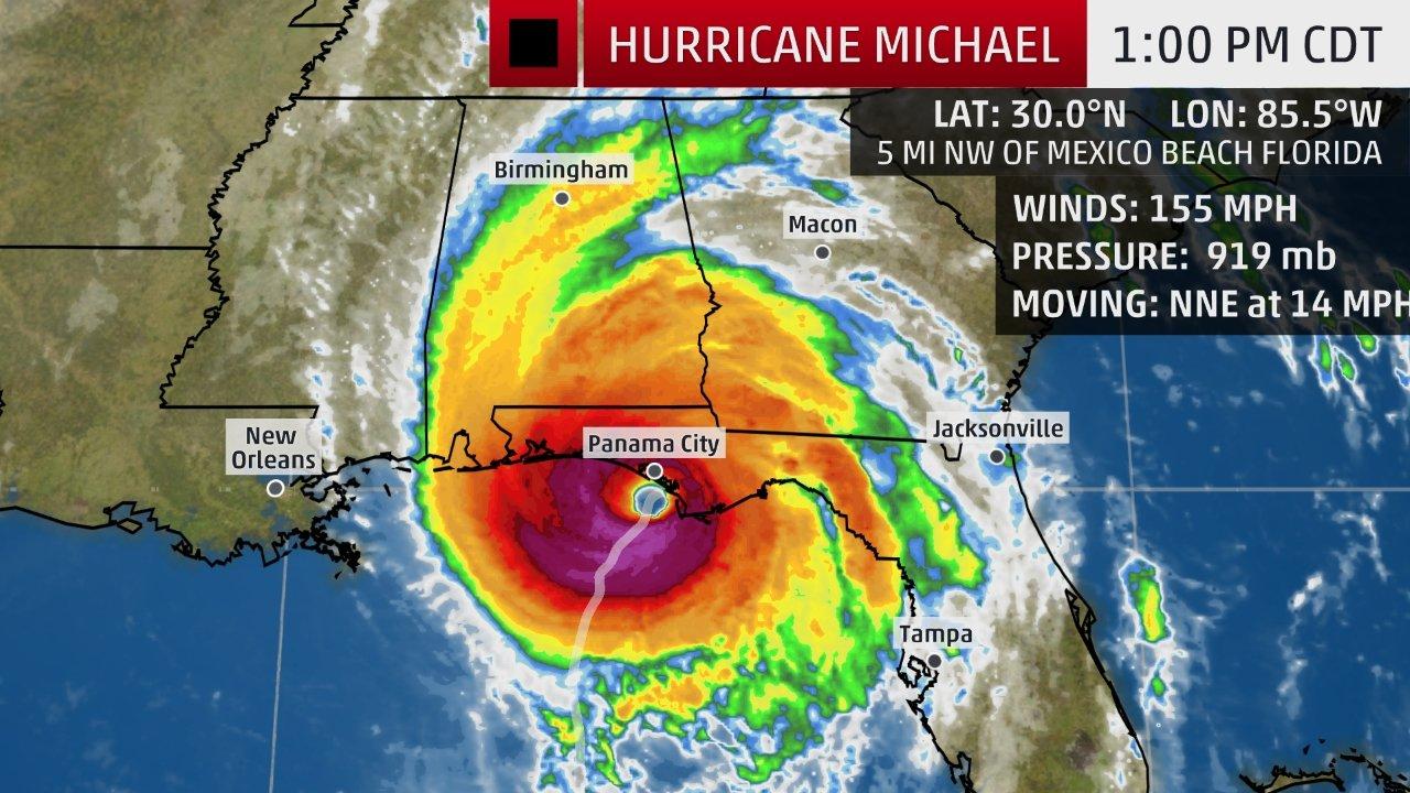
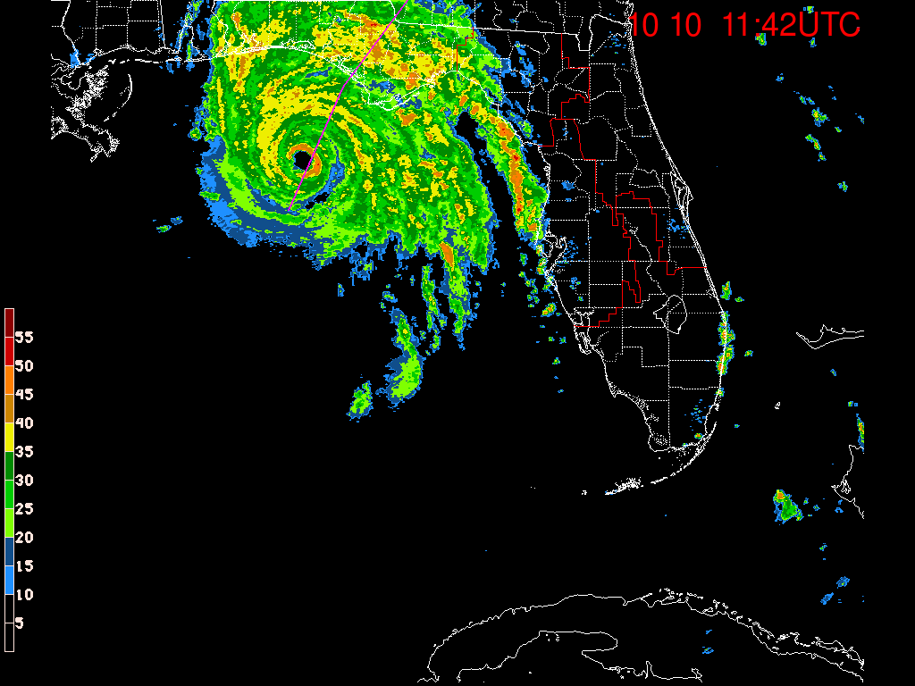
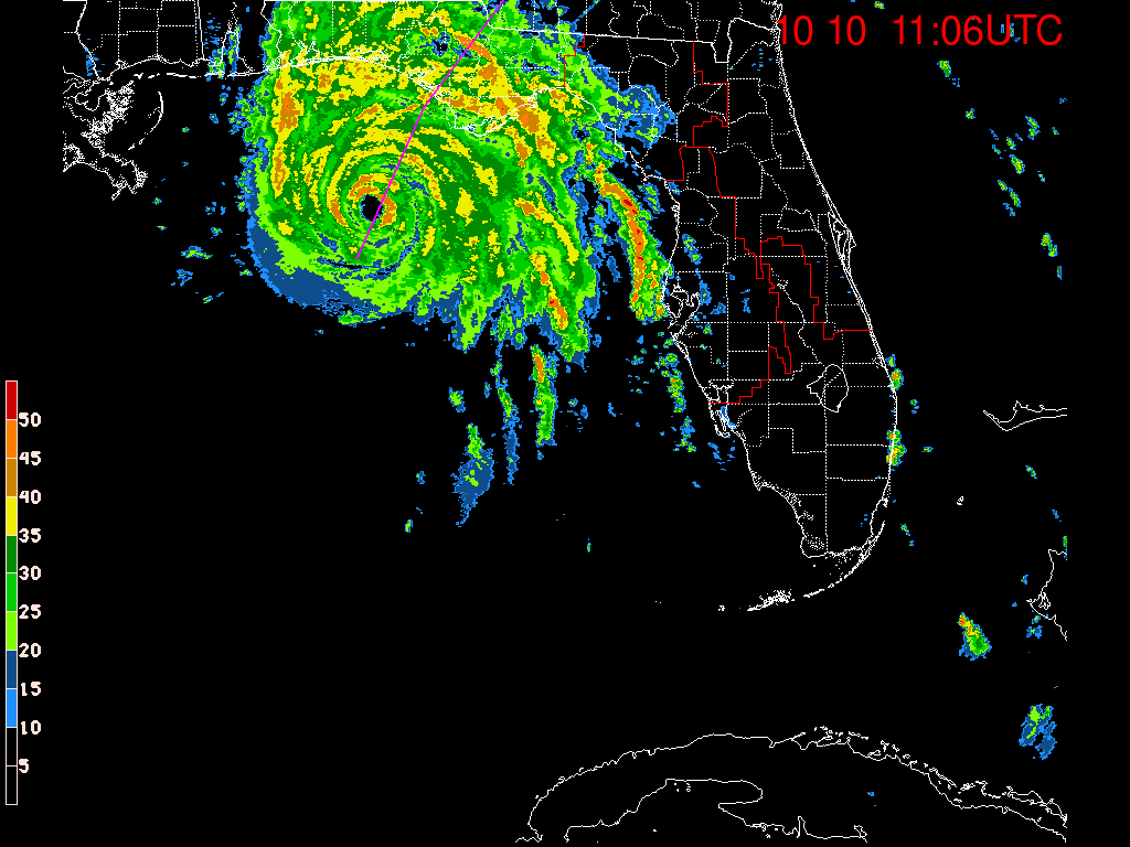
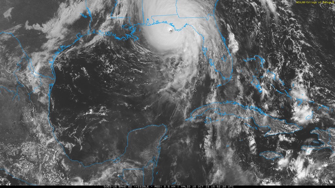
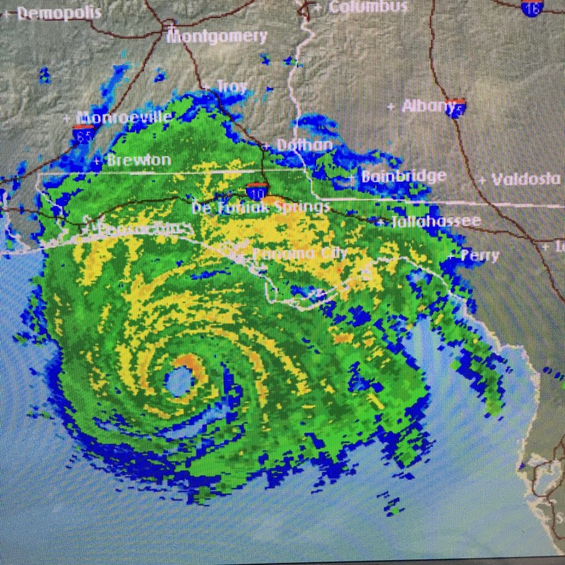
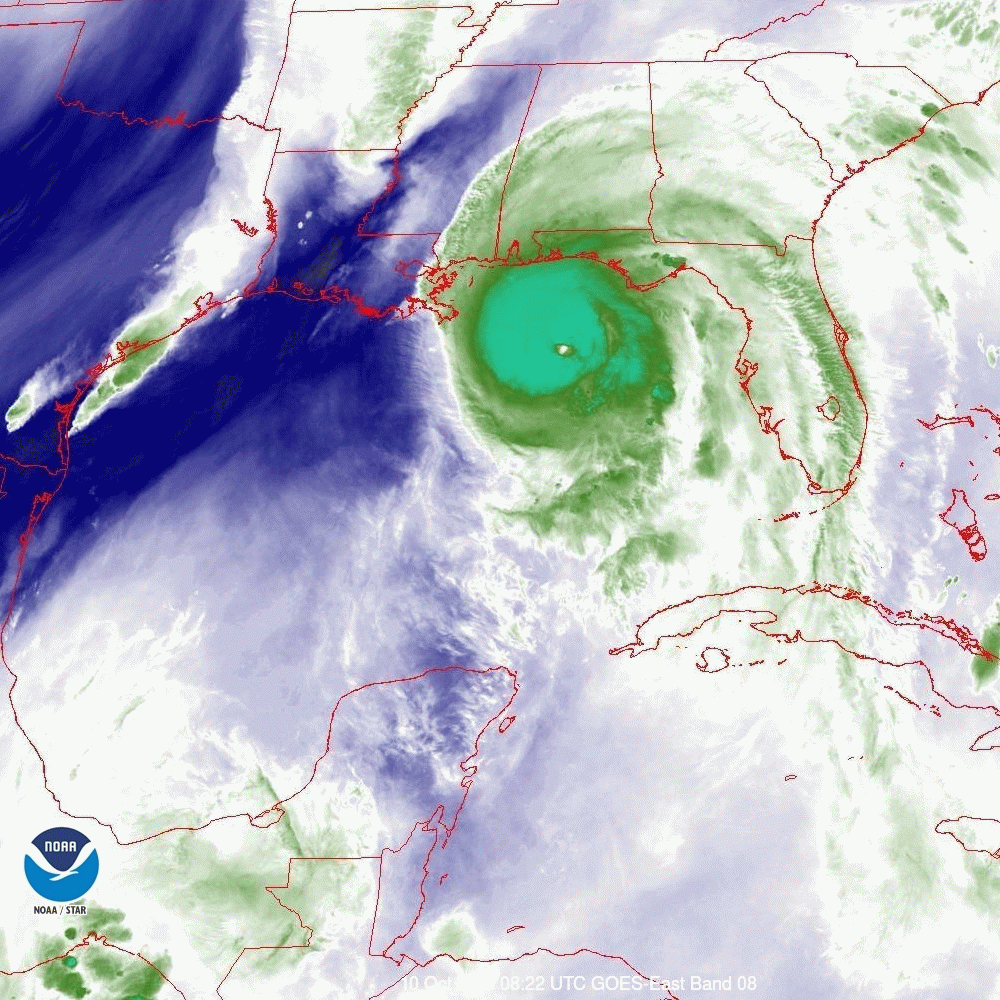
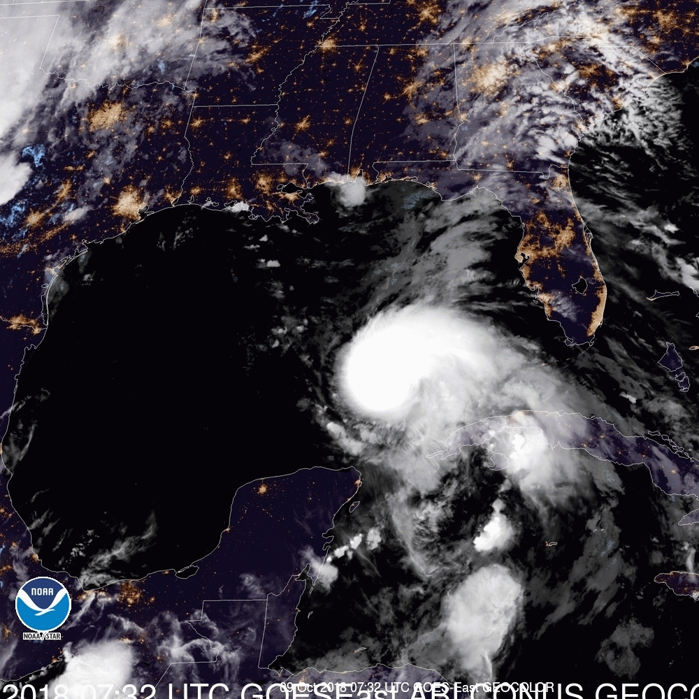
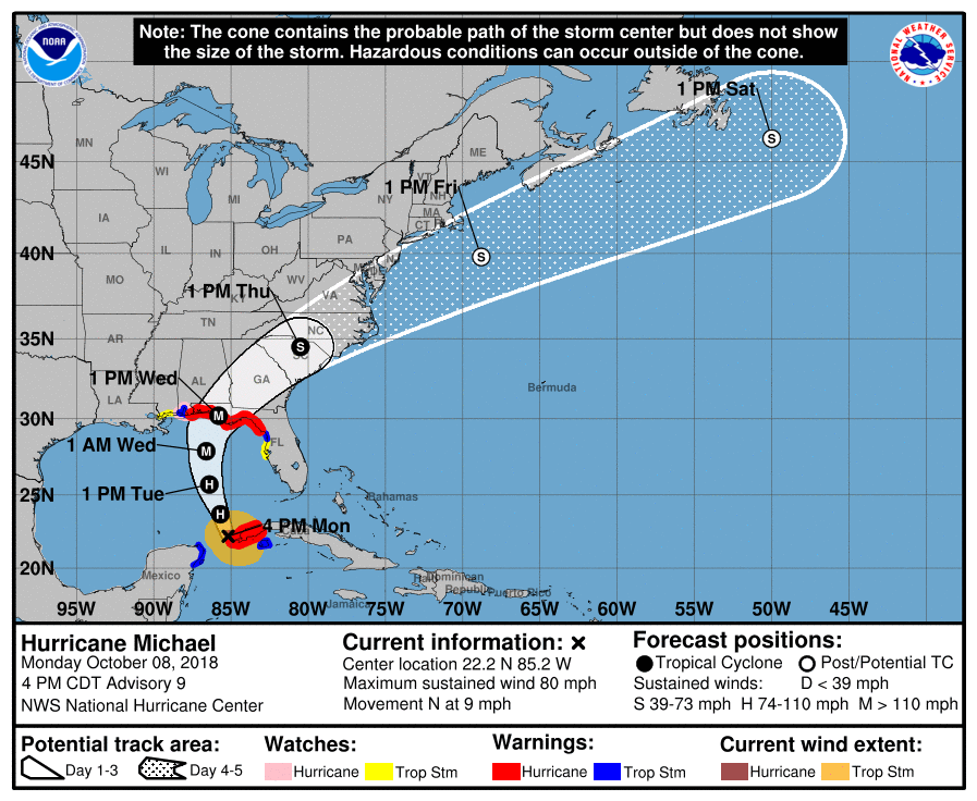
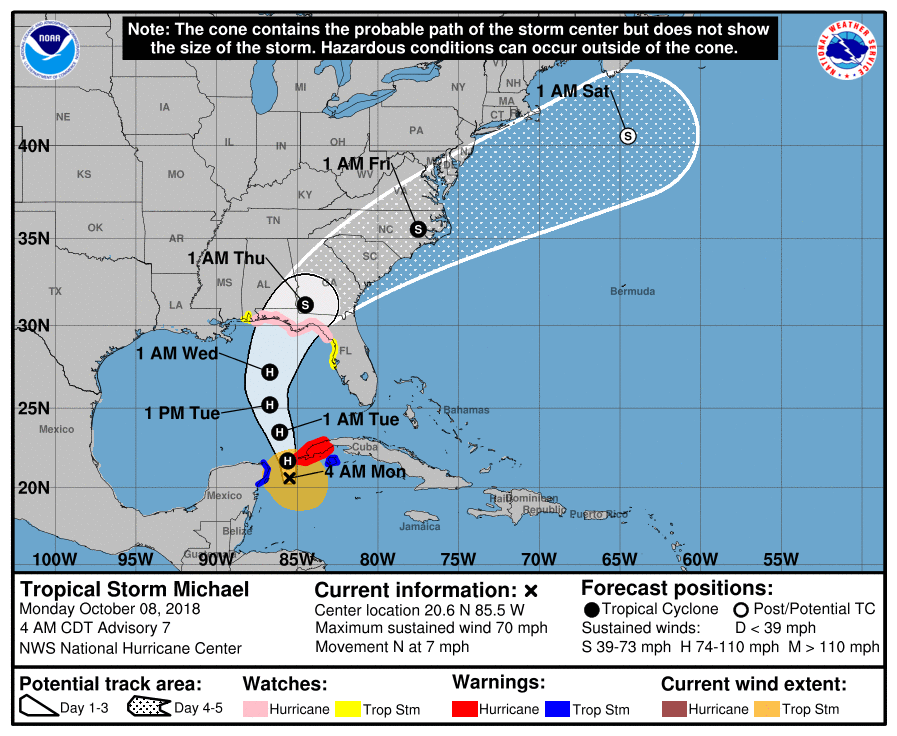
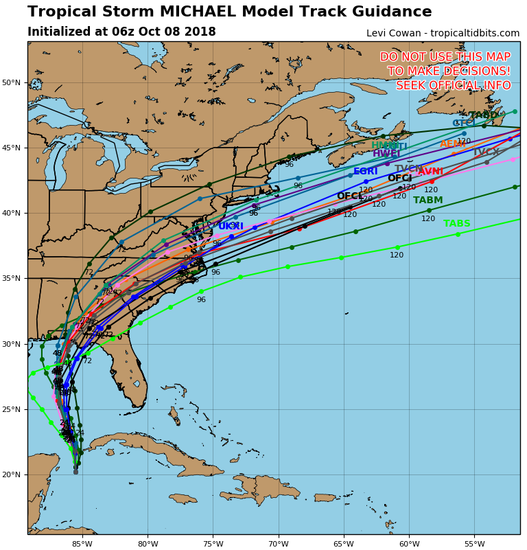
Scientists at NOAA’s National Hurricane Center conducted a
detailed post-storm analysis on all the data available for Hurricane Michael and have determined that the storm’s estimated intensity at landfall was 140 knots (160 mph). This final wind intensity is a 5 knot (5 mph) increase over the operational estimate and makes Michael a category 5 storm on the Saffir-Simpson Hurricane Wind Scale at the time of landfall on October 10, 2018, near Mexico Beach and Tyndall Air Force Base, Florida.Michael is the first hurricane to make landfall in the United States as a category 5 since Hurricane Andrew in 1992, and only the fourth on record. The others are the Labor Day Hurricane in 1935 and Hurricane Camille in 1969. Michael is also the strongest hurricane landfall on record in the Florida Panhandle and only the second known category 5 landfall on the northern Gulf coast.
The real-time operational intensity estimate was 135 knots (155 mph). The final best track intensity estimate of 140 knots (160 mph) was determined by a review of the available aircraft winds, surface winds, surface pressures, satellite intensity estimates and Doppler radar velocities – including data and analyses that were not available in real time. The 5 knot (5 mph) increase in the estimated maximum sustained wind speed from the operational estimate is small and well within the normal range of uncertainty.
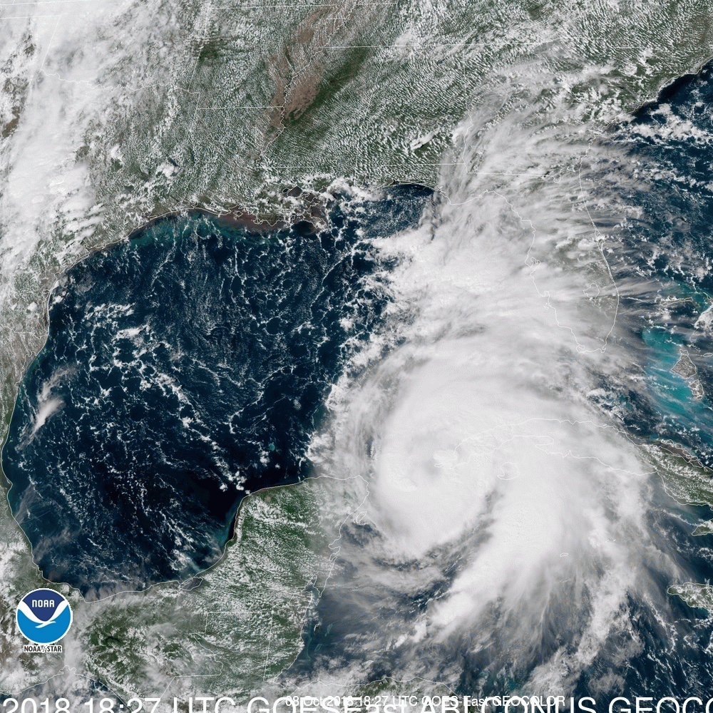
Category 5 winds were likely experienced over a very small area at and near the coast, and the change in estimated wind speeds is of little practical significance in terms of the impacts associated with the storm. Michael produced devastating winds and storm surge and was directly responsible for 16 deaths and about $25 billion in damage in the United States. Before hitting the United States, the cyclone brought hurricane-force winds to the western tip of Cuba when it was a category 2 Hurricane.
Along with wind speed, atmospheric pressure is a measure of storm intensity. In general, the lower a storm’s central pressure, the higher the winds. Michael’s central pressure of 919 millibars (mb) at landfall is the third lowest on record for a landfalling U. S. hurricane since reliable records began in 1900, trailing only the Labor Day Hurricane of 1935 (892 mb) and Hurricane Camille of 1969 (900 mb). Hurricane Andrew of 1992 (922 mbs).

Preseason Tropical Update 2019, 4-16-19

4/16/2019


Good morning.

2018 was a quiet year for South Florida however there were a few remarkable systems. Hurricane Florence which caused extensive flooding across North Carolina and Hurricane Michael which made landfall as a strong Cat 4 near Panama City, FL.
Rainfall at my house totaled  52.37" which was well below my 29 year running average of  67.88" and substantially below 2017s above average rainfall of 76.70".

I've been following atmospheric and sea surface conditions for several months now and it is looking more likely that El Nino conditions will persist throughout the 2019 Hurricane Season. We are currently in a weak El Nino which started around October. It is expected to remain weak or become moderate over the summer. In addition sea surface temperatures along and south of 20 degrees North Latitude are cooler than average with warmer than average sea surface temperatures occurring north of 20 North Latitude and especially north of 25 North Latitude. The Gulf of Mexico in particular remains warm.

The above should lead to an average to slightly below average season as far as the number of storms with the areas at greatest risk being the Carolinas, the Gulf of Mexico and the Bahamas. On average we see  12 named storms/ year with 6-7 hurricanes of which 2-3 become major hurricanes. The overall risk for South Florida should be a little below average. The average risk of hurricane conditions being experienced in South Florida is about 14% chance per year.

I'll be watching closely as usual and will write Updates as the need arises.

Hoping for a quiet season for all,

Matt.

tropical update Monday 11-12-18, 8 am

11/12/2018

 
Good morning.

I am writing about an area of disturbed weather just NW of the Lesser Antilles. The NHC is giving it a 70% chance of tropical or subtropical development over the next 5 d. I am presently not overly concerned by it and suspect the likelihood of development is over stated.

If you look at the Water Vapor Loop below you will notice several features. Moving left to right. First strong SW flow over the SE US, next an upper level low just north of the Virgin Islands which is interacting with the area in question just to its southeast, then to the SE of that, the inter-tropical convergence zone with significant shear over it out of the west.

Next look at the Surface Map and the Wind Shear Analysis below. High pressure just east of Florida and abundant shear over Florida and the SE US should weaken it and ultimately deflect it to the NE.

I will write further if things develop or change however the environment is not conducive for a significant system to develop, or hit us. Due to high SW shear any weather should be NE of the center. As long as it stays even a  little to our east we should be fine.

Matt.

Picture

Picture
Picture
Picture

Tropical Update Friday 10-12-18, 7 am

10/12/2018

 
Good morning.

The Florida Panhandle and the Panama City area in particular are still reeling from the effects of Hurricane Michael. Michael was an unprecedented storm in many ways. Most notable is that it continued to intensify in spite of significant shear as if there were none. Hurricane Matthew did the same thing 2 years ago when it was off the northern coast of South America. Storms can only do that for a limited time, during periods of steady intensification with a small eye where the up flow and outflow are strong enough to negate the affects of the shear. Once they stop intensifying they go through eye wall replacement cycles and often, at least temporarily, weaken.

On Wednesday when the shear lessened it really exploded.

Below is Michaels Wind History Map, an infrared image with its vital statistics just prior to landfall, as well as Tallahassee Radar leading up to landfall. Look at the radar loop closely and you will see a very interesting feature. Notice how steady the eye is leading to landfall. There almost no wobble at all. This can only occur in a very intense, symmetric storm in the absence of shear. It is very rare to see. It happened with Hurricane Andrew in 1992 and with Hurricane Haiyon in the Pacific.

Elsewhere things in the tropics are settling down, Leslie is racing toward North Africa where it should dissipate off the coast and Nadine is expected to dissipate in 1-2 days. Cold fronts should start to pour into the US which should start to cool the waters down. Hopefully there will be no more US land falling systems this year.

Until next time,                                     Matt.


PS. When you have a chance relook at my Preseason Forecast from April 27th, 2018.

Picture
Picture
Picture

landfall 10-10-18, 1:30 pm

10/10/2018

 
Picture
Picture

tropical update Wednesday 10-10-18, 1 pm

10/10/2018

 
Hurricane Michael is making landfall right now at Panama City, Florida. Maximum sustained winds of 150, could end up being more. The northern eye wall is on shore. The eye has contracted and I would estimate that it is about 10-15 miles wide at this time.

Note barometric pressure of 919 mbs. This is VERY low, Andrew's pressure in Homestead 8-24-92 was 922 mbs !
Picture
Picture
Picture

tropical update Wednesday 10-10-18, 7 am

10/10/2018

 
Good morning.

At 7 am H. Michael had peak winds of 140 mph and a minimum pressure of 937 mbs. Overnight Michael has steadily strengthened. The NHC is currently forecasting it to be a 145 mph Cat 4 hurricane at land fall. The Panama City area continues to be in the center of its path.

Below you can see 1) the forecast track 2) the current satellite loop of the Gulf of Mexico 3) current Tallahassee radar and 4) the current water vapor loop of the Gulf of Mexico.

If you look at the satellite loop you can see Michael's distinct eye wobbling to the NNE. On radar you can see the eye wall. (See weather Trivia section for discussion about "The Eye Wall".) On the Water Vapor Loop notice how the frontal system to the west has now moved into Louisiana, this is why it is starting to move more to the NE; compare this to where it was yesterday. Hurricane force winds currently extend 40 miles to the NE and 30 miles to the NW of the center. The eye is currently 20 miles wide. The eye wall is where the strongest winds in a hurricane occur. Eye walls are generally 5-7 miles wide, therefore a 35-40 mile wide area will likely experience Cat 4 conditions. (Note this is wider than the expected 30-34 mile wide area to account for the effects of wobble.) Major hurricane conditions are generally not found outside of the eye wall. In other words if you are over 20 miles from the center of its path you should miss the worst of it.

Tallahassee will likely receive hurricane conditions today. This will be a devastating event for the Panhandle and Big Bend areas of Florida today. Large trees and frame structures will enhance the damage. Storm surge could be significant.

My best to everyone,                       
                                                                    Matt.

PS. I'm sorry for the rushed report this am. I had written a nicer post at 7 this am however just prior to publishing it, it disappeared and I had to rush to put out a report with little time.
Picture
Picture
Picture
Picture

tropical update Tuesday 10-9-18, 6:45 am

10/9/2018

 
Good morning.

Hurricane Michael at 05:00 this morning was moving NNW @ 12 mph with peak winds of 90 mph. Overnight pressure have stabilized at around 973 mbs. Shear is anticipated to decrease some today and Michael is expected to become a Cat 2 storm later today. The NHC is currently forecasting a 120 mph Cat 3 storm at landfall around noon tomorrow along the Florida Panhandle. The NHC's track has not changed since yesterday afternoon and the models are in very tight agreement. The eye remains cloud filled however a distinct eye should form later today as peak sustained winds reach around 100 mph.

Note Florida has received very little rainfall so far from Michael. This is due to it becoming a stronger system than expected which has drawn the moisture closer to its center.

Note the bottom graphic is the currently color satellite loop looking at the SE US and the Gulf of Mexico prior to sunrise. Notice the city lights. My track has not changed since yesterday am and still centers around the Panama City area.

Elsewhere, Leslie is moving out to sea and TD #15 has formed. It is forecast to remain a weak system, probably becoming Tropical Storm Nadine later today or tomorrow. Dissipation is forecast in a few days.

Until next time,                                         Matt.


Picture
Picture
Picture

tropical update Monday 10-8-18, 5 pm

10/8/2018

 
Good evening.

Michael was upgraded to a Cat 1 hurricane this morning as expected. Pressures have been dropping steadily through out the day and winds are currently 80 mph. Hurricane Michael is expected to reach Cat 2 status early tomorrow and Cat 3 tomorrow night or Wednesday. I've attached a current color satellite image which is interesting. You can see the deep convection near the center as well as surface winds out of the east and SE and upper level winds out of the SW. You can also see the frontal system slowly advancing from the west.

It continues to head toward the Florida Panhandle and the area around Panama City currently appears to be at greatest risk. I anticipate that a distinct eye should appear tomorrow which will make it easier to track.

I'll write again in the am,                Matt.


Picture
Picture

tropical update, Monday 10-8-18, 7 am

10/8/2018


Good morning.

Tropical Storm Michael formed yesterday as expected and there are several developments since yesterday. In a nutshell it is further east, it is moving slower and in spite of significant shear, it is stronger than was anticipated yesterday. Hurricane Hunters this am surprisingly found a central pressure of 983 mbs or 29.02 inches of Mercury. (Note you usually need a pressure around 29.00 inches of Hg to get a hurricane, ie. it is close to hurricane strength.) The models are currently in good agreement for landfall along the Florida Panhandle late Wednesday. The NHC is currently forecasting it to be a 110-115 mph storm. Note intensity forecasting as evidenced already in this system can be very difficult and unexpected development can occur. It is quite possible with lessening shear to its north that it could make landfall as a major hurricane (Winds > or = 115 mph).

Outer rain bands are starting to move into the Florida Keys already. Expect a rainy next few days for the state of Florida with hurricane and storm conditions from the Panhandle to the Big Bend area on Wednesday. Everyone in those areas should be preparing now.

I'll write further as things develop however it is unlikely that we will see major changes in its track. The intensity will be the main variable to watch.

Until next time,                           Matt.


Picture
Picture
Picture
Picture
<<Previous
Forward>>

    Categories

    All
    Preseason Update