Matt on the Tropics
Tropical Updates
  • Home
  • About
  • Archive (pre-blog)
  • Contact
  • Weather Links
  • Weather Trivia

tropical update Tuesday 9-14-21, 3:30 pm

9/14/2021

 
Good afternoon.

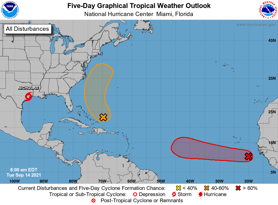
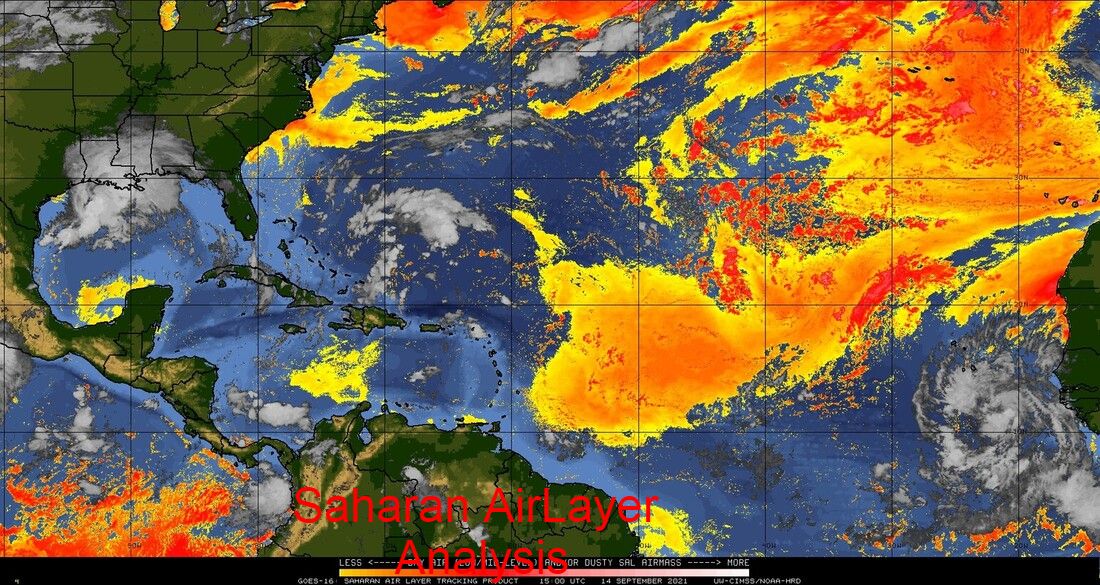
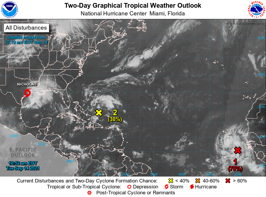
Just a quick note. The tropical wave over Africa that I spoke about last week has emerged off the coast and the NHC is giving it a 70% chance of development. Almost all of the current models take it out to sea, missing the US. It is however early and its pretty far south, around 10.5 degrees N, so until it forms and actually starts moving to the WNW we'll need to keep an eye on it. Saharan dust and dry air to its west should help to slow development.

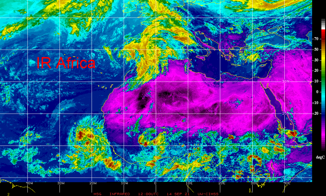
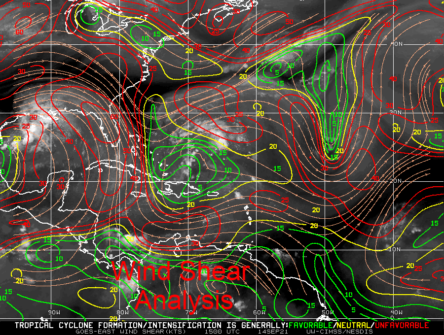
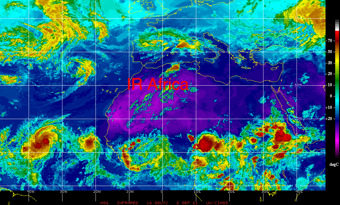
On the good news front if you look at the IR of Africa below, it appears that the Cape Verde season is winding down over Africa and the Inter-Tropical Convergence Zone is starting to drift southward. Once it gets south of around 8 degrees the Cape Verde season usually ends and we'll need to shift our attention to the Western Caribbean Sea and the Gulf of Mexico. If you look at the Wind Shear Analysis below you will notice high shear, almost 60 knots, over the entire state of Florida. This should protect the state for at least the next several days, hopefully longer.

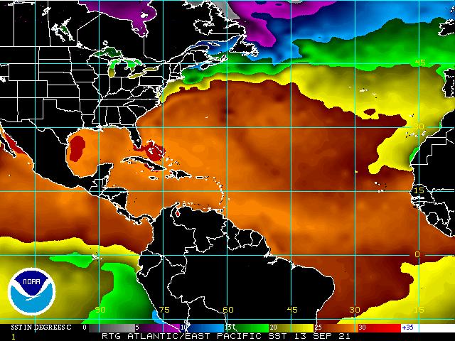
If you look at Sea Surface Temps, bottom diagram you will see 2 pockets of hot water left. One in the Western Gulf of Mexico which Nicholas has taped into and will hopefully remove and one over the Bahamas where a disturbance is currently located which should drift north and hopefully take some of that heat with it. It's amazing how these system will find the warm water.

Looking okay for now.

Until next time,

                                                                Matt.
​
Picture
Picture
Picture
Picture
Picture
Picture

tropical update thursday 9-2-21, 6 pm

9/2/2021


Good evening.

Just a quick update on the tropics.

So far so good.

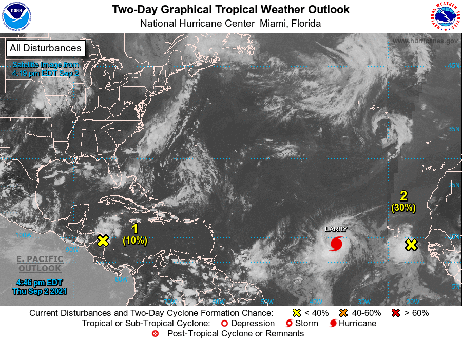
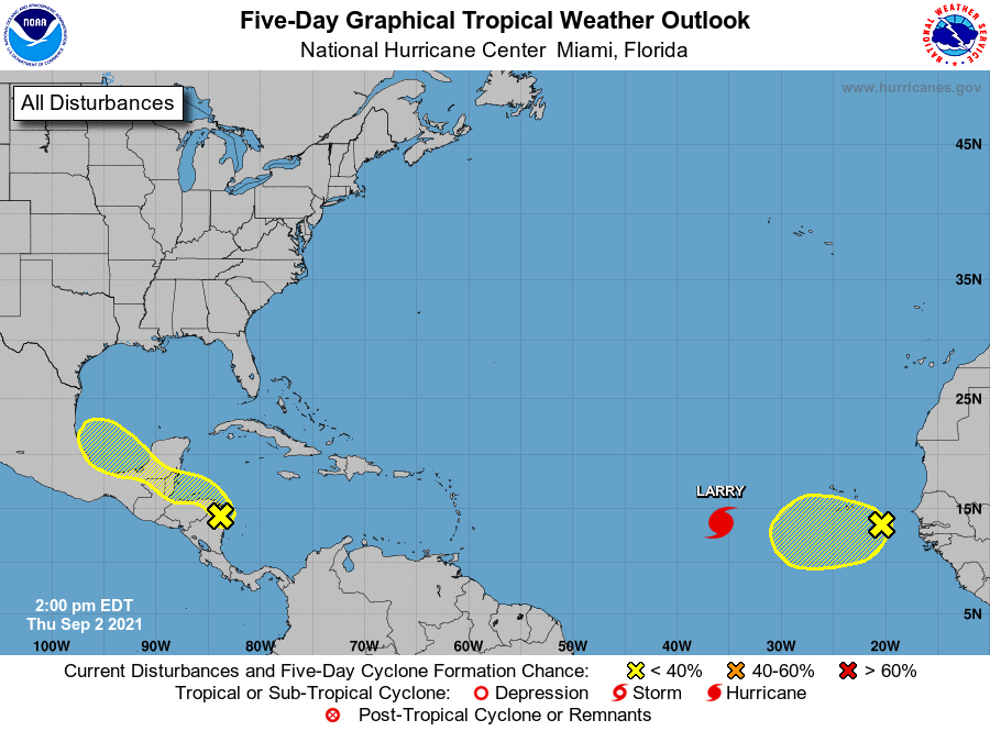
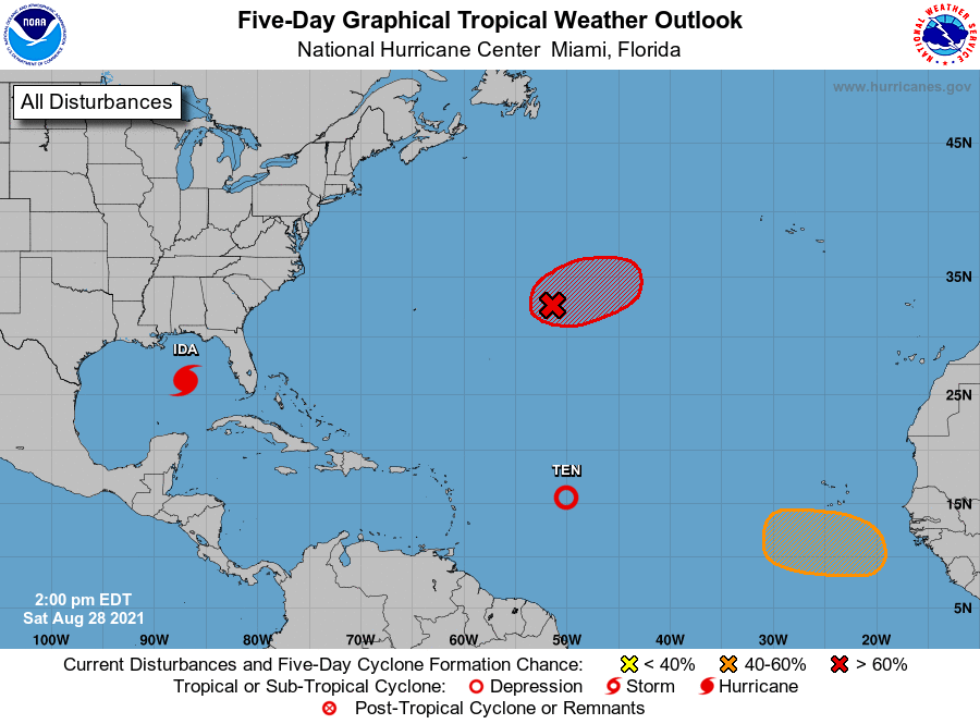
There are a few systems out there but currently none pose a threat to Florida. Hurricane Larry is forecast to move out to sea and potentially threaten Bermuda. The system behind it should follow in its wake on a similar course. The area which we'll need to watch is currently over central tropical Africa, the large red blob on the IR of Africa. It should emerge off the coast in around  5 days.

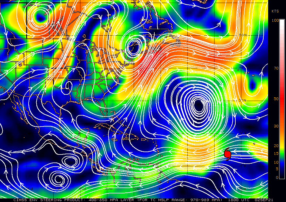
If you look at the surface map below you can see that upper level winds over Hispaniola are moving NNE and are currently protecting the state of Florida from systems in the Atlantic. (This is good.)

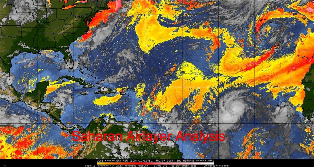
If you look at the SAL below you can see that the prior Saharan dust and dry air has been eroded significantly. Larry should take out most of the rest of it. The protection that we had for most of July and August is disappearing.

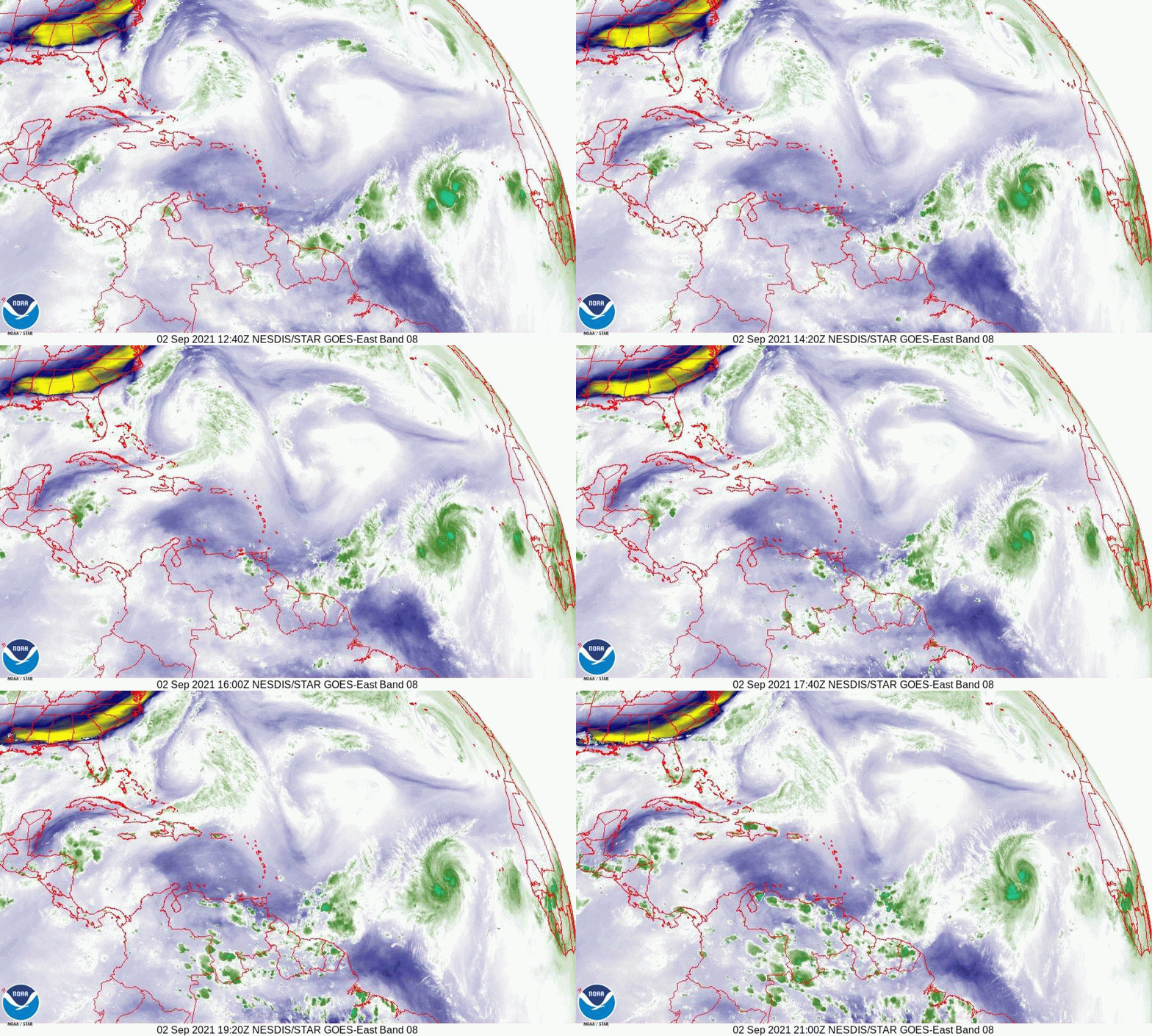
Lastly if you look at the water vapor loop below you can see a large upper level low racing eastward being pushed along by an advancing front moving along the SE US. The associated upper level westerly and southwesterly flow should protect the state of Florida for the next several days. Hopefully the trough in the western Atlantic will persist and steer systems away form the US.

I am going to be away for the next several days and Cassie will be posting if needed. Possibly myself if I have signal.

Until next time,

                                                                  Matt.

Picture
Picture
Picture
Picture
Picture
Picture

tropical update sunday 8-29-21, 5 am

8/29/2021

 
Good morning.

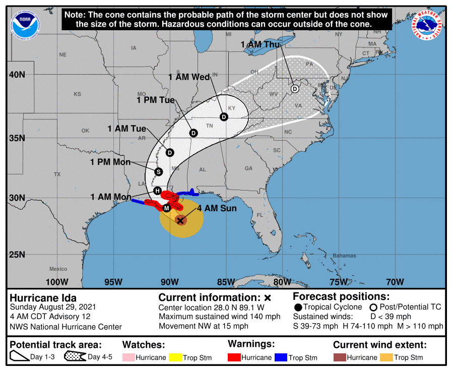
Just a quick update on Hurricane Ida. At 5 am Ida was approaching the SE Louisiana coastline.
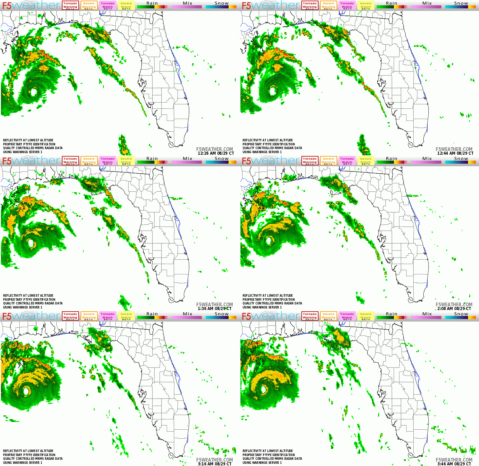
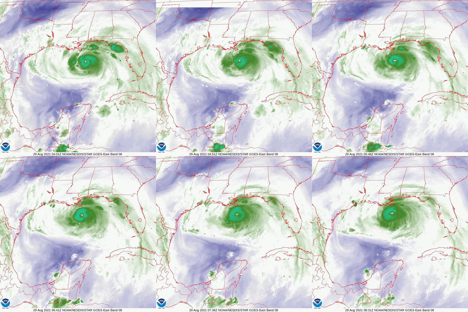
The current NHC track has shifted slightly westward. Of note is that if you look at the water vapor loop below you will notice that Ida took a decided westward wobble between 1 and 4 am. This has placed it a little further west than previously forecast. The result of this is that the eye wall will probably miss New Orleans. They will still however likely experience hurricane conditions. Note a western wobble is often followed by an northern wobble in a NW moving system. When storms are far out they don't make much difference however as they get close to shore they can have a significant impact on just where it makes landfall. The eye is currently 15 nm wide. You can see it on radar. Ida has been steadily intensifying and will likely reach winds of 150-160 mph before landfall. The NHC currently projects peak winds to 145. Ida currently appears to be headed towards Houma, LA. As noted wobbles become significant as storms approach land and Ida has been wobbling a lot so a precise location will be difficult to ascertain. They eye is small so it will have to pass within 12 miles of you to get eye wall. The area most affected will be narrow but extreme.

​The wave over Africa that I spoke about a few days ago is forecast to come off the coast tomorrow and will likely move out to sea.

Best wishes to all.

​Until next time,

                                                     Matt.

​
PS. Just a note. H. Katrina made landfall on 8-29-05. 16 years ago to the date.

Picture
Picture
Picture
Picture

tropical update saturday 8-28-21, 8 pm

8/28/2021

 
Good evening.

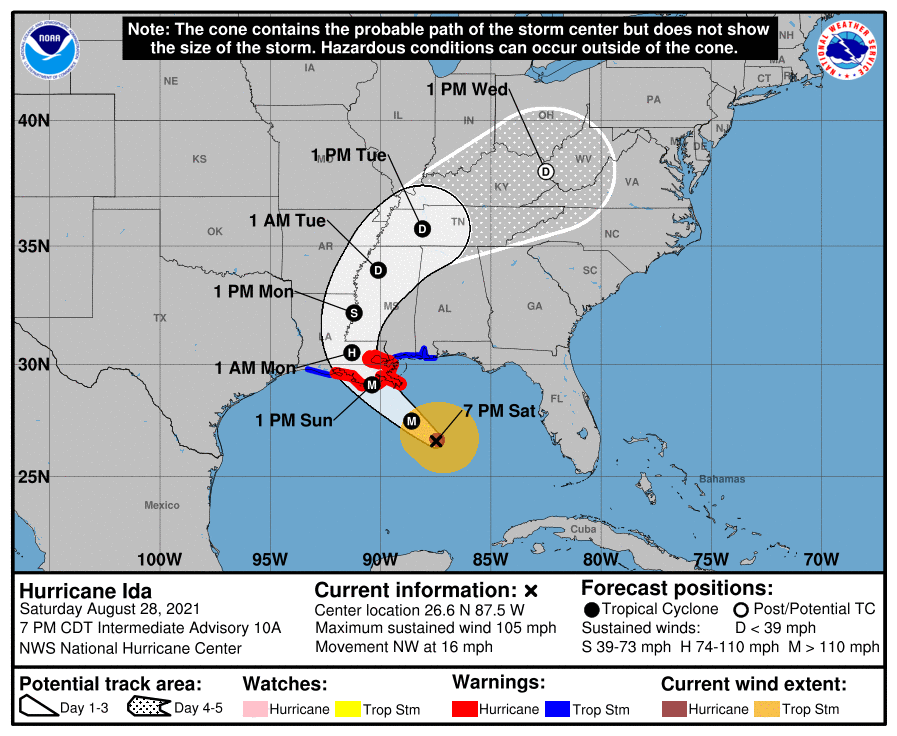
At 8 pm Hurricane Ida was in the east central Gulf of Mexico and is currently headed in the direction of New Orleans. Today it took a NNW wobble and has since resumed its NW motion however this has caused the models and track to shift further east. On its current trajectory it should pass between New Orlean and Houma in the vicinity of the La Fourche Bayou and Golden Meadow.
Ida is projected to be a 130-140 mph Cat 4 storm at landfall with a very narrow band of hurricane force winds. They are projected to extend 30 miles to the NE and SE of the center and 25 miles to the NW. The major hurricane force winds should be confined to the eye wall. Hurricane hunters are probably in the storm now and hopefully we'll have more information soon about the size of the eye and if an eye wall has formed yet. In a major hurricane "eye wall is everything". If you are outside of the eye wall you usually only receive Cat 1 conditions. (Occasionally Cat 2 in extreme storms.) Due to its forecast rapid intensification I would estimate that the eye will be between 10-20 miles wide at landfall. Eye walls are usually 3-5 miles thick. If we take the 2 larger numbers, 20 mile eye, 5 mile thick eye wall, it would have to pass within 15 miles of you to receive major hurricane conditions. (Possibly as little as 8 if we take the 2 smaller numbers.)

It is going to be close for New Orleans. If it receives eye wall it will be worse than Katrina. Fortunately its moving fairly quickly so its shouldn't be a prolonged event but its going to be very bad for those in its direct path. Stick structures do not fair well in major hurricanes.

Note the ULL in the Gulf is now south of Texas and should have no influence on Ida.

I wish everyone well and that those in its direct path can get out, and that it's center doesn't pass within 15 miles of NOLA.

Until next time,             

                                                             Matt.

Picture
Picture
Picture
Picture

tropical update friday 8-27-21, 7 am

8/27/2021

 
Good morning.

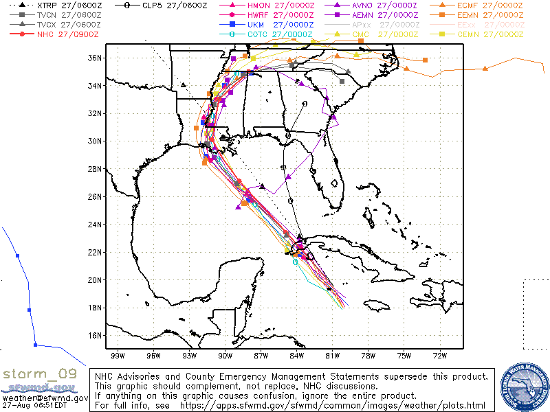
Just a brief update. Florida currently appears to be okay however it looks like Louisiana is going to get another hurricane possibly a major one. If you look at the models below they have become focused on Louisiana. 

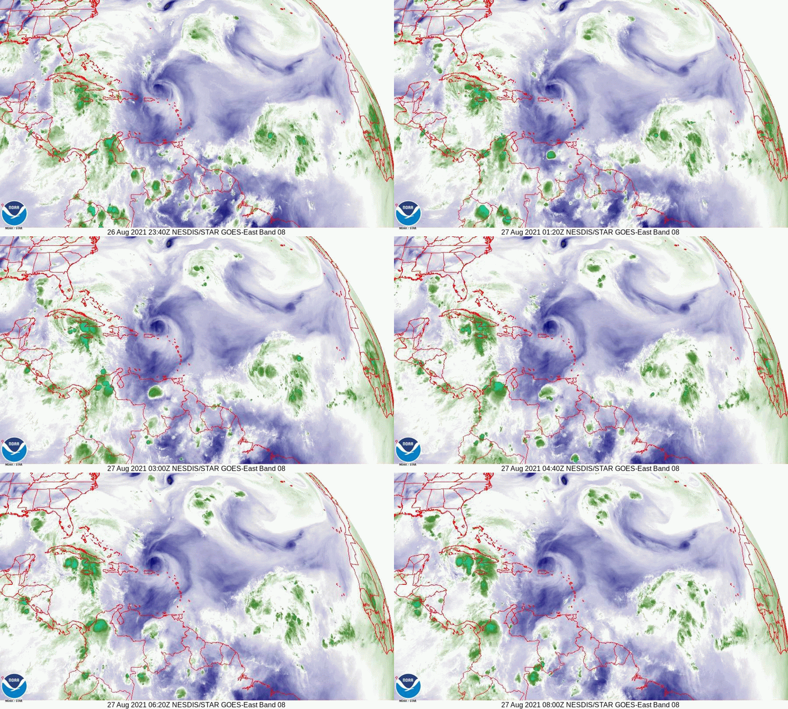
If you look at the Water Vapor Loop below you will notice an upper level low just south of Mississippi moving slowly westward. This was the same ULL that was just off the SE FL coast 2 d ago. Just where it is on Sunday may have a significant influence on just where Ida goes. If it is just to the west of it, it will tend to deflect her eastward, conversely if it remains to its east a more westerly track. If it is not close enough to affect it, it would tend to proceed straight in the direction that it is currently headed which would be towards Lake Charles, Louisiana.

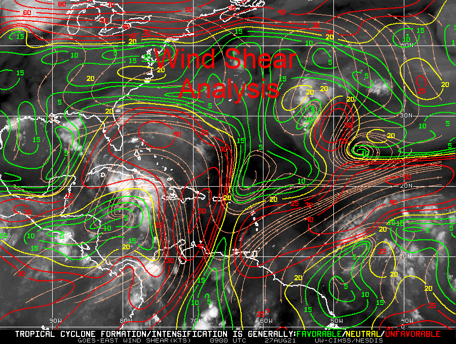
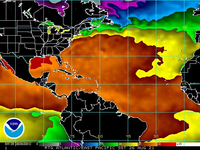
After it enters the Gulf of Mexico it will be entering an area of low shear and very warm water, (see Wind Shear Analysis and SSTs below) and rapid intensification is possible. The NHC is currently forecasting it to be a Cat 3 115 mph hurricane at landfall. It could even be more but hopefully will run out of time before it gets a chance.

I'll try to put out an update tomorrow evening when we should know more.

Until next time,

                                                                    Matt.
​
Picture
Picture
Picture
Picture
Picture
Picture
Picture
Picture

tropical update wednesday 8-25-21, 7 am

8/25/2021

 
Good morning.

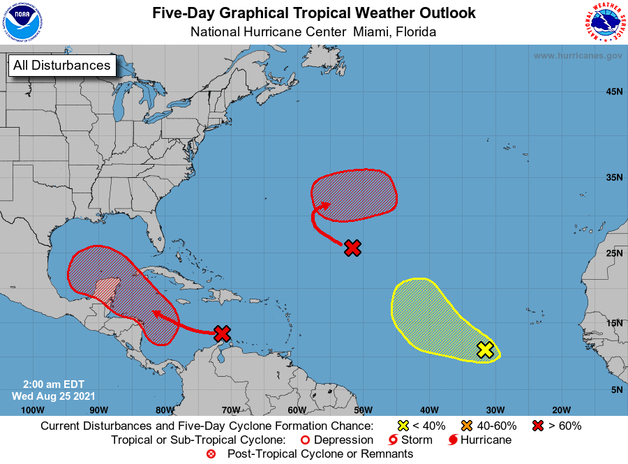
​I'm writing today about a few systems out there but would like to start by saying that none are currently forecast to affect the US. Texas will need to keep an eye on the one in the Caribbean however it is currently expected to turn west into Mexico.

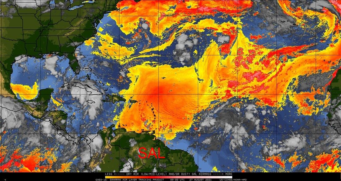
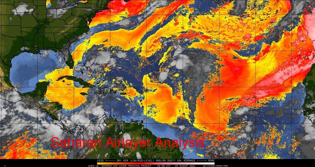
I just would like to point out a few things. First if you look at the SAL Analysis below you can see that dry Saharan air and dust are still being pumped SW deep into the Tropical Atlantic. This is good and has led to relatively little activity so far in July and August of this year. You can also see the dust currently over South Florida, and some larger gaps in it are starting to form. This has been due to erosion of the dust by the various weather systems in the Atlantic, you can actually see the effects of each of them.

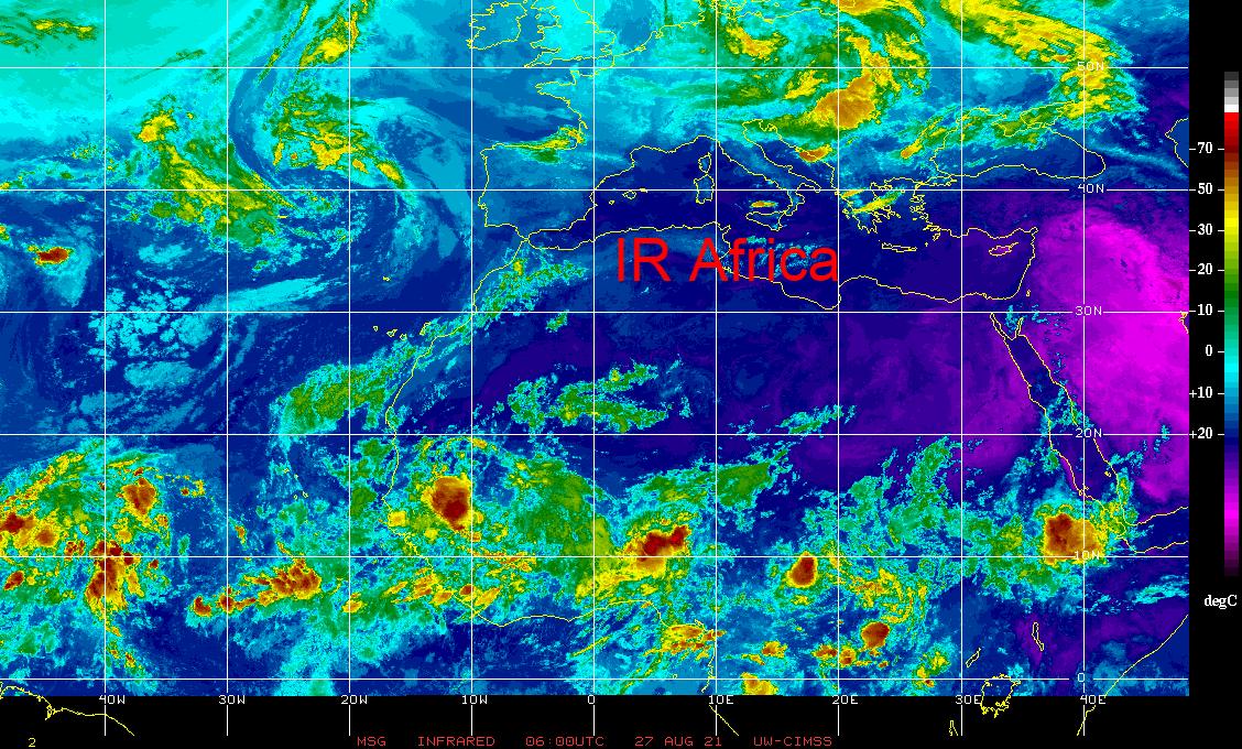
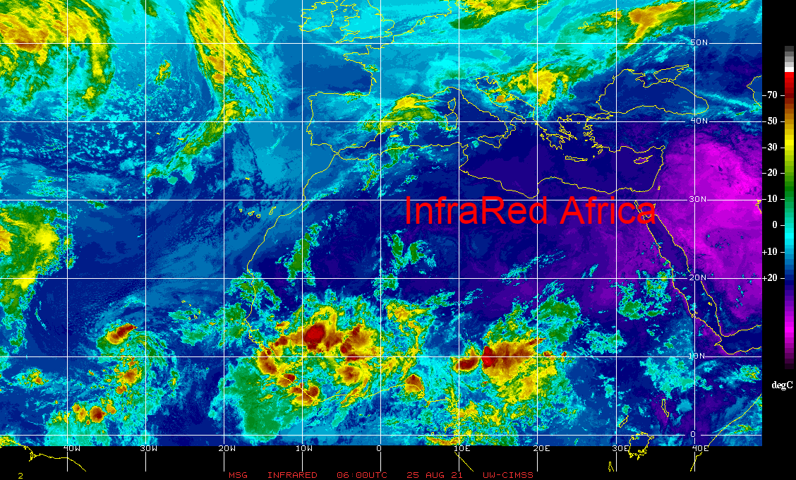
Next if you look at the IR of Africa below you can see a weather system over central Africa centered around 10 degrees latitude. This will become the next system for us to watch. It should come off the African coast in around 4 days and is around 14 days away from potentially affecting the US. Hopefully it will move out to sea, however it may be coming off the coast in the "sweet spot" (between 10 and 12 degrees) and climatologically at a time of high risk for development.

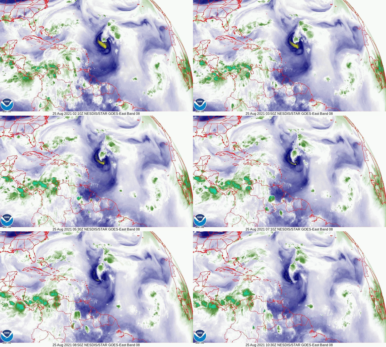
Next if you look at the water vapor loop, last image, you can see an upper level low over the Bahamas moving west towards South Florida. This will lead increased rain chances across South Florida for the next several days.

So far so good.

Until next time,
​
                                                          Matt.


Picture
Picture
Picture
Picture

tropical update Monday 8-16-21, 7:30 am

8/16/2021

 
Good morning.

We have three systems to discuss this morning but none to worry about.

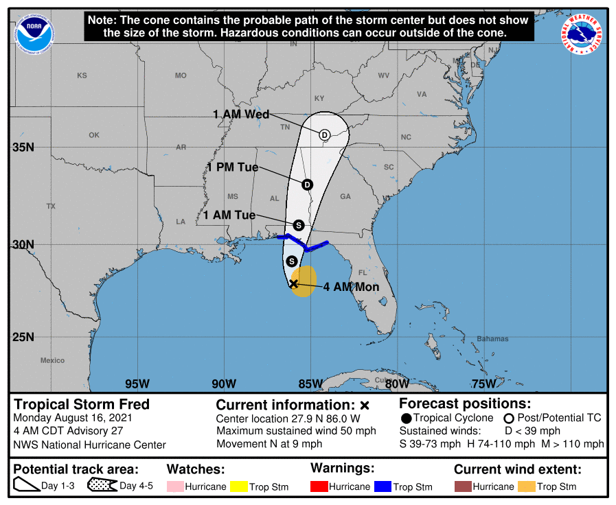
Fred is currently headed to the Panama City / St. Vincent Island area as a 50 mph tropical storm. It should arrive tonight and primarily be a rain event for them.

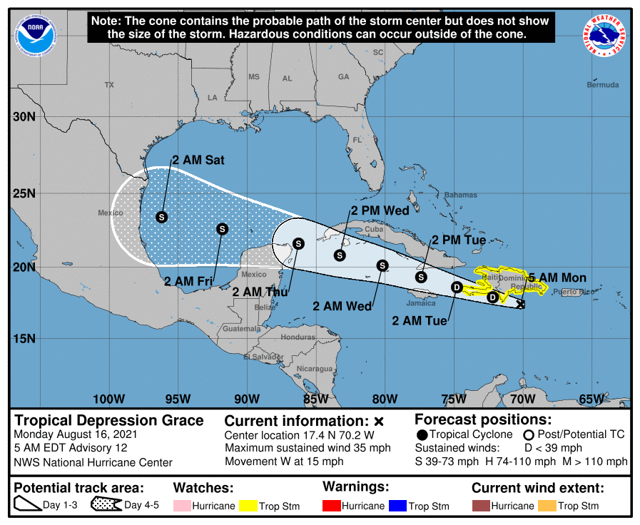
TD Grace never made the WNW move as the NHC had forecast yesterday and instead moved west all day yesterday. In light of this the models and tracks have shifted further south and it now appears that she will be going to Mexico. (It may even track further south than the current track.)

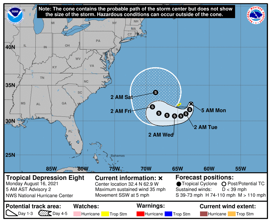
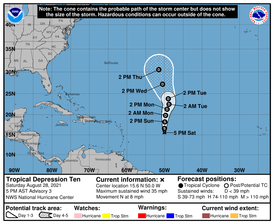
TD #8 formed yesterday NE of Bermuda and is forecast to take a loop around the island and then move out to sea.

Elsewhere all is good for now. I may not write for a few days unless things should change with Grace or other threats should arise.

Until next time,

                                                                       Matt.

Picture
Picture
Picture
Picture

tropical update sunday 8-15-21, 11:30 am.

8/15/2021

 
 Good morning.

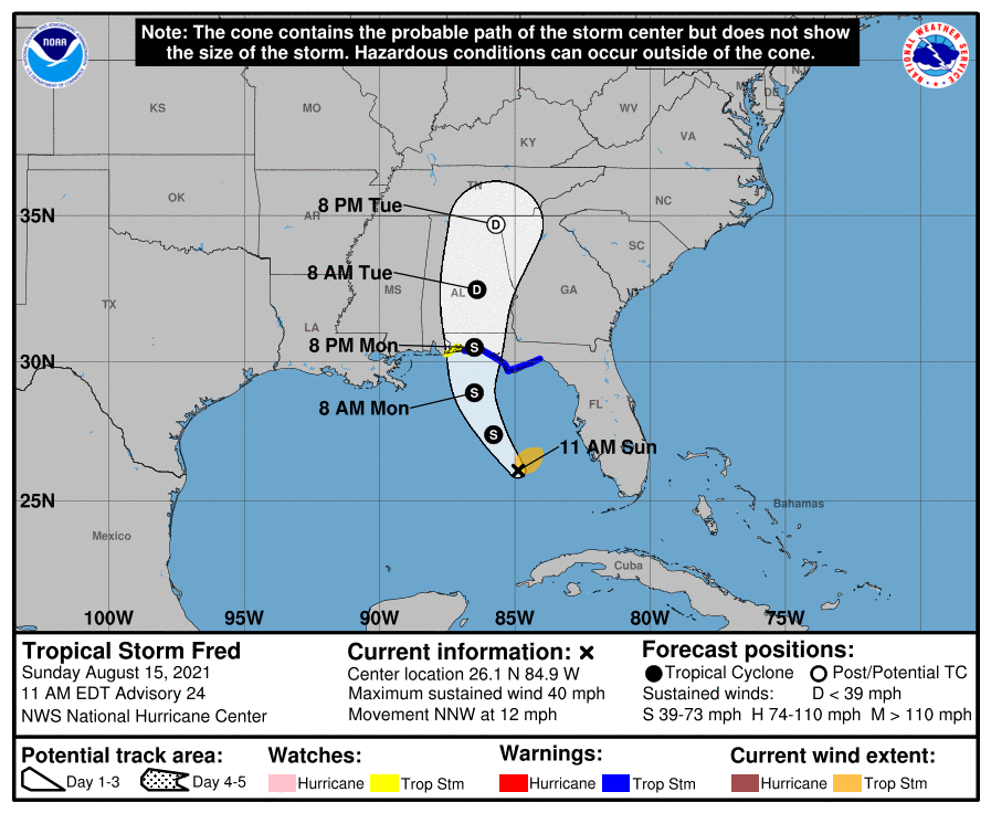
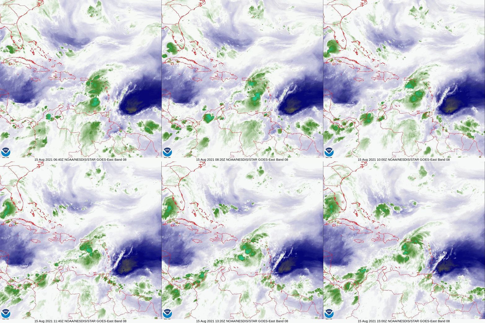
He's back ! Hurricane Hunters this morning found a new center of circulation well north of where they had projected the old one to be and TS Fred is back. Due to shear Fred is only anticipated to be a 45-50 mph TS when it makes landfall tomorrow along the Florida Panhandle. The primary impact will be rainfall.

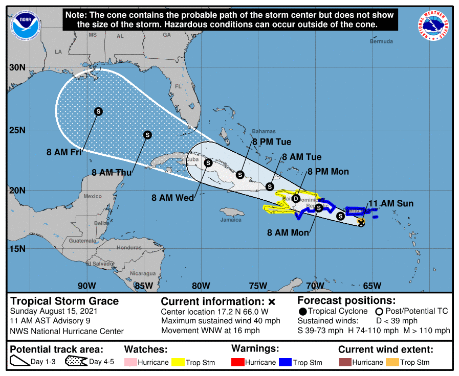
Meanwhile Grace remains poorly organized and in looking at Puerto Rico radar a clear center of circulation is not evident. It remains a minimal TS and is about to cross Hispaniola and Cuba. No significant weather is anticipated for Florida though some enhancement of our normal summer thunderstorms can be expected with the increase in tropical moisture when it passes south of Florida.

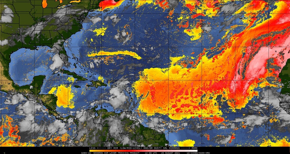
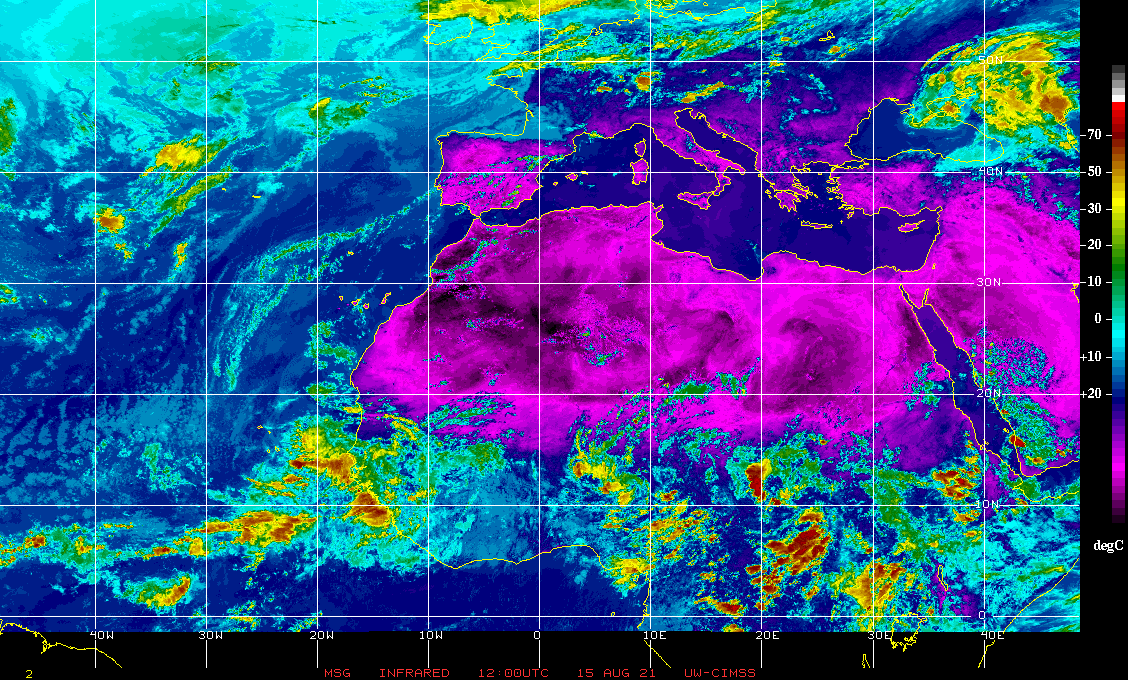
If you look at the Saharan Air Layer Analysis and the IR Satellite image of Africa below you see what I talked about yesterday evening. We should be ok for a while.

Until next time,

                                            Matt.

Picture
Picture
Picture
Picture
Picture

tropical update 8-14-21, 7 pm

8/14/2021

 
Good evening.

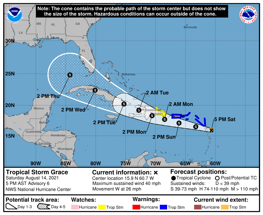
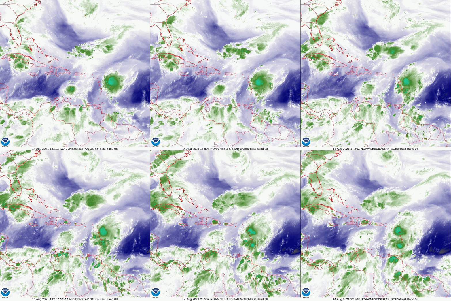
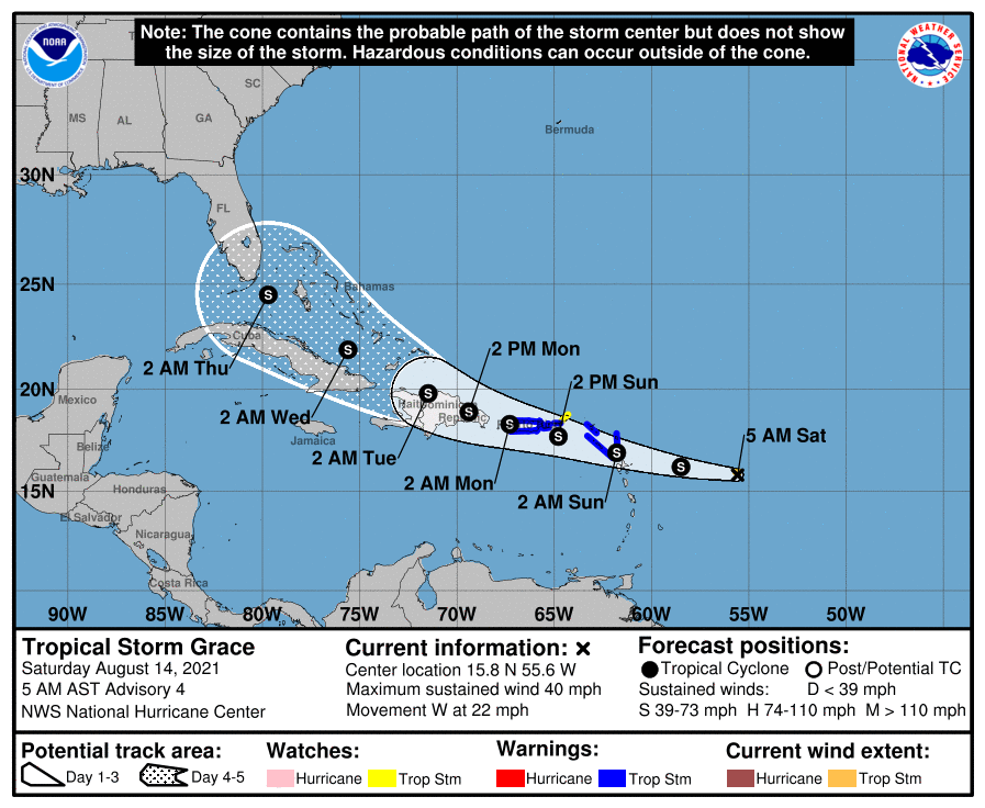
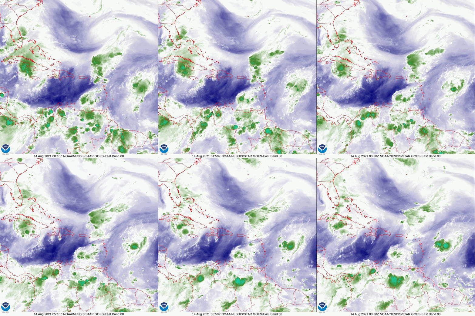
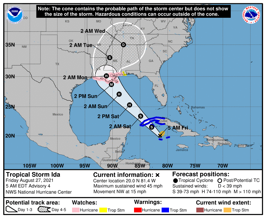
At 11 am the NHC officially acknowledged Fred's dissipation though they still expect that it may regenerate. My thoughts about it are unchanged since this am. Grace however appears to have chosen the southern route and the NHC have shifted their track accordingly. Early this morning it appeared to be moving WNW however if you look at the current water vapor loop below you can see that it has taken a decided WSW  move, ? wobble. The net effect is that Grace has moved overall due west today and has entered the Caribbean. The NHC's current track is in alignment with the model consensus along the southern scenario that I mentioned this am. Grace is currently a tiny storm and hopefully will meet the same fate as Fred. We'll see. It is moving rather quickly as you can see below.

I will probably post tomorrow early afternoon as it will take that time to see just how Grace approaches Hispaniola. That will be key. If it takes the NHC's track it would be severely disrupted. A more northerly track could be of concern but hopefully will remain a minimal tropical storm, or less.

​Beyond Grace Saharan dust and dry air has once again invaded the Eastern Tropical Atlantic and I suspect that we will not see further activity for 1-2 weeks or more.

Until next time,

                                                                   Matt.

Picture
Picture

tropical update saturday 8-14-21, 5 am

8/14/2021

 
Good morning.

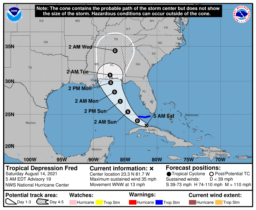
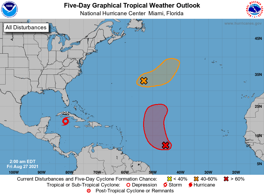
At 5 am the NHC guesstimated the center of Fred just north of Havana. If you look at the water vapor loop you will notice once again that there is no weather anywhere near this area. In reality Fred dissipated on Thursday. The NHC hasn't acknowledged it yet because they have felt that it would regenerate once it enters the Gulf of Mexico, which is possible, however they have been unable to find a center of circulation for a while. If it should regenerate it is likely to only become a minimal system and I presently have little concerns about it. It is probably at its closest approach to SE FL now. Also note that the ULL off the FL SW coast has moved little and will make it even harder on Fred.

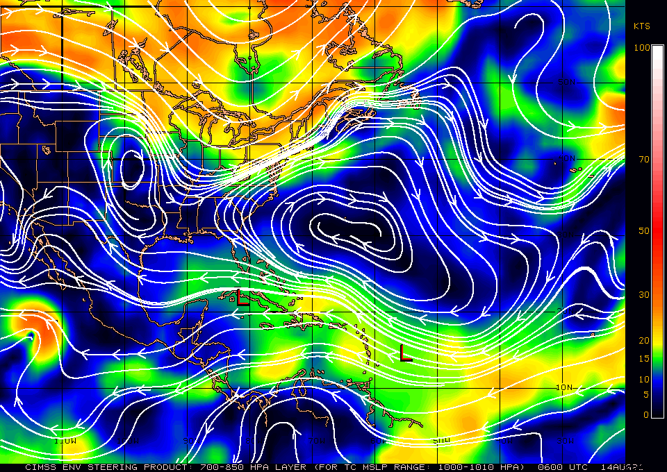
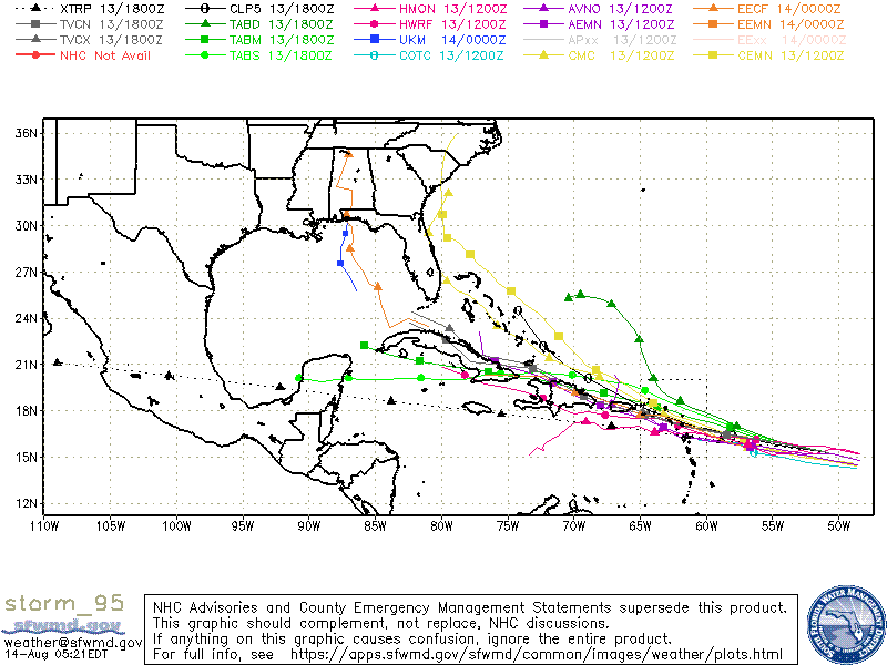
The one which we'll have to watch for now is Grace. Grace formed yesterday and was much further SE than the NHC had originally thought. This has placed it further south than anticipated earlier and it has a chance of entering the Caribbean. The NHC track, no surprise, is center near Miami however if you look at the models 2 distinct scenarios are present. One that takes it into Cuba and the other that takes it east of Florida. They of course have to average them and pick Miami, despite none of the models are pointing at us. I suspect it will take the northern route however until it makes its move, and remains to our south we'll have to watch it. It way too early to say. Grace is presently a tiny system and would have to go thru a similar environment that Fred did, which took him out. It is only projected to be a 40-50 mph TS when it is near FL. The average NHC error in their tracks at 5 days is almost 200 miles. The current NHC track is unlikely.

Until next time,

                                                 Matt.
​
Picture
Picture
Picture
Picture
Picture
<<Previous
Forward>>

    Categories

    All
    Preseason Update