Matt on the Tropics
Tropical Updates
  • Home
  • About
  • Archive (pre-blog)
  • Contact
  • Weather Links
  • Weather Trivia

tropical update Thursday 9-7-17, 5 pm

9/7/2017

 
Picture
Good evening.

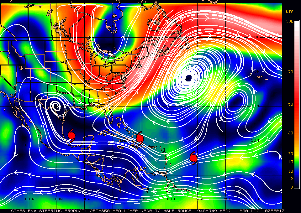
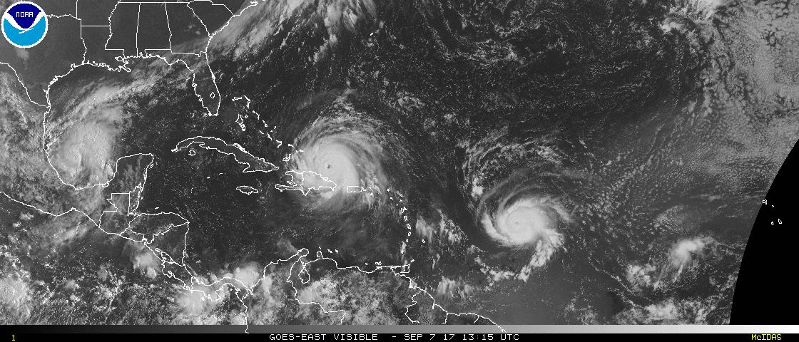
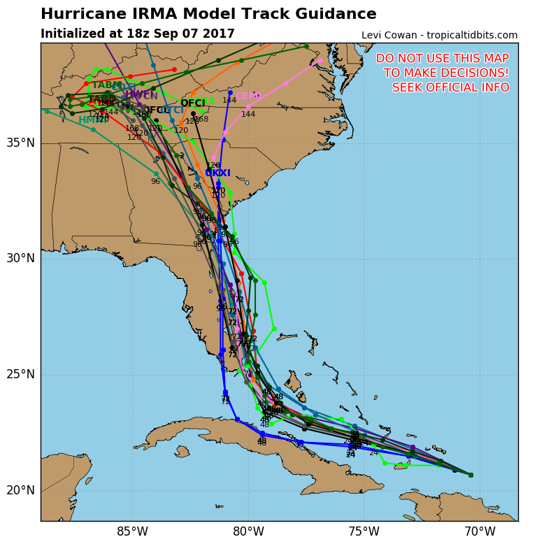
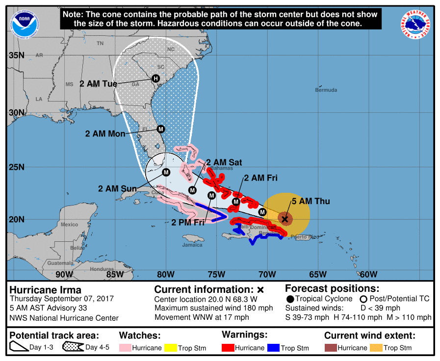
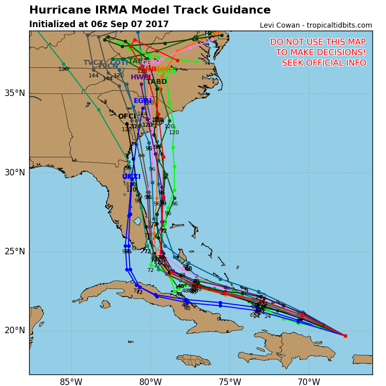
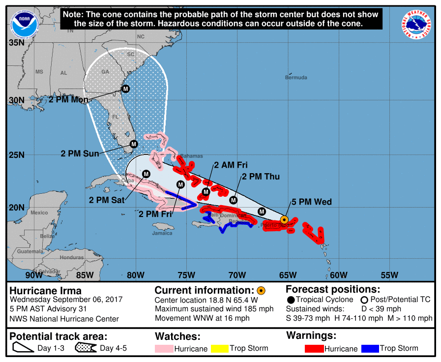
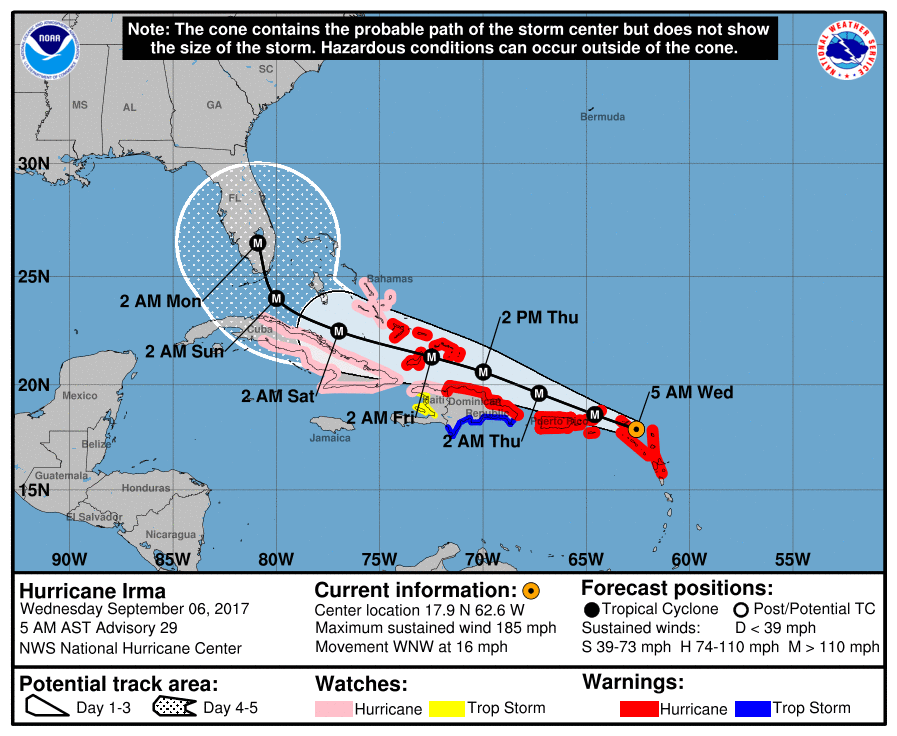
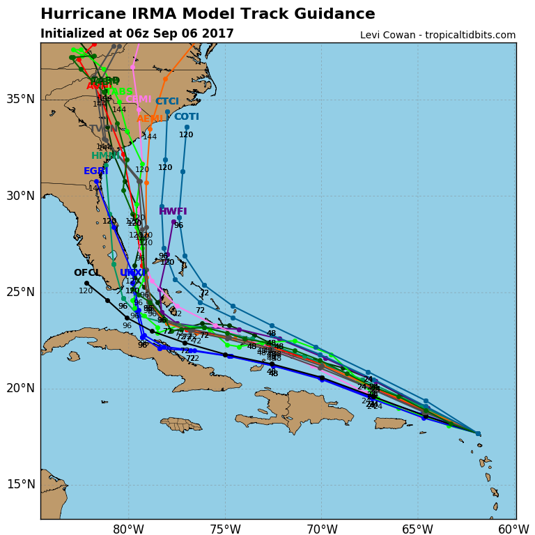
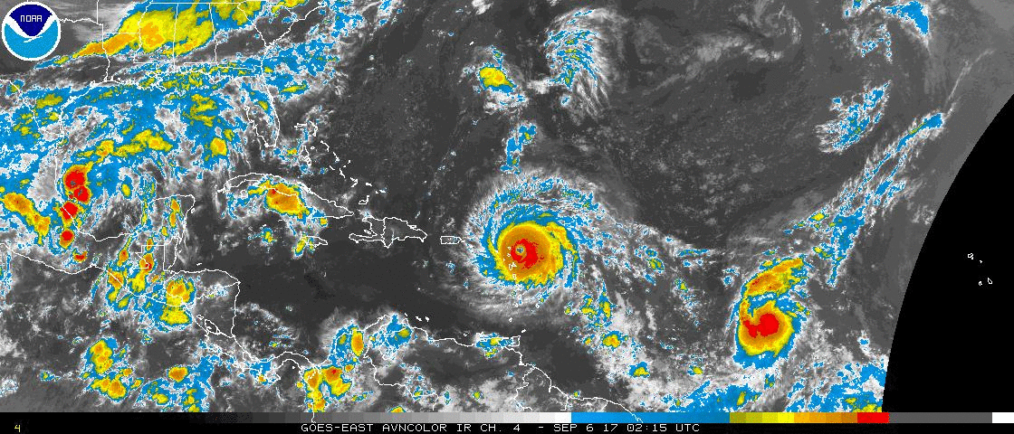
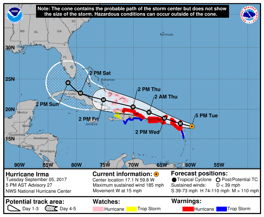
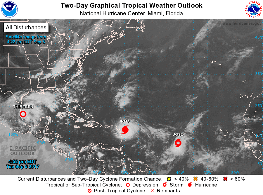
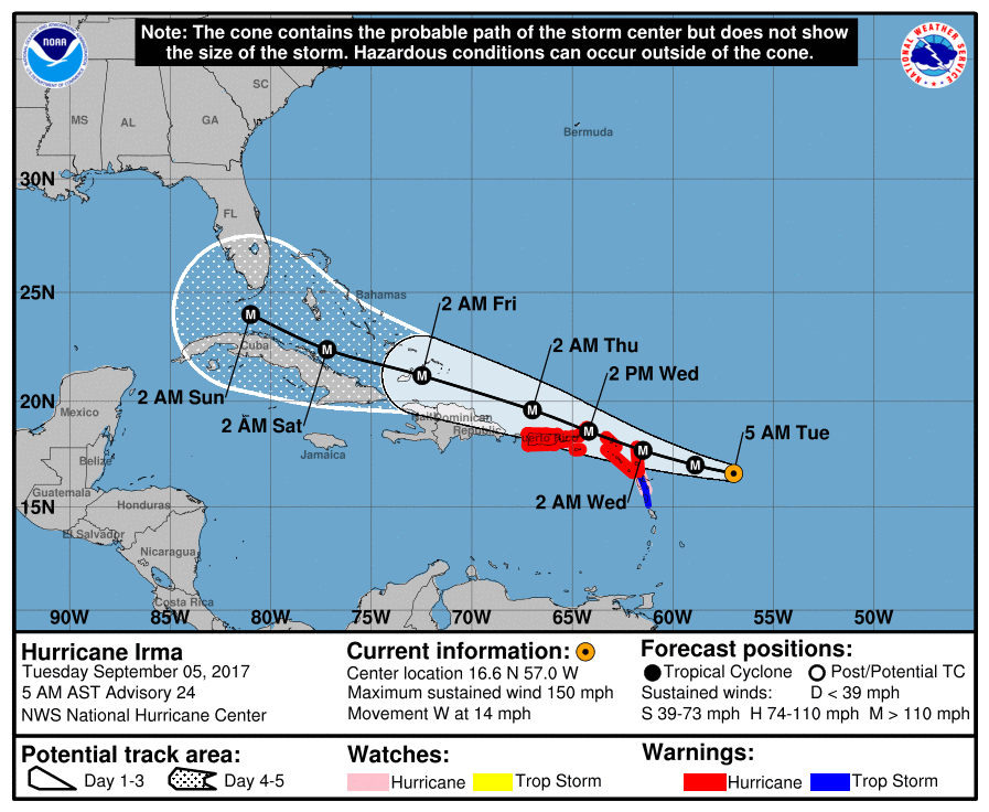
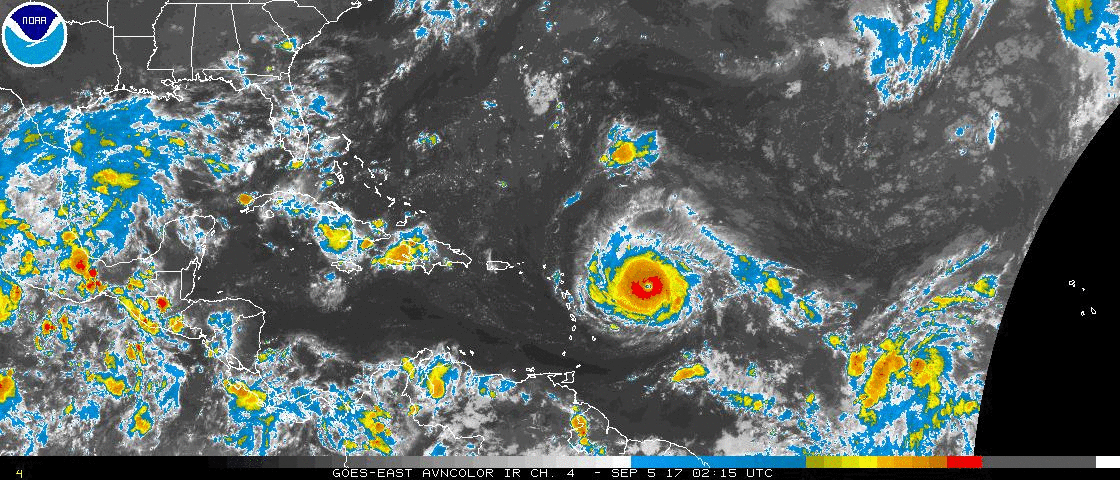
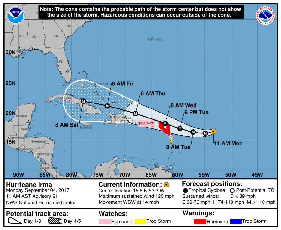
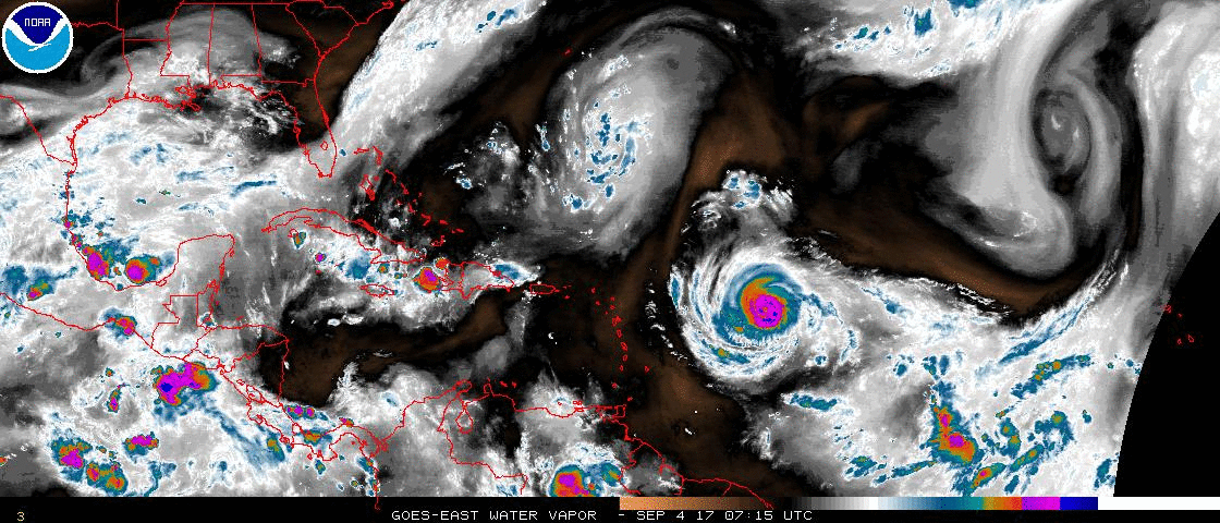
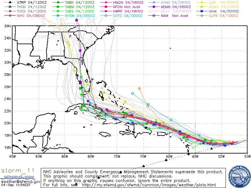
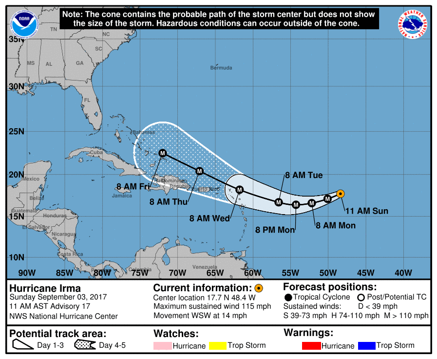
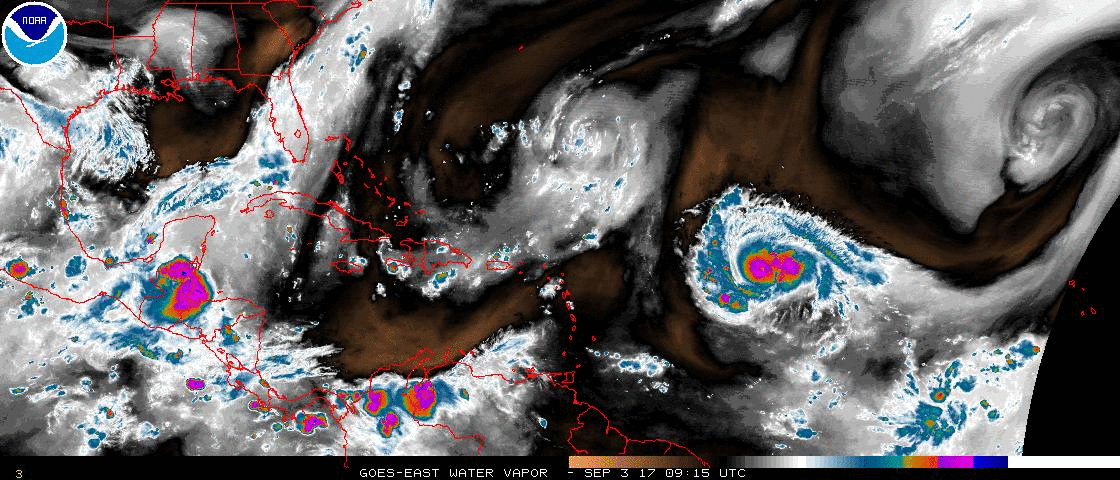
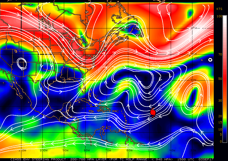
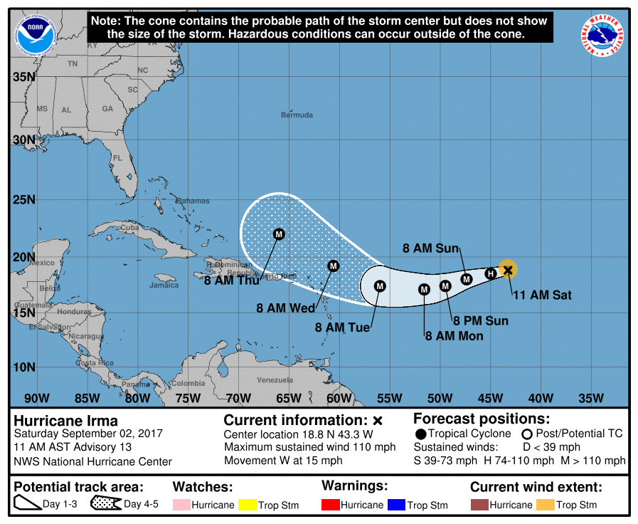
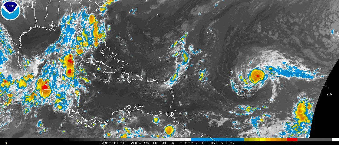
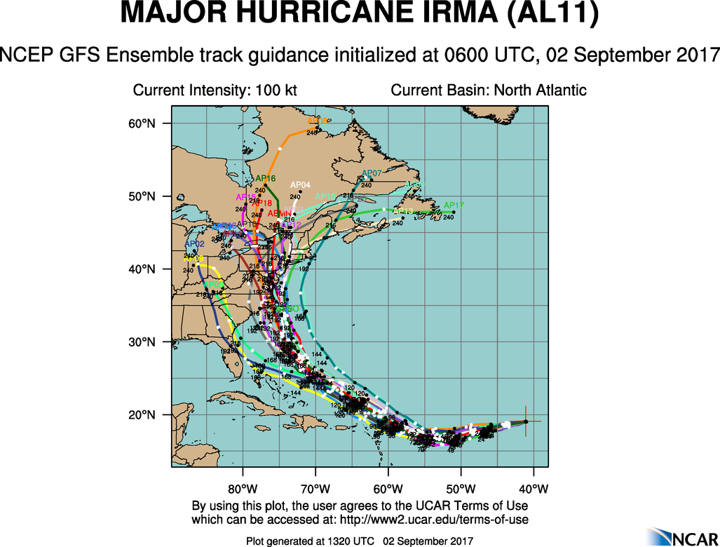
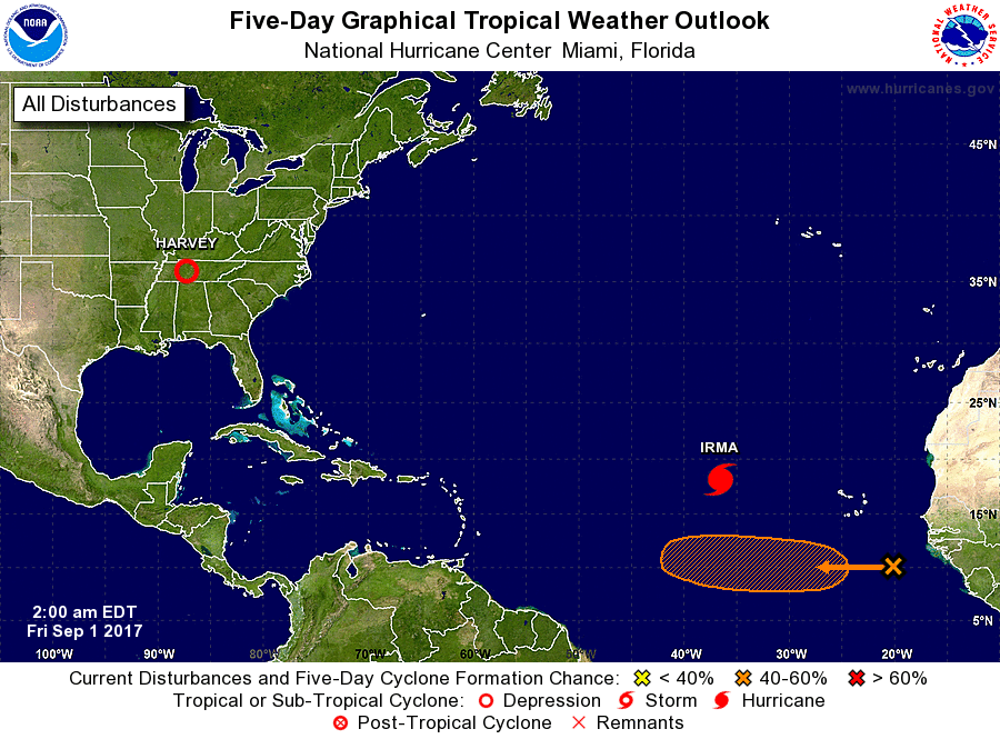
At 5 pm Hurricane Irma was located at 20.9 N & 71.1 W and was moving WNW @ 16 mph. In looking at the Satellite Loop below Irma appears to be moving a little faster and further north than was anticipated yesterday. The NHC however expects it to shift to a little more westerly course tomorrow which could bring it further west than expected yesterday. The net result of this is that the NHC track has now shifted slightly west and currently targets Miami. The fast motion if it persists may allow Irma to move further west before the anticipated northern move occurs on Saturday. The European Model is currently projecting landfall around Naples with a track up the state. In reality not much has changed with Irma. There is considerable spread in the models, see below and there is still a lot of uncertainty as to where the NW-N turn will take her. To the east of Southeast Florida, over SE Florida or to the west coast of Florida. As we've seen they have been fluctuating over all of these possibilities over the past few day. SE Florida however remains at the center of these choices and remains the target of the NHC track. It does not however mean that the center will pass over Miami.
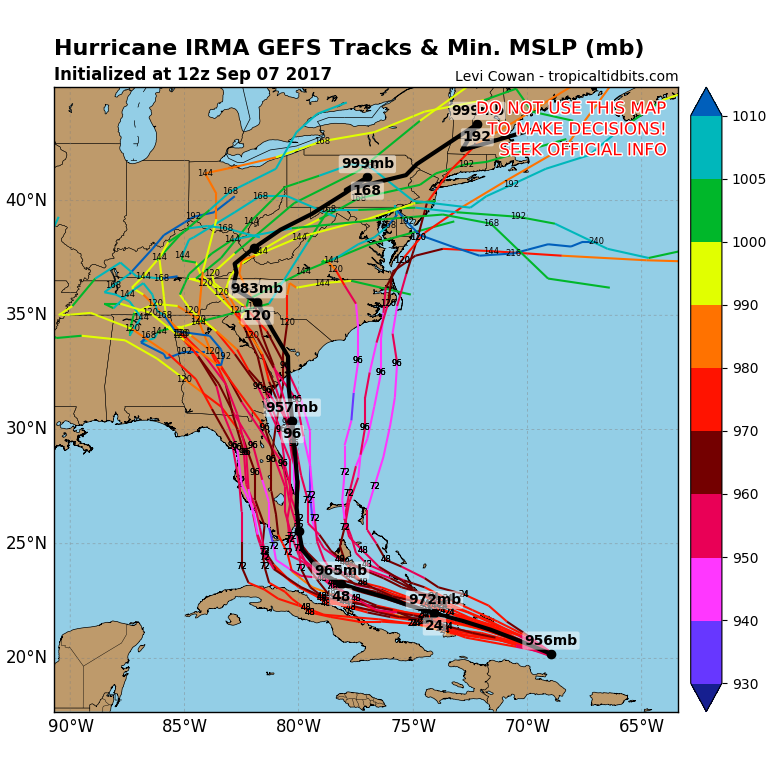
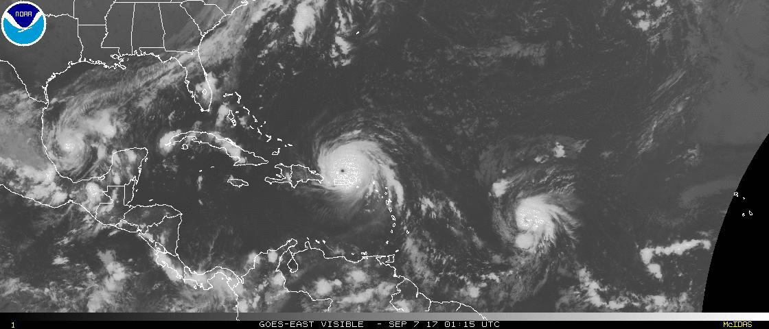
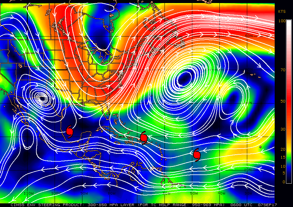
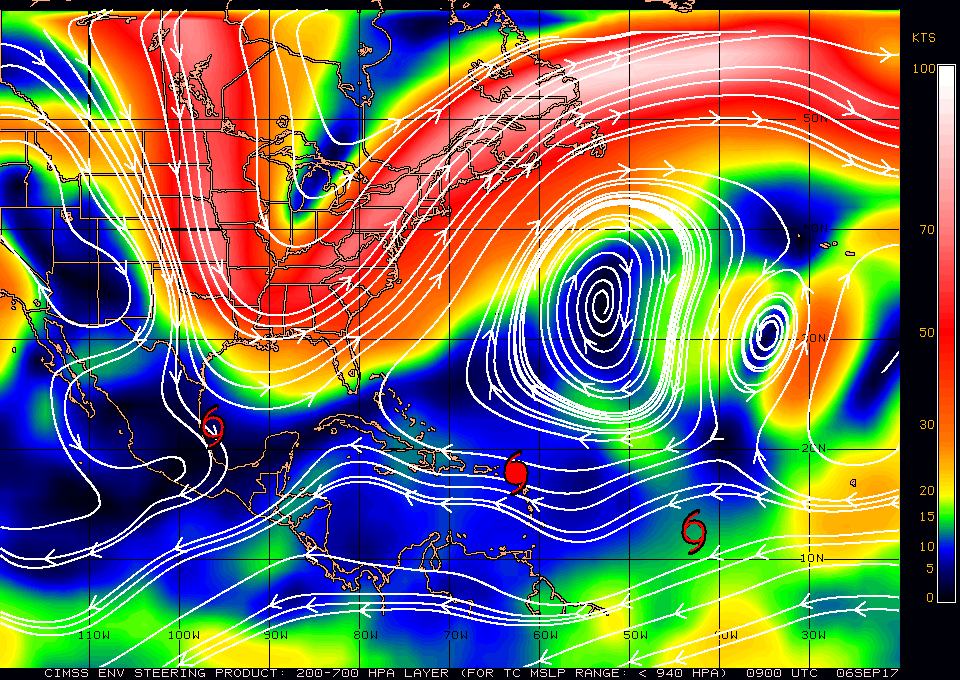
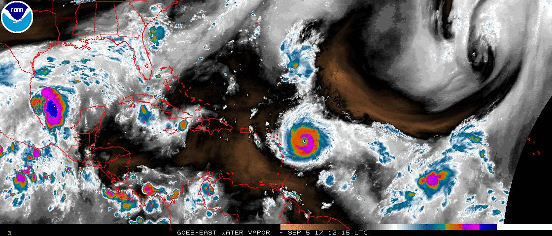
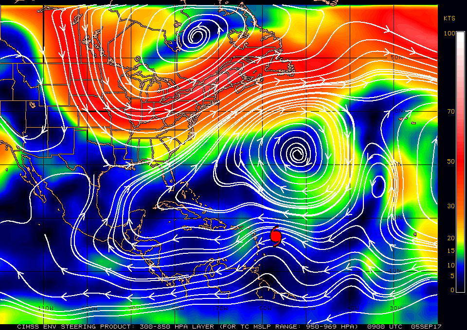
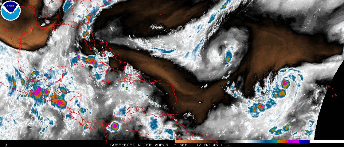
In looking at the Surface Map below all of those options appear possible. To me it still appears to be headed toward Andros Island. My concern is that it may continue straight to Miami or just off shore before turning N. Unfortunately we will probably not know until after the turn starts on Saturday.

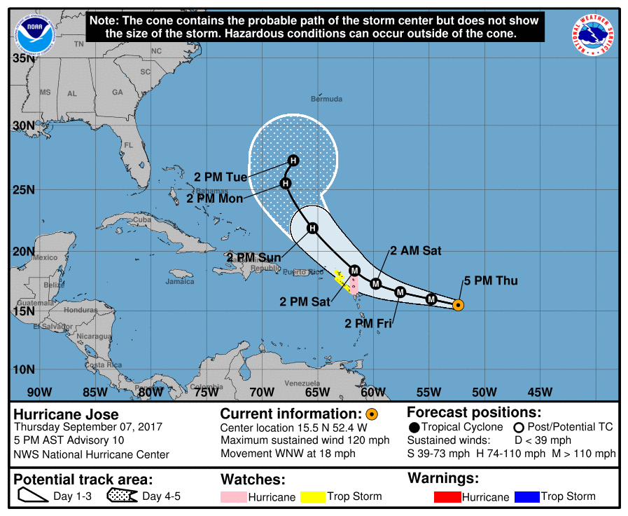
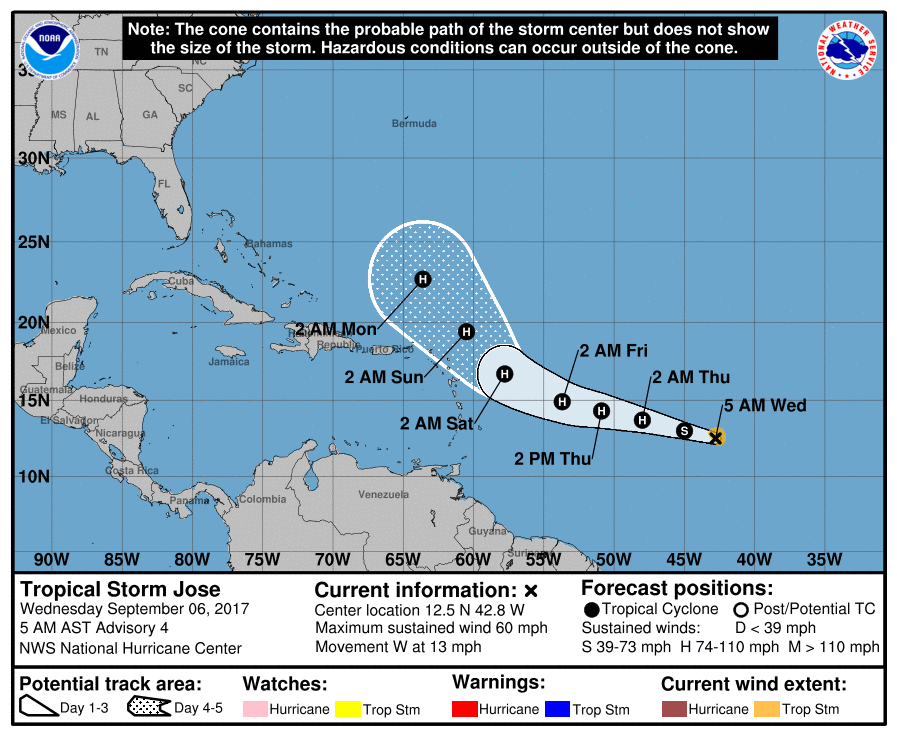
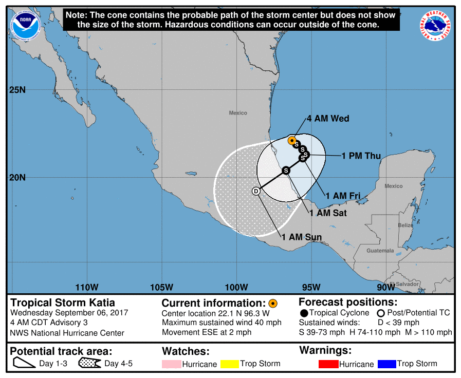
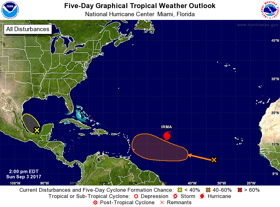
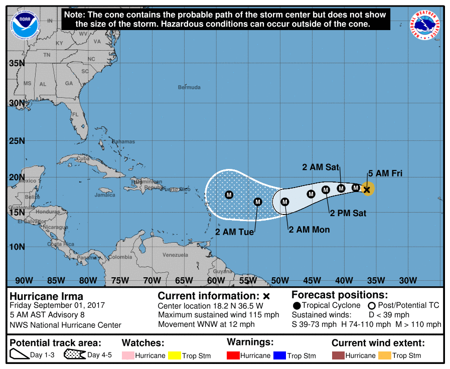
Elsewhere Jose is now a Cat 3 and still remains a potential threat to Bermuda. (See below.)

Starting tomorrow I will begin writing posts throughout the day. As things clarify I will tell you just what  to anticipate as far as winds, timing and which wind directions will be strongest so if needed we can be on the opposite sides in our houses.

Until tomorrow,                                          Matt.

PS. I have not given up hope, there are still several scenarios which spare SE Florida from the brunt of Irma.

Picture
Picture
Picture
Picture
Picture

tropical update Thursday 9-7-17, 5 am

9/7/2017

 
Picture
Good morning.

At 5 am Hurricane Irma was located at 20.0 N & 68.3 W and was moving WNW @ 16 mph. Since last night not much has changed with Irma. It continues to head WNW toward South Florida and the Bahamas. It should remain over warm water in a low shear environment until it is in our area and the NHC is currently calling for it to be a strong Cat 4 with 150 mph winds when it is in our vicinity,  The Global Models have shifted slightly to the E however the NHC has not changed its forecast track as they could shift back to the W. My track has not changed significantly from yesterday and still brings Irma over or just west of Andros Island and Grand Bahama Island. It is going to be a close call for South Florida and we are not going to know just how much weather we are going to receive until late in the forecast period ( ?Saturday am? ). We will probably receive at least tropical storm conditions, possibly much more and we all need to prepare. A few miles either way could make a big difference for us in South Florida.

Elsewhere Jose and Katia are now both Hurricanes, but fortunately are not threatening the US at this time.

I will write again this evening and will probably post frequently Friday, Saturday and Sunday as things develop and will let you know just what to expect as things get clearer.

Until later,                                                       Matt.


Picture
Picture
Picture
Picture

Tropical Update Wednesday 9-6-17, 5 pm.

9/6/2017

 
Picture
Good evening.

At 5 pm Hurricane Irma was located at 18.8 N & 65.4 W and was moving WNW @ 16 mph.
Though it started a little to the south of the NHC forecast track this am it now back on the NHC's track. If this continues it may miss landfalls in Hispaniola and Cuba which could bring a stronger storm towards the US. Computer models have oscillated today and currently center around a track similar to Hurricane Matthew's from last year. Irma however is a much larger and stronger storm than Matthew was and potentially could have much greater effects. The periphery of the high pressure ridge steering Irma shifted further east since yesterday however with time it will drift back to the west. Just where it is when Irma is in our vicinity will determine how much weather we get. With time the accuracy of the Global Models will increase and we will get a better idea of what to expect .

Irma is currently passing just north of Puerto Rico. This am it was heading straight for it however a distinct wobble this afternoon has pulled it far enough to its north that it should avoid the core of the hurricane. They will probably only experience Cat 1, maybe 2, conditions there.

Hopefully Irma will be as gracious to the rest of us and spare us her worst.

Until tomorrow,                                               Matt.

Picture

Tropical Update Wednesday 9-6-17, 7 am

9/6/2017

 
Picture
Good morning.

At 5 am Hurricane Irma was located at  17.9 N and 62.6 W and was moving WNW @16 mph with a barometric pressure of 914 mbs and peak winds of 185 mph. Irma remains a very strong Cat 5 hurricane. Since yesterday there has been a significant change in the forecast track of Irma. If you look at the Surface Map below you will see a trough digging deep into the SE US. This appears to be stronger than anticipated and may be our White Knight. Almost all of the models have shifted significantly to the east because of this. (see third diagram below) The NHC has shifted its track to a worst case scenario track for South Florida however it is well west of the model consensus and lies between yesterday's consensus and today's, being on the conservative side. If this trough continues to push southward and remain strong a recurvature before it reached Florida, east of the Peninsula, would become more likely.
Due to significant shear over Florida when it is in our area it will no longer be a symmetric storm as it is now. The Forecast Advisory when it is in our area currently projects hurricane force winds to extend 50 miles to the east of the center and 40 to the west, strong storm force winds to extend 90 miles to the east and 60 to the west and weak storm force winds to extend 180 to the east and 100 miles to the west of the center. In addition to experience extreme winds over 100 mph it would need to pass within 25-30 miles of you. Note at 4 days out the average error in NHC forecasts is almost 200 miles and expect the tracks to continue to fluctuate. The current risk for hurricane conditions in South Florida is about 30%.
If the trend above continues my new track takes Irma over the northern coast of Puerto Rico today, then along the northern coast of Hispaniola and Eastern Cuba before turning to the  NW and N near Andros Island and Grand Bahama. Once it gets north of South Florida shear will increase and it should weaken and accelerate to the N and NE.

Elsewhere Jose and Katia currently do not appear to pose a threat to the US. (see below)

Hoping the eastward trend continues and maybe moves further east,

                                                                   Matt.

Picture
Picture
Picture
Picture
Picture

Tropical Update Tuesday 9-5-17, 5 pm

9/5/2017

 
Picture
Good evening.

At 5 PM Hurricane Irma was located at 17.1 N & 59.8 W and was moving just north of  W @ 14mph. During the day Irma has been steadily intensifying and is now a strong Category 5. Winds have increased to 185 mph which matches the peak winds of Wilma in 2005 when it set the record for most intense hurricane in the Atlantic Basin with a barometric pressure of 882 mbs and peak sustained winds of 185 mph.
Irma appears to be making a bee line for Puerto Rico. If it should make a direct hit with that intensity it could devastate the island.
My track so far hasn't changed from this am, however if it should remain on the more southerly track and hit Puerto Rico, Hispaniola and Cuba it could slow and a more easterly path, east of Florida could become more possible. The NHC has revised its track a little further south, see above.

We'll just have to see how things develop.

Elsewhere in the Tropics Jose has formed, see below. No way Jose! Jose should pass well to our east and only present a potential threat to Bermuda. In addition a new Tropical Depression #13, has formed in the Bay of Campeche, is expected to meander for a few days. It is pulling a lot of moisture into the air over the Gulf of Mexico and at least for now mostly poses a rainfall risk to southern and eastern Mexico.

I'll write again tomorrow am early.

Until then,                                                 Matt.
Picture
Picture
Picture

Tropical Update Tuesday 9-5-17, 7 am

9/5/2017

 
Picture
Good morning.

At 5 am Hurricane Irma was located at 16.6 N and 57.0 W and was moving W @ 14 mph. Irma is a large and powerful hurricane now with peak winds of 150 mph. It's wind field is much larger than Harvey's was at this time. Irma remains south of where the NHC anticipated it to be yesterday and so far today as well. I anticipate models will continue to shift a little southward.
My current track, south of the NHC's, takes Irma into the extreme NE Caribbean, over Puerto Rico, over the north coast of the Dominican Republic and along or over the north coast of Cuba. Due to weakness of the southern end of the frontal trough over Florida a recurve to the east of Florida is becoming unlikely. In looking at the Surface Map below the problem for Florida and the US will be when the recurve to the N and NE occurs. Currently the west coast of Florida appears to be at greatest risk. ? Ft Myers to Tampa? If it hits the DR and Cuba it would be a much weaker system, The high pressure north of it is expected to shift a little to the west, which could bring it further west before it recurves. It will recurve and a Florida landfall appears likely. It is still early and things could change. If it tracks down Cuba and slows a turn further east is possible. On the current NHC track, and mine, South Florida would receive peak winds in the 40s-50s. If it recurved earlier and came in over Naples or Florida Bay, South Florida would receive hurricane conditions.

We're just going to have to wait and see. For now we should all make preparations for at least a  tropical storm. Because it will be fairly close to us when the recurve occurs and we may be in weather when it occurs, we should probably prepare for a hurricane as well, though hopefully South Florida won't experience one.

I'll write again this evening and will probably go to twice daily reports until it is past us.

                                                                         Matt

Picture
Picture

tROPICAL uPDATE Monday 9-4-17, 11 AM

9/4/2017

 
Picture
Good morning.

At 11 am Irma was located at 16.8 N & 53.3 W and was moving W @ 14 mph and is currently headed toward the Northern Leeward Islands, The British Virgin Islands and The US Virgin Islands. Pressures have been dropping and winds have increased some. Since yesterday a few things have happened with Irma. First is that it is south of where the NHC had predicted it to be at this point in time and as noted yesterday the models have shifted to the south. It is supposed to be at its southern most latitude late tonight. Over the past 3 hours Irma has been headed due west. This may be a wobble however if it is an early turn that would be good and if it is a shift in the models to the north and east would be anticipated. It is too early to say. If it should enter the Caribbean and pass over or south of Cuba the risk for South Florida would be greater. If it passes north of the Islands and stays south a track similar to Matthew's from last year is possible. It is still 6 days out. The current NHC track is unlikely to occur. The southern end of the frontal trough over Florida has weakened which could allow it to move further west.

We'll know a little more tomorrow.

Until then,                 Matt.


Picture
Picture

Tropical update Sunday 9-3-17, 2 pm

9/3/2017

 
Picture
Good afternoon.

At 11 am Hurricane Irma was located at 17.7 N & 48.4 W and was moving WSW @ 14 mph. Since yesterday a few things have happened with Irma. Most notably its WSW move has begun and it has already moved south 1.3 degrees from its northern most location so far of 19.0 N. Tomorrow night it is expected to reach its southern most point before beginning its WNW move. Just how far south it goes will be key in determining its ultimate location(s) of landfall. In general the further south it goes the greater the risk for Florida and the East Coast of the US. It is forecast to get to around 16.5 N. If it is much further south than that expect the models to shift to the south and west. (They have already shifted a little to the south today.) The converse if it turns earlier. If it were to enter the Caribbean South Florida could be at risk. On water vapor loop notice that the front across Florida has moved a little further east. This would be good as long as it stays to our east. If it should get south of South Florida it could draw it towards it. (see surface map below). We should know by Tuesday morning.

Elsewhere in the tropics the wave SE of Irma remains poorly organized however the NHC has given it a medium chance of developing in the next 5 days (see bottom chart).

*** Note the NHC tracks over 48 hours out have a high degree of uncertainty. Don't let them psyche you out. They are just lines on a graph and have no influence on the storms themselves. They will certainly change and fluctuate going forward.

Until tomorrow,                   Matt.

Picture
Picture
Picture

Tropical Update Saturday 9-2-17, 11 am

9/2/2017

 
Picture
Good morning.

At 11 am Hurricane Irma was located at 18.8 N & 43.3 W and was moving just south of west at 15 mph. Due to somewhat cooler water and dry air around it , see below Sahara Air layer image, it has weakened a little and is now a Cat 2 storm. This will be temporary as conditions will become more favorable as it approaches the Leeward Islands and the Bahamas. In looking at the Infra Red loop below you can see a frontal trough has moved a little eastward and is now across NW FL extending into the eastern Gulf of Mexico. This should help to keep it away from Florida. The main concern for Florida would be if Irma would slow down, building high pressure over the Atlantic could shift it westward. This is expected to occur later in the forecast period and which is why models are suggesting a more westward move toward the US east coast after it is past Florida. (see Ensemble models below). It is still too early to make an accurate prediction as to ultimate landfall for Irma. There are numerous variables in play which are in constant flux. For now the risk for Florida appears to be lessening however we'll just have to see.

I'll be writing daily for now. Elsewhere the wave to the SE of Irma has weakened, but I'll continue to keep an eye on it.

Until tomorrow,                         Matt.
Picture
Picture
Picture

Tropical Update Friday 9-1-17, 7 am

9/1/2017

 
Picture
Picture
Good morning.

At 5 am Hurricane Irma was moving WNW @ 12 mph, see above, first diagram. Yesterday am the models of Irma were trending southward however due to steady WNW motion over the past 24 hours they are now trending northward which may be good news for us all. An upper level low in front of Irma is moving SW, (see above, second diagram, Water Vapor Loop) which could shift her slightly more northward. The key will be if Irma enters the Caribbean or not. Yesterday it was looking likely, today that is not the case. If Irma stays north of the Caribbean a track through or near the Bahamas followed by a turn to the N and then NE near or along the Coastal Carolinas, hopefully missing the US, would be more likely. If it enters the Caribbean a track toward the NE Gulf Coast would be more likely.


Elsewhere in the tropics one of the other Tropical Waves over Africa has emerged off the coast. see below. This one is significantly lower that Irma, about 10 degrees and has a much greater chance of getting into the Caribbean. This is the one we'll really need to keep an eye on. It is almost 2 weeks away and the weather patterns will certainly change by then. We'll just have to see.

*** FYI waves coming off of Africa between 10 and 12 degrees N latitude are the ones which pose the greatest potential threat to South Florida. Those are the ones with the greatest chances of getting into the Caribbean and getting south of us. Note due to the Coriolis Effect all storms want to move north. They only move in other directions when something is preventing them from moving north. ***

Have a good weekend and I'll keep you posted.   Matt.

Picture
<<Previous
Forward>>

    Categories

    All
    Preseason Update