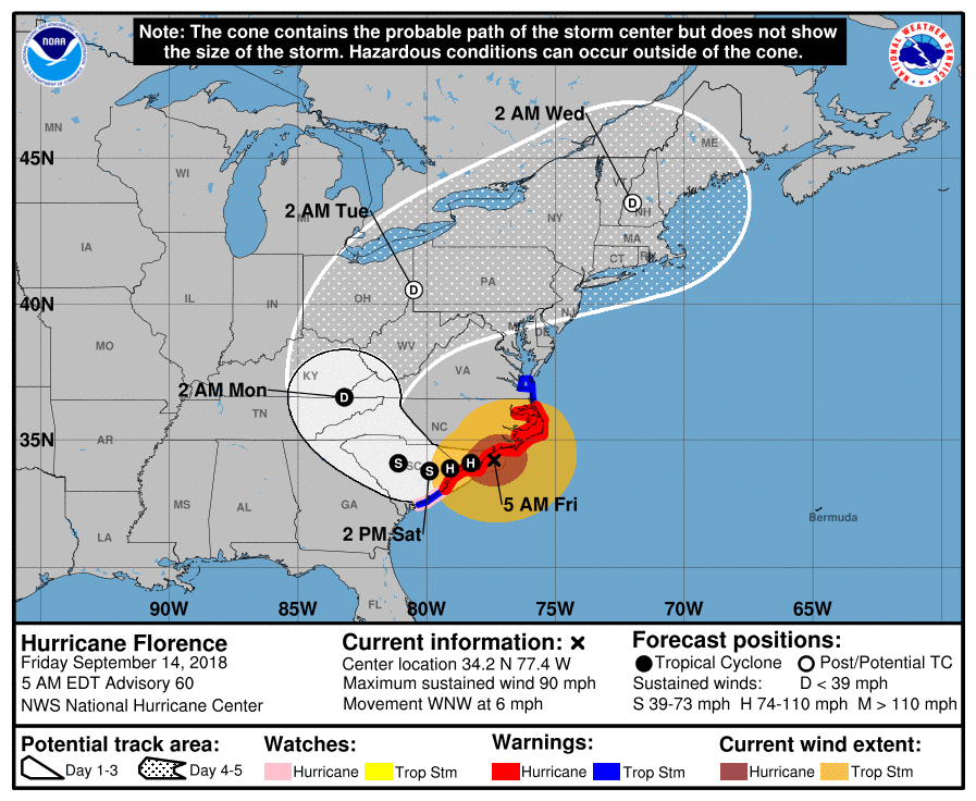
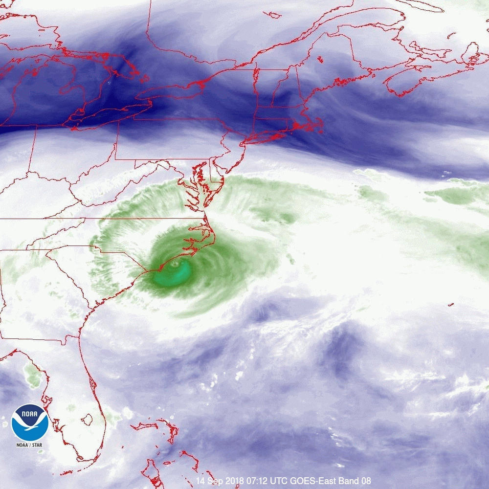
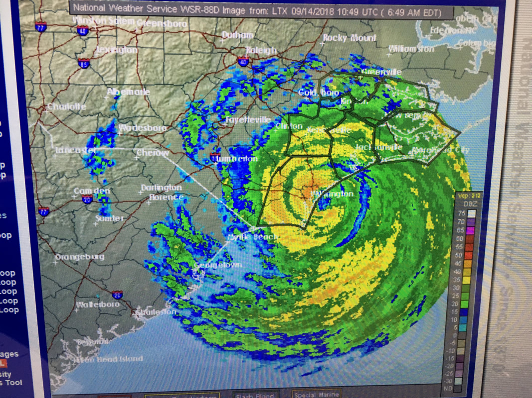
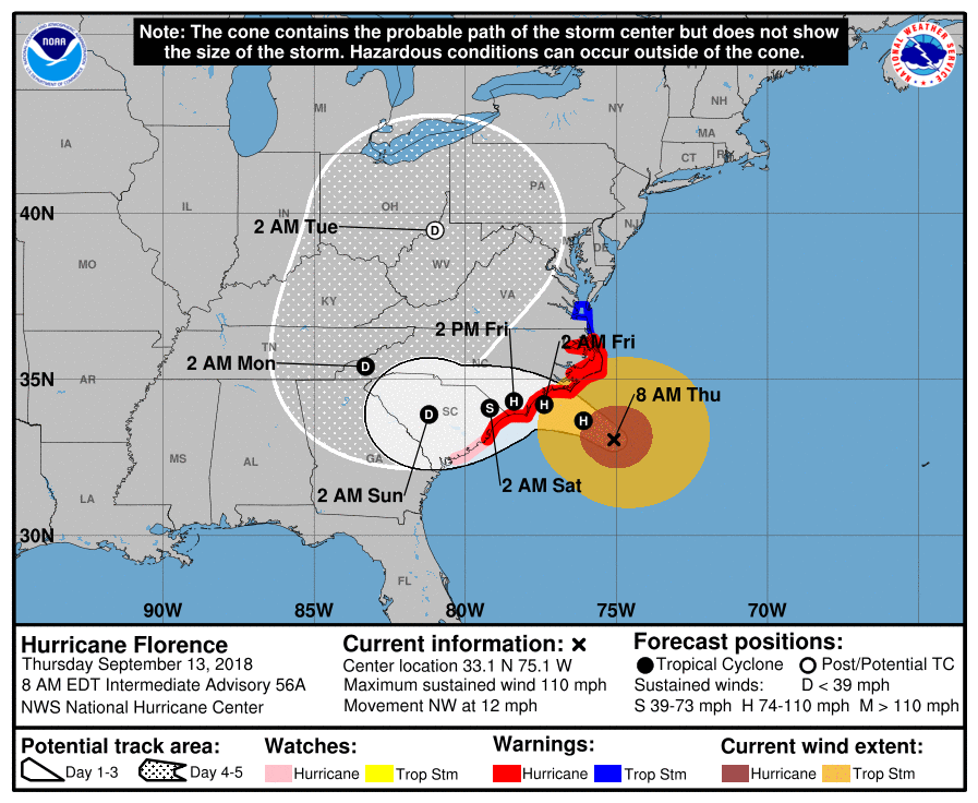
Good evening.
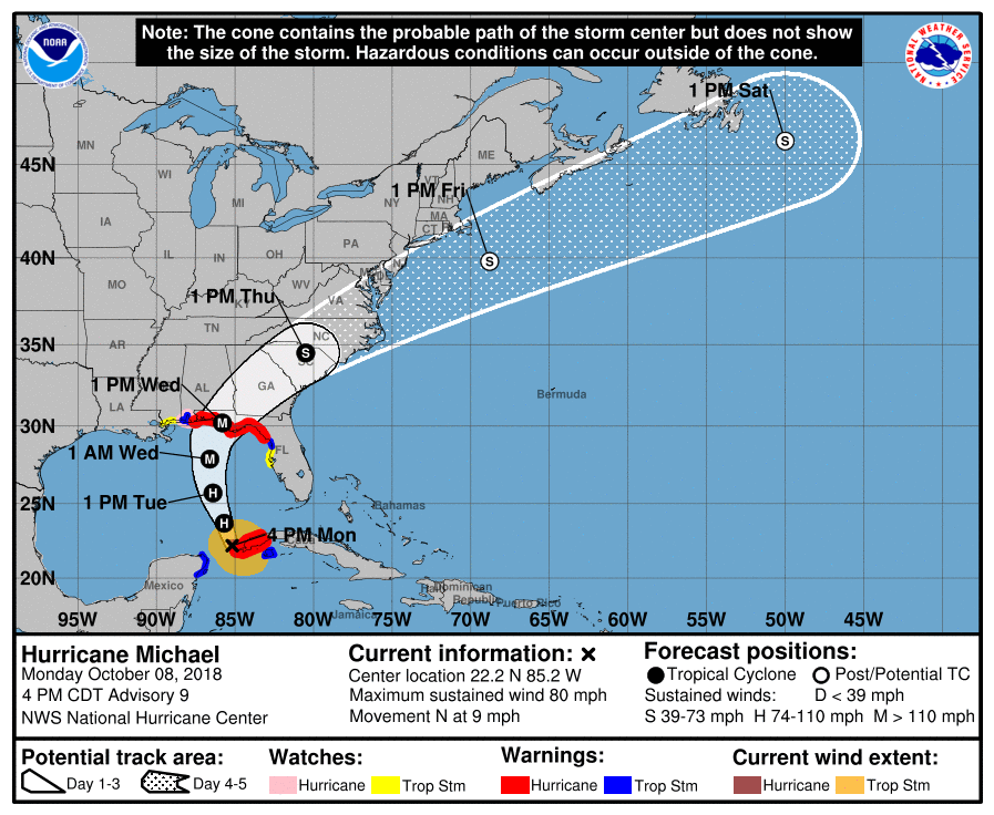
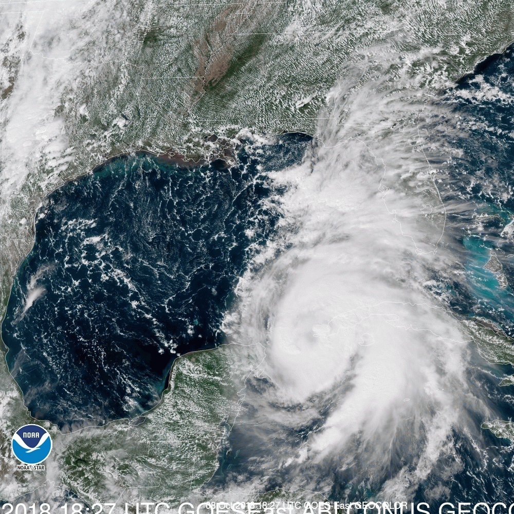
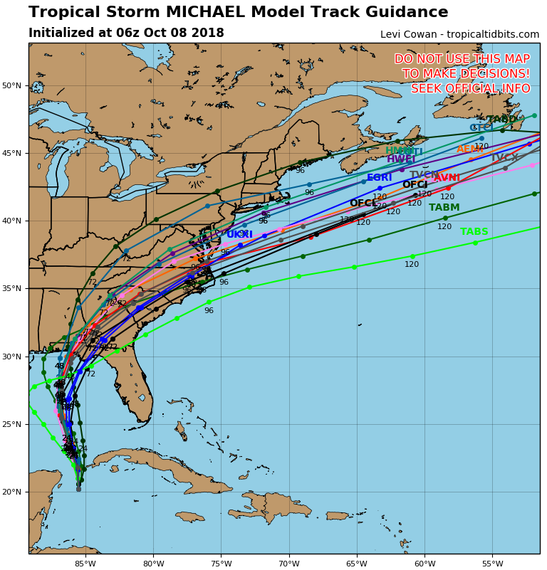
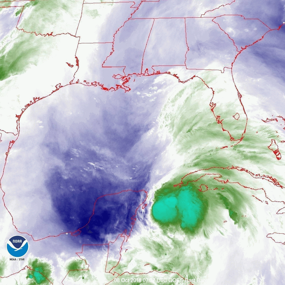
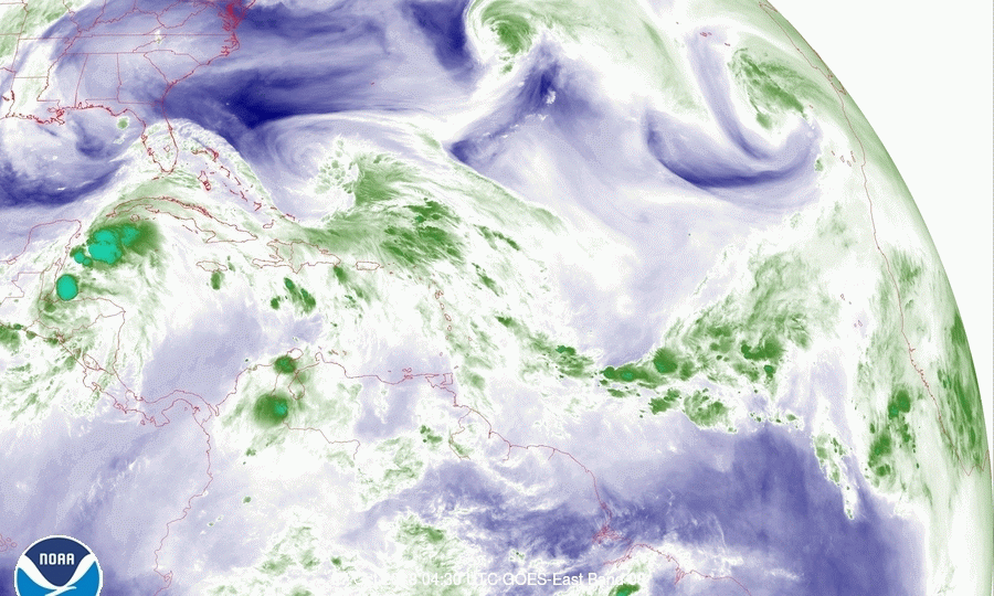
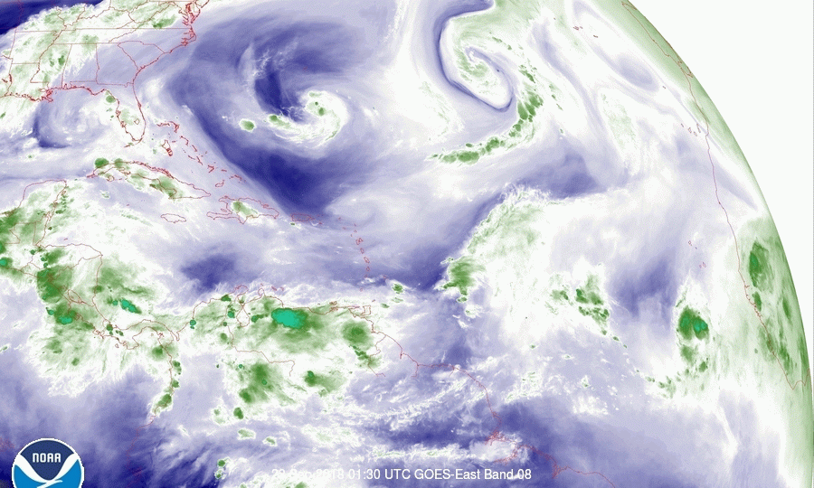
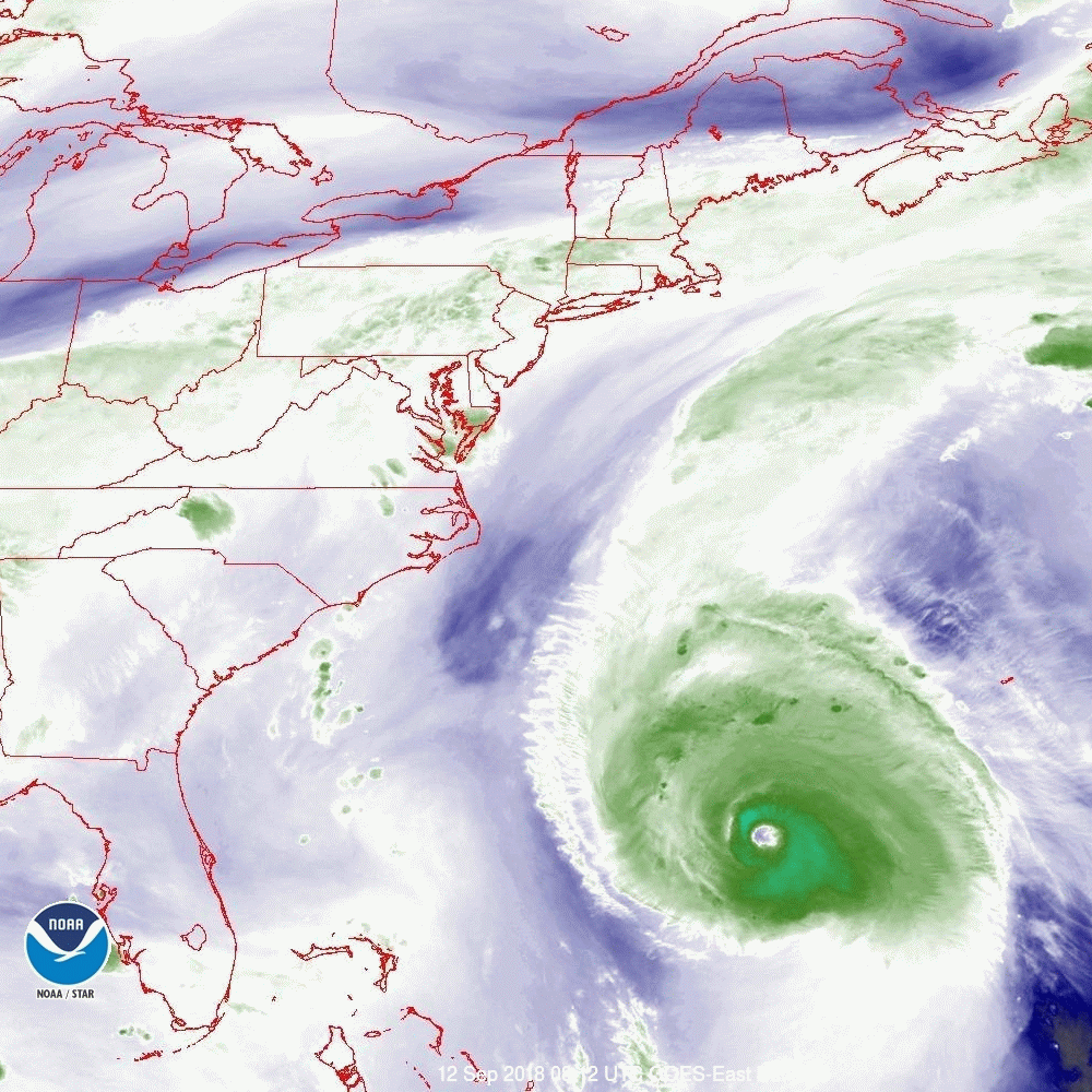
Michael was upgraded to a Cat 1 hurricane this morning as expected. Pressures have been dropping steadily through out the day and winds are currently 80 mph. Hurricane Michael is expected to reach Cat 2 status early tomorrow and Cat 3 tomorrow night or Wednesday. I've attached a current color satellite image which is interesting. You can see the deep convection near the center as well as surface winds out of the east and SE and upper level winds out of the SW. You can also see the frontal system slowly advancing from the west.
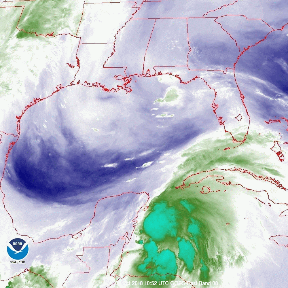
It continues to head toward the Florida Panhandle and the area around Panama City currently appears to be at greatest risk. I anticipate that a distinct eye should appear tomorrow which will make it easier to track.
I'll write again in the am, Matt.
Michael was upgraded to a Cat 1 hurricane this morning as expected. Pressures have been dropping steadily through out the day and winds are currently 80 mph. Hurricane Michael is expected to reach Cat 2 status early tomorrow and Cat 3 tomorrow night or Wednesday. I've attached a current color satellite image which is interesting. You can see the deep convection near the center as well as surface winds out of the east and SE and upper level winds out of the SW. You can also see the frontal system slowly advancing from the west.
It continues to head toward the Florida Panhandle and the area around Panama City currently appears to be at greatest risk. I anticipate that a distinct eye should appear tomorrow which will make it easier to track.
I'll write again in the am, Matt.