Matt on the Tropics
Tropical Updates
  • Home
  • About
  • Archive (pre-blog)
  • Contact
  • Weather Links
  • Weather Trivia

Tropical update monday 9-2-19, 5:30 am

9/2/2019

 
Good morning.

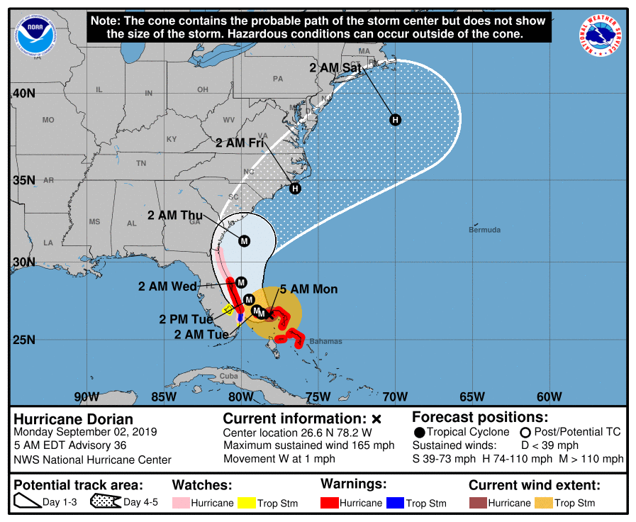
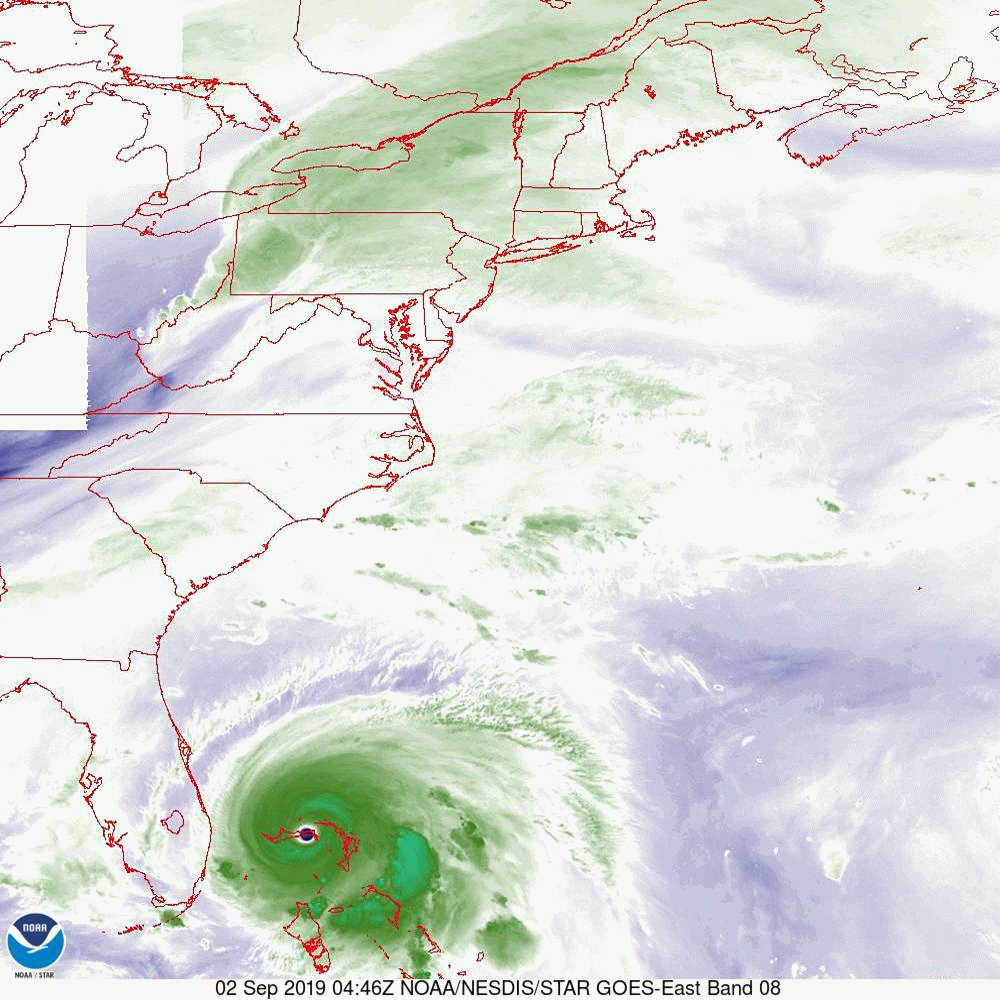
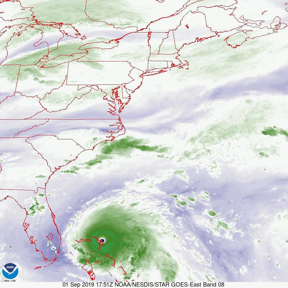
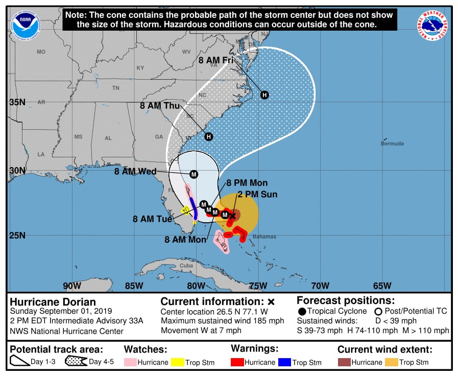
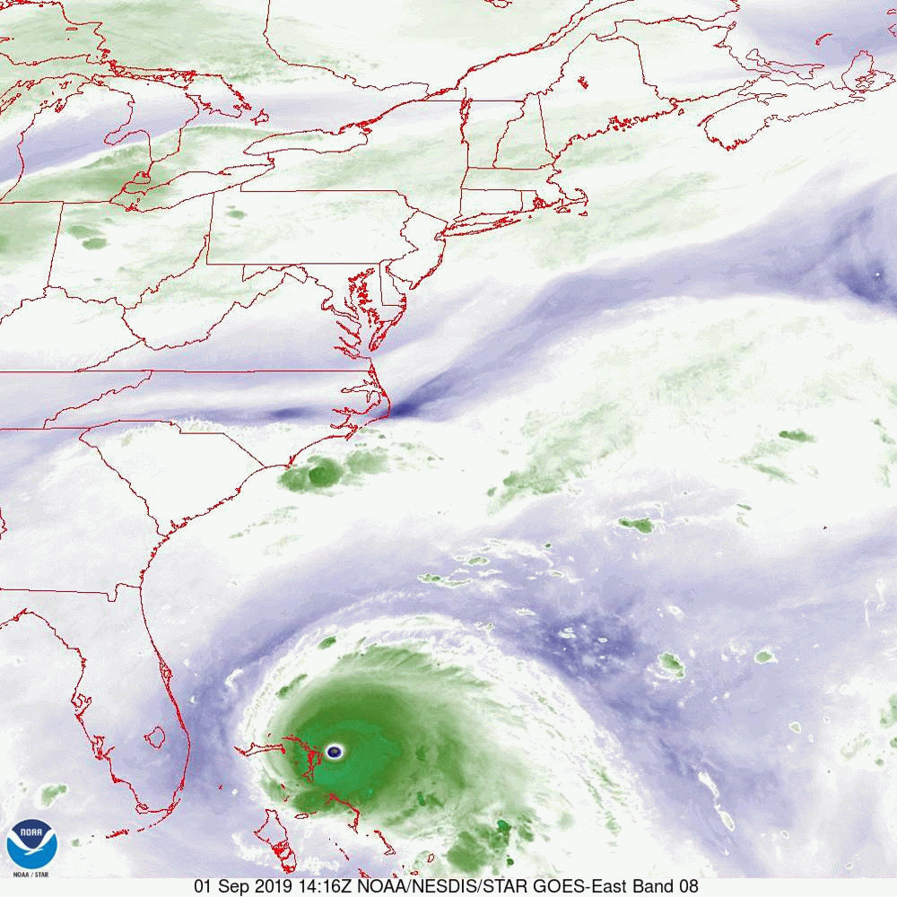
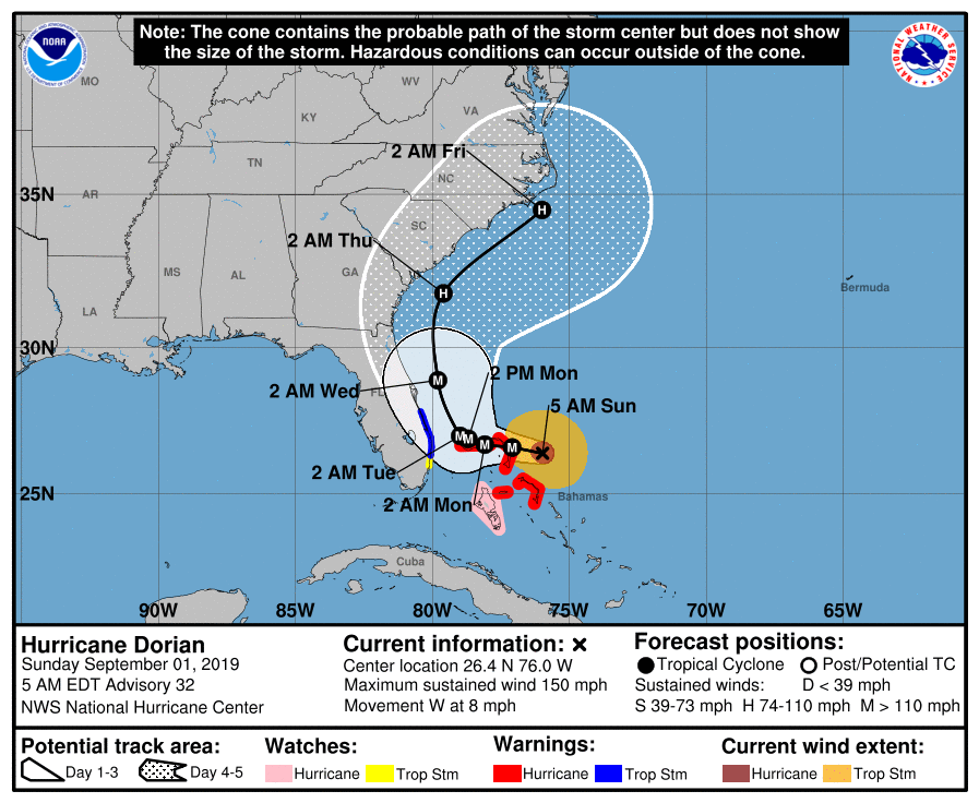
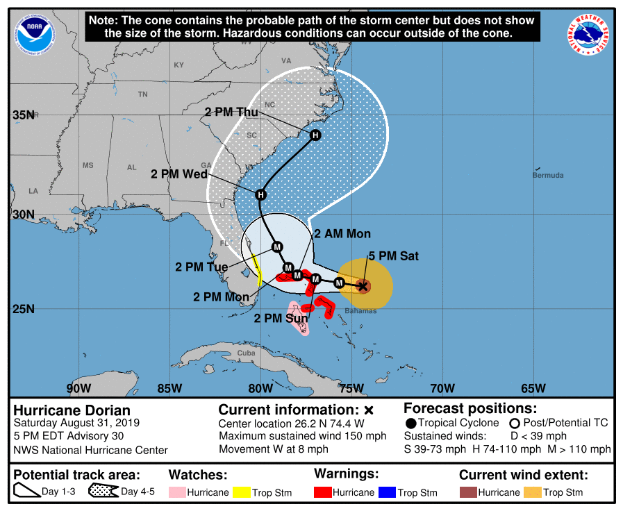
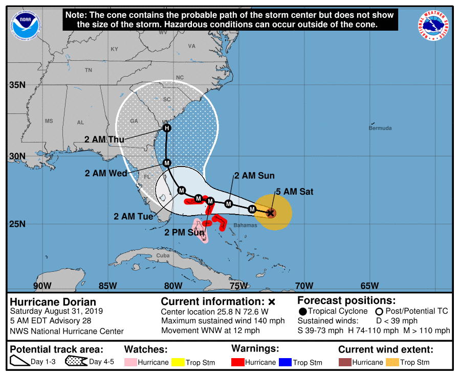
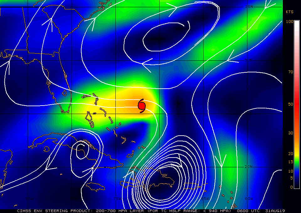
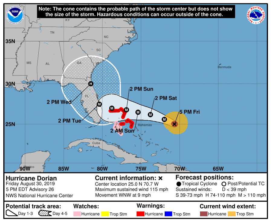
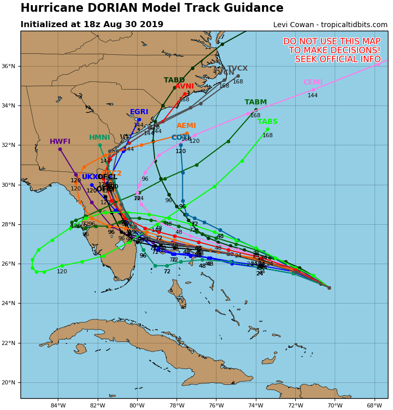
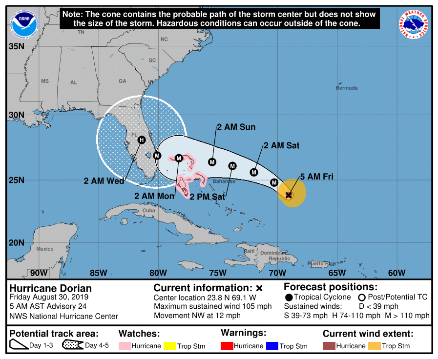
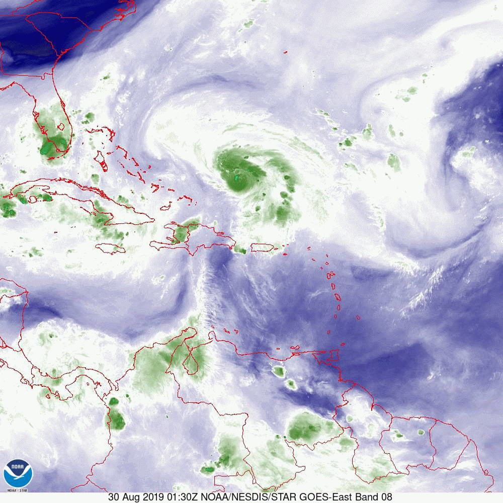
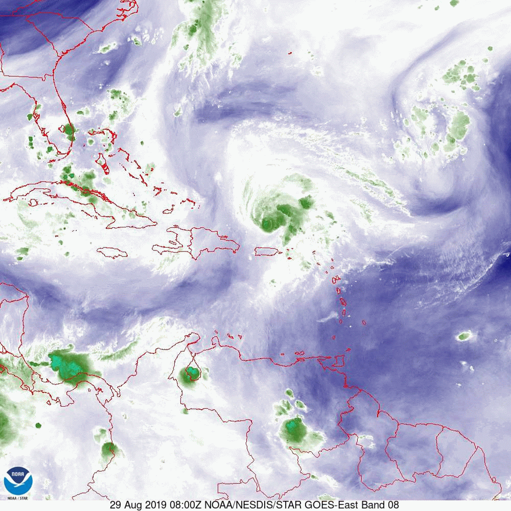
 In looking at the water vapor loop this morning you will see that Dorian has stalled over east central Grand Bahama Island.  It is currently approximately 150 miles to the east of Hutchinson Island.  It should wobble in this area today and tomorrow start moving north west then north and north east. The NFC East track has shifted slightly west however note it is further west than the model consensus. The model consensus brings Dorian approximately 50 miles from the coast.  Dorian’s eye has expanded to 20 nautical miles today from 10 nautical miles yesterday. Dorian’s wind field  has expanded some.  Hurricane force winds extend 30 miles to the west of the center, strong tropical storm force winds in the 50 to 70 mile an hour range extend 50 miles to the west of the center and storm force winds 80 miles to the west of the center. Major hurricane force winds extend 15 miles from the center. If it remains on the NHC‘s track it will be too close to call as to whether some parts of the state may experience hurricane conditions.  Because of this areas from Jupiter and north should prepare for possible hurricane conditions.  Most of the East Coast will experience a tropical storm. If it remains 50 miles off shore, in line with the model consensus it would be good. Dorian remains a threat to the Outer Banks.

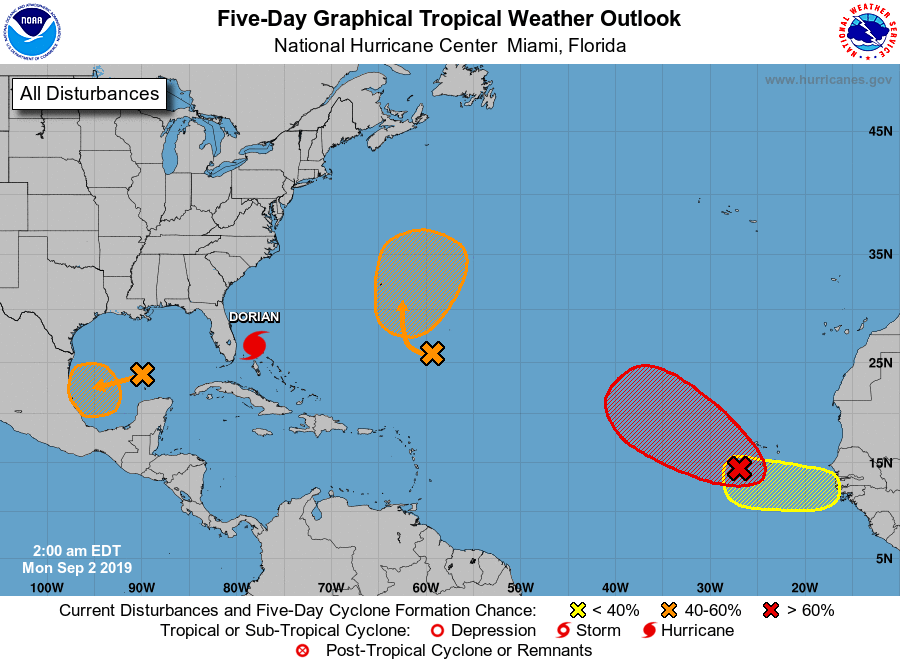
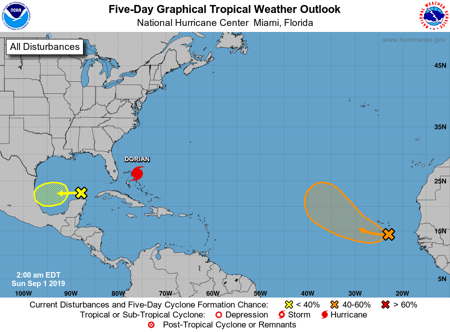
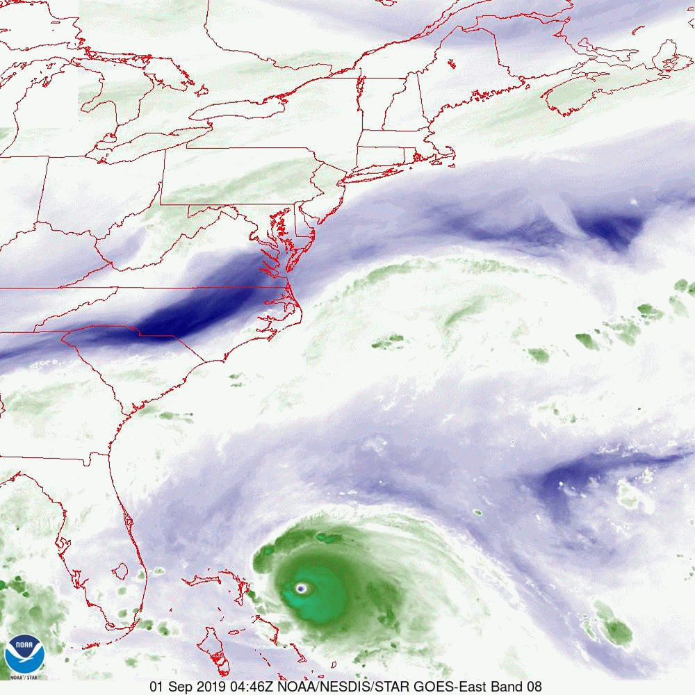
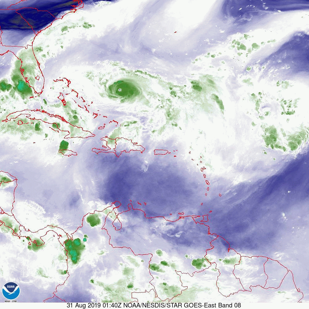
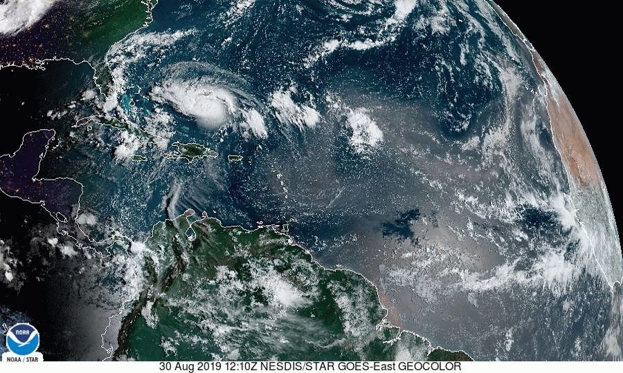
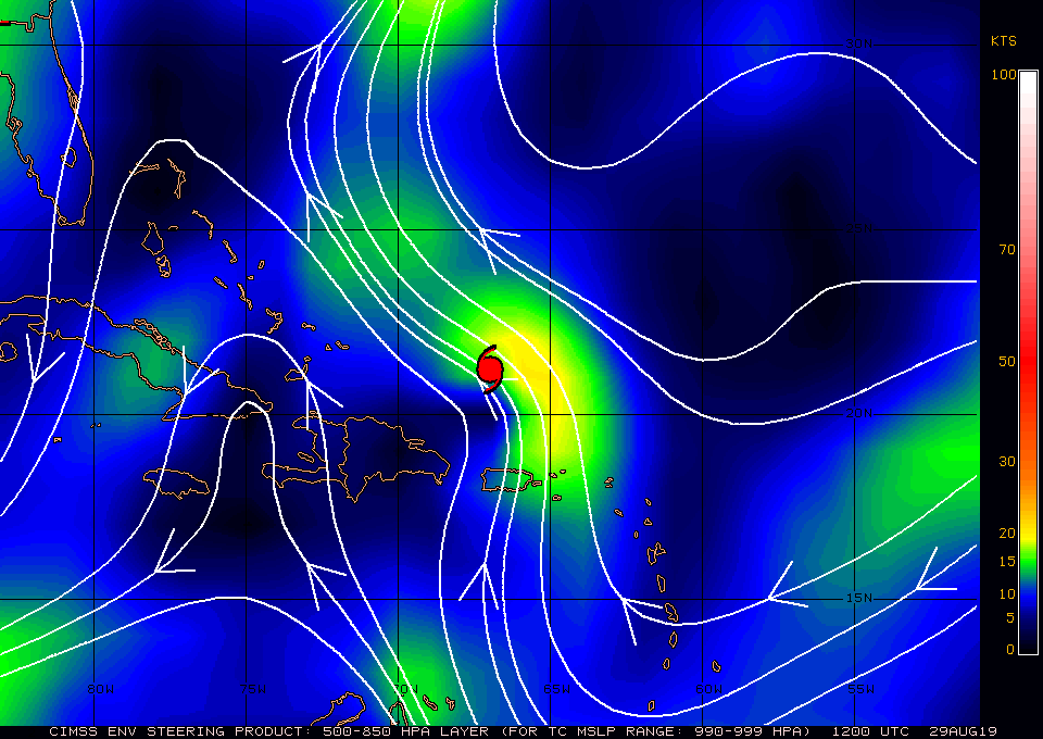
 if you look at the bottom diagram you’ll see that there are several new areas of interest however none pose a threat to the US at this time. 


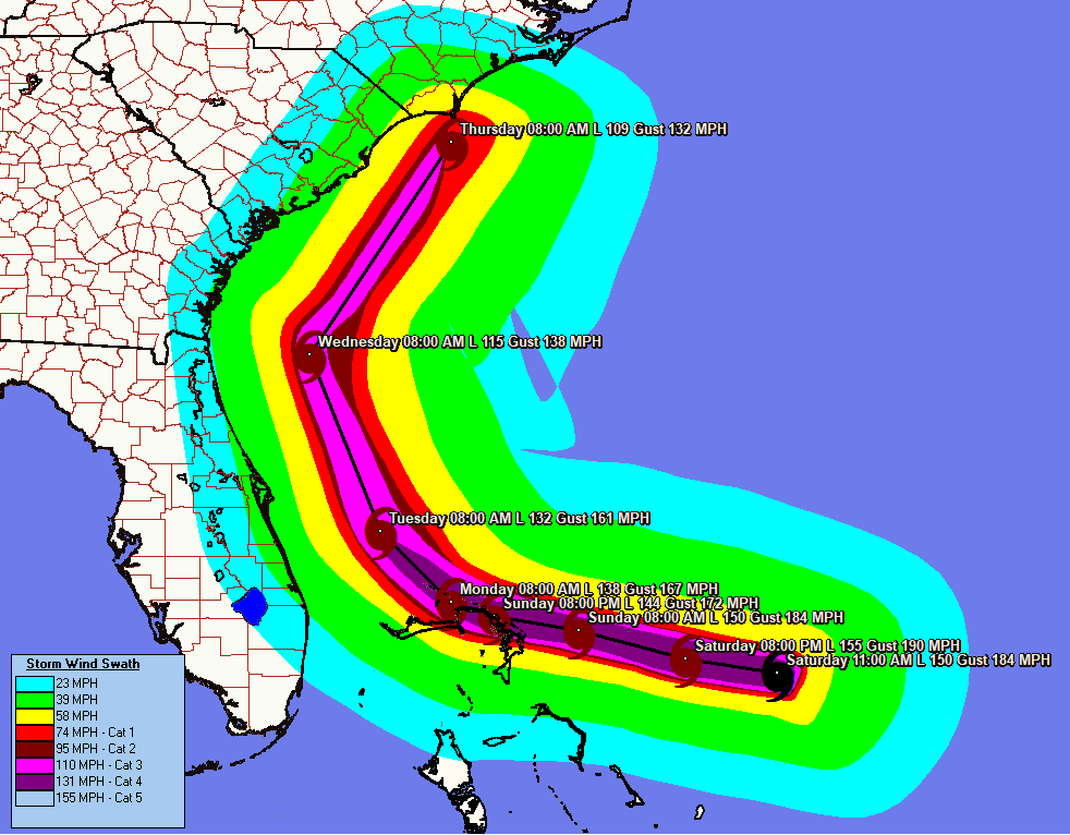
I will write again this evening and will post a diagram of the wind field projections later this morning when it becomes available. 

Until later,  Matt.
​
Picture
Picture
Picture
Picture

Tropical update sun. 9-1-19,  6 pm

9/1/2019

 
Good evening.

Rearding the 3 pm update. Dorian wobbled north of Great Abaco however the smaller islands to its north did not present enough resistance to deflect it. It gained about 7 miles of north latitude but not enough to alter the NHC’s track which has not changed since this am. It has however slowed significantly, down to 5 mph as of 5 pm. A good sign.

I’ll write again early tomorrow with what to expect weather wise. At this time I do not anticipate any significant weather for Miami-Dade Country. Winds in the 10s -20s with scattered showers. More to the north, how much? We’ll see.

Matt.
​
Picture

Tropical Update sunday 9=1-19, 3 pm

9/1/2019

 
Good afternoon.

At 2 pm Dorian was located over Marsh Harbor on Great Abaco. Peak sustained winds were 185 mph with a barometric pressure of 910 mbs. Currently a very interesting phenomenon may be taking place. If you look at the water vapor loop below you will notice Dorian taking a distinct wobble to the north.  This may be a simple wobble however it may be a move along the contour of the islands due to a land / storm friction interaction. The result of this, if it persist, Dorian may skirt the north east coast of the Abacos and re-emerge in the Atlantic on a course 20 to 30 miles north of its projected course. This would have a significant impact on lessening the risk to Grand Bahama as well as Florida. We’ll just have to see if this motion persist or as stated is a simple wobble. 

This phenomenon has occurred several times in the past most recently was with hurricane Maria in 2017 as it took a decided westward wobble over Xiques Island which deflected it into the isle of Puerto Rico it was on a course to pass just to the east of the island prior. This also happened with hurricane Ivan in 2004 on its approach to Jamaica. It’s course mirrored the coast line of southern Jamaica missing landfall on the island. This can only occur when the angle of incidence is acute enough, steering forces weak enough and forward speed slow enough where this is allowed. Those conditions exist now.

We should know by later this evening. I have my fingers crossed.

Matt.

PS. Magnify the image of Dorian in the loop to see.
Picture
Picture

Tropical update sunday September 1st, 2019, 11 am

9/1/2019

 
Just a brief update on Hurricane Dorian, which has reached a new milestone. At 11 am, it was about to make landfall on Great Abaco as a Category 5 hurricane with peak sustained winds of 180 mph,  an eye diameter of 15 nm and a barometric pressure of 913 mbs. This makes it the most intense hurricane in recorded history to hit the Bahamas. Note Hurricane Andrew hit South Florida  8-24-92 with a barometric pressure of 922 mbs and Hurricane Michael hit the Panama City area last year with a pressure of 919 mbs, i.e., Dorian is stronger than both of those storms.

Dorian is starting to slow, and I'll be writing an additional update this evening.

Matt.

TROPICAL update  sunday 9-1-19, 6am

9/1/2019

 
Good morning.

With regards to Dorian​ in looking at the Water Vapor Loop above you can see it slowly approaching the Abaco Islands in the Bahamas. It continues along the line towards Jupiter. Compared to yesterday’s forecast track it is slightly west of where the NHC had expected it to be at this time. As a result the NHC’s track has shifted slightly west and a Tropical Storm Warning has been issued for Palm Beach County and north. Dorian remains an intense though compact storm with Cat 4 winds extending just 10 miles and hurricane force winds extending 20-25 miles from the center. This will be a devastating event for the Abacos and Grand Bahama. If you zoom in on the stalled frontal boundary  you will see it spanning from roughly Tampa Bay to Cape Canaveral. 

Dorian is expected to stall tomorrow over the  Bahamas before starting to move north on Tuesday towards the stationary front. After it passes the Abacos and stalls it will encounter shallow water, this will lead to gradual weakening. In general hurricanes draw energy from the top 200 feet of the water column. If they stall over shallow water they can use up the heat content of the water and cool the water to less than 80°. Once they start to move again this effect ends. Once it starts moving north it will encounter increasing shear (see bottom diagram,Wind Shear Analysis). This will lead to further weakening.

I’ll write again this evening. The real key to watch for is that it stalls. In general before making any drastic change in direction hurricanes usually need to stop, or at least slow way down.

Matt.
Picture
Picture
Picture
Picture
 

Tropical Update 8-31-19, 5:00 pm

8/31/2019

 
Good evening,

At 5 pm Dorian was moving slowly west at 8 mph. NHC's track (below) has shifted slightly further east in agreement with the UK model. A reinforcing front currently over the Mississippi Valley moving southeast is anticipated to reinforce the stationary front currently across north-central Florida. This is expected to cause Dorian to turn more northward in two days.

Will write again tomorrow, sooner if things change, but so far so good. On its current track, Florida would avoid hurricane conditions but until it has passed we'll need to keep an eye on it.

Until next time,
Matt
Picture
Picture

Tropical Update Saturday, 8-31-19, 7 am

8/31/2019


​Good morning.

We have some good new with regards to Dorian this morning. The models are continuing to trend further east. In the first diagram below you can see NHC's current track.

In the second image, the water vapor loop, you'll notice the upper-level low, which has been influencing  Dorian on its present track and shearing it to the east, is now over Andros Island and moving into the Florida Straits. You'll also notice southwest flow associated with the stationary front located over north-central Florida. Also notice that most of the weather is on the east side of the storm. That should continue and, if it stays offshore, would lead to less weather for the state of Florida.

As Dorian approaches Florida and continues to slow, the lack of strong steering forces to its north, combined with the Coriolis Effect, will allow the storm to start drifting generally northward. Notice in the third diagram, the stationary front across north-central Florida. This will become the next factor steering Dorian. On the surface map (fourth diagram), Notice the isobar north of Dorian, which suggests that the storm could be steered toward the Outer Banks of North Carolina.

Finally, if you look at the computer models you will notice that most are even further east than the NHC's track. If this trend continues, Florida will probably only experience tropical storm conditions with the main risk of hurricane conditions being the Outer Banks, though they too could be spared. As a note of caution, note that the model tracks have shifted every day. Though they have trended east yesterday and today, until it is past us things could change.

I'll be writing again this afternoon and tomorrow morning, with additional updates if needed if anything significant changes. Note Miami-Dade County is no longer in the cone.

Until next time,  

Matt and Cassie.
​
Picture
Picture
Picture
Picture
Picture

Tropical update friday 8-30-19, 5 pm

8/30/2019

 
Good evening.

The 5 pm model run is showing an interesting trend. The main change has been that Dorian is slowing down earlier than previously anticipated. The net result of this is that the turn to the north Tuesday afternoon may occur off shore. The latest track runs right along the coast. That would be bad, however it could easily occur off shore possibly even sparing the state and possibly even the US from a hurricane. Tropical  storm conditions would still be likely. We still need to prepare as this may me a last minute move and it may not happen in time but the possibility is intriguing. See the global models below. This may be a temporary shift but I have my fingers crossed. The current NHC track brings it near Vero Beach. We will probably continue to see further fluctuations in the track as slow moving systems are harder to predict.

Until tomorrow,   Matt.
Picture
Picture
Picture

Tropical Update Friday August 30th, 2019, 7 am

8/30/2019

 
Good morning. 

With regards to Dorian there are a few features of note this morning. First it is starting to move slightly west of North West in addition the models are coming into better agreement with a course more towards Central Florida. When looking at the water vapor loop below you will notice Dorian and the the upper level low which is over the Bahamas now and moving west. They appear to be moving at around the same speed. If you look at the Surface Map next you can see the trough between the 2 high pressure ridges that are steering Dorian. Notice how the line that it is on ends in Central Florida east of Lake Okeechobee. That intersection with the coast is Jupiter and is currently the area at greatest risk. Also note on the surface map the wide area between isobars north of Jupiter. That gap implies very weak steering forces. The result of this is that is should slow down markedly as it approaches the coast. This will lead to a prolonged rain and wind event. Notice the NHC's forecast track (first diagram) is much slower with Dorian making landfall on early Tuesday morning. That slowing will also lead to greater uncertainty in the forecast as with time things can change. The front to the north has stalled across north-central Florida, if Dorian can drift north enough it still potentially could get pulled NE by it and miss the state, though if you look at the Global Models, (fourth diagram) not many are showing this now. There is still one model that brings it into Southern Miami-Dade however it its an outlier. Of concern is that the European Models brings it near Boca Raton. If that were to happen Miami-Dade could experience weak Tropical storm force winds. Fortunately Dorian is forecast to remain a compact storm with Hurricane force winds extending only 20 miles from the center and storm force winds extending only 70 miles to the south and 80 miles to the north of the center. UNLESS the center passes within 20 miles of you, you will likely NOT experience a hurricane. Unfortunately it is forecast to be a Cat 4 Hurricane at landfall the damage to those in its path will be extreme. Due to the uncertainty in the forecast we will continue to need to watch this one closely.

Look closely at the fifth diagram, Wind  Field Projections to see what type of winds you can expect for your location. This may be changing and I will forward revisions as needed. The last diagram is Sea Surface Temperatures. The reds are hot around 30 degrees Celsius. The Gulf of Mexico is super warm and that red plume of red off the east coast of Florida represents the Gulf Stream bringing that warm Gulf water into the Atlantic. If it stalls over that it could really enhance the wind and rain.

I will be writing at least twice a day, more frequently as it gets closer and if significant changes in the course should occur.

Until this afternoon.

Matt.
Picture
Picture
Picture
Picture
Picture
Picture

tropical update thursday 8-29-19, 12:30 pm

8/29/2019

 
Good afternoon,

In looking at the data on Dorian today there are a few interesting features. First, it has continued to move north and east of yesterday's NHC forecast. Next, and most important, if you look at the water vapor loop below you'll see that the upper-level low, which had been between Erin and Dorian yesterday, is now moving west towards Florida. The main impact of this should be 1) it should not have a significant effect on weakening Dorian, and 2) it should support the storm's northwest movement--probably until the storm is north of South Florida.

The other important feature is that the NHC is forecasting Dorian to slow and possibly not approach the coast until late Monday/early Tuesday.

If you look at the surface map below you will again see a broad area between isobars, this denotes an area of weak steering currents which will add to slowing motion and uncertainty in the forecast. One of the impacts of the slowing is that it will allow the frontal system (the blue area  you can now see right along the SE coast) to proceed even further south. This could become the "White Knight." One distinct possibility is that Dorian could stall just off the coast of Central or North Florida and then move NE avoiding a Florida landfall all together potentially threatening the outer banks of NC or even missing the US entirely. The latest Global models are starting to reflect this possibility.
The European model, due to projection of a stronger western Atlantic high pressure ridge, is currently forecasting landfall in the area of Vero Beach. The GFS or American model, which only projects a weak high pressure ridge, currently centers closer to the Florida/Georgia border. Since this morning, the model trends are starting to shift northward. This could be temporary.

Dorian is projected to be an asymmetric storm when it approaches Florida, with most of the weather on the eastern side of the storm. If it were to make landfall in central Florida, Miami-Dade County would only experience winds in the 20s and only a few passing showers. It is still too early to say and the weak steering forces will probably continue to lead to low probability forecasts for everyone. This is why the NHC has such a wide cone.

I'll write again tomorrow morning.

Until next time,
Matt
Picture
Picture
<<Previous
Forward>>

    Categories

    All
    Preseason Update