Good evening.
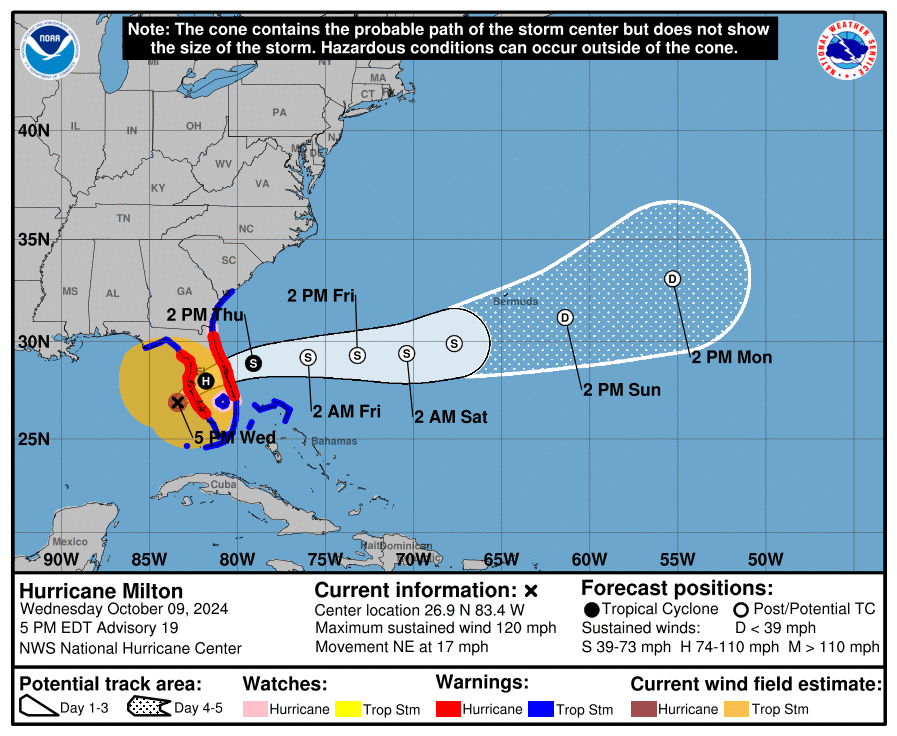
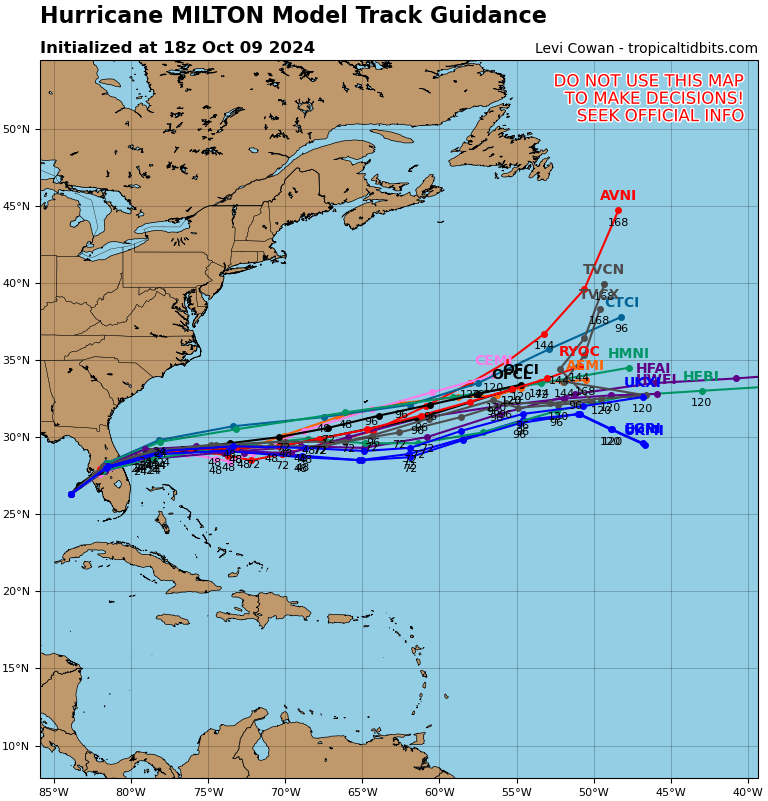
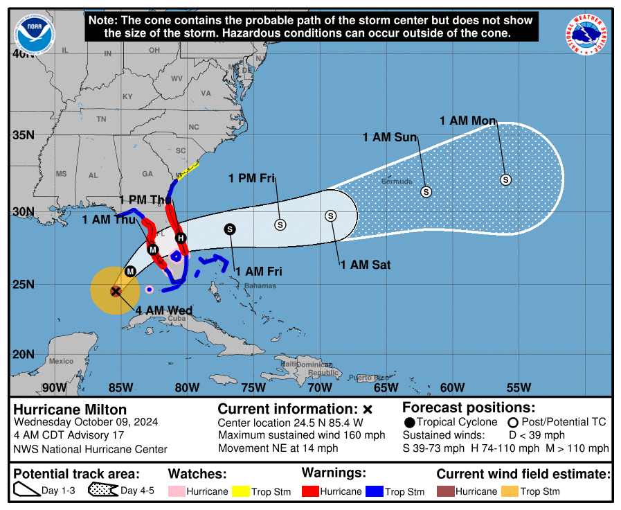
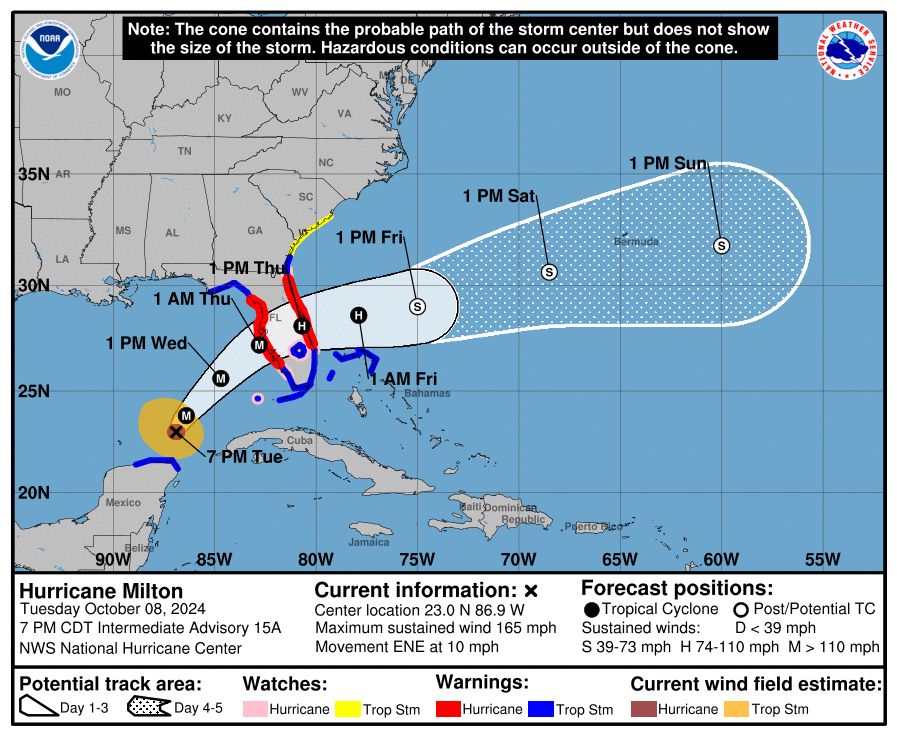
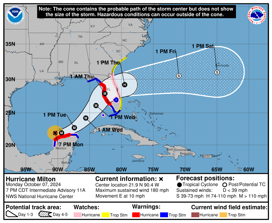
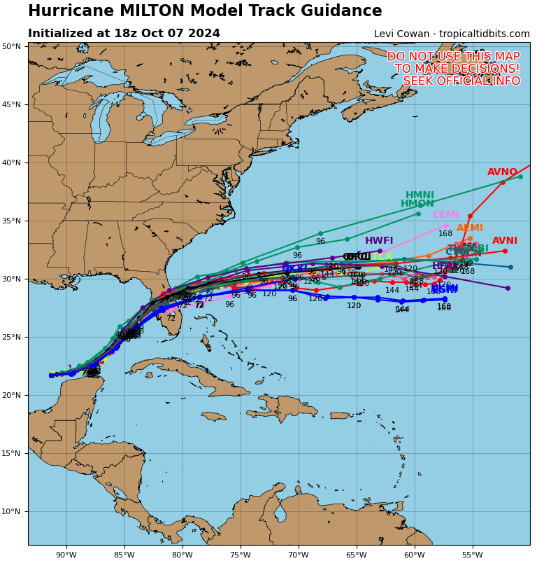
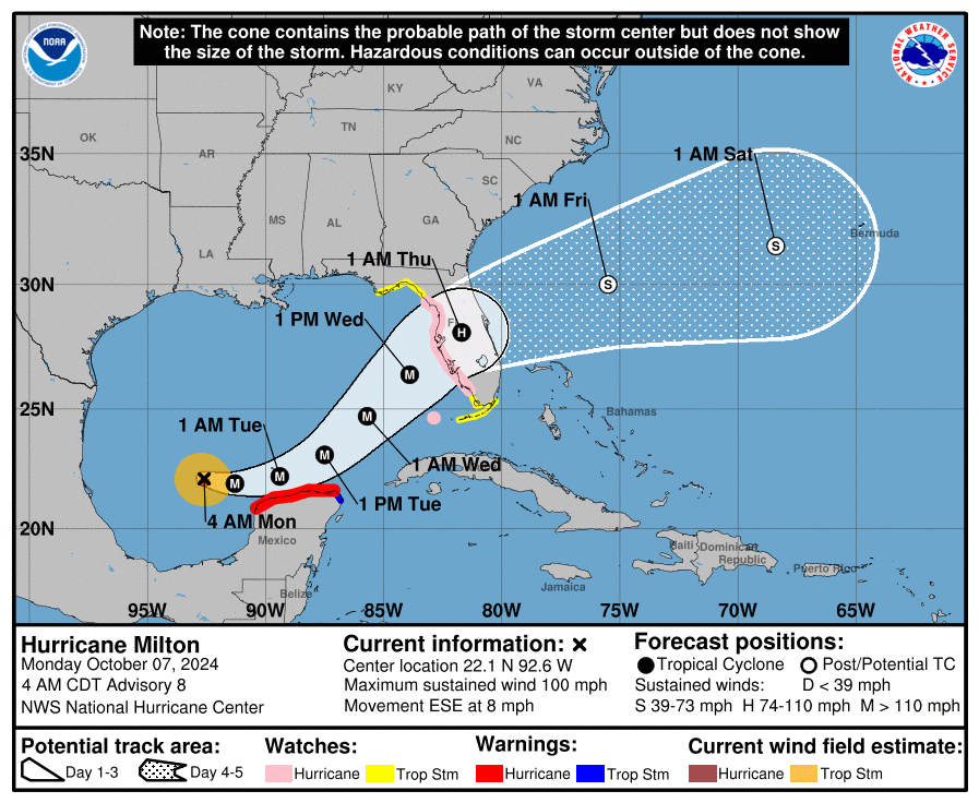
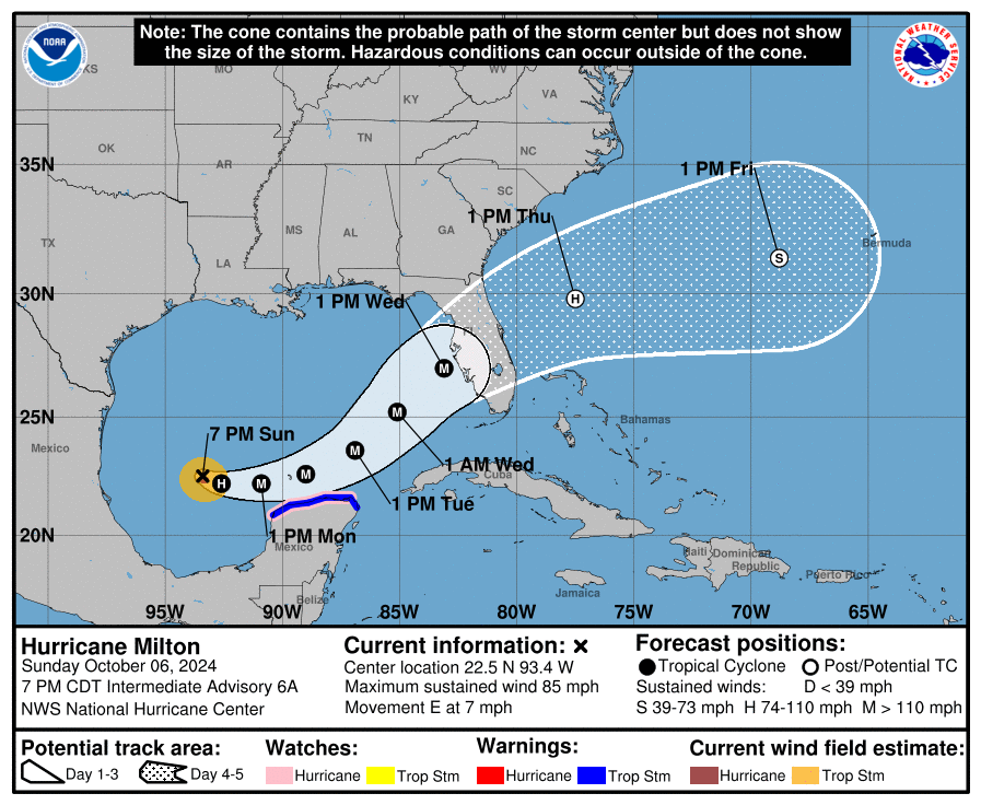
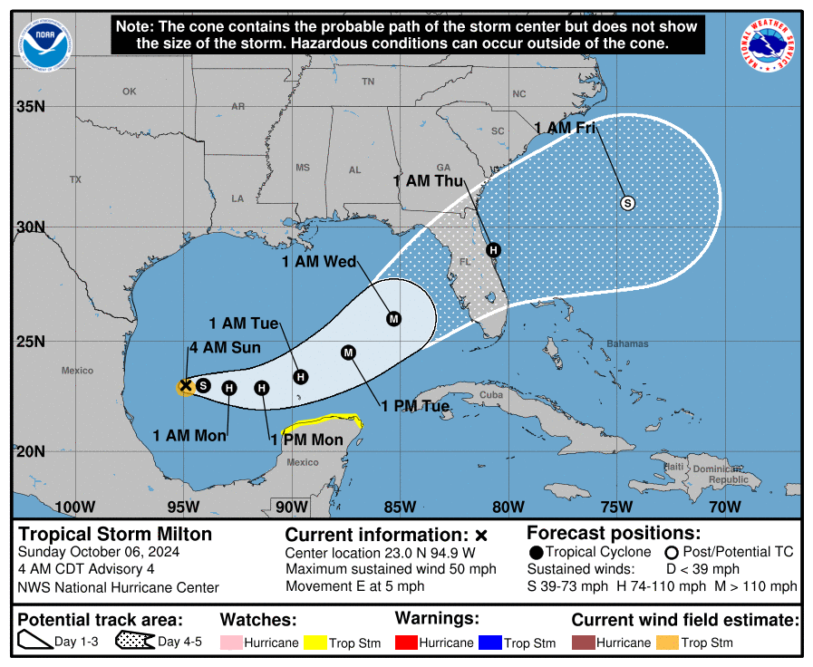
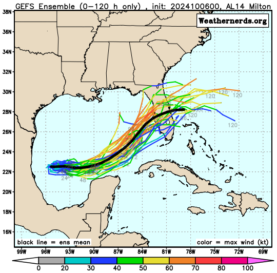
Since this morning there have been several changes with Milton. Most importantly it is encountering significant shear and it is weakening. During the day it has been moving faster and well north of where the NHC had anticipated it to be at this time. The models and the NHC track now take the center just south of Tampa Bay, near Sarasota and Bradenton.
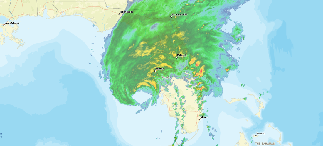
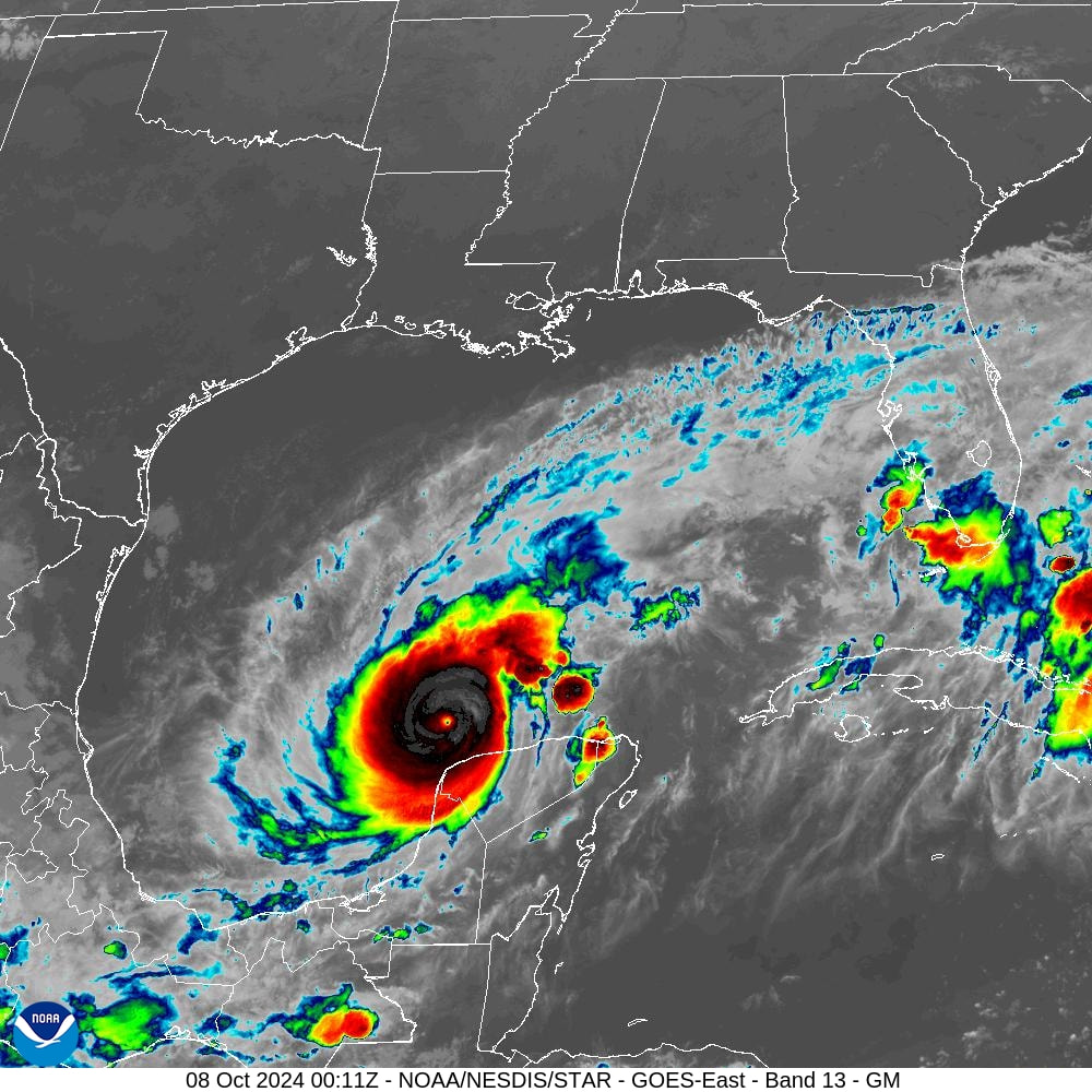
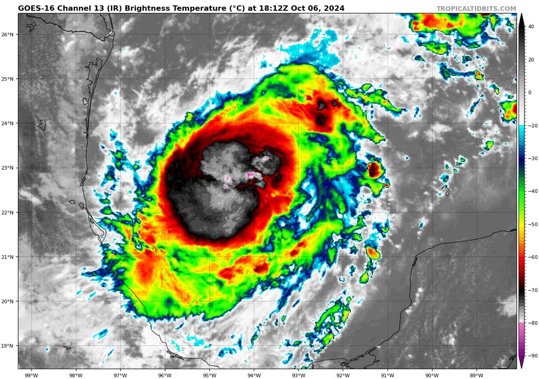
If you look at the radar below you notice first is that the eye now is very large, probably 40-50 miles across and all of the areas which we've been talking about the past few days will probably receive eye wall. The pressures have been rising steadily all day and have risen from 909 mbs this am to 948 mbs at 5 pm. They will continue to rise and Milton will continue to weaken. The center is around 70 miles from shore however with the large eye, the eye wall will arrive much sooner than the center. Most of the weather due to shear is now north of the center and the SW eye wall is now open. This will lead to further weakening. ? will it be enough, probably not however every little bit will help to reduce the extent of damage and injuries. The NHC is currently forecasting peak sustained winds to be around 115 mph, 100-110 may be more likely however it will still be enough to to cause extensive damage particularly to wooden structures. At least it is not the 165 mph Cat 5 we saw this morning.
SE Florida will likely experience little effects, especially with almost all of the weather now north of the center.
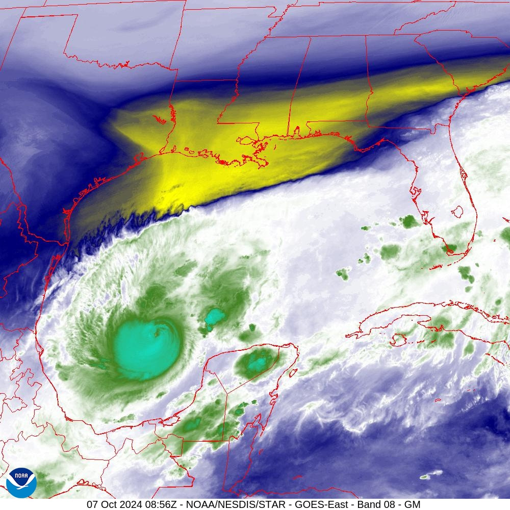
If you look at the water vapor loop below you will notice a lot of dry air behind it, yellows and blues. This is also helping to weaken it. After it passes this will move into the state.
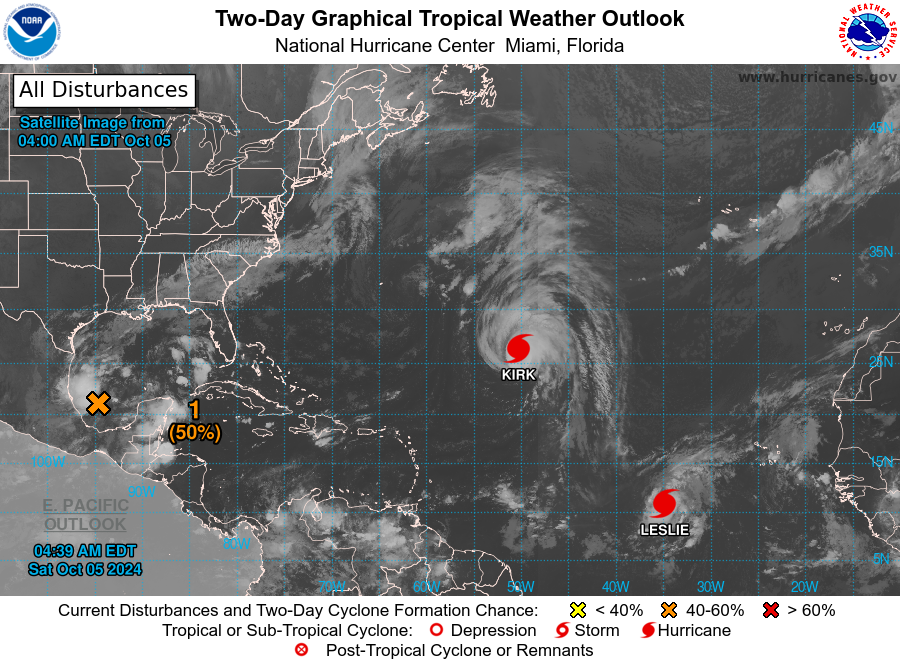
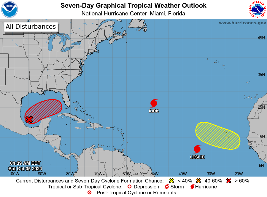
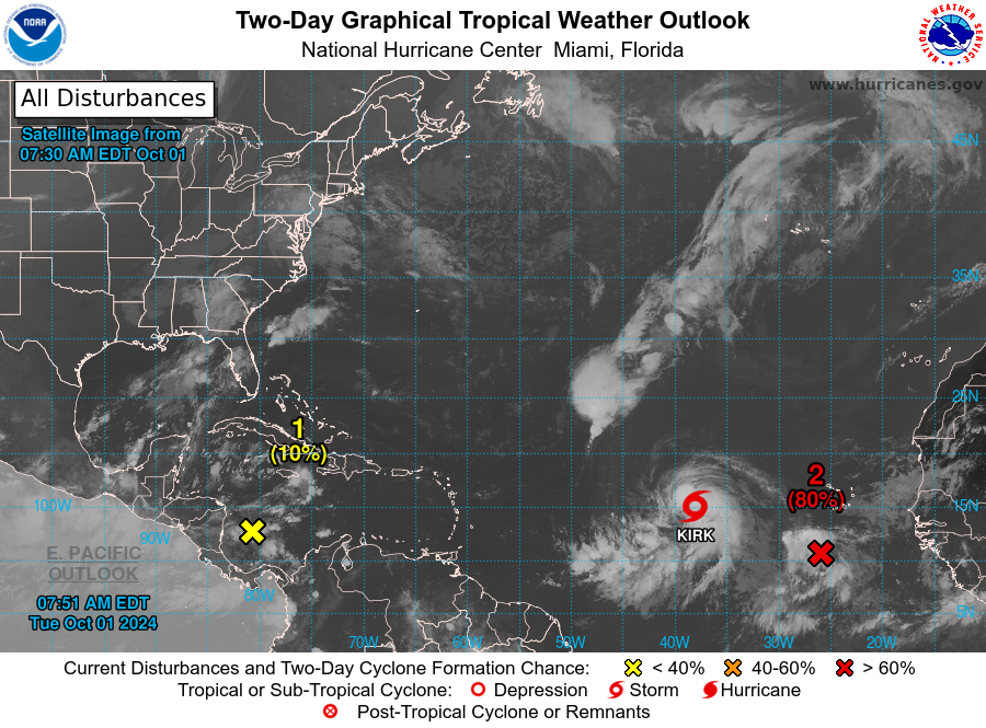
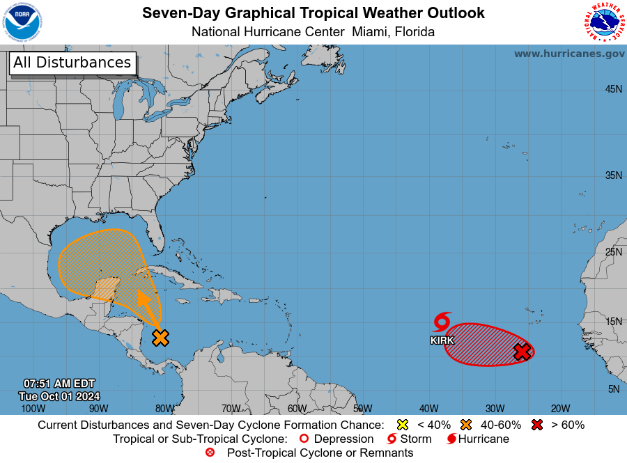
Elsewhere everything else is moving out to sea.
Hoping everyone out there is safe.
Until next time,
Matt.
Since this morning there have been several changes with Milton. Most importantly it is encountering significant shear and it is weakening. During the day it has been moving faster and well north of where the NHC had anticipated it to be at this time. The models and the NHC track now take the center just south of Tampa Bay, near Sarasota and Bradenton.
If you look at the radar below you notice first is that the eye now is very large, probably 40-50 miles across and all of the areas which we've been talking about the past few days will probably receive eye wall. The pressures have been rising steadily all day and have risen from 909 mbs this am to 948 mbs at 5 pm. They will continue to rise and Milton will continue to weaken. The center is around 70 miles from shore however with the large eye, the eye wall will arrive much sooner than the center. Most of the weather due to shear is now north of the center and the SW eye wall is now open. This will lead to further weakening. ? will it be enough, probably not however every little bit will help to reduce the extent of damage and injuries. The NHC is currently forecasting peak sustained winds to be around 115 mph, 100-110 may be more likely however it will still be enough to to cause extensive damage particularly to wooden structures. At least it is not the 165 mph Cat 5 we saw this morning.
SE Florida will likely experience little effects, especially with almost all of the weather now north of the center.
If you look at the water vapor loop below you will notice a lot of dry air behind it, yellows and blues. This is also helping to weaken it. After it passes this will move into the state.
Elsewhere everything else is moving out to sea.
Hoping everyone out there is safe.
Until next time,
Matt.